Inspiration
Our public security forces must be extremely organized and prepared in our current world of terrorist attacks, natural disasters and possible nuclear wars started by edgy world leaders.
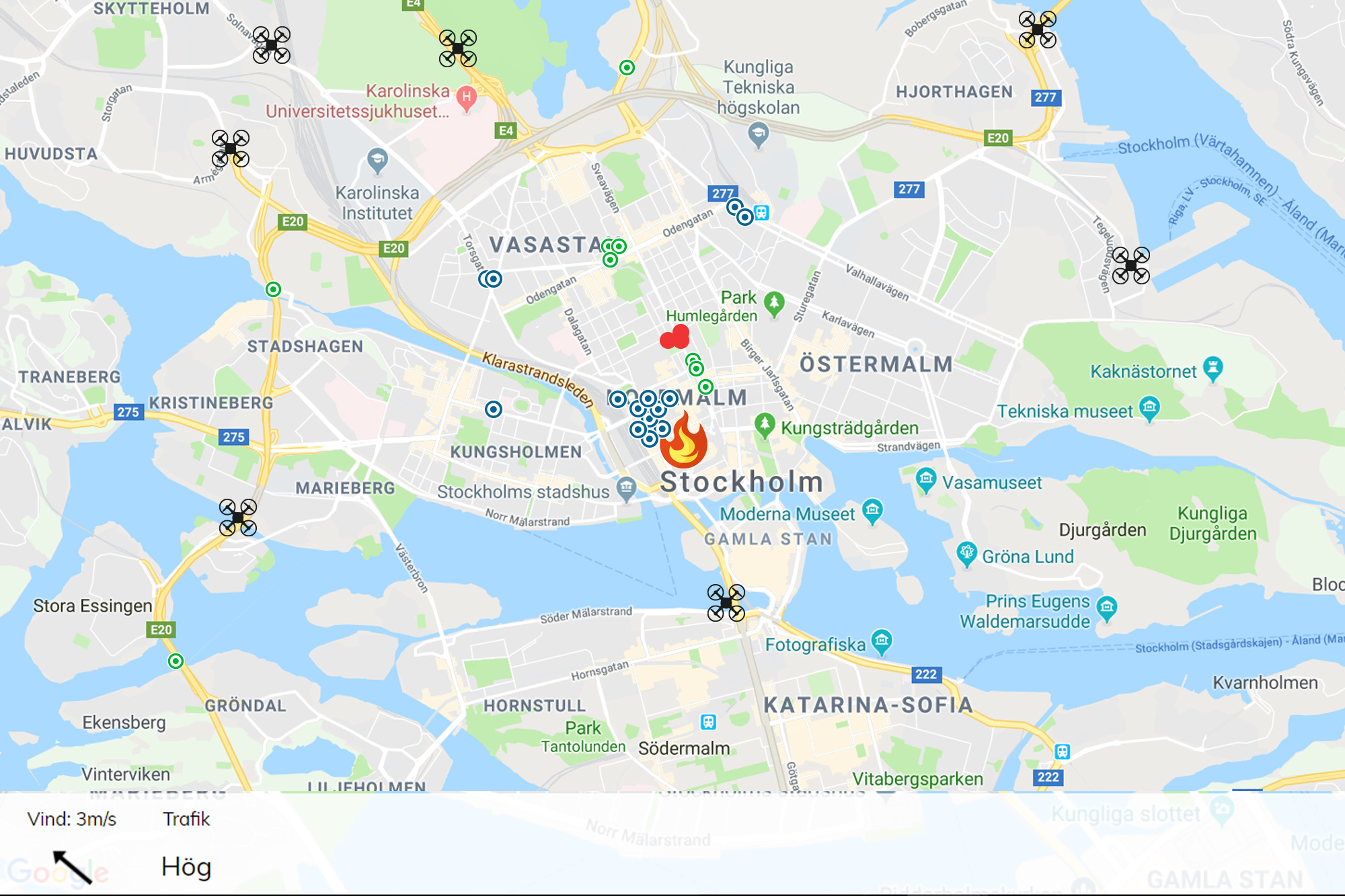
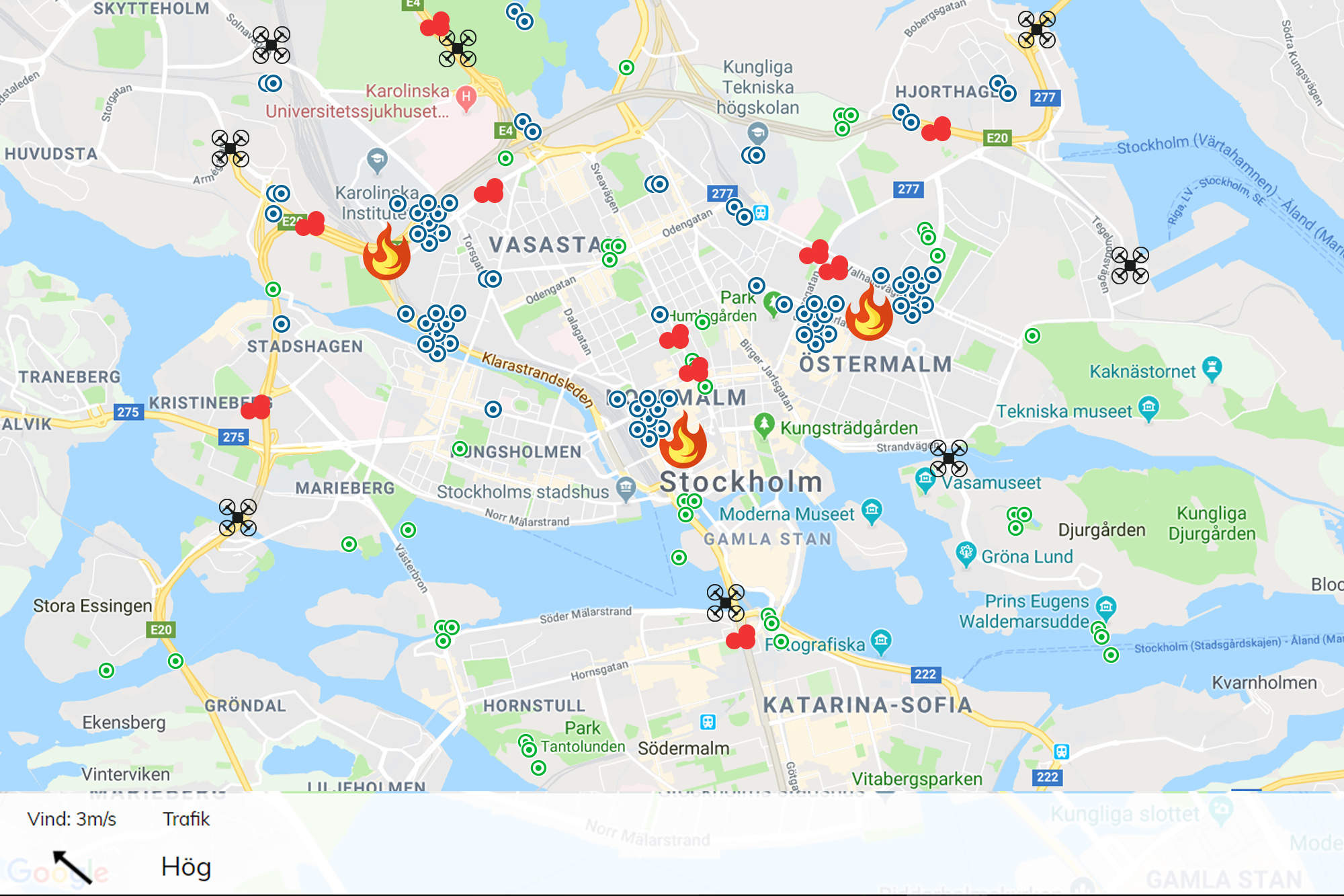
What it does
In case of a disaster - organizers will have a clear detailed overview of where every police, medic, firefighter and military are located. Organizers will have detailed data about the current overall situation in the area, like:
- Wind direction = Needed if there has been a toxic explosion
- General map data = map all potential escape routes so organizers know where to put drones with cameras to eventually catch important footage of a perpetrator.
- Traffic situation = used to calculate how far the perpetrators might have fled
Side note
This weekend we focused on the force location part. The GPS positions of every rescuer is obviously not open data but we built a simple tracker to show capabilities of the technology. This MVP will prove how effective it CAN be when combining all kinds of data. MUCH more data can be applicable to this organizer dashboard.
How we built it
Code and hammers
Challenges we ran into
When compared to well designed, modern REST apis from unicorn startups like Stripe, it's kind of hard to work with some old authority data sources.
What we learned
More beer will not improve ideas.

Log in or sign up for Devpost to join the conversation.