-

Home
-
Services
-

Map
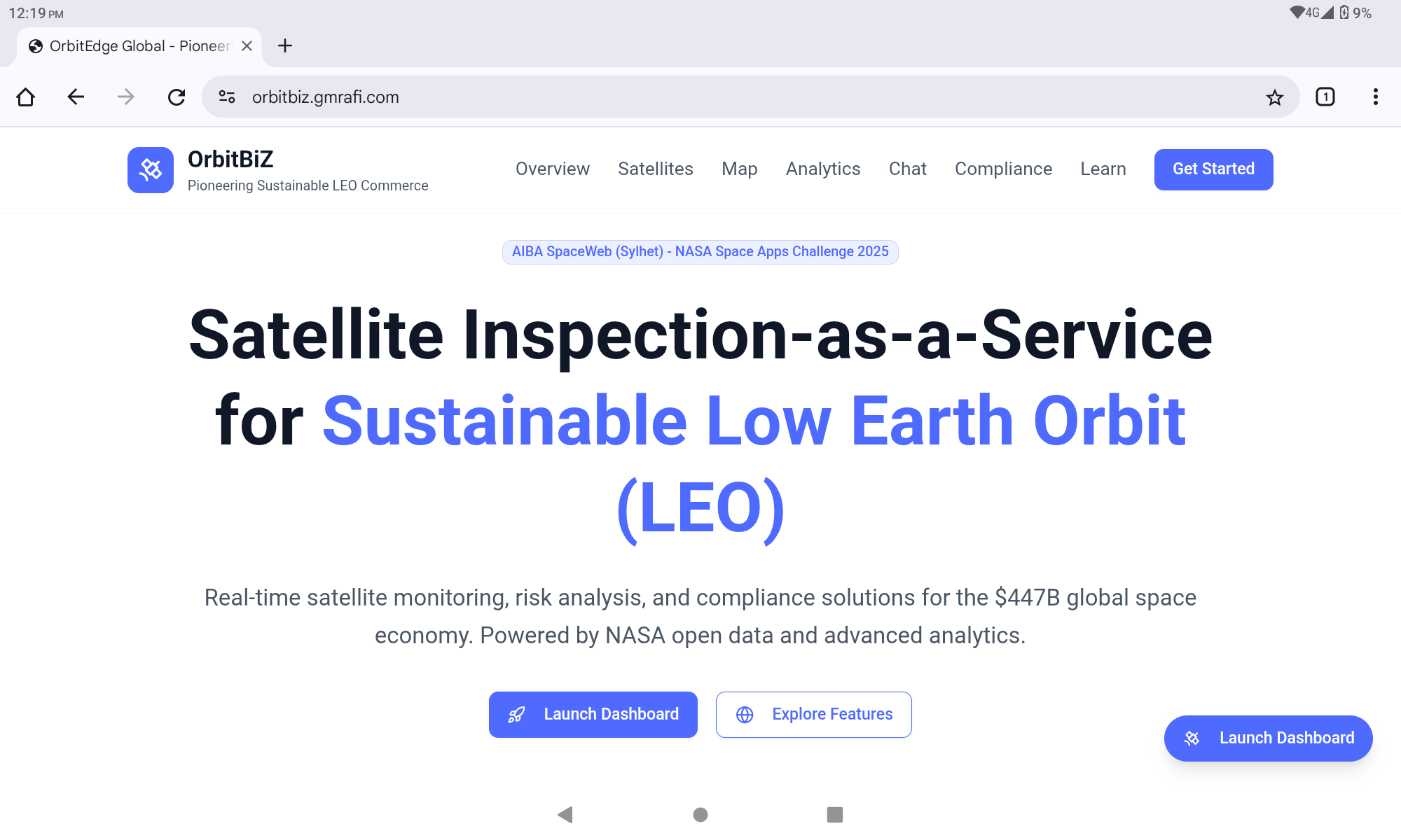

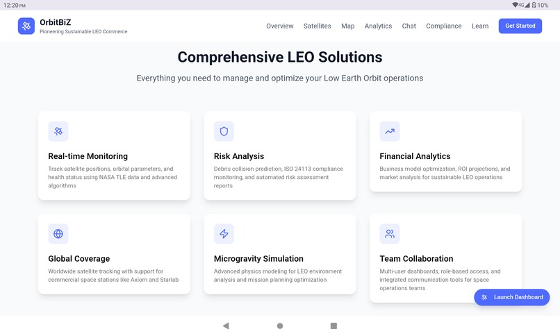
OrbitBiZ is a comprehensive Satellite Inspection-as-a-Service (SIaaS) platform that transforms Low Earth Orbit (LEO) challenges into sustainable business opportunities. Our platform addresses the critical need for real-time satellite monitoring, debris risk assessment, and commercial LEO operations management in an increasingly crowded orbital environment. Core Functionality:
upload_image.06:20:15.890886upload_image.06:34:28.974803
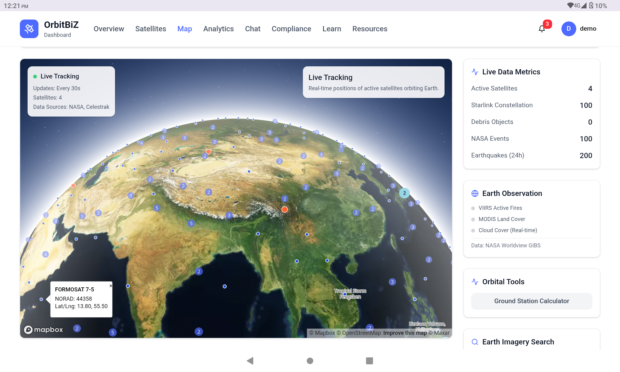
Real-Time Satellite Tracking: OrbitBiZ tracks over 64,000 orbital objects using NASA Two-Line Element (TLE) data from Space-Track.org and Celestrak. We employ the satellite.js library with SGP4/SDP4 orbital propagation algorithms to calculate precise satellite positions, velocities, and orbital parameters in real-time. Each satellite's trajectory is visualized on an interactive 3D globe powered by Mapbox GL JS v3.0.
upload_image.06:22:32.088619 Advanced Debris Visualization: Integrating NASA Orbital Debris Program Office (ODPO) data, our platform displays debris density heatmaps with risk-level color coding (Critical: 400-500km altitude in red, High: 500-700km in orange, Medium: 700-900km in yellow, Low: 900+ km in green). Users can click on individual debris objects to view NORAD catalog IDs, altitude, velocity, and collision risk metrics.
upload_image.06:24:12.702435 NASA Earthdata Integration: Using our authenticated NASA Earthdata CMR API access (Bearer token), we provide:
Real-time fire detection via VIIRS VNP14IMGTDL_NRT product (last 24 hours) Earth observation layers from NASA GIBS (MODIS Land Cover 2022, True Color Clouds) Click-to-search imagery tool for Landsat 8/9 and Sentinel-2 scenes with metadata (acquisition date, cloud cover, resolution) upload_image.06:26:12.143707upload_image.06:26:43.852436upload_image.06:32:47.215864 Multi-Agency Satellite Catalog: Users can filter satellites by category: Space Stations (ISS, Tiangong), Starlink, OneWeb, GPS, Galileo, Weather satellites, and Science missions. Dynamic counters show real-time satellite counts per category, powered by Celestrak GP API queries.
Advanced Orbital Tools:
Ground station calculator: Input any latitude/longitude to calculate satellite visibility Pass predictions: Next 24-hour orbital passes with AOS/LOS times, maximum elevation angles, and duration Coverage area visualization: 2000km radius coverage circles on the map Business Intelligence Suite: Our platform includes comprehensive financial analytics with TAM/SAM/SOM market analysis ($447B global space economy), unit economics calculator, ROI projections, Customer Lifetime Value (CLV) analysis, and break-even modeling. We also feature a Microgravity Manufacturing Simulator and Space Tourism Planner to explore emerging LEO business models.
upload_image.06:28:09.112900upload_image.06:29:00.093982
Risk & Compliance Management: Automated monitoring for ISO 24113 and NASA-STD 8719.14A compliance, collision probability algorithms, and a 25-year Asset Lifecycle Manager for sustainable end-of-life disposal planning.
Built With
- nextjs
- react
- typescript

Log in or sign up for Devpost to join the conversation.