-
-
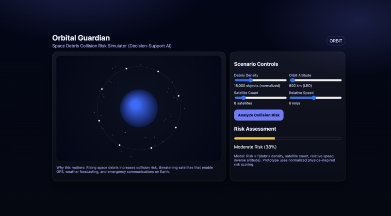
Orbital Guardian AI: An interactive simulator visualising space debris collision risk based on orbital conditions.

About the Project
Inspiration
Space around Earth is becoming increasingly crowded with operational satellites and fragments of debris. While satellites power everyday services such as GPS navigation, weather forecasting, and emergency communications, the risks created by orbital congestion are often invisible to the public. Orbital Guardian was inspired by these real-world concerns, where a simple, visual way to understand collision risk can help people appreciate why space sustainability matters.
How the Project Is Used (Use Cases)
Orbital Guardian is designed as an educational and awareness tool for students and the general public to explore space debris risks.
Use Case 1: Classroom Learning
Students explore how changing debris density and orbital altitude affects collision risk, helping them understand why Low Earth Orbit (LEO) is more congested and risky.Use Case 2: Public Awareness
Users interact with the simulator to visualize orbital congestion and learn how increasing satellite deployments can raise collision risk for existing satellites.Use Case 3: Scenario Exploration
Users simulate hypothetical scenarios such as rapid growth of satellite constellations to see how collision risk levels increase.
How I Built It
Orbital Guardian is a lightweight web application built using HTML, CSS, and vanilla JavaScript. The orbit visualization is rendered using the HTML5 Canvas API. Users can adjust debris density, orbital altitude, satellite count, and relative speed. All calculations are performed on-device without any backend.
How AI Is Used
Orbital Guardian implements a lightweight decision-support model that estimates collision risk from multiple input features, including debris density, satellite count, relative velocity, and orbital altitude. These inputs are first normalized and then combined using weighted coefficients to produce a risk score. This mirrors the inference pipeline of simple machine learning models (feature normalization → weighted combination → thresholding), but is implemented in an interpretable way for fast, on-device feedback in the prototype.
In future iterations, the same feature pipeline can be connected to a trained machine learning classifier using historical conjunction and debris datasets to learn weights automatically and improve prediction accuracy.
Collision Risk Logic (Math)
$$ \text{Normalized Debris} = \frac{\text{Debris Density}}{\text{Max Debris Density}} $$
$$ \text{Risk Score} = 0.45D + 0.25S + 0.20V + 0.10(1 - A) $$
What I Learned
- Building interactive visualizations using the HTML5 Canvas
- Translating domain concepts into a simple, explainable decision model
- Designing intuitive controls for non-technical users
- Structuring a complete frontend-only project
Challenges Faced
- Balancing realism with simplicity in orbital simulation
- Keeping the animation smooth with many moving elements
- Making the UI intuitive for first-time users
Future Improvements
- Integrating real space situational awareness datasets
- Training a machine learning model on historical conjunction data
- Adding preset scenarios (e.g., mega-constellation growth)
- Exporting simulation results for reports


Log in or sign up for Devpost to join the conversation.