-
-
UI
-
UI
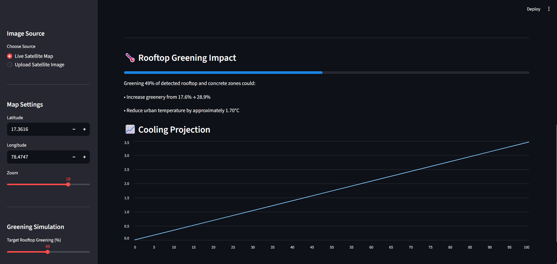
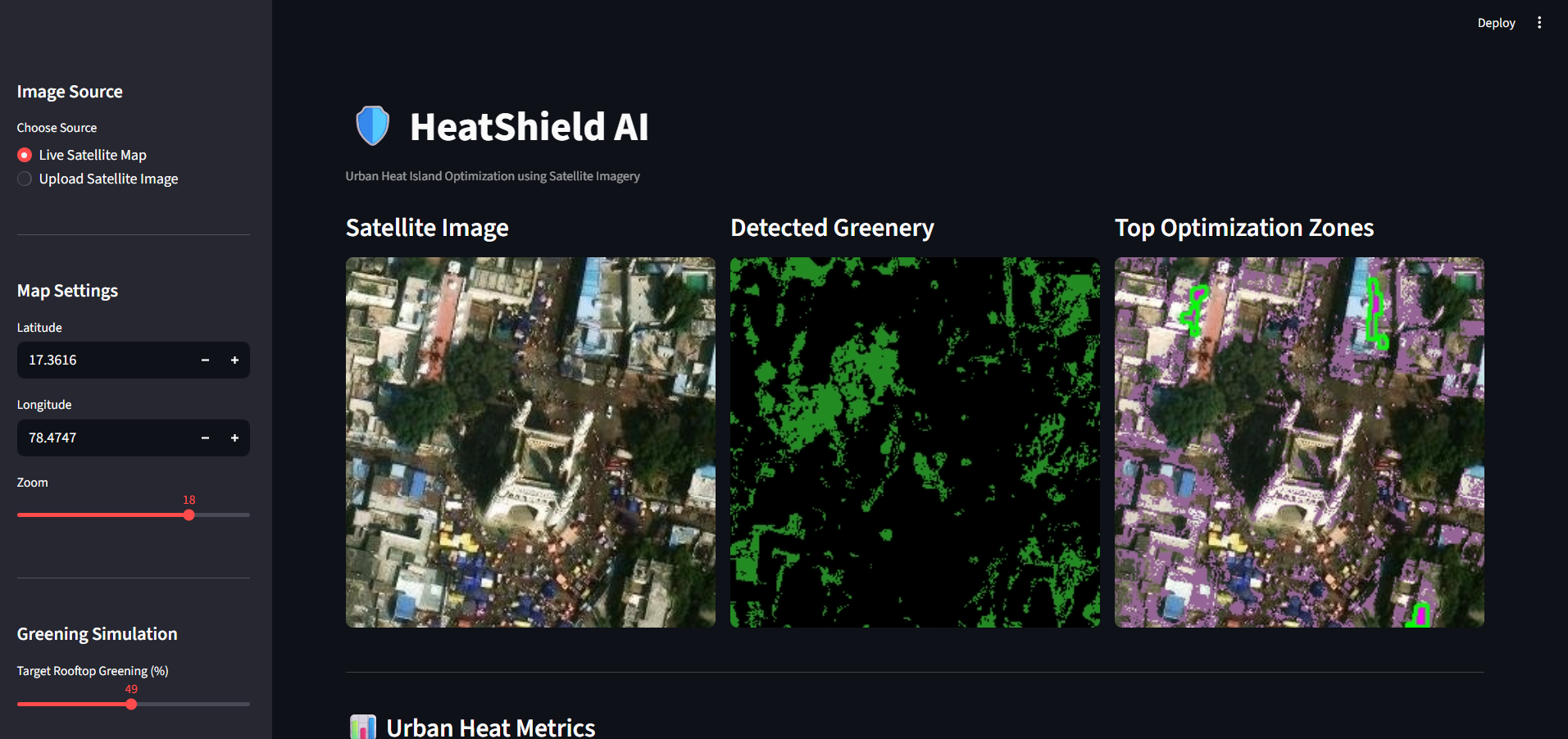
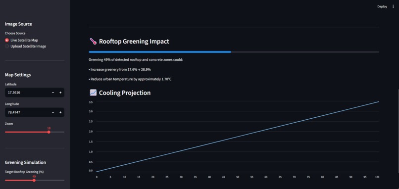
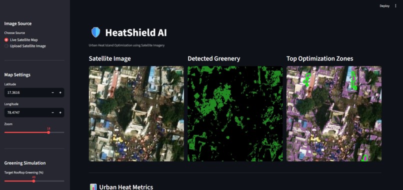
HeatShield AI is inspired by the growing problem of urban heat islands in rapidly developing cities like Hyderabad, where dense concrete infrastructure and limited green spaces significantly raise local temperatures. The project aims to analyze satellite imagery to detect green cover and heat-absorbing surfaces, identify high-impact zones for intervention, and simulate the cooling effects of rooftop greening and urban forestry. It was built using Python and Streamlit for the interactive interface, OpenCV for image processing, NumPy and Pandas for analysis, ArcGIS satellite tiles for real-world imagery, and the Google Gemini API for generating AI-powered urban planning recommendations. One of the major challenges was accurately distinguishing greenery from complex urban textures and designing a simple yet meaningful temperature reduction model using limited visual data. Despite these challenges, the project successfully integrates satellite vision with generative AI to provide actionable insights for urban cooling, something we are proud of achieving in a real-time interactive system. Through this, we learned how computer vision and AI can be combined to address real environmental problems in an accessible way. Moving forward, we plan to enhance detection accuracy using deep learning segmentation models, integrate real climate datasets, and expand the system into a scalable urban planning tool for multiple cities with predictive heatwave simulation capabilities.

Log in or sign up for Devpost to join the conversation.