Inspiration
The Space Object Catalog Database provides information about registered aircrafts, however, the real danger are unmarked aircrafts sent by foreign governments for malicious purposes. The intents of these aircrafts are to be hidden which threaten our safety and security. Given the dangers of the unknown in space we wanted to build more security against those dangers that may interfere with our daily routines of aerial and space travel.
What it does
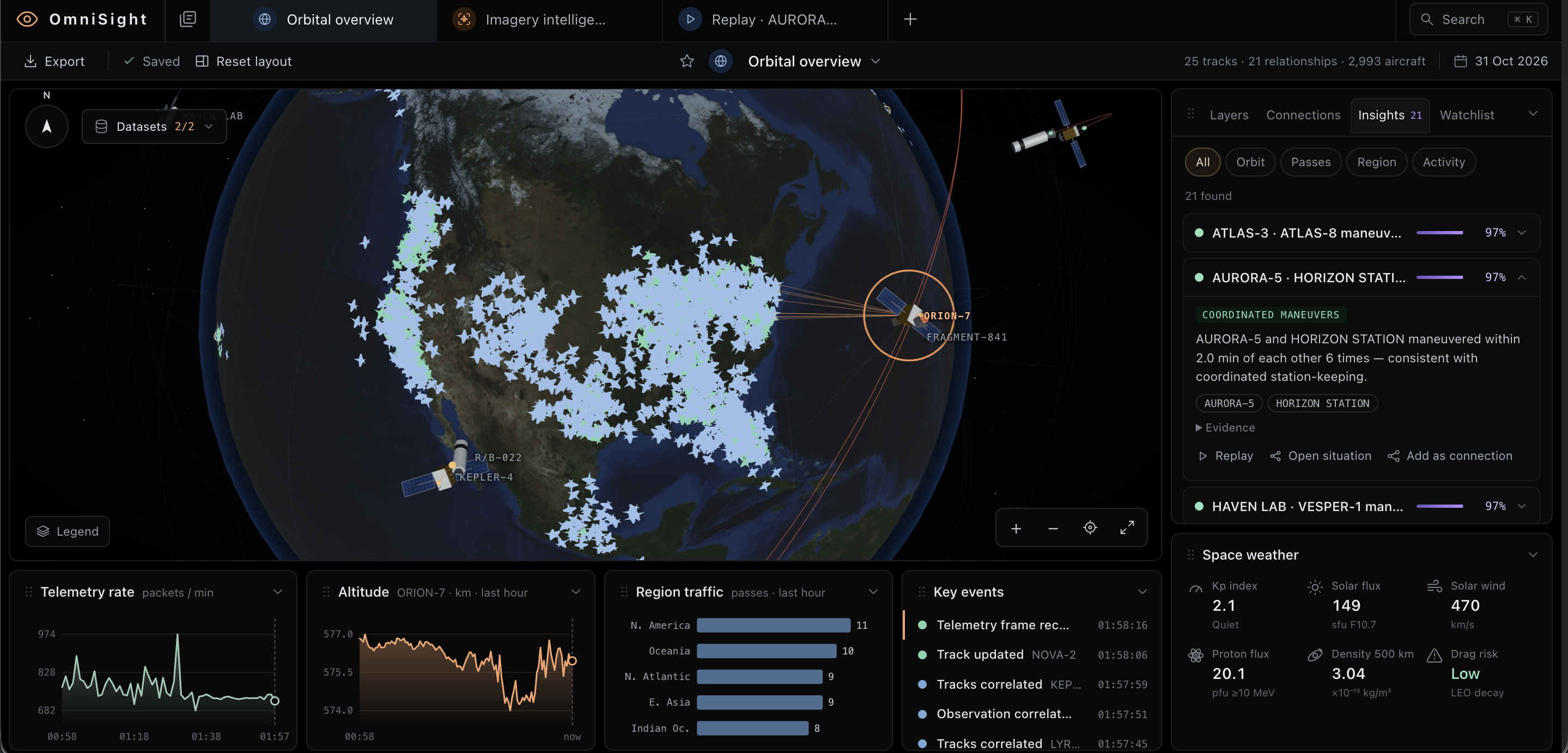
OmniSight is a surveillance and security intelligence platform that detects and monitors unregistered aircraft and unidentified objects orbiting our planet.
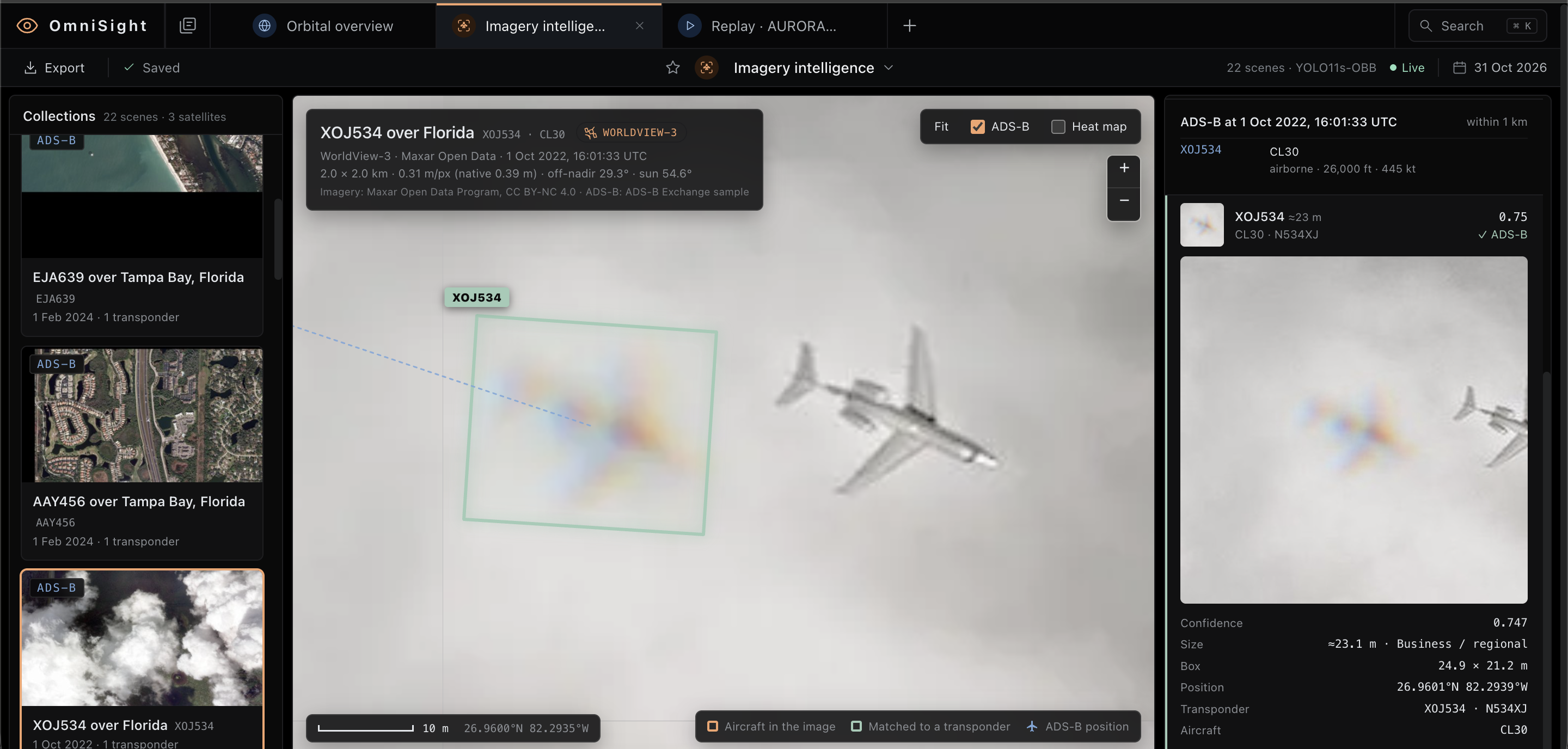
Given raw satellite images and data, our vision model detects aircrafts and compares them to aircraft registration databases in real time, in order to detect anomalies and unregistered aircrafts, helping security teams investigate unusual activity.
After processing the satellite data, we make a 3d model representing all of the aircrafts in our planet and those that orbit around it. With this model we are able to make a threat assessment of all satellites by comparing movement patterns with other satellites. The user is also able to view the history of these movement patters.
How we built it
We started by scraping open source satellite data and aircraft registration from public space agencies. For aircraft detection we integrated YOLO11s-OBB, a computer vision model that identifies aircraft in high resolution satellite imagery. We then developed a matching algorithm that compares detected aircraft against public registration records from the time each satellite image was captured. Finally, we built an interactive dashboard using typescript with a python backend for computer processing.
Challenges we ran into
One of our biggest challenges was finding reliable satellite imagery and matching it with historical aircraft tracking data. Aircraft positions often didn't align with satellite images due to differences in capture times, viewing angles, and aircraft movement. Another major challenge was detecting aircrafts in low resolution images. We addressed this by training our own lightweight model to recognize the color trails left by moving aircrafts.
Accomplishments that we're proud of
Our biggest accomplishment was integrating real world satellite data into our refined lightweight model. Most importantly we are proud to have built something with real world potential to help strengthen national security.
What we learned
We learned how visualization, data processing, algorithms, and user interaction can all work together in one program. We also learned how important data accuracy is and that the system needs to consider how reliable information is.
What's next for OmniSight
Since we already have integrated real world satellite data, we can expand the number of satellites being used to provide this data, leading to more precise aircraft and orbiting objects' positions. Once we have more precise data, we will send data of unregistered aircrafts or unidentified objects to nearby military operations areas, so they can prepare for the threat that might be posed.
Built With
- javascript
- machine-learning
- three.js
- typescript
- yolo11s-obb

Log in or sign up for Devpost to join the conversation.