-
-
-
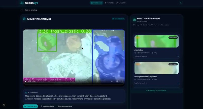
OceanEye dashboard detects ocean trash with YOLOv8, runs RAG via Gemini for insights, and visualizes optimized cleanup routes in real-time.
-
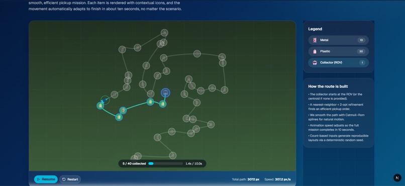
Cleanup paths are optimized by clustering trash sites and smoothened using Catmull-Rom spline interpolation for boat-friendly routes.
-

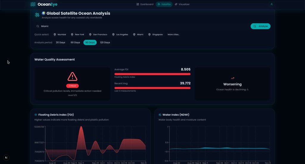
Plot satellite data from Google Earth Engine to visualize debris, clean water zones, and pollution trends on interactive maps.


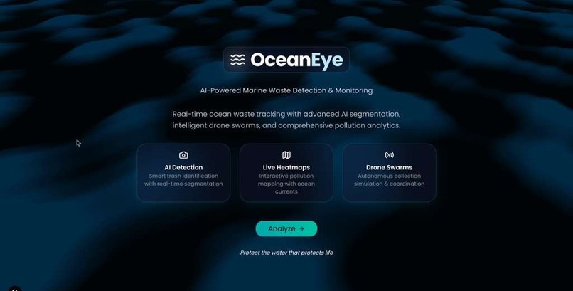
🌊 OceanEye
Inspiration
Every year, millions of tons of plastic enter our oceans, and over 100,000 marine animals die from entanglement or ingestion of waste. We watched footage of turtles struggling with plastic rings and dolphins swimming through oil streaks, and it struck us:
the ocean is vast, but our cleanup strategies are still manual, slow, and inefficient.
We wanted to build something that could help — not someday, but now.
OceanEye started with a simple goal: use AI to detect, map, and optimize the cleanup of ocean waste while minimizing carbon emissions and protecting marine life.
What it Does
OceanEye analyzes ocean footage in real-time, detecting different types of trash floating on the water surface. It then:
- Identifies and classifies waste (plastic bottle, fishing net, bag, etc.)
- Maps the geographic coordinates of detected trash clusters
- Optimizes the cleanup route to minimize travel distance, fuel, and ecological disruption
- Generates detailed environmental insights using generative AI to help researchers and cleanup organizations understand pollution patterns over time
How We Built It
OceanEye is powered by a full AI + simulation + web visualization pipeline:
🧠 Detection Model
- Fine-tuned YOLOv8 on custom drone & satellite imagery datasets of ocean debris
- Used data augmentation to simulate wave distortion, glare, and turbidity
- Performs instance segmentation to outline the exact shapes of waste items
📡 Spatial Mapping & RAG Pipeline
- Incorporated Sentinel-2 satellite coastal data and Google Earth Engine (GEE) to detect high-probability garbage accumulation zones and track pollution spread
- Detection outputs are pushed into a Retrieval-Augmented Generation (RAG) pipeline using Google Gemini
Gemini analyzes:
- Historical pollution correlations
- Seasonal tide + wind patterns
- Geo-temporal clustering behavior
Gemini then generates cleanup insights, trend reports, and risk assessments
🚤 Route Optimization & Cleanup Simulation
To determine the most efficient cleanup path:
| Component | Method / Algorithm | Result |
|---|---|---|
| Cluster Sorting | Nearest Neighbor + 2-Opt Heuristic | Groups waste sites into efficient pickup clusters |
| Path Smoothening | Catmull-Rom Spline Interpolation | Generates smooth, boat-friendly traversal paths |
- Dynamic pickup route visualization
🌐 Web Platform
| Layer | Tech |
|---|---|
| Frontend Hosting | Netlify |
| Backend Hosting | Vultr |
| Frontend Framework | Next.js (App Router) + React + TypeScript |
| UI Components | Tailwind CSS v4, Radix UI, shadcn/ui |
| Charts & Visualizations | Recharts + R3F |
| Backend | Flask + Flask-CORS |
| AI & ML | PyTorch, YOLOv8, Google Gemini API |
| Image/Video Processing | OpenCV + Pillow |
| Satellite Data Analysis | Google Earth Engine (GEE) |
| Data Storage | File + vector store for RAG context |
Challenges We Ran Into
- Training the model to distinguish ocean surface glare from actual plastic required extensive augmentation and tuning
- Integrating multiple data modalities (video + satellite imagery + geo-coordinate metadata) required custom preprocessing pipelines
- Ensuring the cleanup path was both fuel-efficient and eco-safe involved balancing cost functions rather than just minimizing distance
- The RAG pipeline required careful prompt + metadata design so Gemini generated useful insights instead of generic summaries
- Working with satellite data in GEE required preprocessing for cloud cover, water turbidity, and aligning geospatial coordinates with detected trash
Accomplishments We’re Proud Of
- Built a functional ocean waste detection AI system with strong real-world segmentation performance
- Created a dynamic cleanup route optimizer with biologically safer navigation paths
- Integrated satellite data from GEE for debris monitoring and pollution tracking
- Demonstrated how AI can meaningfully contribute to environmental conservation
- Successfully integrated detection + simulation + analysis into a single operational dashboard
What We Learned
- Fine-tuning models on real-world imagery isn't about getting accuracy — it's about robustness
- RAG pipelines require clean, structured context to produce meaningful intelligence
- Optimization isn’t purely technical — it must respect ecosystems, wildlife, and ocean currents
- The simplest algorithms (like nearest-neighbor) can outperform complex ones when tuned well
- Satellite data analysis requires careful preprocessing and integration with real-time AI detection outputs
What’s Next for OceanEye
- Scale training with live coastal camera feeds
- Collaborate with marine conservation organizations
- Introduce real-time drone fleet coordination
- Add predictive waste drift modeling based on wind & tide forecasts
- Deploy on autonomous cleanup vessels long-term


Log in or sign up for Devpost to join the conversation.