Inspiration
Critical infrastructure, such as railway corridors, faces frequent, unidentified drone activity. Emergency centers often get overwhelmed by duplicate reports and the high risk of civilians misidentifying harmless objects (like birds or planes) as drones. We were inspired to build a system that eliminates these "false positives" and provides field operators with an AI-verified audit trail. Military solutions like ARC4 are highly precise but unavailable to the civilian market and too expensive, so we aimed for an accessible format.
What it does
[NOT] AURA is a software-based AR system that provides "X-Ray" tactical awareness and drone command. It connects field operators directly with command centers, allowing for real-time 3D mapping to enhance situational awareness. The system also enables autonomous swarm coordination, delegating dynamic path planning to multiple drones simultaneously.
How we built it
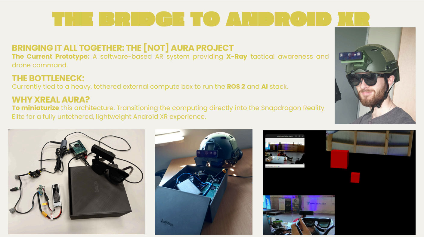
The hardware prototype utilizes XR Goggles, a mobile computing unit, and a sensor suite. On the software side, we developed a cross-platform Web App using lightweight AI models, Kalman filters for flight prediction, and an anti-spoofing protocol. We utilize SLAM and Nav2 algorithms for 3D mapping and autonomous navigation, which are seamlessly connected via a custom ATAK plugin.
Challenges we ran into
Our main bottleneck currently is that the system is tied to a heavy, tethered external compute box required to run the ROS 2 and AI stack. Our future plan and ongoing development focus is to overcome this by transitioning the computing directly into the Snapdragon Reality Elite for a fully untethered Android XR experience.
Built With
- ai
- atak
- c++
- kalman
- nav2
- ros-2
- slam
- web-app
- xreal

Log in or sign up for Devpost to join the conversation.