-
-

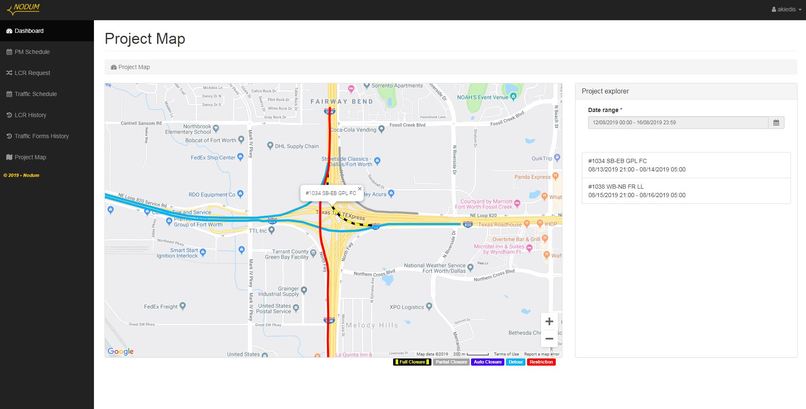
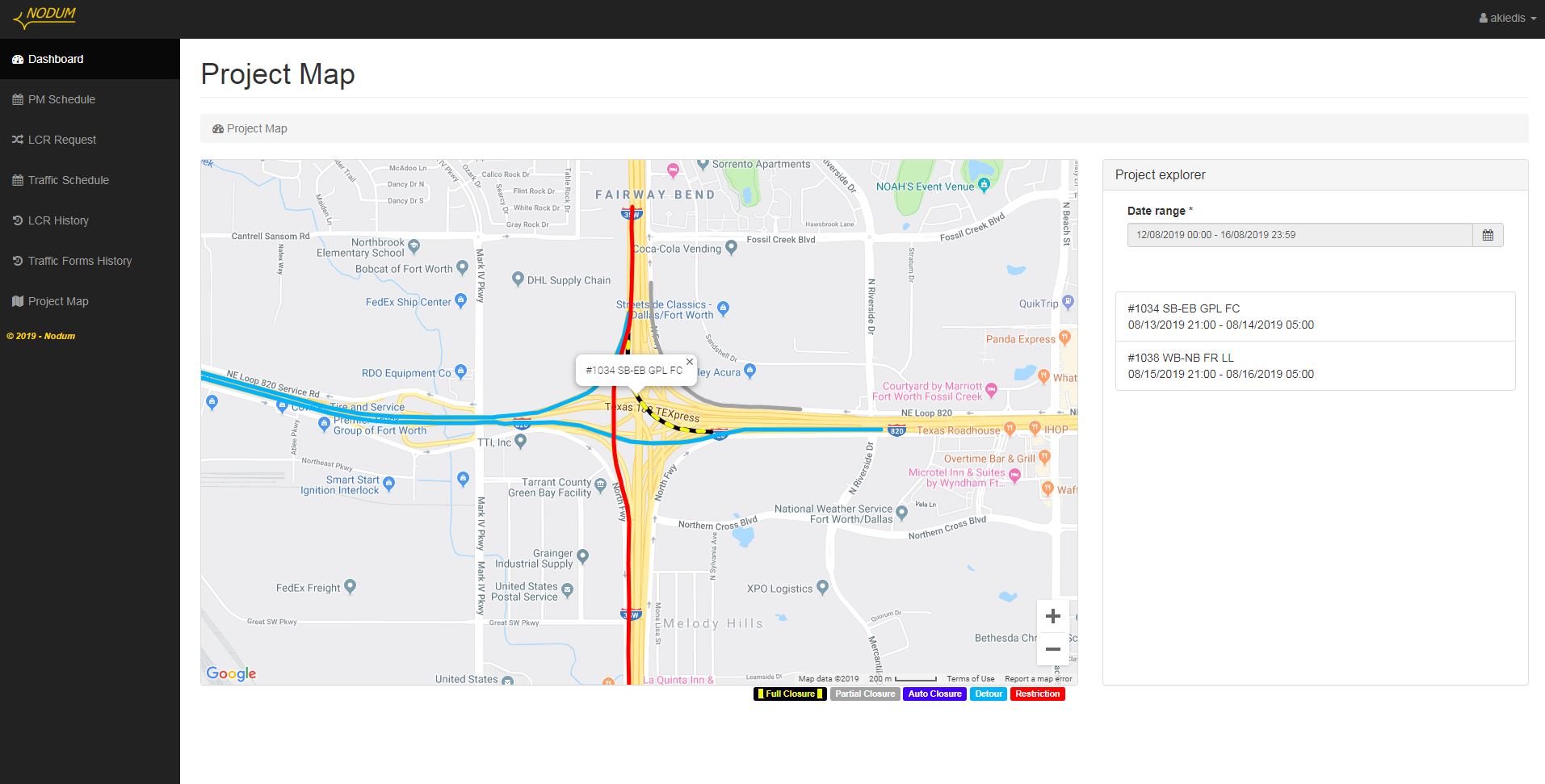
Map showing the lane closures due to construction activities scheduled in a specific date
-
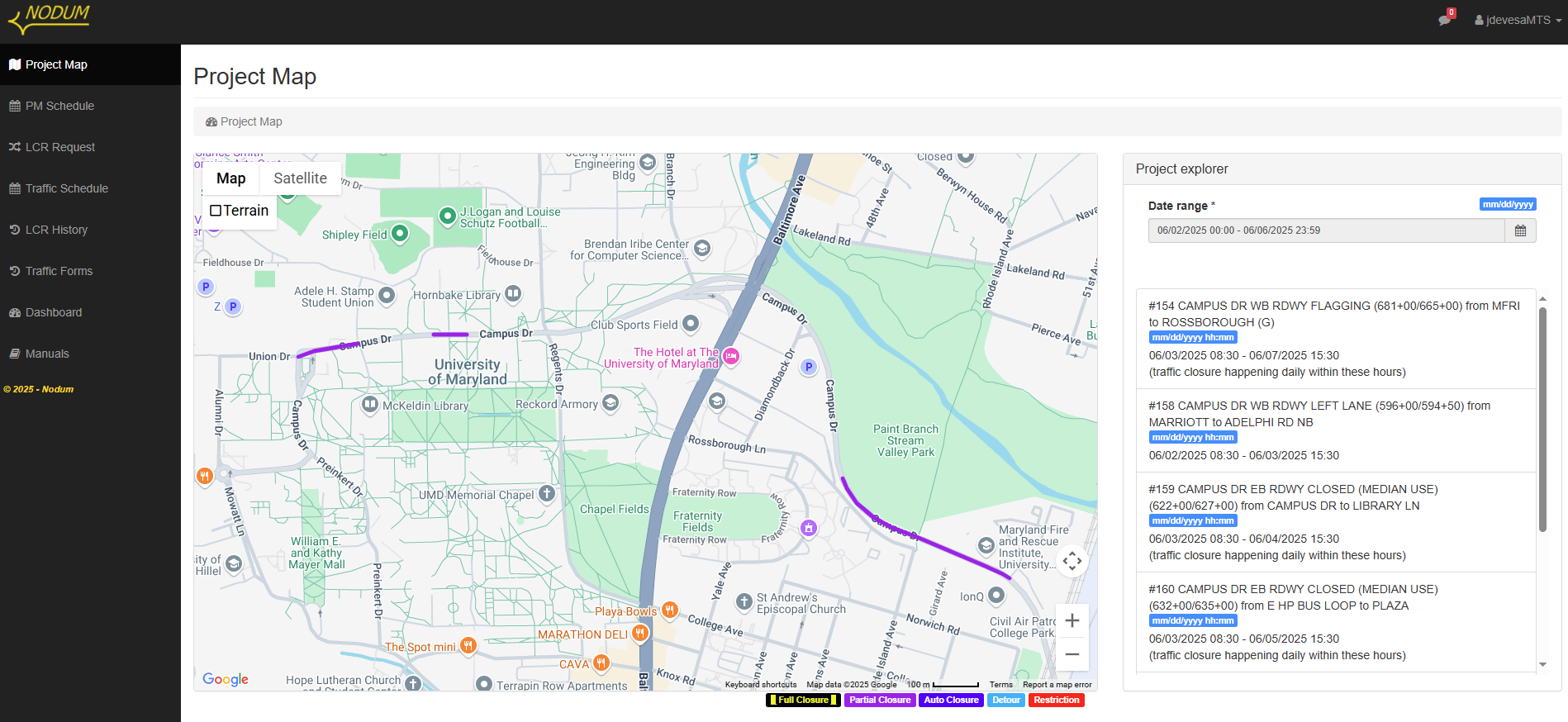
Map showing the lane closures due to construction activities scheduled in a specific date with the proper detours
-

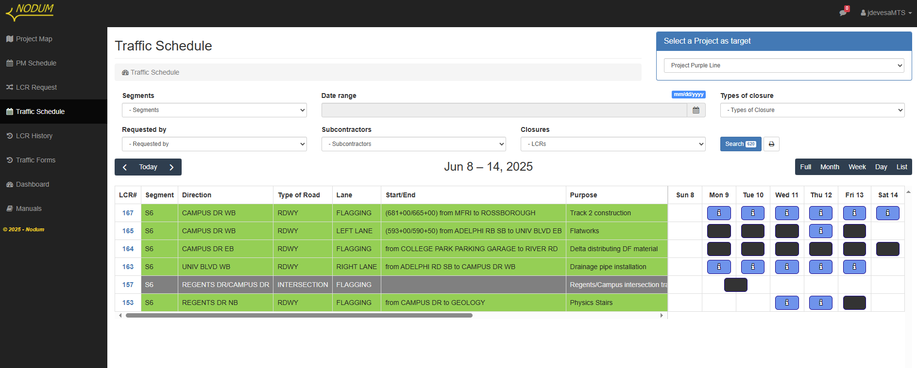
Schedule including all lane closures planned in a week and their approval status by the Department of Transportation
-
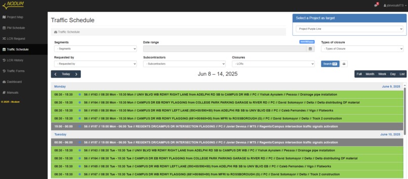
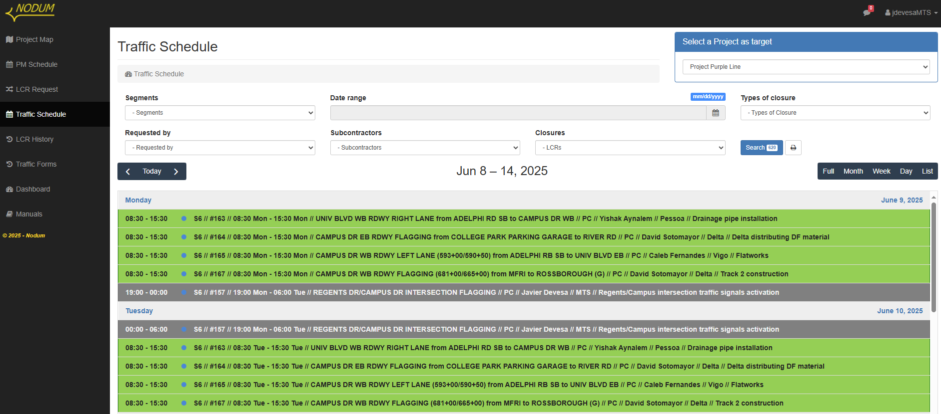
Schedule in a list view
-
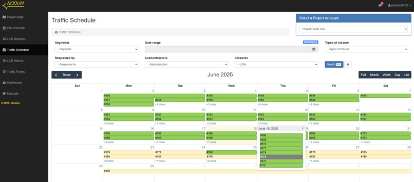
Schedule in a month view
-

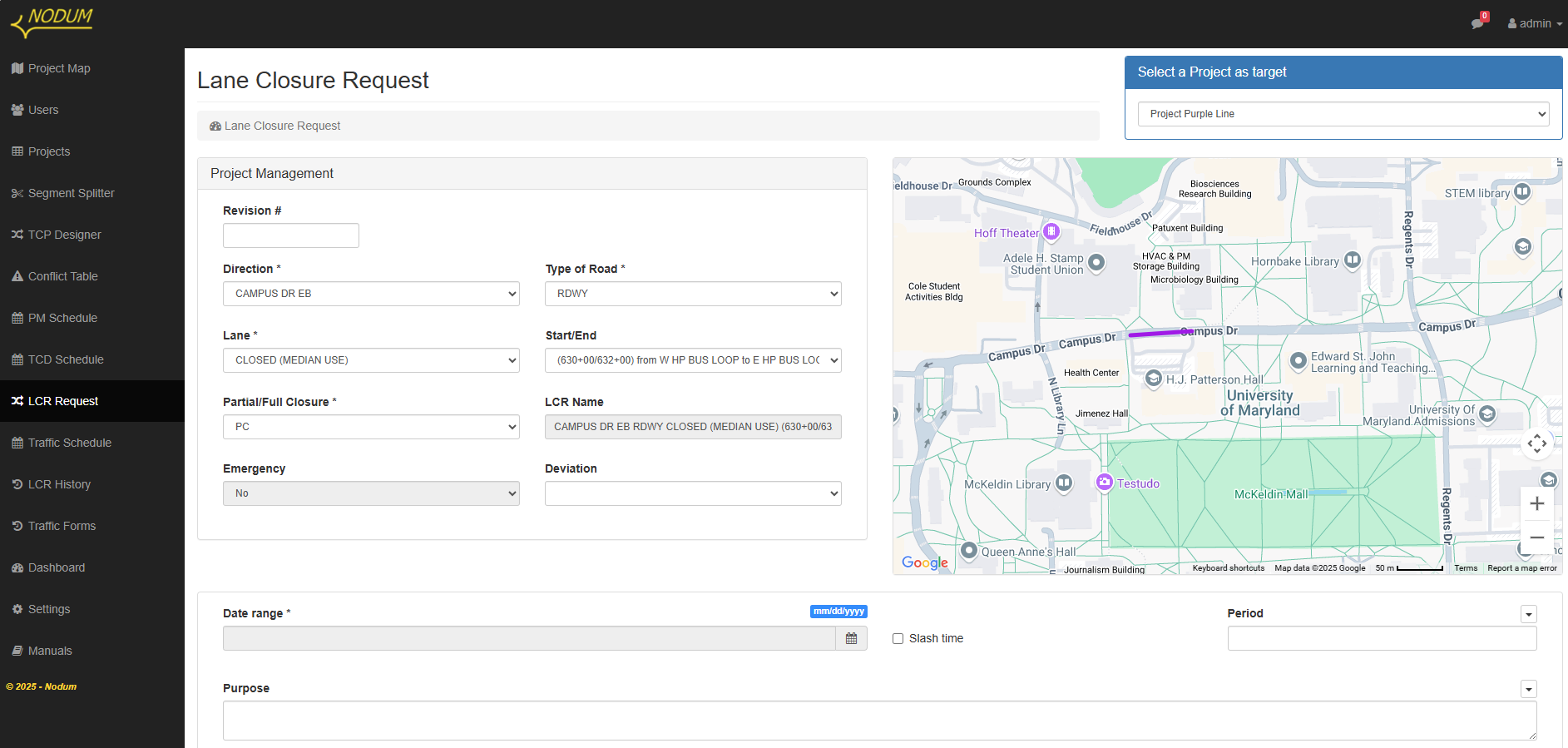
Request form to schedule a lane closure by the General Contractor
-
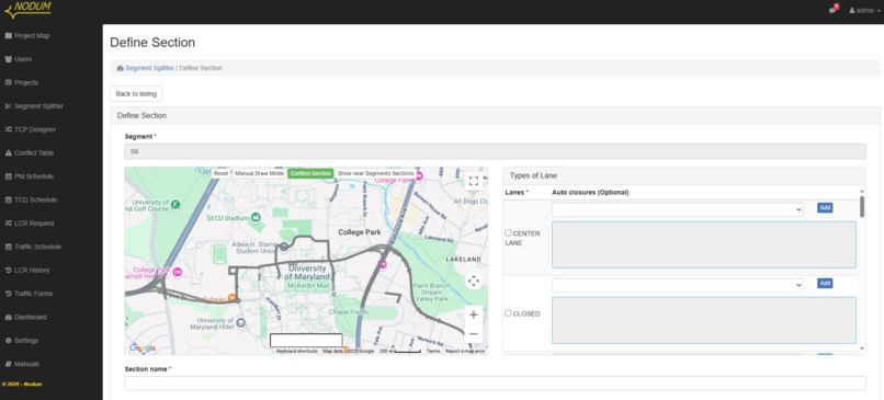
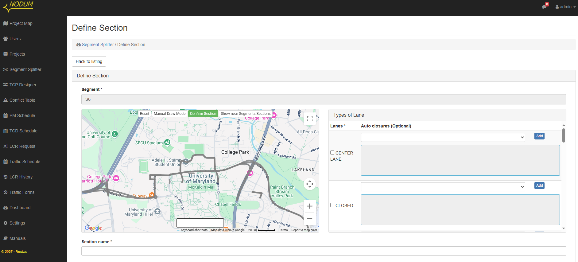
The General Contractor has previously entered a full data base of all possible lane closures that can be scheduled in a project
-
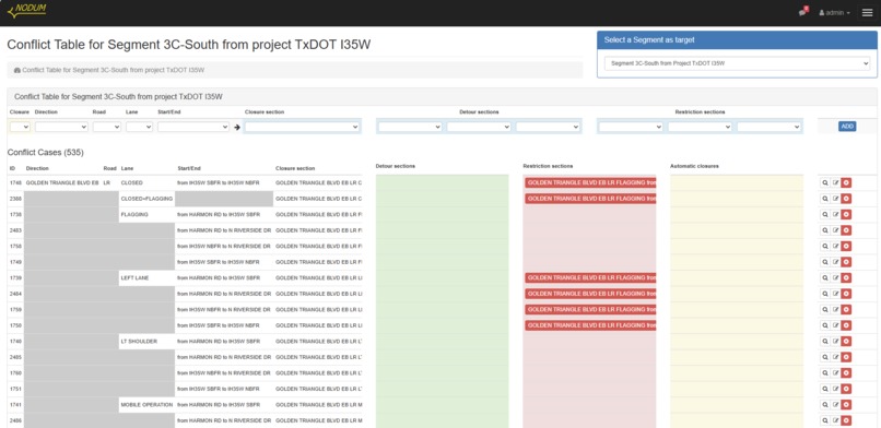
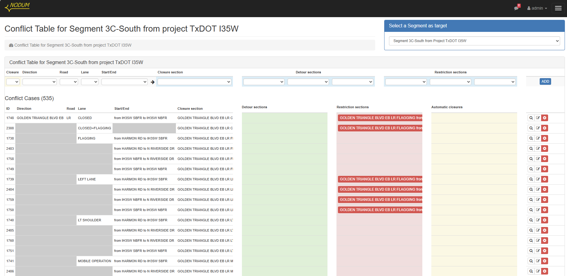
All possible project lane closures are included in this Conflict Table. Rules are set to avoid conflicts if requested simultaneously
-
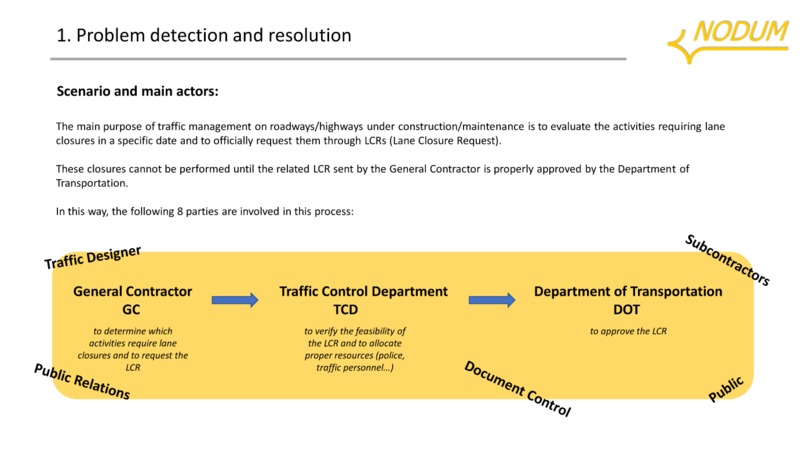
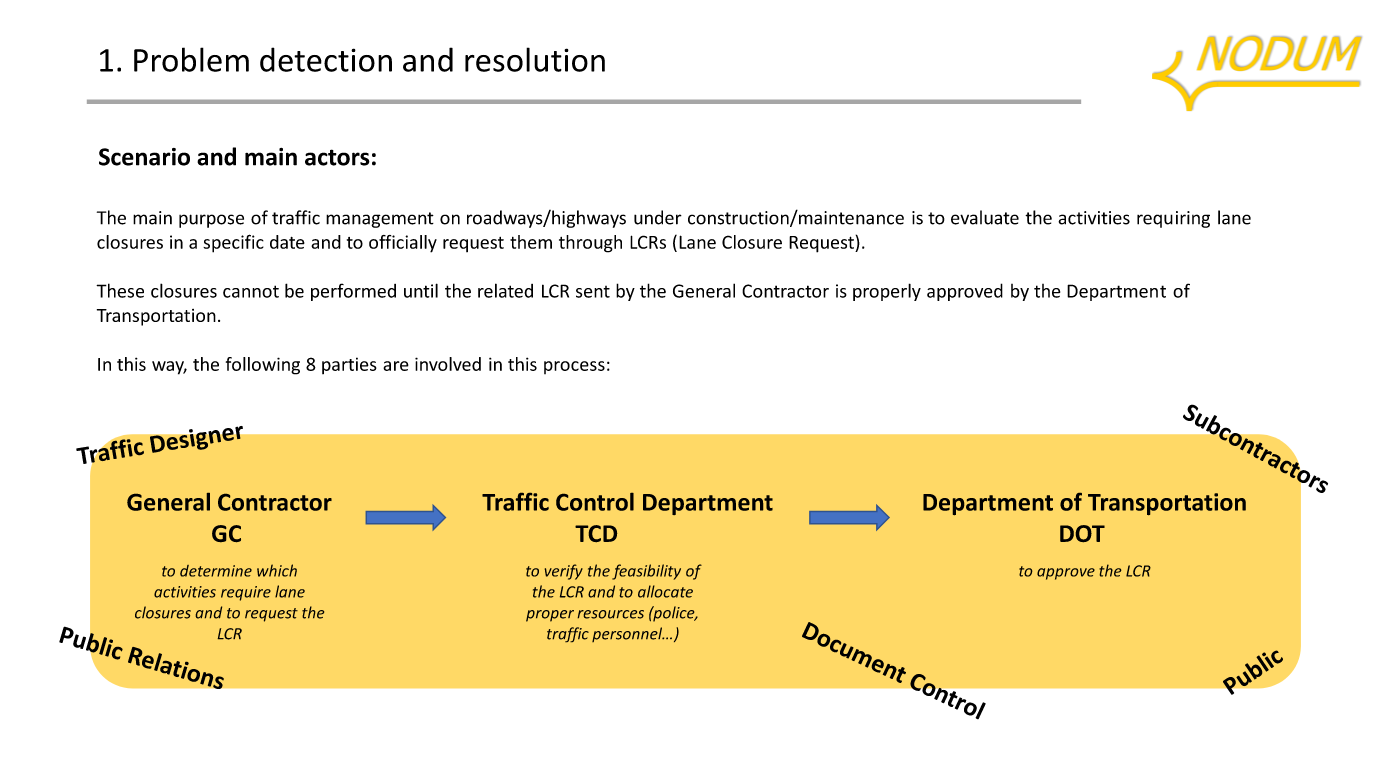
Business Pitch - Problem detection and resolution
-

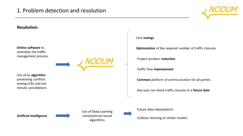
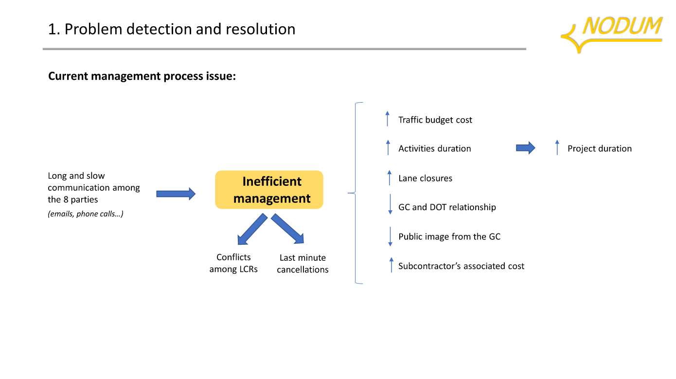
Business Pitch - Problem detection and resolution (2)
-
Business Pitch - Problem detection and resolution (3)
-

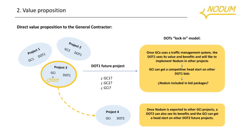
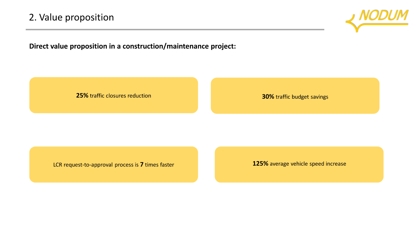
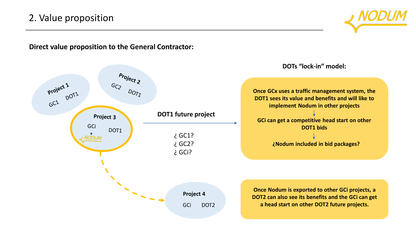
Business Pitch - Value proposition
-
Business Pitch - Value proposition (2)
-

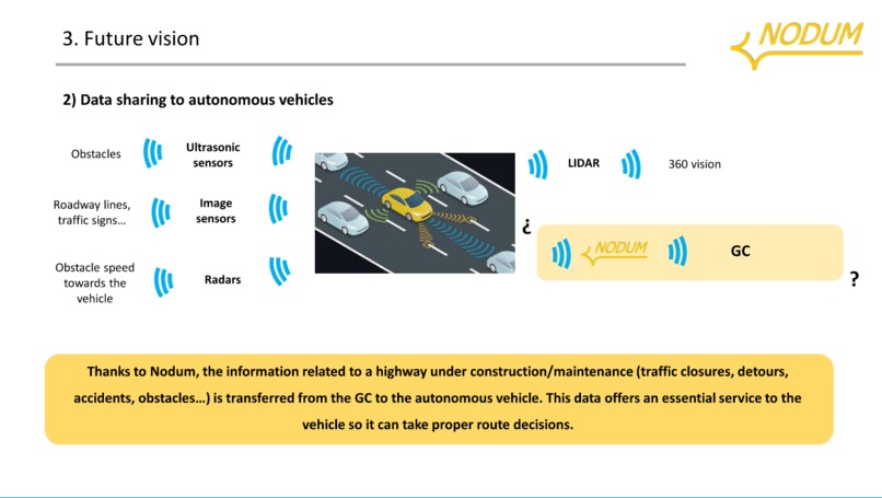
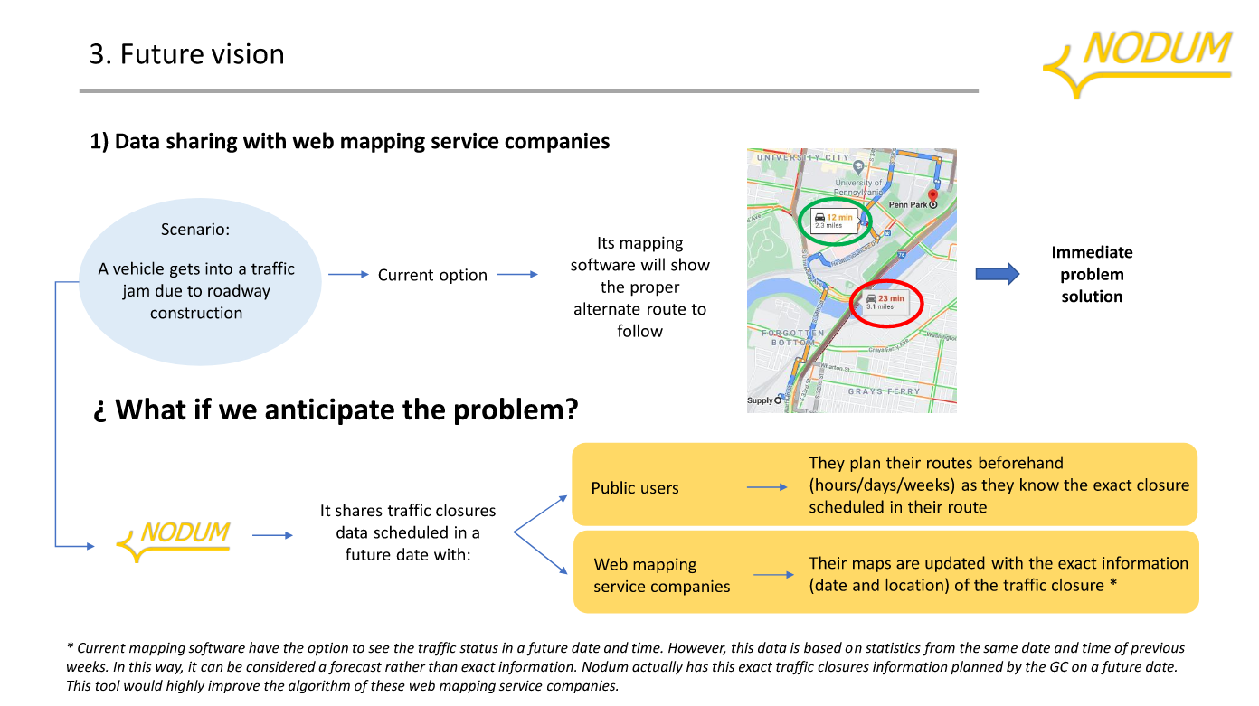
Business Pitch - Future vision
-
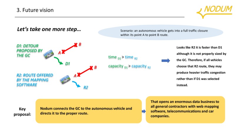
Business Pitch - Future vision (2)
-
Business Pitch - Future vision (3)


Nodum: Highways Connected to People
Nodum was born in the heart of a highway infrastructure project: the I-35W/I-820 interchange in Dallas–Fort Worth, Texas.
If you zoom into this area on Google Maps, you'll find a four-level highway featuring 26 bridges—one of the most complex and congested spaghetti junctions in the U.S.
The Problem
The construction of this intersection required constant lane closures to coordinate activities with ongoing traffic. Every time a bridge was built over an existing road (let’s call it Roadway A), that section had to be closed, and traffic detoured through Roadway B.
But what if Roadway B was also scheduled to be closed at the same time?
Where would all that traffic go?
This coordination was handled by hundreds of engineers trying to meet deadlines—using only phone calls and emails.
Primitive tools for such a complex and time-sensitive task.
Imagine managing nearly 40 lane closures per day in that environment.
One small scheduling error could trigger a domino effect: traffic chaos, construction delays, and cost overruns.
This isn’t just a one-time problem. It’s a systemic issue on large-scale highway and infrastructure projects.
The Spark
One of our team members was tasked with coordinating traffic for that project.
He experienced firsthand the inefficiencies, waste of resources, and domino traffic jams caused by an outdated, disconnected system.
Out of that frustration came an idea:
What if we created centralized software, built over Google Maps, that could schedule all lane closures in the most efficient, conflict-free configuration?
That’s how our journey began.
The Solution: Nodum
We started building what we now call Nodum, derived from the Latin word for “knot” or “intersection.”
Our goal: untangle the mess of traffic coordination through a simple, visual, and intelligent platform.
Our team isn't made up solely of software engineers—we’re also civil engineers, lawyers, and economists. That multidisciplinary input shaped Nodum into a practical and comprehensive solution.
What Does Nodum Do?
Nodum connects everyone involved in a construction project—subcontractors, departments of transportation, stakeholders, and the public—through a shared platform.
Step 1: Define the Network
A Traffic Designer enters the project’s road network into the system by tagging key attributes on a Google Maps-based interface:
- Number of lanes
- Road types
- Lengths
- Type of closures
This network is divided into “sections” from crossing to crossing, node to node.
We’re talking about hundreds of entries, depending on the project.
Step 2: Create Lane Closure Requests (LCRs)
From this database, Nodum generates Lane Closure Requests (LCRs), each representing a specific road section that could be closed.
- LCRs span from point A to point B
- They can be classified as:
- Partial Closure – congestion, but traffic still flows
- Full Closure – traffic must detour from point A to C
- Partial Closure – congestion, but traffic still flows
The Traditional Problem
Someone might unknowingly request a full closure of LCR#2 (A → C), not realizing it overlaps with the detour for LCR#1.
This creates a critical conflict.
Multiply that by 80+ LCRs per day, and chaos is almost guaranteed—unless every conflict is caught in time.
Step 3: Conflict Prevention
That’s where Nodum steps in.
- ✅ Conflict-detection algorithm blocks conflicting LCRs
- 🔍 Issues are caught before they happen
- 🚧 Ensures all closures are compatible, efficient, and safe
Step 4: Smart Detour Design
Let’s say Google Maps reroutes 150 highway vehicles onto a narrow local road.
The first 20 cars might get through, but the rest? Another traffic jam.
Nodum solves this with:
- Pre-approved detours reviewed by traffic engineers
- Only routes with sufficient capacity are selected
- Prevents highway traffic from spilling onto weak local streets
How Does Nodum Work?
Once an LCR is selected by a Project Manager, it follows a streamlined approval workflow:
- ✅ Validated by the Traffic Control Department
- 📋 Reviewed and approved/rejected by the Department of Transportation
- 🗺️ Approved closures are shown on an interactive map with detour paths
This user-friendly system and visual clarity is something the industry currently lacks.
Now imagine:
- 🚑 Emergency responders knowing future road closures
- 🚚 Logistics companies avoiding last-minute delays
- 🛫 Travelers checking airport access two days ahead
Nodum makes that visibility possible.
The Journey So Far
After building a full version of the software, we introduced it to infrastructure companies across:
- 🇺🇸 United States
- 🇨🇦 Canada
- 🇪🇸 Spain
- 🇳🇴 Norway
- 🇩🇪 Germany
Selling traffic software to massive firms as a small, unknown startup was tough.
But we stayed focused on the value:
- 💰 Cost savings
- ⏱️ Shorter construction timelines
- 🚦 Improved traffic flow
- 😌 Fewer headaches
Our First Big Win: The Purple Line
Our first major client was the Purple Line Project—the largest light rail system currently under construction in the Washington D.C. area:
- 16.2 miles
- 21 stations
- 5 years of construction
- Built by Flatiron-Dragados and OHLA
A particularly complex zone: University of Maryland campus with 40,000 students navigating daily.
Here, Nodum made the biggest difference:
- 📉 Fewer closures
- 🔄 Smarter detours
- 🚗 Continuous traffic flow
The Future
We envision Nodum as part of a connected, intelligent mobility network:
- Integrated with smart, autonomous vehicles
- Feeding closure data into Google Maps and navigation tools
- Cars rerouting not just based on live traffic—but also on what’s planned for tomorrow
Nodum could be the missing piece in truly intelligent mobility.
Final Thoughts
They say necessity is the mother of invention—but we’ve learned that frustration is the father.
What began with a headache on a construction site evolved into a platform that can reshape how we build roads and move people.
We’re honored to be part of the Google Maps Awards and proud to share our story with you.
Guided by our slogan, we will continue working toward our vision of having:"Highways connected to people."


Log in or sign up for Devpost to join the conversation.