Inspiration
This weekend Hurricane Isaias hit Atlanta, and Peachtree Creek rose from 19 to 3,750 cubic feet per second overnight. More than half of flood drownings happen in a car. People get county-wide warnings and map apps that reroute only after a road is closed, and NOAA's road flood data skips the side streets where people live.
What it does
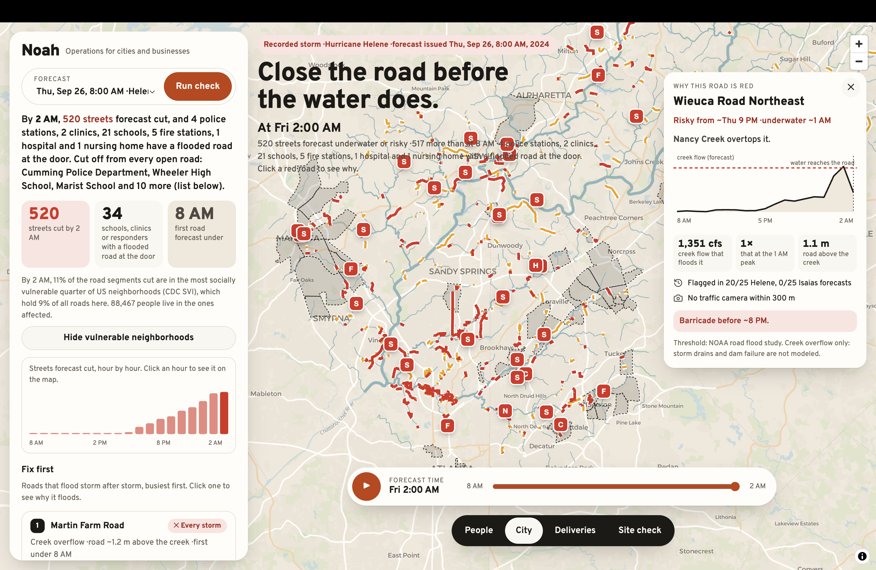
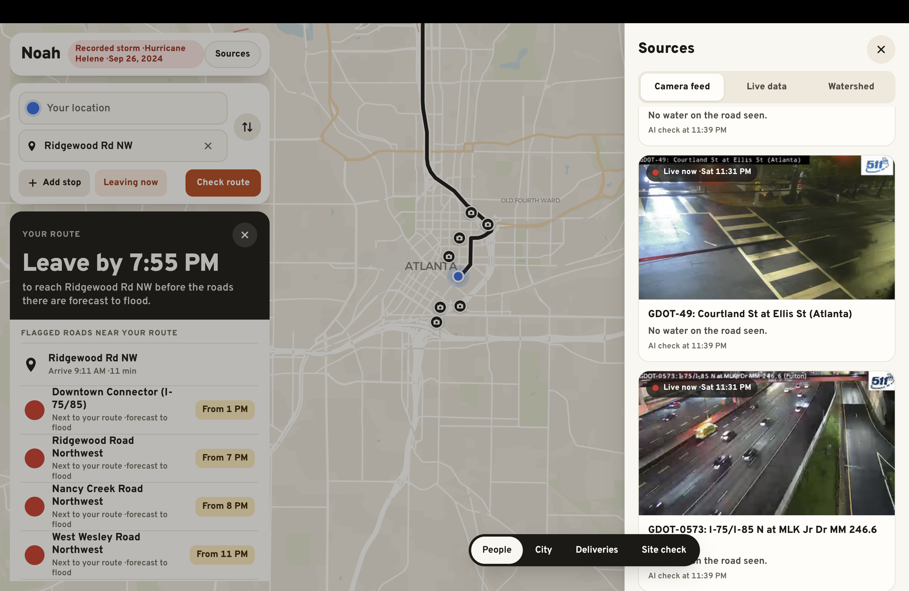
Noah predicts which streets will flood, and when, up to 18 hours ahead.
- Drivers: routes around flooded roads and a time to leave.
- Anyone, by iMessage: ask a question, get traffic-camera photos with a risk checklist, or text
alerts onand Noah texts first. No app, no account. - Cities: which schools and hospitals get cut off, and which roads to fix first.
How we built it
- Forecast: NOAA's National Water Model gives creek flow for the next 18 hours.
- Street thresholds: NOAA's terrain and flood data give the flow at which each road floods. We computed our own thresholds for 62,202 residential streets.
- Routing: OpenStreetMap roads, with flooded streets removed hour by hour.
- Agent: about 30 live sources (warnings, gauges, rain, cameras, public reports) feed a FastAPI agent, reached over iMessage through Photon Spectrum.
- App: an iPad app with four tabs, built on MapLibre.
A road floods at the first forecast hour when the creek flow reaches the flow that puts water on the road's lowest point
Here \( Q_t \) is the forecast creek flow at hour \( t \), \( \text{HAND}_{\min} \) is the road's lowest height above the creek, and \( \text{RC} \) is the rating curve that turns flow into water height.
Challenges we ran into
- NOAA's road list skipped the residential streets that flooded in Helene, so we computed those thresholds ourselves and checked them against NOAA's.
- The camera AI raised false alarms, so a camera now counts only when two separate checks see water.
- We kept Noah running live through a real storm while still building it.
Accomplishments that we're proud of
- Helene: 13.2 hours of warning. Noah flagged Windsor Parkway for 10 PM, and the city closed it about 10:15 PM.
- Isaias, live: Friday night's run predicted Saturday's creek peaks within about 10%, 11 to 13 hours ahead.
- Alerts: Noah texted warnings before anyone asked, for 9 of 11 watched routes.
What we learned
Flood forecasts already exist. What's missing is the last mile: turning a creek's flow into "your street, at 7 PM, leave by 6:30" and getting that to people who won't open an app.
What's next for Noah
More watersheds (the same pipeline runs on NOAA's national model), storm-drain data where cities publish it, and a pilot with an Atlanta city department or delivery business.
Team
Margulan Baizhakyp: built the forecast pipeline, live loop, route watch, iMessage agent and Noah Operations; built the web map, trip planner and routing API, live-checks engine and iPad app during Hacklanta, and competes separately in the Fintech track.
Built With
- azure-openai
- fastapi
- geopandas
- maplibre
- networkx
- noaa-national-water-model
- node.js
- osmnx
- photon-spectrum
- python
- typescript
- usgs

Log in or sign up for Devpost to join the conversation.