Inspiration
In the light of recent extreme catastrophic events such as the flooding induced by Hurricanes Harvey and Irma, real-time monitoring and prediction of stream levels are as vital as ever. A common strategy to mitigate the impacts of extreme weather events is to enhance resilience at both the individual and community levels. The National Research Council report outlines the importance of the utilization of new technologies to improve monitoring and data acquisition approaches for disaster management and increased resilience (NRC 2007). Accurately measuring the surface elevation of a water body (e.g. river, lake, reservoir, sea) is a vital component of environmental monitoring and modeling efforts.
United State Geological Survey (USGS) has water level sensors all around the US, each cost around $10,000, plus the maintenance costs.
Local institutions have dedicated bridge-mounted water level sensors that costs around $3,000.
What it does
We developed a novel geometrical method to to assess water levels using a camera, accelerometer, gyroscope sensors in combination with fine LIDAR data (3D model of earth's surface constructed by remote sensing techniques).
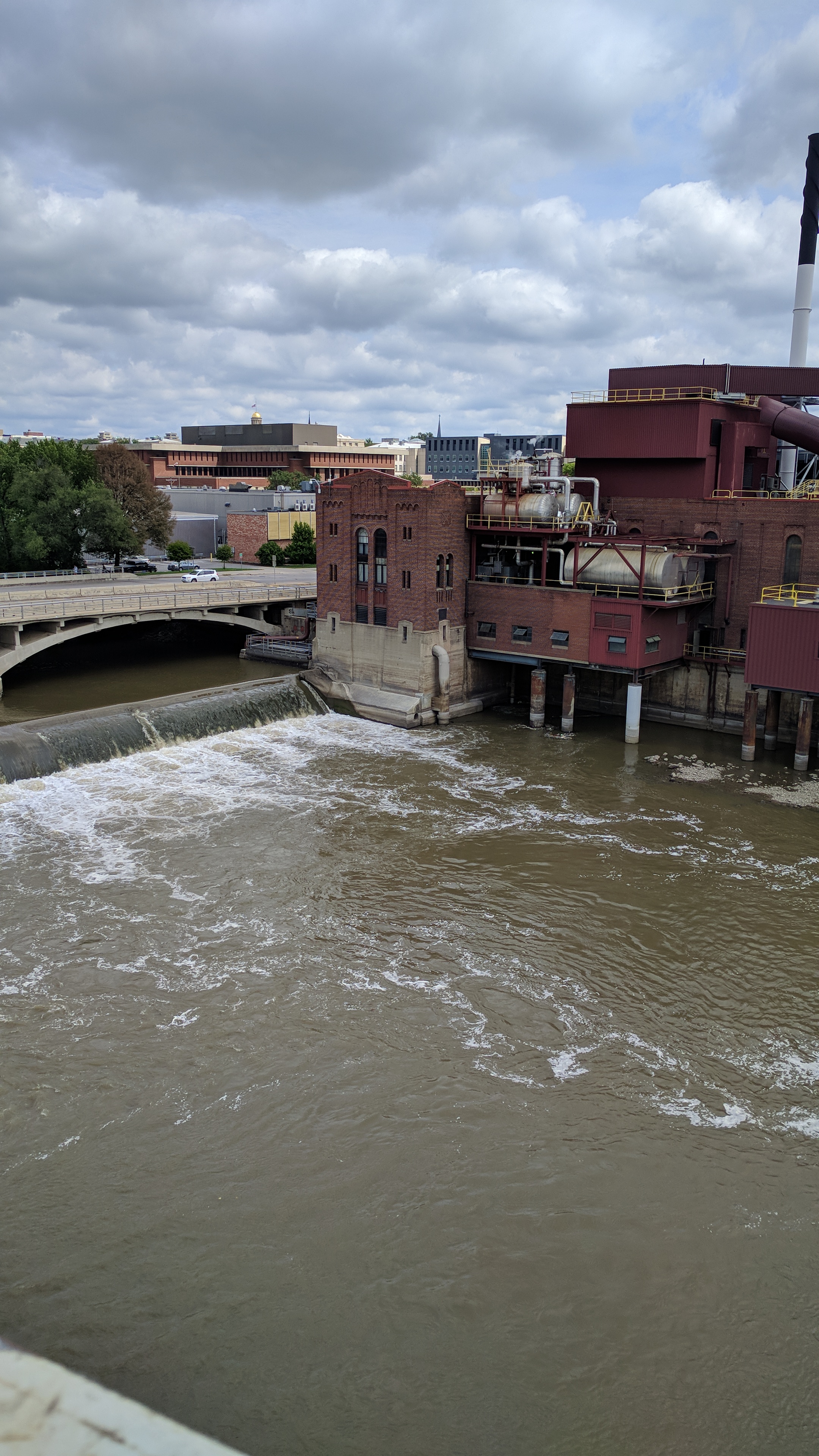
A camera-based sensor is installed on a location that looks to the intersection of a water body (i.e. river) with a rigid object. Our image processing module finds the intersection of the water with object and moves the camera so that the intersection is right in the middle of the camera feed. Our motion sensors pick up the exact degrees of angle that is caused by this change to assess the 3D orientation of the camera.
Then, we create a vector in 3D world starting from the camera and goes to the infinity. We then find the approximate point that this vector intersects with the discretized LIDAR data. If found, that is our point of interest. The z value of that point is the elevation, and hence gives the water level.
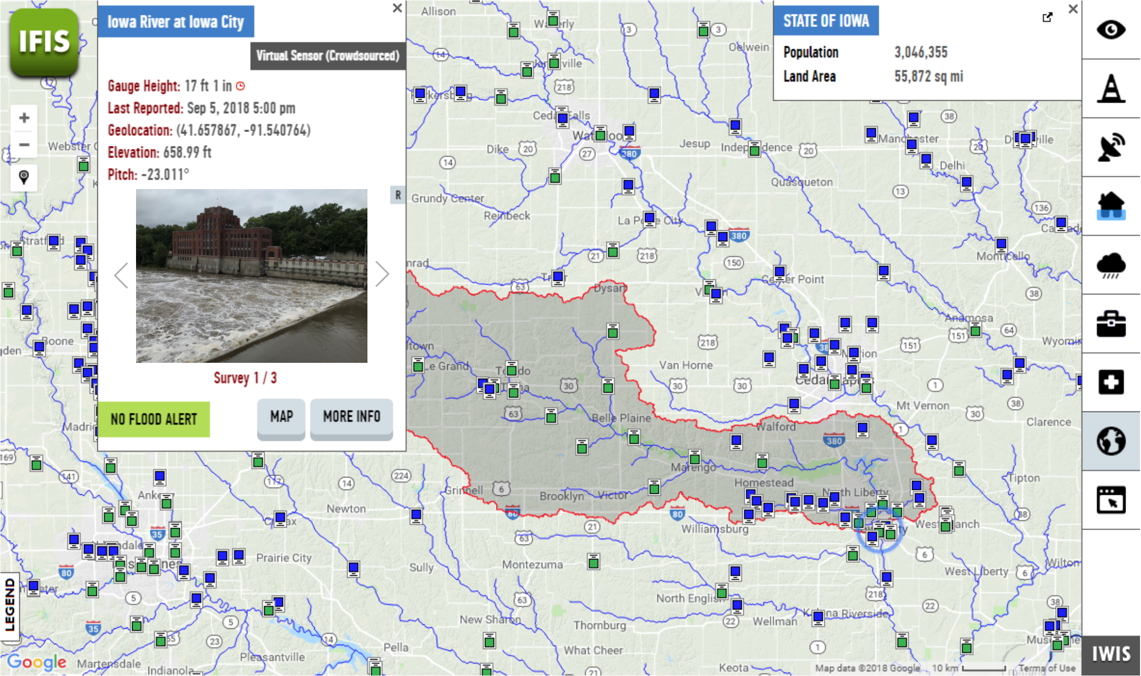
Additionally to the sensor, we also designed a web-based system to retrieve and visualize these water level readings (see image).
How we built it
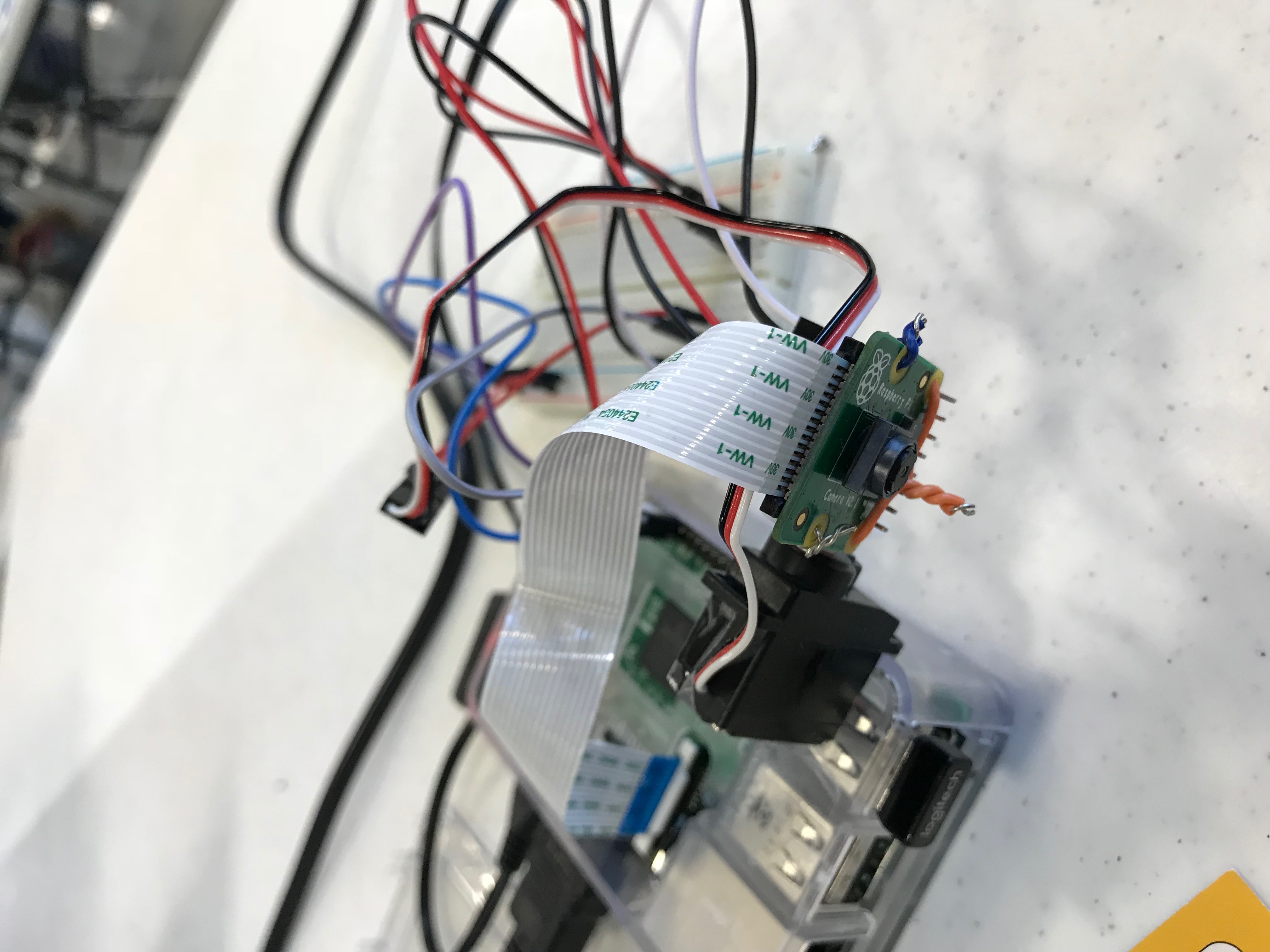
We have used a Raspberry pi, an accel/gyro sensor, a high-res camera, and a servo motor to design a stand-alone camera-based water level measurement sensor. We retrieved the LIDAR data (1m resolution).
Challenges we ran into
Since we dealt with real-world, we came across with lots of challenges:
- LIDAR data can be huge, and making geographical analysis on-the-fly on an embedded system was extremely hard.
- Soldering components: We integrated camera and accel/gyro sensors together in a way that angles we are measuring will always represent the cameras angle. And, we made this lightweight and compact enough to work with a servo.
- Our method will be as accurate as our sensor readings. We employed both hardware and software-based refinements to our readings such as using computationally low-cost Complementary filter to merge accel and gyro readings to smooth the orientation signal as well as using caps and circuit elements to reduce the electrical noise.
Accomplishments that we're proud of
- Our solution costs less than $100 while other prevalent water level sensors cost thousands of dollars!
- It actually works!
What we learned
What's next for Next-gen Low Cost Water Level Measurement
- Accuracy and error-rate of the system should be evaluated for different environmental conditions (e.g. night, rain, corrupt LIDAR, etc.)
- Efficient battery management strategies, employing a solar-powered option.
- Designing data transfer protocols for minimizing the routine costs.

Log in or sign up for Devpost to join the conversation.