-
-
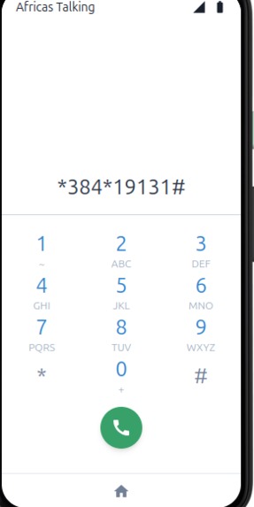
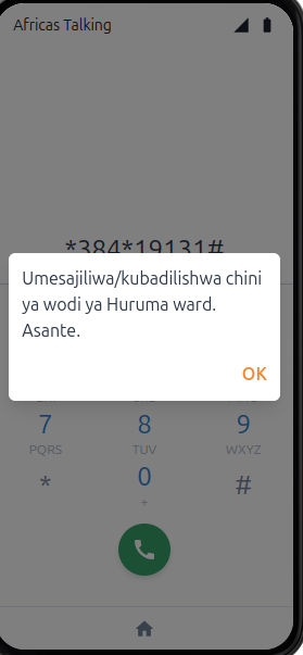
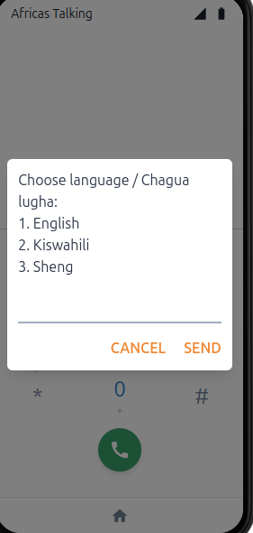
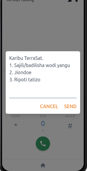
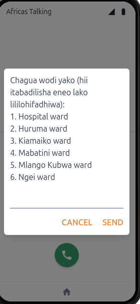
USSD
-
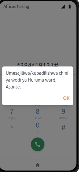
Reg url
-
-
-
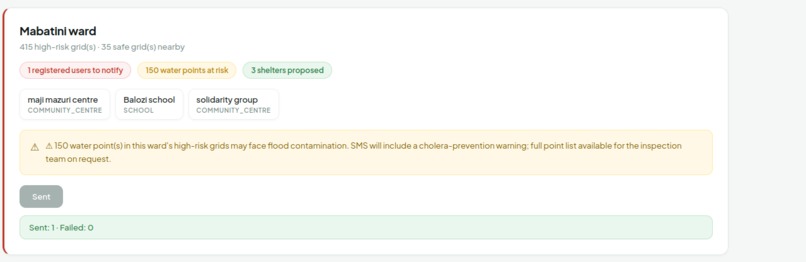
-
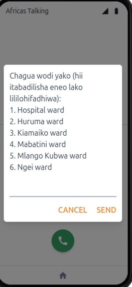
-
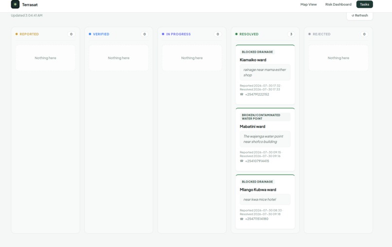
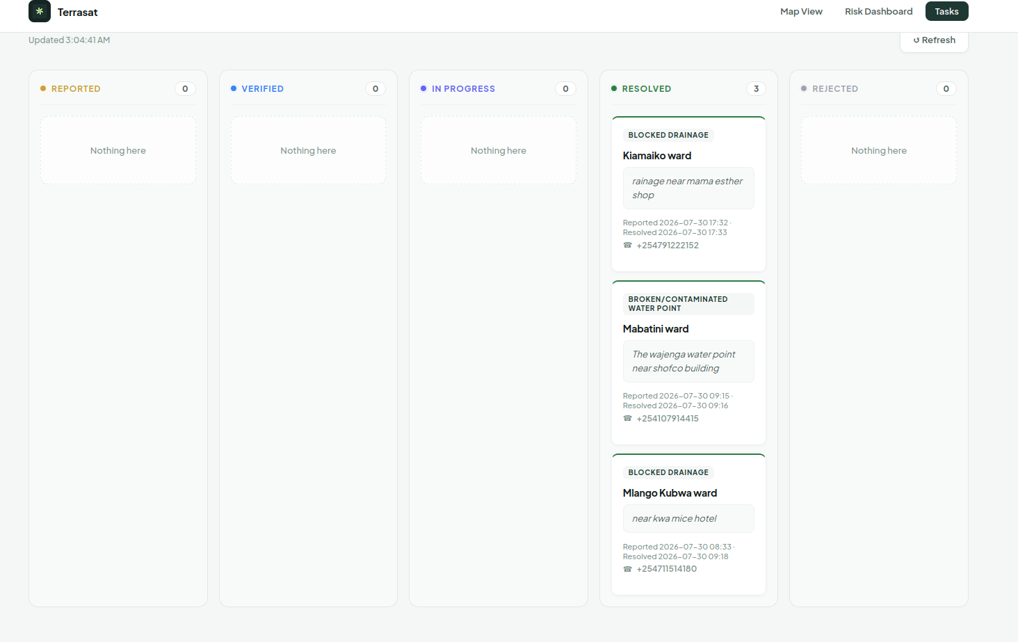
Maintenance task page
-
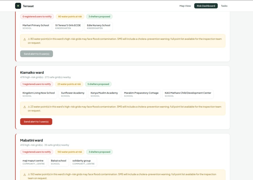
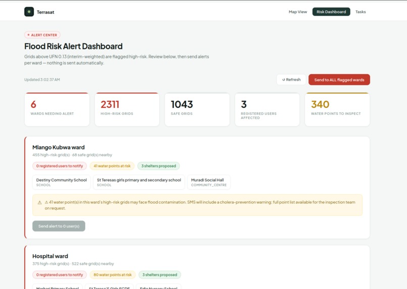
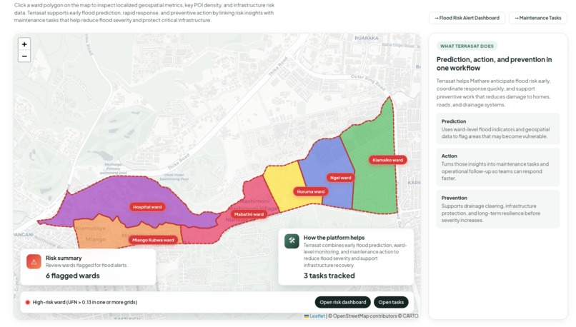
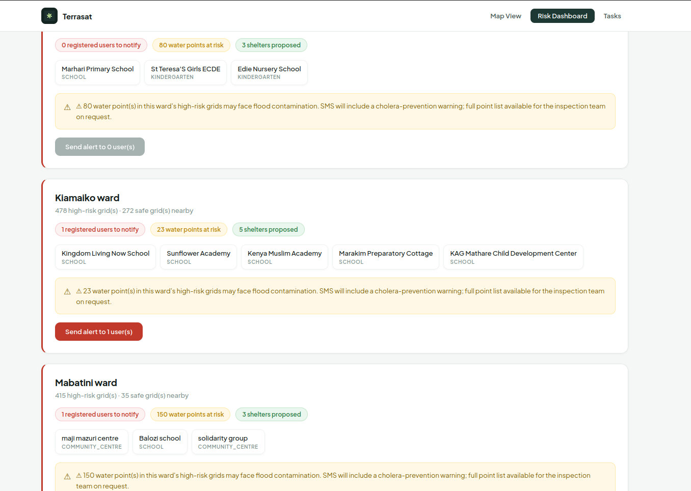
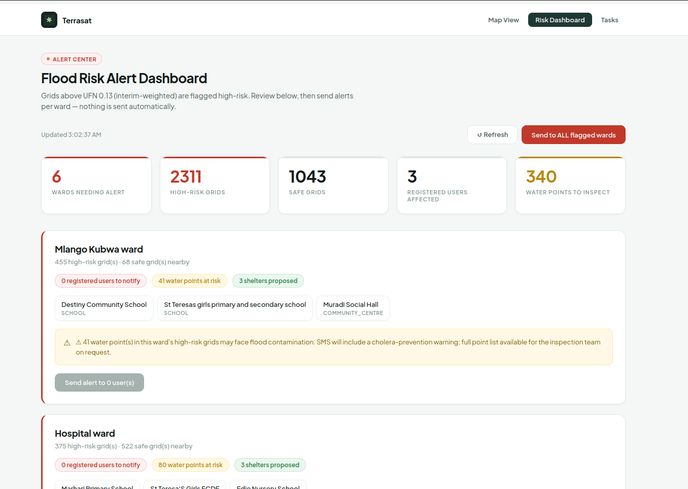
Risk analysis page
-
-
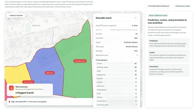
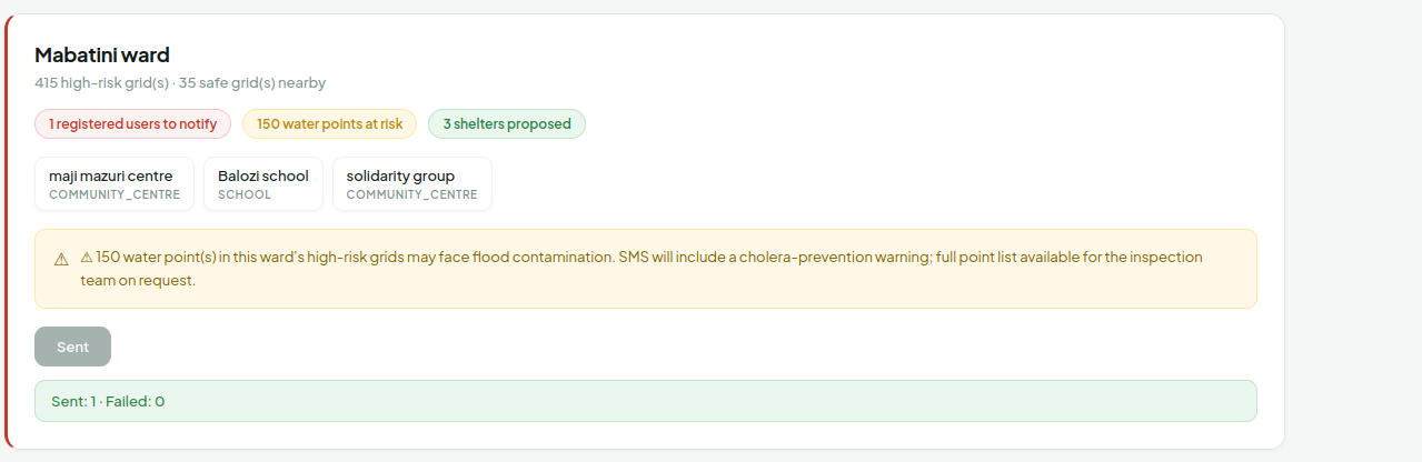
Dashboard
-
NEWIS: Nairobi Early Warning & Intervention System Inspiration NEWIS was born from walking alongside communities rather than working behind a computer. Between 2024 and 2026, Kenya experienced consecutive years of devastating floods that claimed hundreds of lives, displaced thousands of families, damaged homes, schools, businesses, and public infrastructure. Climate-related disasters are estimated to cost Kenya approximately KES 186 billion every year, equivalent to nearly 3%of the country's Gross Domestic Product (GDP).
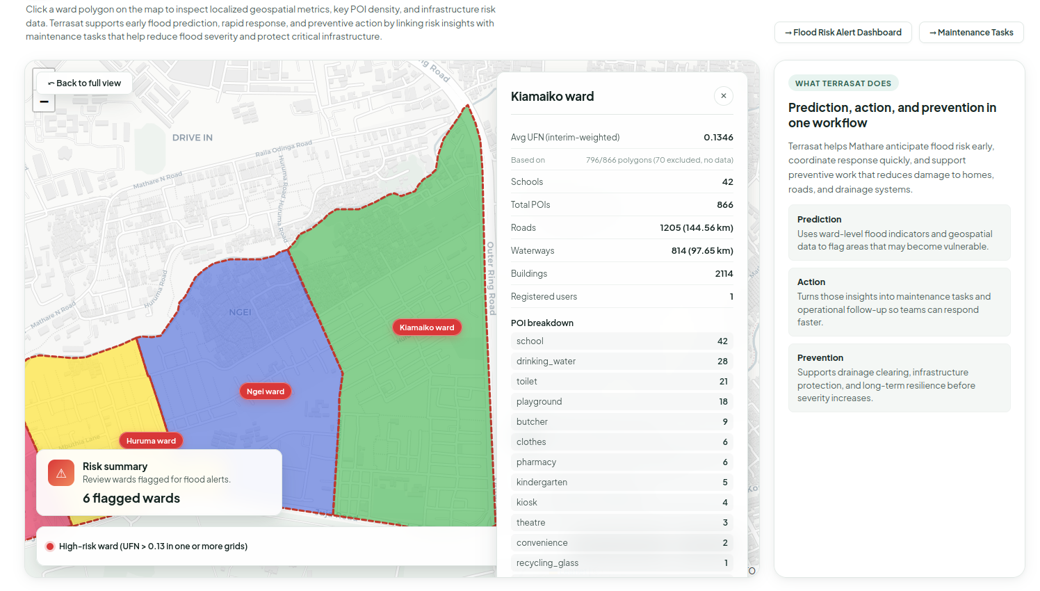
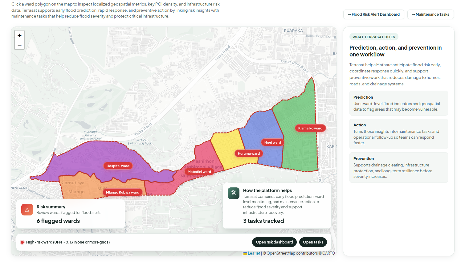
While these numbers demonstrate the national scale of the problem, they do not reflect what communities experience every rainy season. Our inspiration came from spending time in Mathare, one of Nairobi's largest informal settlements located along the Nairobi River. Together with the Mathare River Adoption Initiative, community leaders, youth groups, and Community Health Promoters (CHPs), we walked through flood-prone neighborhoods including Mabatini, Mlango Kubwa, Hospital Ward, Huruma, Kiamaiko, Ngei, and Utalii.
These visits completely changed how we viewed flooding. Residents showed us drainage channels blocked by plastic waste and debris, narrow pathways that disappear within minutes once the river rises, homes built only a few metres from floodwater, and schools and community halls that quickly become inaccessible during heavy rainfall.
We listened to families describe evacuating in the middle of the night, carrying children, household belongings, and essential documents through flooded pathways without knowing which locations were actually safe.
One conversation remained with us. Community volunteers explained that flood warnings sometimes reached residents through television, radio, or social media, but those warnings rarely answered the questions communities needed most.
- Is myneighborhood at risk?
- Where is the nearest safe place?
- Which route is still accessible?
- What should youth groups and community responders do first?
The challenge became even greater after floodwaters receded. Overflowing pit latrines mixed with floodwater. Blocked drainage systems trapped contaminated water throughout neighborhoods. Standing water remained for days, creating mosquito breeding sites while increasing the risk of cholera, typhoid, diarrheal diseases, skin infections, and malaria. Community Health Promoters explained that the health emergency often begins after the flooding has ended.
At that moment we realized something important. Flooding in informal settlements is not only a flooding problem. It is a community coordination problem, a public health problem, and ultimately an information-to-action problem.
That realization became the foundation of NEWIS.
Building NEWIS Instead of asking, "How can we predict floods better?" we began asking a different question: "How can communities know exactly what action to take before, during, and after flooding?" Every design decision was guided by conversations with communities.
Residents consistently told us that smartphones could not be the foundation of an early warning system. Many households rely on feature phones with limited internet access and tight data budgets.
This led us to build NEWIS around technologies people already trust and use every day:
- SMS
- USSD
- Local community response networks
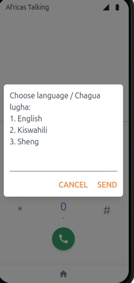
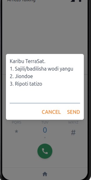
NEWIS is a Lat-Mile community-first Early Warning and Intervention System** designed to transform flood information into practical community action. Residents register using their ward and preferred language through USSD or SMS. When flooding threatens their neighborhood, NEWIS delivers localized warnings instead of broad city-wide alerts.
Rather than only informing residents that flooding is expected, the system recommends the*nearest verified safe location—such as a school, church, health centre, or community hall—that has been confirmed as both:
- outside immediate flood risk, and
- physically accessible. NEWIS also supports the people already protecting their communities.
Community Health Promoters, youth volunteers, and local responders receive prioritized operational tasks that include:
- drainage inspection,
- blocked channel clearance,
- verification of evacuation spaces,
- and community response coordination.
Our fieldwork also highlighted another overlooked reality. Flood disasters continue long after floodwaters disappear. To address this, NEWIS introduces a post-flood public health layer.
By combining:
- flood exposure,
- sanitation conditions,
- drainage status,
- and proximity to shared water points,
The platform identifies neighborhoods at greatest risk of contaminated water and mosquito breeding.
These communities receive targeted public health messages on:
- safe water,
- hygiene,
- cholera prevention,
- malaria awareness,
- and sanitation practices,
while response teams prioritize drainage interventions where they can reduce the greatest health risks.
NEWIS therefore supports the complete disaster cycle:
Warn → Guide → Act → Protect
Challenges We Faced Building NEWIS has involved much more than developing software. One of our greatest challenges has been translating community knowledge into a digital system without losing the realities that exist on the ground. Flood pathways, drainage behavior, informal access routes, and trusted community gathering spaces often do not appear on official maps. Understanding these realities required continuous engagement with residents rather than relying solely on satellite imagery or existing datasets. Another challenge has been helping stakeholders understand what NEWIS actually is. Because it combines disaster preparedness, public health, infrastructure management, and community coordination, many initially assume it is simply another weather application. In reality, NEWIS is designed as a community decision-support platform that connects residents, responders, and local organizations around one shared operational picture. As an early-stage innovation, we have also faced limitations in:
- computational resources,
- access to high-quality datasets,
- prototype development,
- and funding for continuous field validation.
Processing geospatial information while conducting community-centered design requires resources that are often difficult for young innovators to access. Perhaps our biggest lesson has been balancing innovation with simplicity. Communities do not need more complicated technology. They need systems that are reliable, affordable, locally relevant, and easy to use during emergencies. Looking Ahead Our vision extends well beyond Mathare. We believe NEWIS can become a model for strengthening resilience across informal settlements throughout Nairobi and eventually across African cities facing similar climate risks. Beginning with Mathare, we aim to validate a platform that connects:
- residents,
- Community Health Promoters,
- youth organizations,
- county responders,
- and community-based organizations through one coordinated response system. Success will not be measured by the number of alerts sent.
It will be measured by outcomes such as:
- families reaching safety earlier,
- blocked drainage being cleared before flooding intensifies,
- fewer post-flood disease outbreaks,
- stronger coordination among responders,
- and communities becoming active participants in climate resilience rather than passive recipients of disaster information.
The communities of Mathare inspired NEWIS.
Our responsibility is to build a system worthy of their trust—one that transforms early warning into early action, strengthens community resilience, protects public health, and helps save lives before the next flood arrives.
Built With
- arc
- arq
- django
- gis
- gis-cloud
- java
- javascript
- python


Log in or sign up for Devpost to join the conversation.