What Inspired Us
In February 1971, two Apollo 14 astronauts climbed toward the rim of Cone Crater. The terrain was rugged, their orbital maps were inadequate, and every ridge looked the same. Exhausted and running low on turnaround margin, they turned back. Orbital imagery later revealed they had stopped just $30\text{ m}$ from the rim.
Hope is not a navigation strategy. With no GPS, a one-way light-time signal delay of up to $22\text{ min}$, and sudden global dust storms, the first human explorers on Mars will not have the luxury of being $30\text{ m}$ wrong. We built NeuroNexus (from Rajshahi, Bangladesh) to turn NASA's multi-resolution planetary archives into deterministic, source-grounded Marswalk plans that show how sure every number actually is.
How We Built It
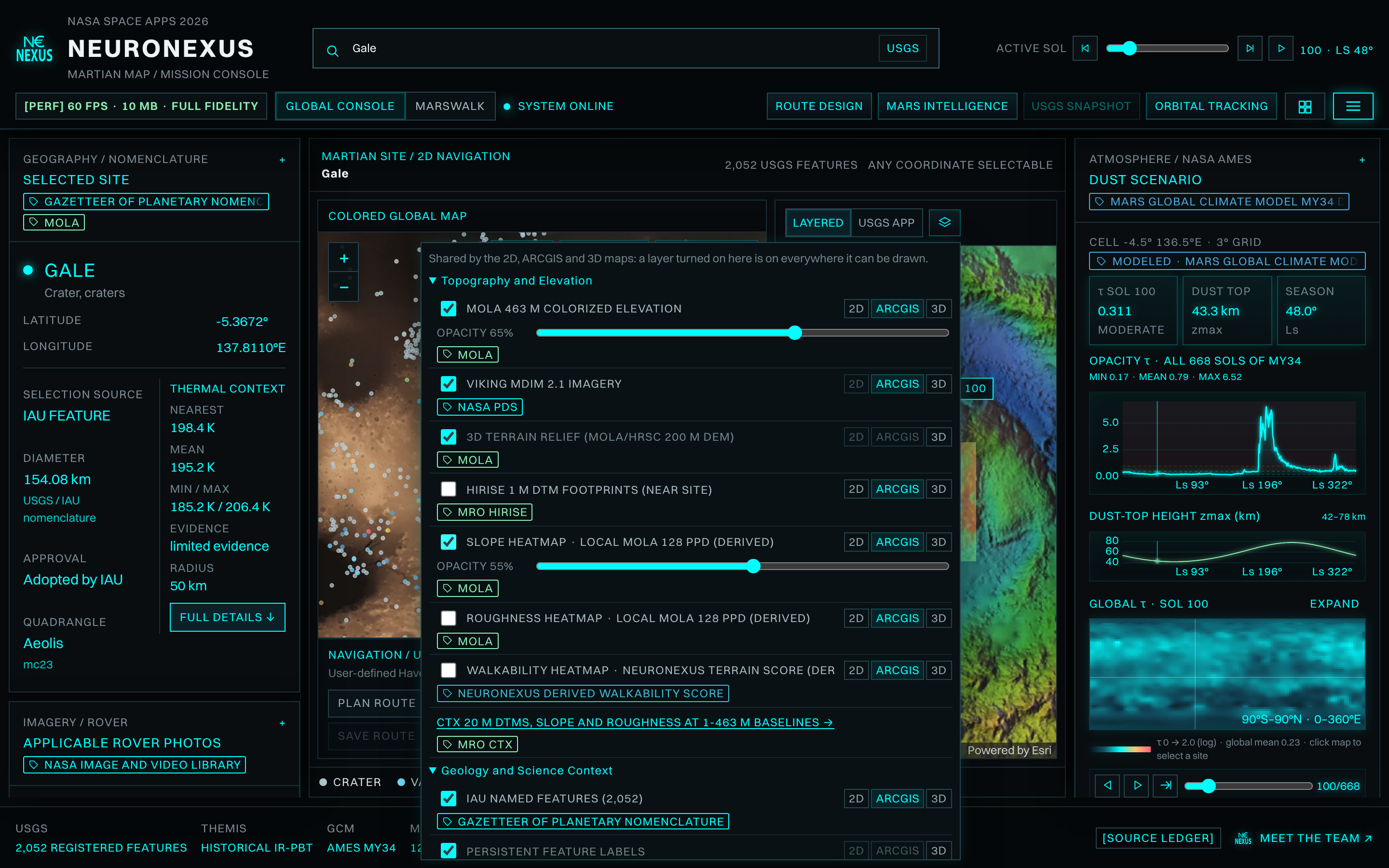
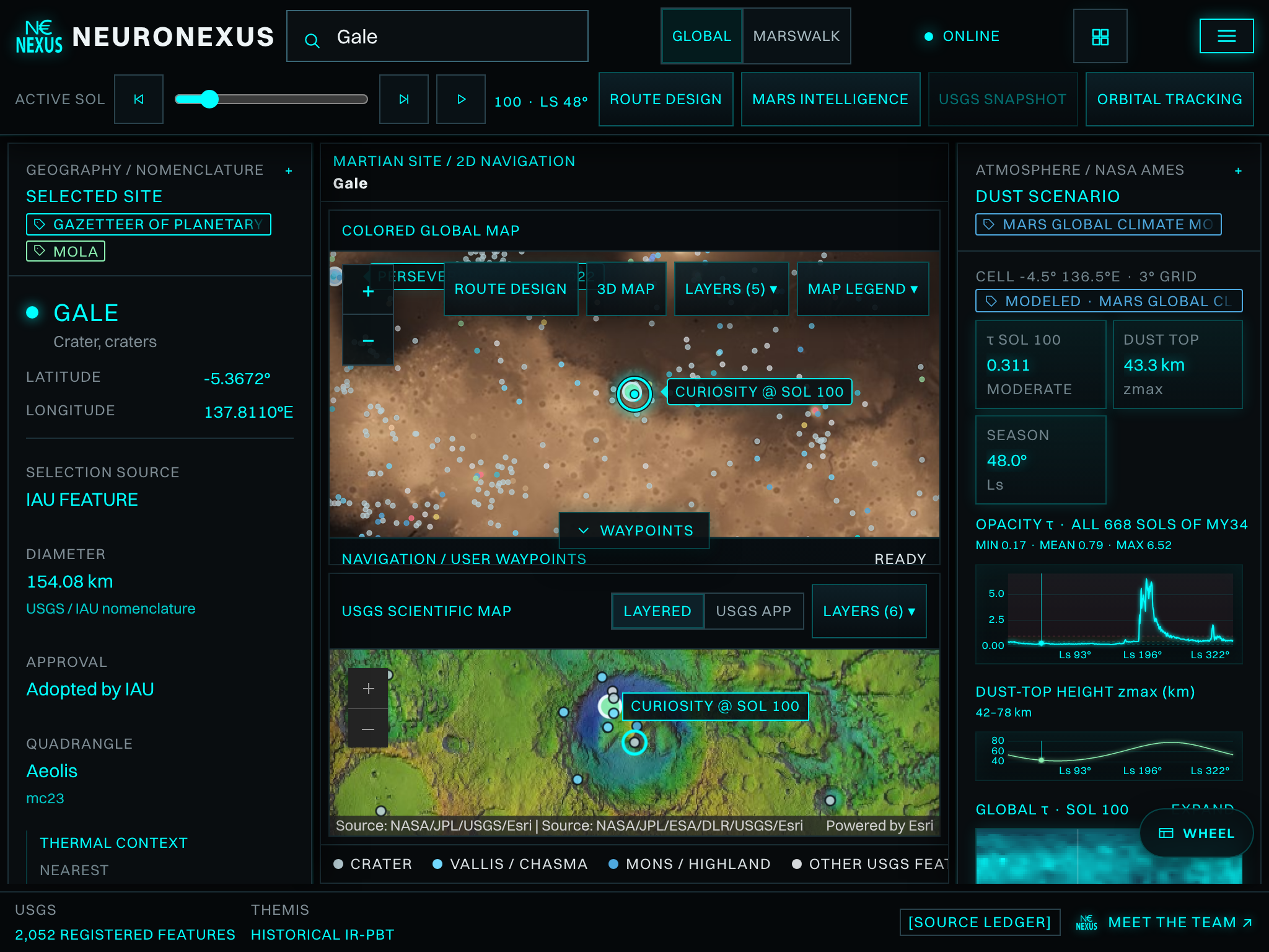
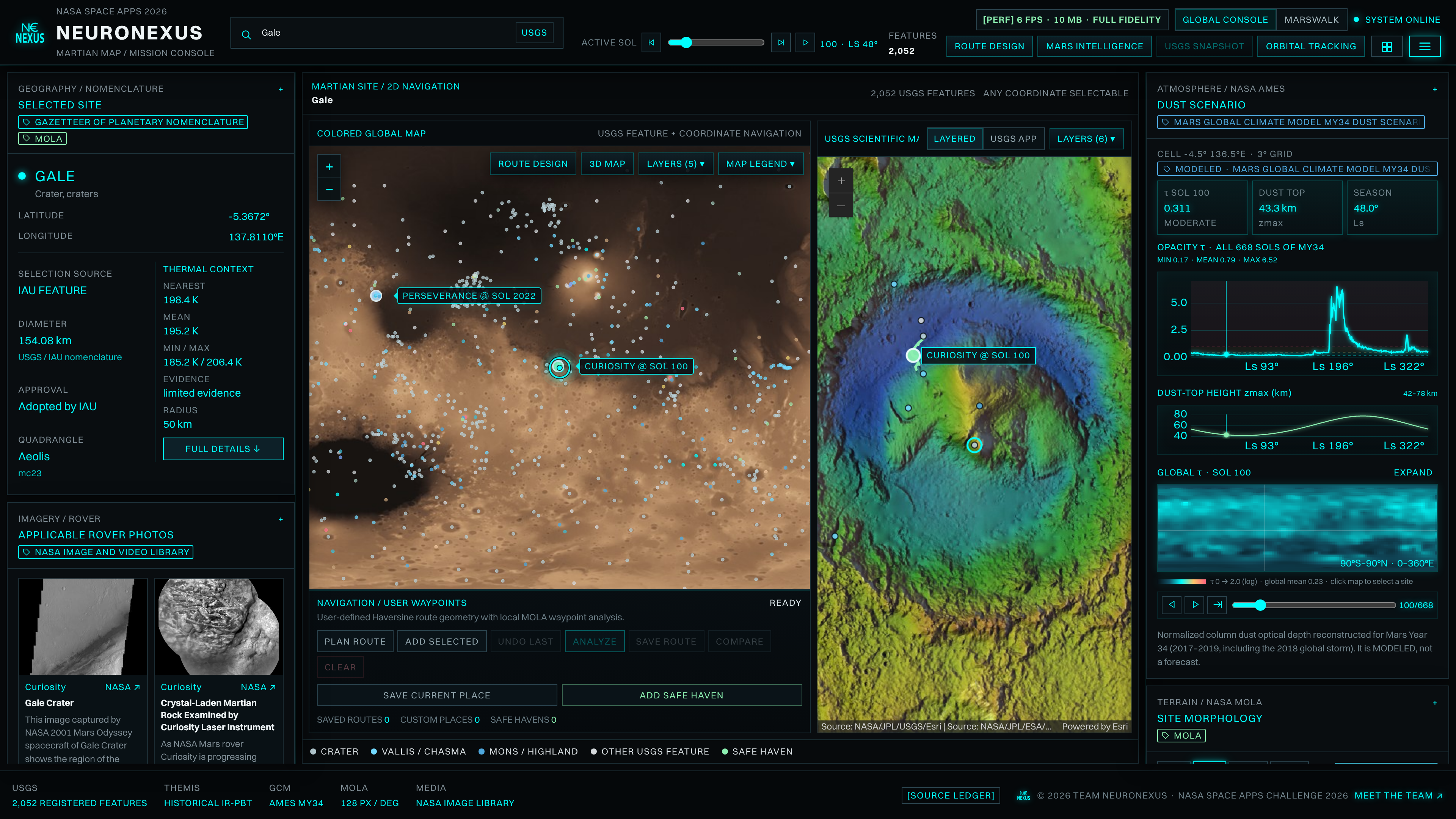
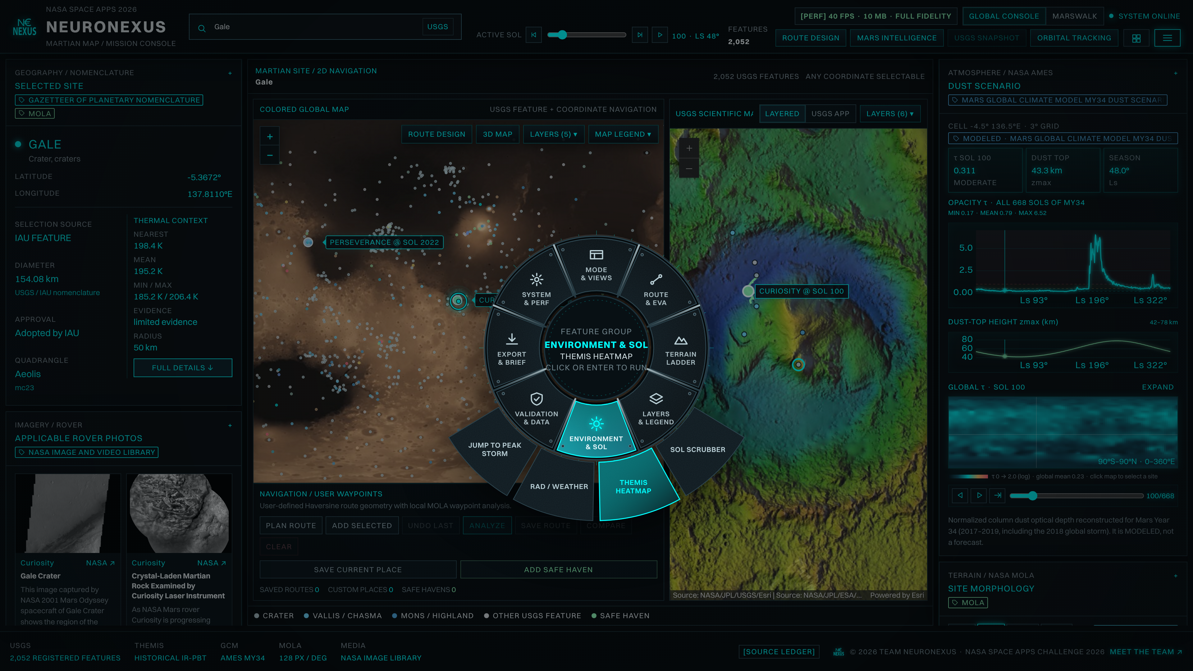
NeuroNexus unifies 76 canonical NASA, USGS, and ASU data sources into a synchronized 2D global map, USGS SIM 3292 geologic viewer, and 3D Mars globe running at $60\text{ FPS}$ inside a $45\text{ MB}$ browser footprint:
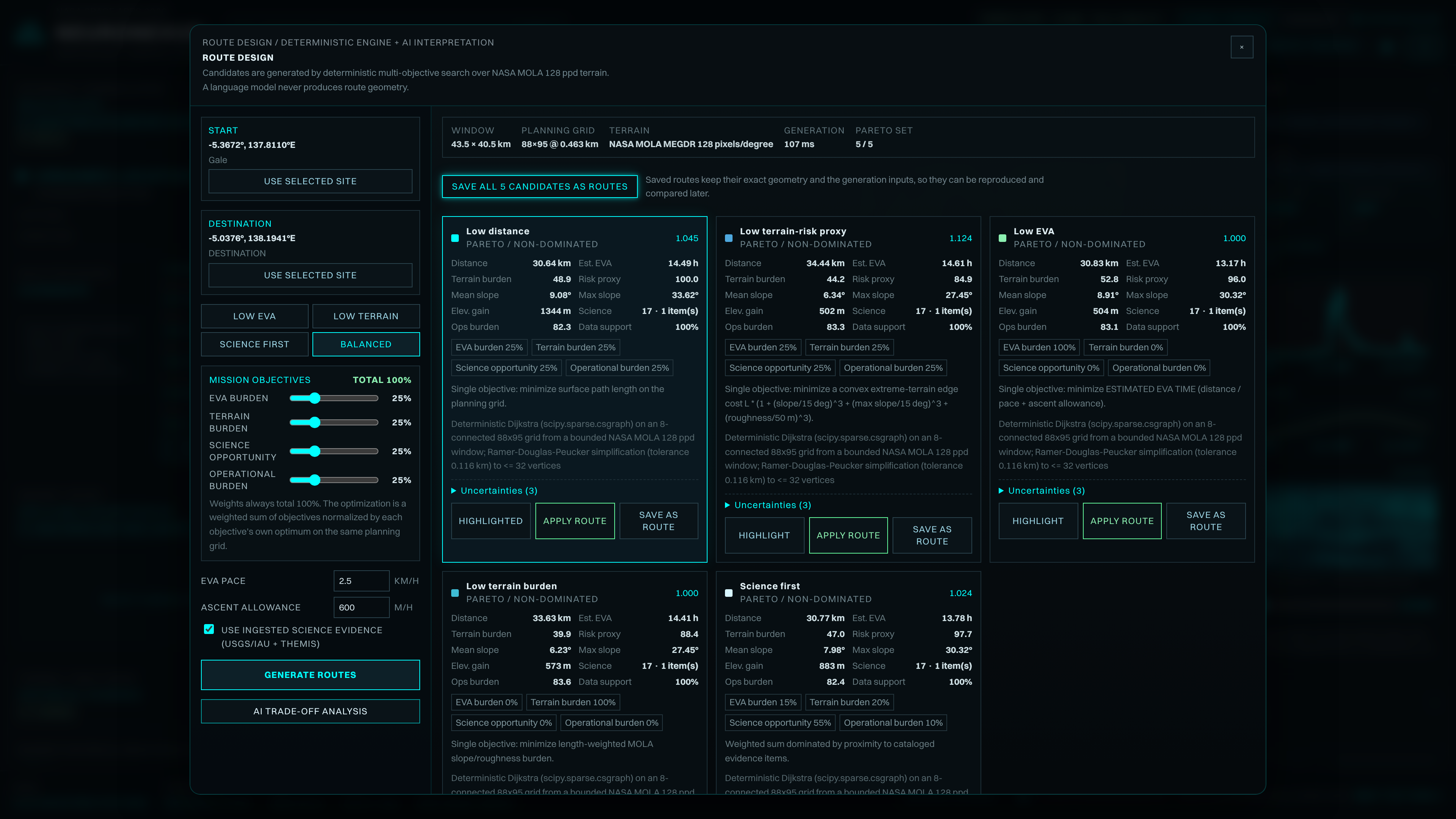
Deterministic Multi-Objective Pareto Route Engine (
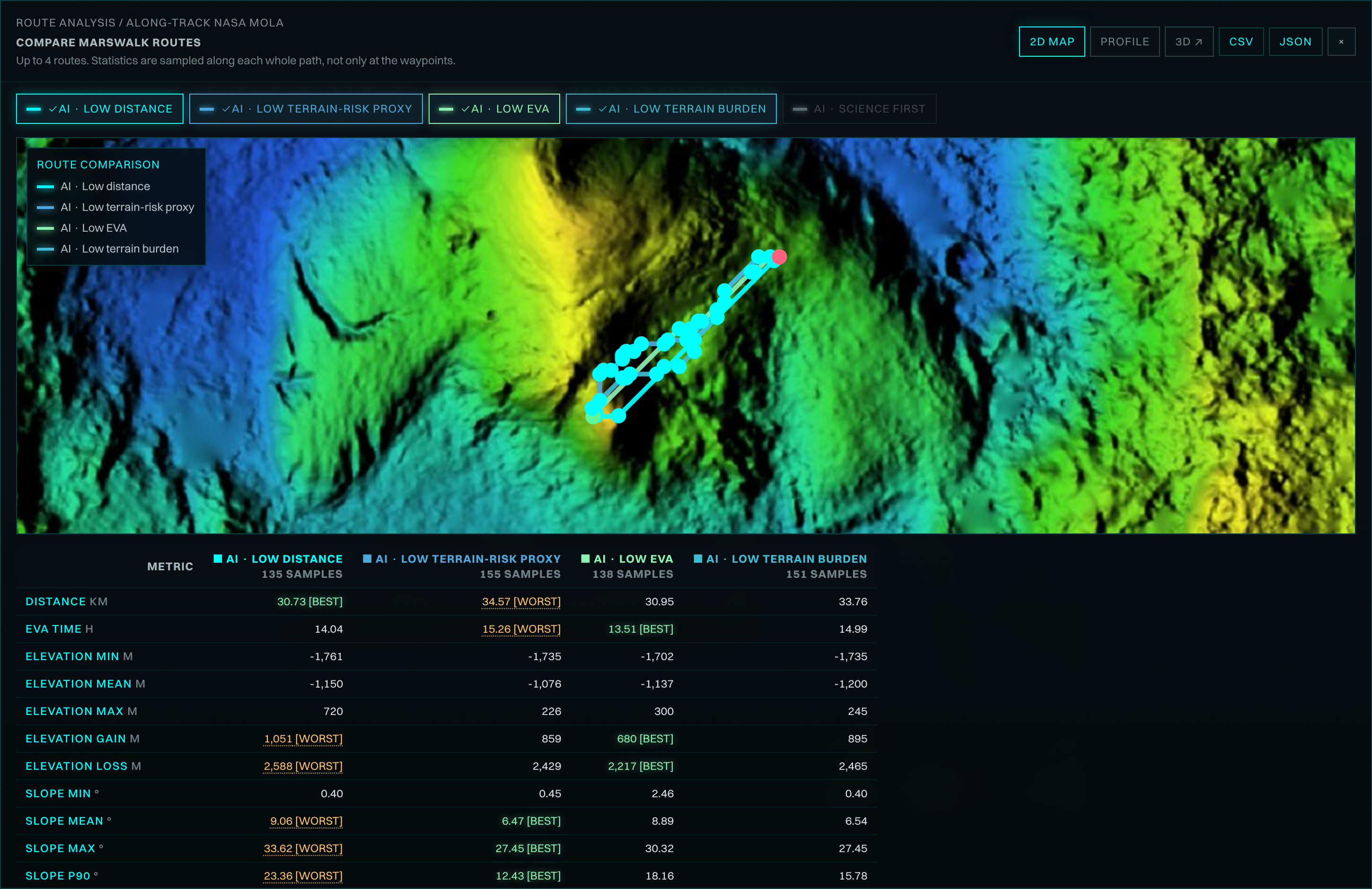
ROUTE DESIGN): Over a $60 \times 108$ grid ($\Delta x = 0.926\text{ km}$) combining NASA MOLA $128\text{ ppd}$ ($463\text{ m}$) elevation, USGS SIM 3292 geology, and ASU THEMIS evidence, ourscipy.sparseDijkstra solver runs in $2,018\text{ ms}$ to return 6 candidate routes across four normalized objectives (EVA burden, terrain burden, science opportunity, and operational burden summing to $100\%$). To penalize steep scarps deterministically, every grid edge of length $L_e$ is weighted by a convex extreme-terrain cost: $$C(e) = L_e \left( 1 + \left(\frac{\theta_{\text{mean}}}{15^\circ}\right)^3 + \left(\frac{\theta_{\text{max}}}{15^\circ}\right)^2 + \left(\frac{r}{150\text{ m}}\right)^2 \right)$$Multi-Resolution
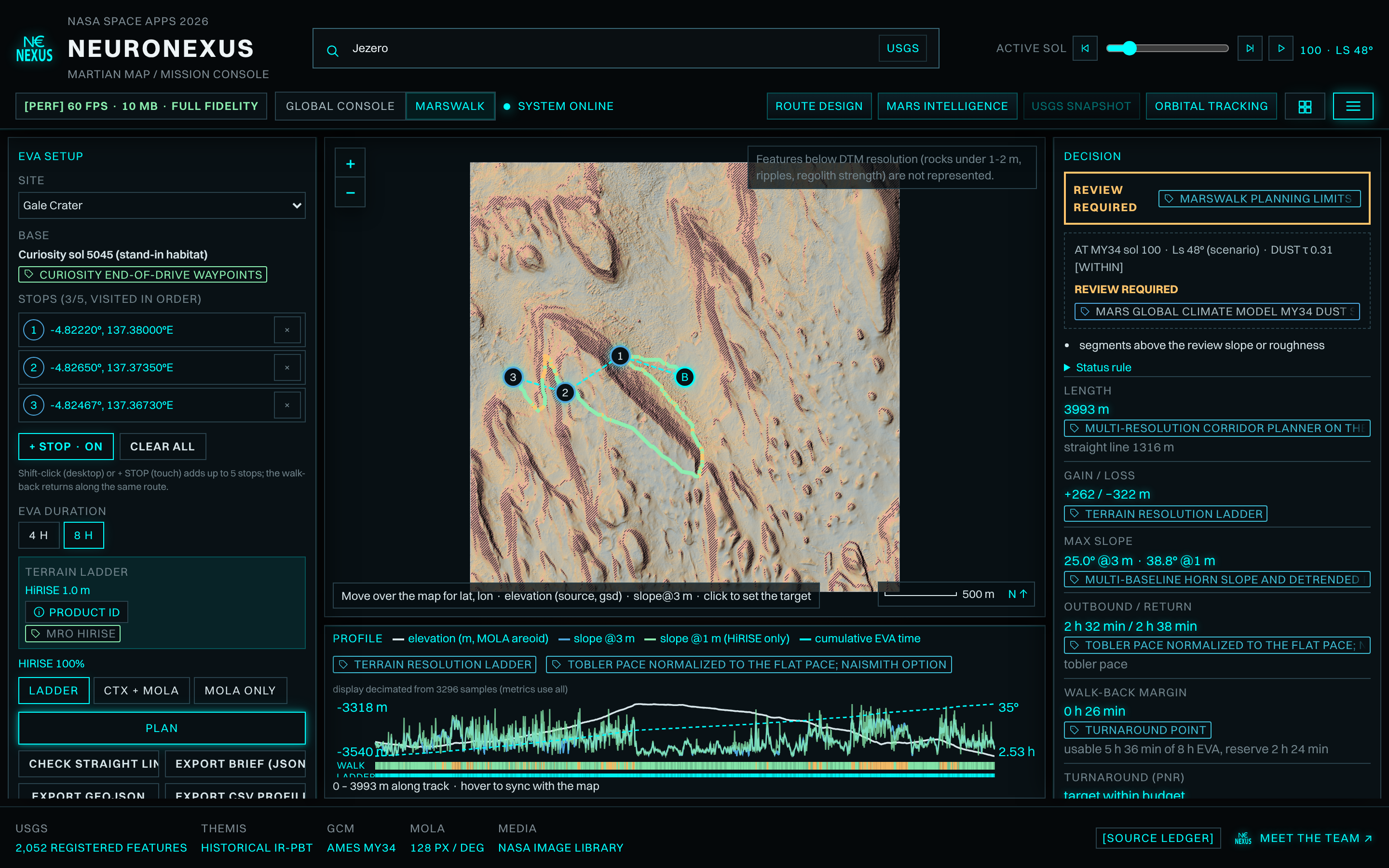
MARSWALKCorridor Planner ($1\text{ m}$ HiRISE): Zooms into meter-scale HiRISE stereo terrain ($1\text{ m/px}$) and CTX ($20\text{ m/px}$) to plan $4\text{-h}$ and $8\text{-h}$ EVAs with explicit turnaround points, weaving around hatched $>15^\circ$ scarps ($1,627\text{ m}$ corridor path vs. $1,351\text{ m}$ straight line).668-Sol Spatio-Temporal Survival Matrix (
MY34): Evaluates every route across all $668$ sols of Mars Year 34 using the NASA Ames Mars Global Climate Model (MGCM) dust optical depth ($\tau$), MSL RAD surface radiation ($156\text{ }\mu\text{Gy/day}$, $26\text{ to }28\text{ }\mu\text{Gy}$ per $4\text{-h}$ EVA), and REMS weather, plus Potential Exploration Zones ($941\text{ km}^2$ around Gale Crater).Guarded 27-Tool
Mars Intelligence&V1-V7Validation: An AI assistant explains trade-offs with clickable source provenance, while never drawing route geometry. Every metric is benchmarked by our automatedV1-V7validation suite ($20/20$ byte-identical reproducible runs).
Challenges We Faced
- Coarse Orbital Scale Bias: Across $n = 1,386$ Curiosity end-of-drive IMU tilt measurements in Gale Crater, $463\text{ m}$ MOLA underestimates $90\text{th}$-percentile ($p_{90}$) steep terrain by a factor of $1.79\times\ [1.70, 1.85]$ (and $2.35\times$ out-of-sample at Jezero Crater). Bridging MOLA, CTX, and $1\text{ m}$ HiRISE evaluated at a $3\text{ m}$ rover baseline was required to recover rover-felt slope at $0.99\times\ [0.89, 1.07]$ at Gale and $0.92\times$ at Jezero.
- Cross-Sensor Seams & Missing Data: HiRISE-to-CTX boundaries exhibit a mean vertical step bias of $7.3\text{ m}\ [7.00, 7.70]$ (
V6), MSL RAD telemetry carries a $215\text{-day}$ archive lag, and localized THEMIS IR-PBT thermal windows can be missing. Instead of interpolating or fabricating values, we engineered strict epistemic status tags (observed,modeled,derived,unavailable) and planning-limit states (WITHIN PLANNING LIMITS,REVIEW REQUIRED,EXCEEDS PLANNING LIMIT). - Performance on Constrained Hardware: Developing and profiling a multi-layer 3D/2D planetary GIS console from a $4\text{ GB}$ RAM desktop via GitHub Codespaces forced us to optimize tile streaming, sparse graph memory, and WebGL rendering down to a $45\text{ MB}$ client footprint.
What We Learned
- The Shortest Path Is Often a Mathematical Trap: In our Gale-to-Escalante Pareto set ($5/6$ non-dominated), minimizing horizontal distance ($1,464.72\text{ km}$) forces $31,332\text{ m}$ of vertical climbing and the highest risk proxy ($94.3$). Walking just $+480\text{ m}$ ($+0.03\%$) on the Low-EVA route saves $8,735\text{ m}$ of climb, and trading $+45.6\text{ km}$ ($+3.1\%$) on the Low-Terrain-Risk route cuts $9,916\text{ m}$ of climb and drops the risk proxy to $79.5$.
- Time Changes Terrain Feasibility: A walk that is geometrically
REVIEW REQUIREDfor $570$ sols flips intoEXCEEDS PLANNING LIMITon $98$ sols during the 2018 MY34 global dust storm when $\tau$ spikes. - Epistemic Honesty Builds Real Trust: A planetary navigation tool is only as trustworthy as its willingness to flag what it does not know. Inspiration

