-
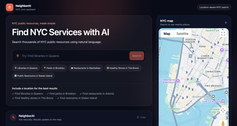
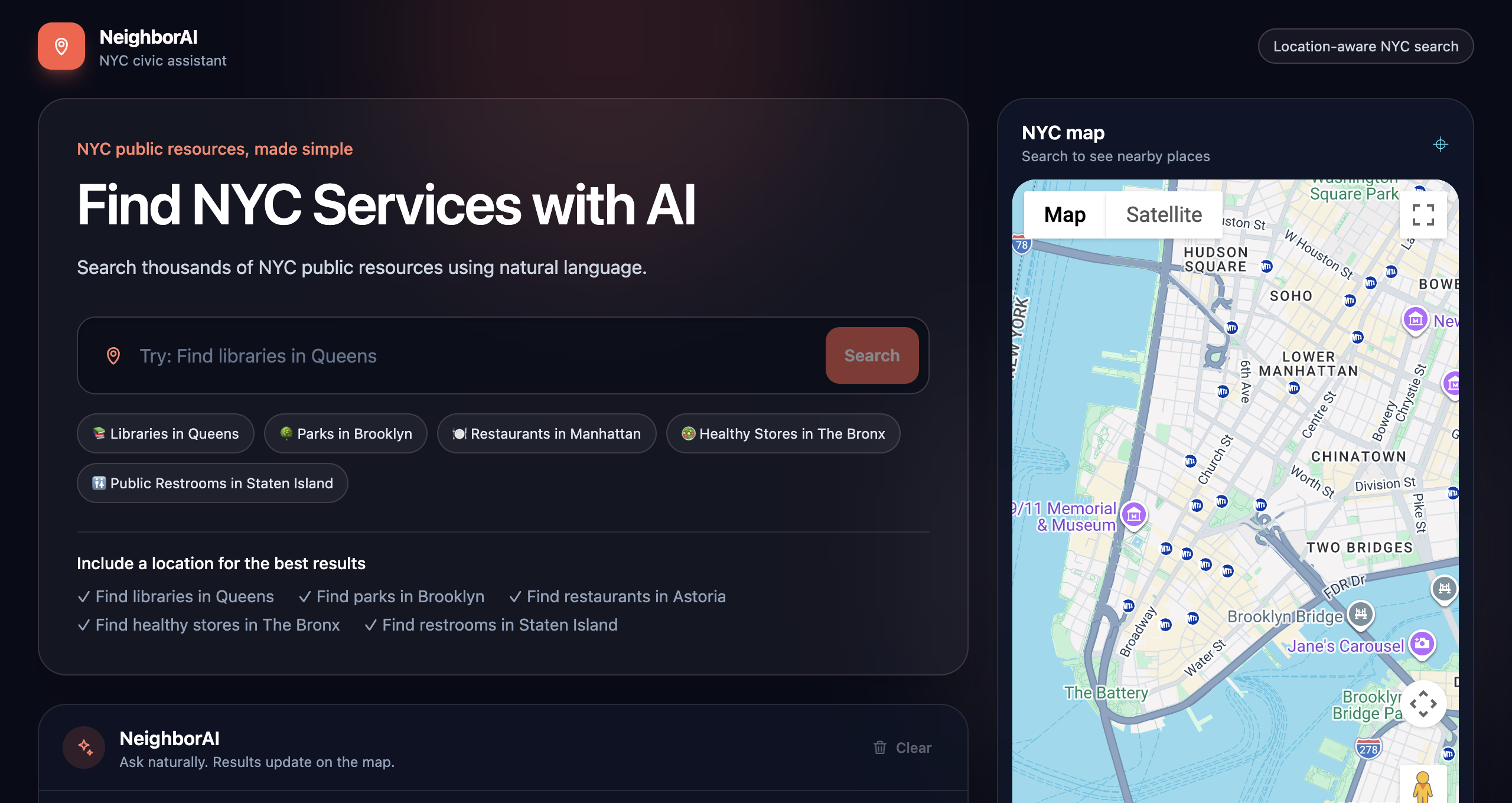
Ask NeighborAI in plain English — results appear instantly on an interactive NYC map
-
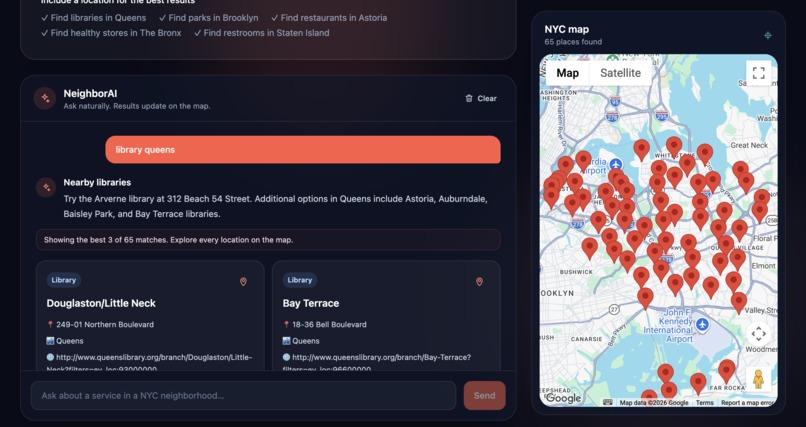
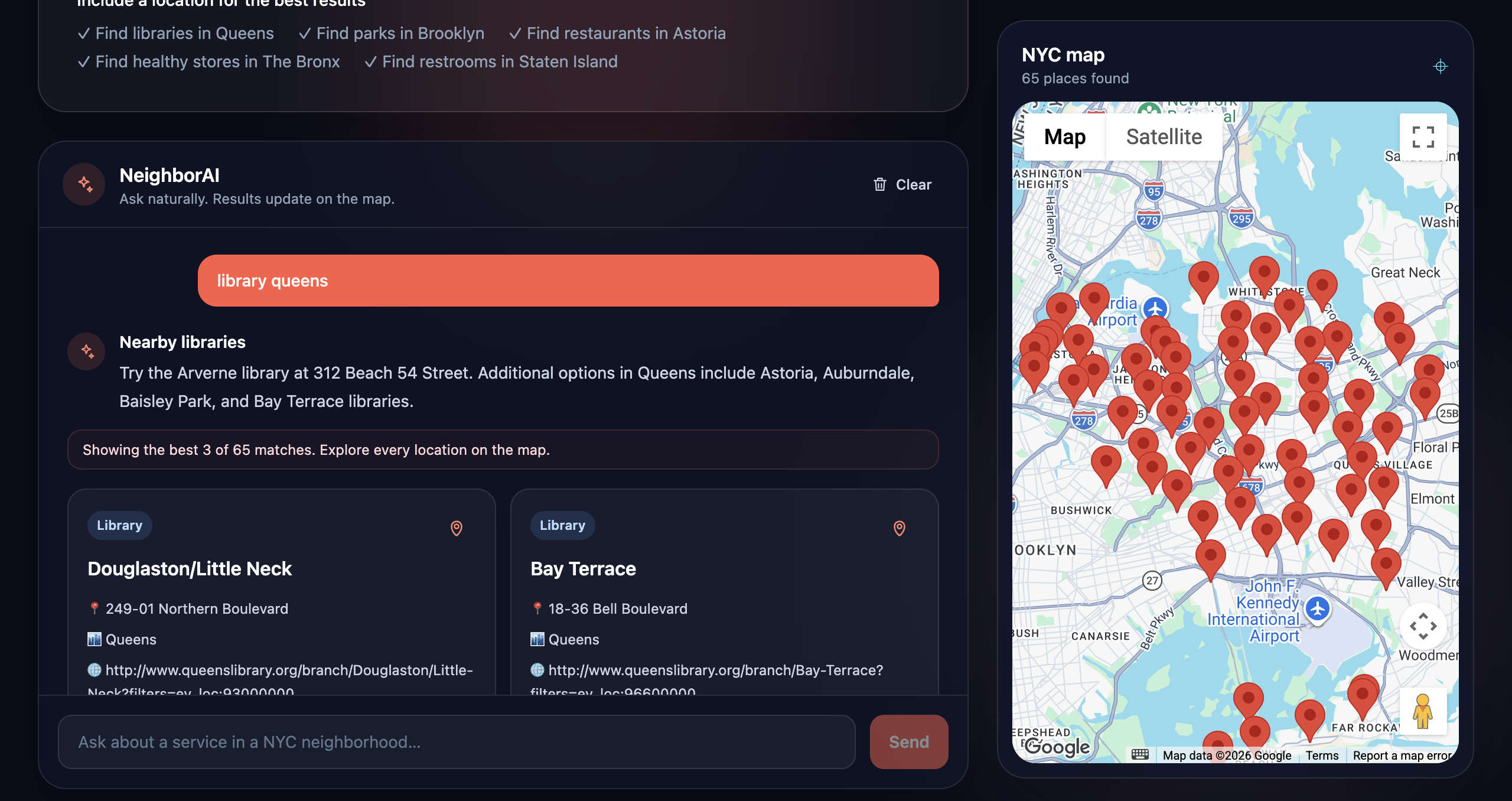
"Library queens" returns all 65 real NYC library branches in Queens, closest first.
-
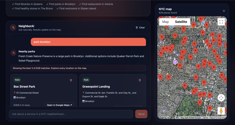
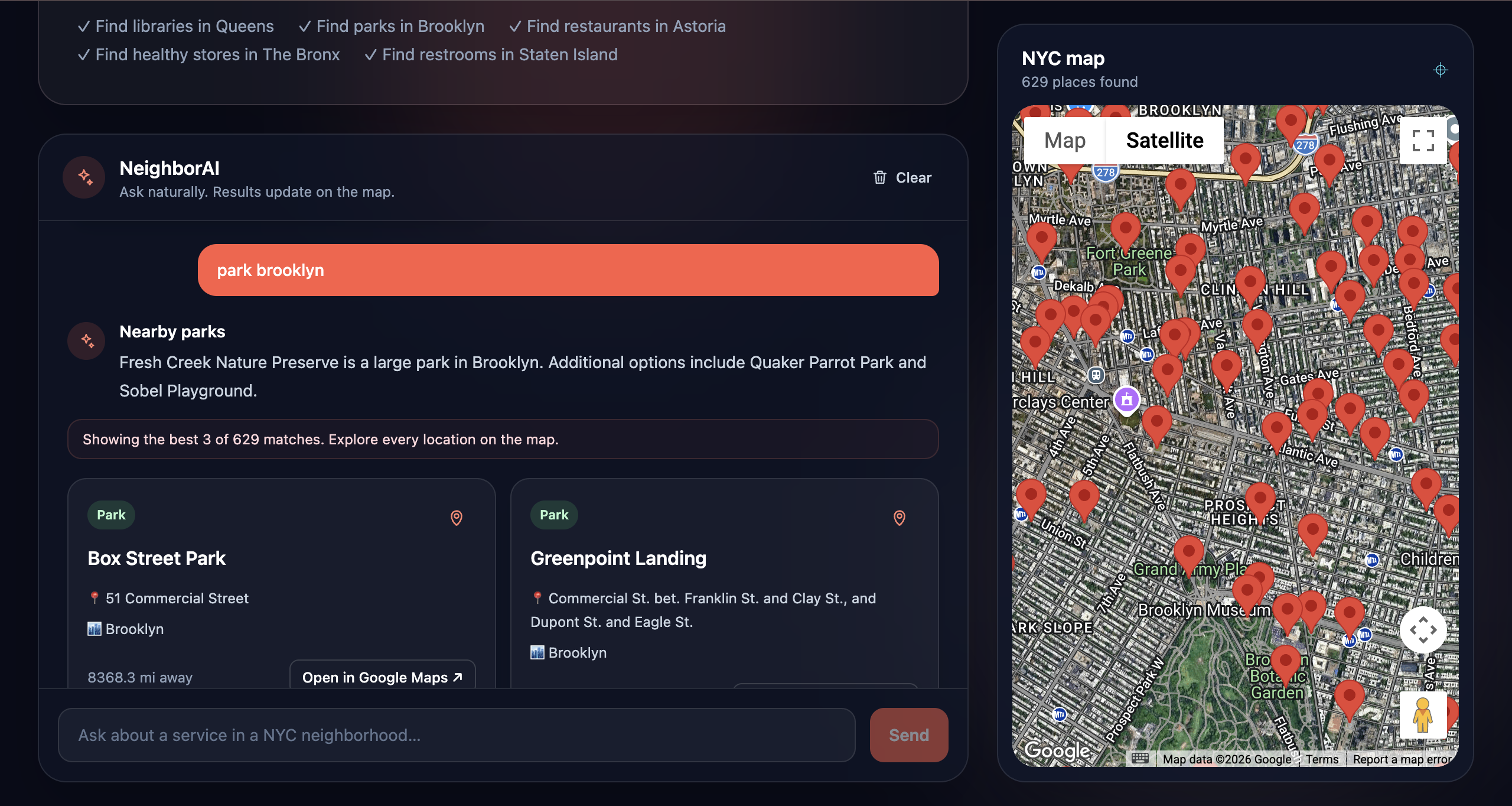
Park Brooklyn" surfaces all 629 official NYC parks, summarized in one natural sentence.
-
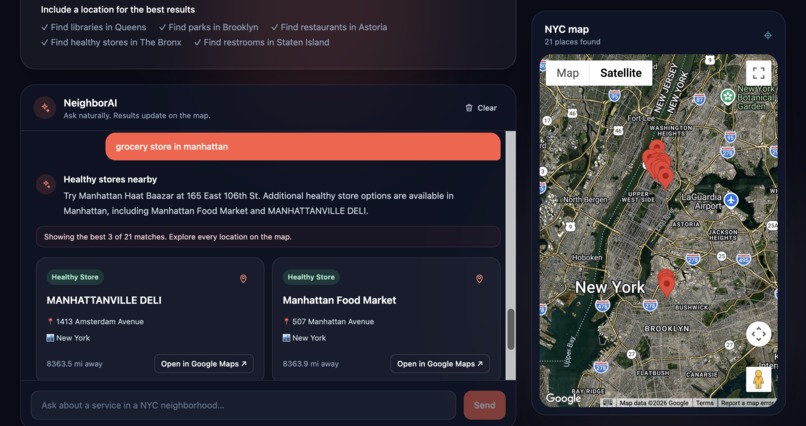
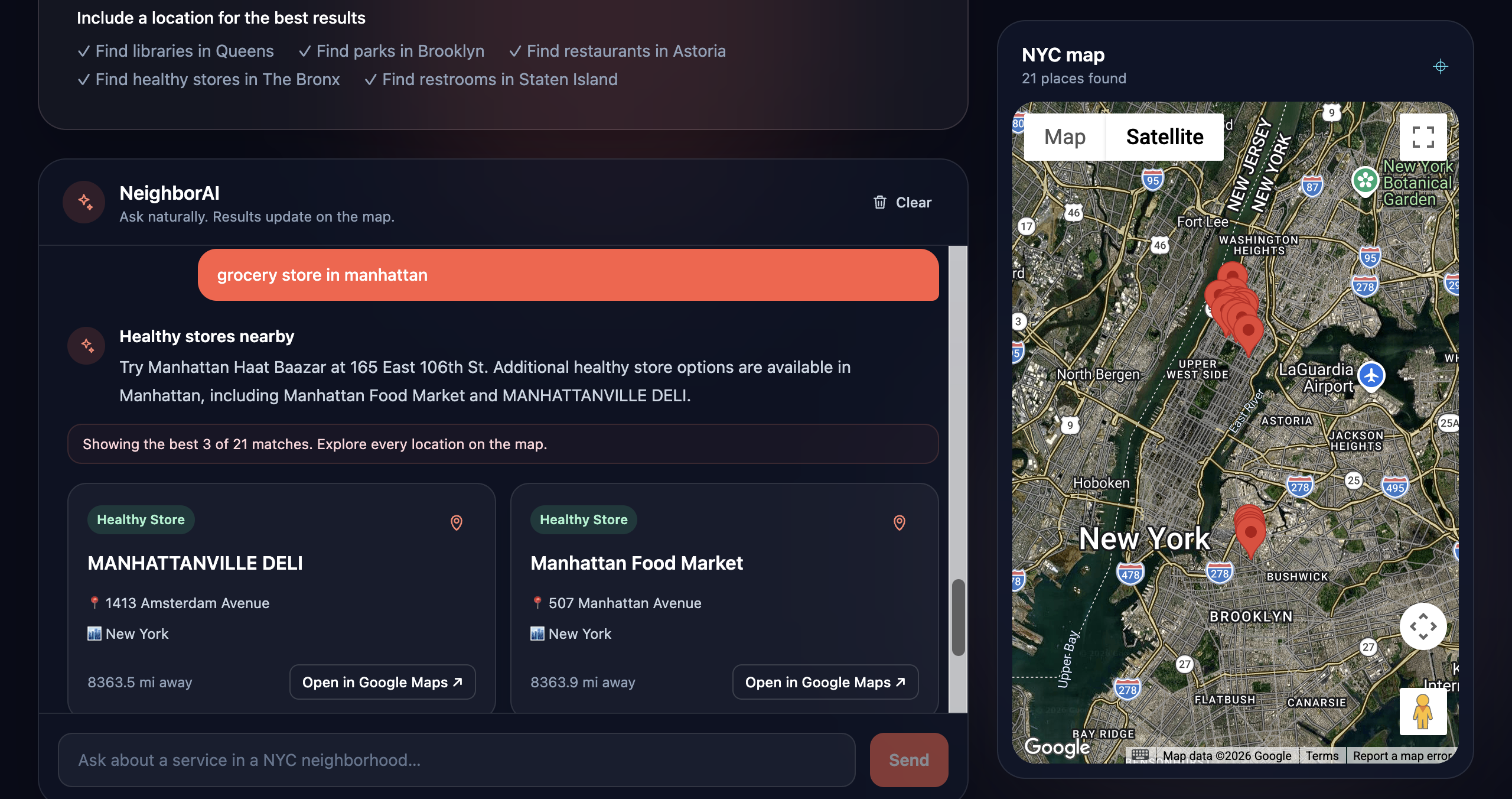
"Grocery store in Manhattan" is understood as Healthy Stores — no exact keyword needed.
Inspiration
NYC is one of the most resource-rich cities in the world, but knowing what's actually near you right now — a library with quiet study space, a public restroom on a long walk, a healthy grocery store in a food desert, a park to decompress in — usually means digging through half a dozen different city agency pages and open data portals that were never built for someone standing on a sidewalk with a phone. We wanted asking for a city service to feel as natural as asking a friend, without losing the fact that the answer has to come from real NYC data, never a guess.
What it does
NeighborAI is a conversational NYC civic assistant. Ask it something like "I'm hungry in Manhattan", "quiet place to study", or "restroom near Central Park", and it will:
- Understand your intent and figure out which of five official NYC Open Data datasets you need — Libraries, Parks, Restaurants, Healthy Stores, or Public Restrooms
- Search only that real dataset — it never invents a location
- Sort results by actual distance from you using live geolocation
- Summarize the results in plain language and plot them on an interactive Google Map
It also handles greetings, small talk, and follow-ups like "what about Brooklyn?" without breaking the conversation or asking you to repeat yourself.
How we built it
- Frontend: Next.js (App Router) + TypeScript + Tailwind CSS + Framer Motion, deployed on Vercel with CI/CD from GitHub
- Data pipeline: five NYC Open Data CSV exports (Libraries, Parks, Public Restrooms, Recognized Healthy Stores, Dining locations) cleaned and normalized into typed JSON via small Node scripts — this is the deterministic "ground truth" layer
- Search engine: a rule-based keyword/fuzzy search over that dataset — fast, deterministic, and the only thing allowed to produce actual results
- LLM layer, added on top rather than replacing anything: an intent router (Llama 3.3 70B via Groq) classifies each message as a greeting, small talk, a new search, or a follow-up, and extracts the dataset + location as structured JSON — but it only routes to the real search engine, it never generates a location itself. A second LLM pass turns the raw search results into a natural, friendly summary
- Geolocation: the browser's Geolocation API + a Haversine distance calculation, so "closest" is a real number, not a placeholder
- Maps: Google Maps JavaScript API via
@react-google-maps/apifor interactive pins and directions
Challenges we ran into
- Keeping the LLM "on a leash" — the core design challenge was letting the model route and narrate, while making sure official NYC Open Data always stays the single source of truth and nothing gets fabricated
- A subtle bug where the router's internal intent key (
healthyStore) leaked into the keyword search string and silently broke every healthy-store search — a reminder that even a thin AI layer needs to be tested against the deterministic system underneath it - The public restroom dataset has no borough field at all, so borough search for it only works when a borough name happens to appear in a facility's own name — a real NYC Open Data quirk we had to design around, not paper over
- Making the LLM calls fail gracefully — if the model API is briefly unavailable, the app should fall back to plain keyword search instead of breaking
Accomplishments that we're proud of
- A genuinely additive architecture — the LLM layer can be stripped out entirely and the app still works correctly as a plain NYC dataset search. The AI adds understanding, not a dependency
- Real distance sorting from real geolocation, not a hardcoded "Nearby" label
- A conversational experience that handles greetings, thanks, and follow-ups without ever inventing an address
What we learned
- Treat the model as a router and narrator, not a database — the underlying open dataset has to remain non-negotiable ground truth
- Small mismatches between how an LLM names things internally and how deterministic code parses strings can cause silent, hard-to-notice failures — worth testing explicitly at that seam
- NYC Open Data is genuinely useful, but inconsistent across datasets (missing fields like borough) in ways that directly shape what you can build on top of it
What's next
- Add real borough data to the public restroom dataset (e.g. via reverse geocoding from lat/long)
- Move from straight-line distance to walking-time ETAs
- Add open/closed-now filtering using the operational-status fields NYC Open Data already provides
Built With
- framer-motion
- geolocation-api
- google-maps
- groq
- javascript
- llama-3.3
- next.js
- node.js
- nyc-open-data
- react
- rest-api
- tailwind-css
- typescript

Log in or sign up for Devpost to join the conversation.