💡 Inspiration
In times of local emergencies, power outages, natural hazards, or sudden safety alerts, seconds matter. While standard emergency services exist for major crises, hyper-local community awareness often falls into a gap. Neighbors often rely on fragmented group chats, slow social media feeds, or word of mouth to stay informed.
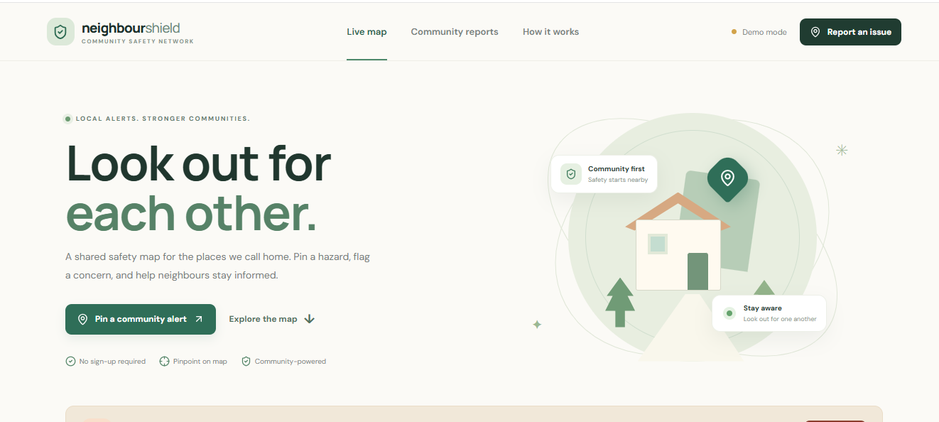
We built Neighbor Shield to bridge this gap—a real-time, community-driven safety platform that empowers neighbors to connect, report local incidents immediately, and look out for one another when it matters most.
🛠️ How We Built It
We designed Neighbor Shield with a focus on speed, real-time sync, and intuitive geolocation-based reporting.
- Frontend: Built using React / Next.js and Tailwind CSS for a responsive, mobile-first, and intuitive user experience.
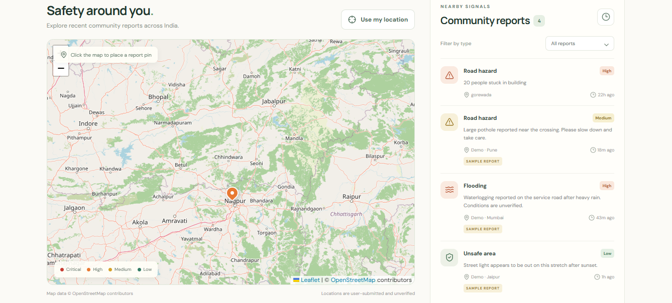
- Mapping & Geolocation: Integrated interactive map services (Mapbox / Leaflet / Google Maps API) to allow users to pin, view, and filter safety alerts within their precise neighborhood radius.
- Backend & Database: Leveraged real-time data streaming (Supabase / Firebase) to push instant incident notifications and updates to connected neighbors without requiring page refreshes.
- Deployment: Deployed on Vercel for fast edge distribution and smooth CI/CD workflows.
🚨 Challenges We Ran Into
- Real-Time Map Synchronization: Ensuring that new incident pins and safety alerts updated instantly on every active user’s map without causing UI lag or performance bottlenecks was a major technical hurdle.
- Accurate Geolocation & Radius Filtering: Fine-tuning the spatial distance calculations so users only receive relevant, nearby alerts rather than being overwhelmed by distant events required multiple iterations.
- Balancing Simplicity & Security: Designing a frictionless reporting flow for users during stressful emergency situations while ensuring data validation to prevent false alarms or spam.
🎓 What We Learned
- The Power of WebSockets & Real-Time Databases: We gained deep hands-on experience in managing live state subscriptions and optimizing real-time event broadcasting for hyper-local updates.
- UX for Emergency Scenarios: We learned that user interfaces built for high-stress situations must prioritize ultra-clean navigation, high-contrast visual cues, and minimal click paths.
- Geospatial Data Handling: Working closely with map APIs taught us how to efficiently render dynamic markers, manage spatial queries, and handle device location permissions gracefully.
Built With
- api
- icons
- leaflet.js
- lucide
- mapbox
- maps
- next.js
- react
- supabase
- tailwind-css
- vercel


Log in or sign up for Devpost to join the conversation.