Inspiration
Roads in North Carolina such as I-40 always have the most horrific crashes on the side of the road, and during certain seasons, driving in North Carolina can be very dangerous. Map services such as apple maps provide some information on weather conditions, but not everything, so we sought out to provide something with a little more coverage for other considerations.
What it does
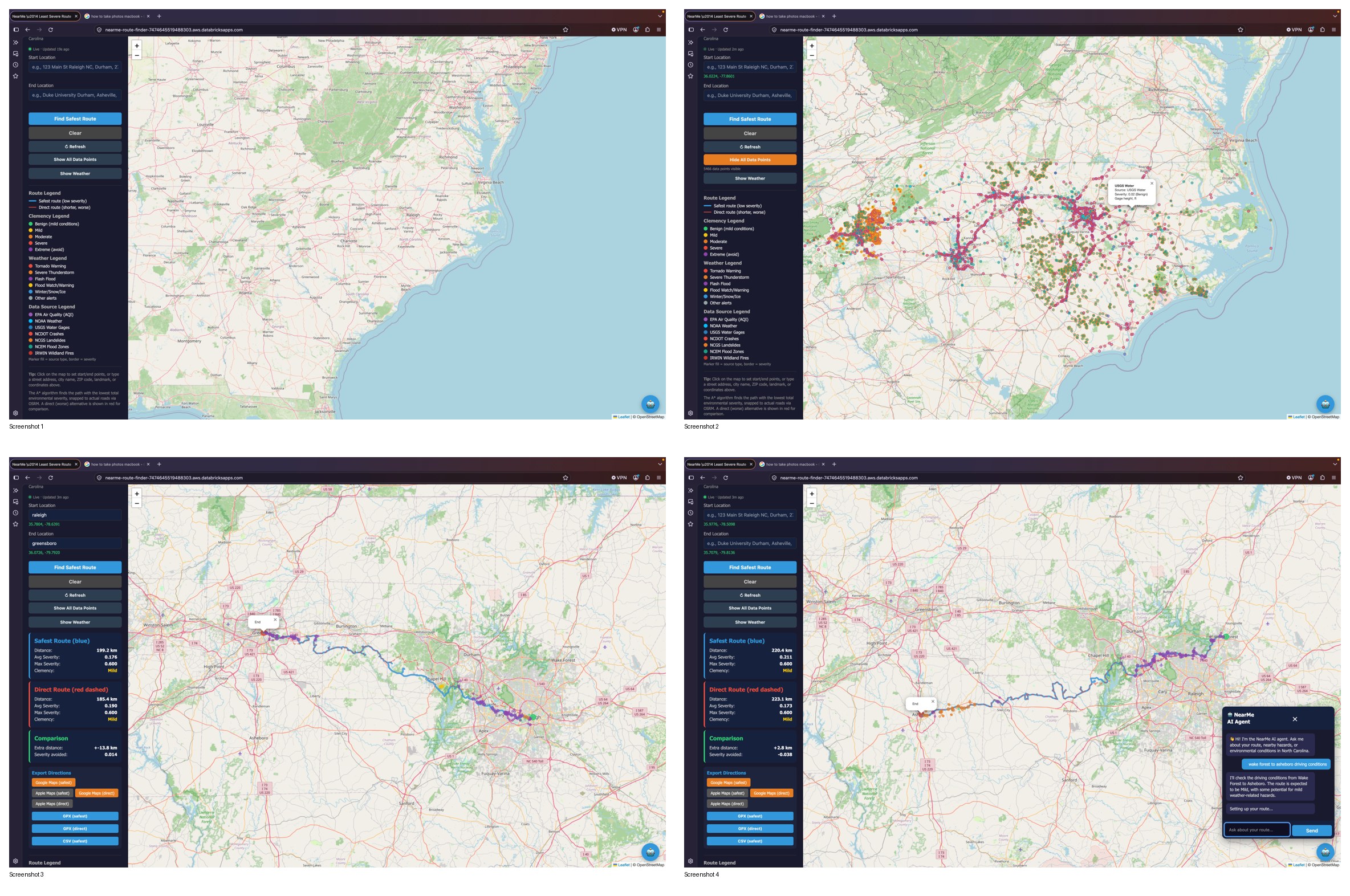
NearMe helps users find alternative routes to avoid risks on the roads such as areas with poor driving conditions, nearby crashes, and other concerns.
How we built it
We spent the first couple hours brainstorming about designs and what we wanted to make, and ensuring that it followed the track's criteria, we leveraged the free tools on data bricks to implement our designs starting with the pipelines, then cleaning the data, then outputting it to a frontend.
Challenges we ran into
We had a hard time creating something that was actionable, but with consultation with some of the mentors, we pushed to make something that could not only make roads safer, but also provide users with some piece of mind that they are being safe rather than sorry.
Accomplishments that we're proud of
We are proud of the final product, and the design principles we used, We feel that our prior coursework really helped to make a comprehensive product.
What we learned
We learned a lot about data streaming and how Realtime data can be used in applications for very good causes, we also learned a little more about RestAPIs and data transmission from public resources.
What's next for NearMe
NearMe will probably just be a side project unless we win, it already is a somewhat rough market since the closest things to compete with would be google maps and apple. Perhaps Nearme will pivot into a more comprehensive geospatial tool beyond just driving concerns.

Log in or sign up for Devpost to join the conversation.