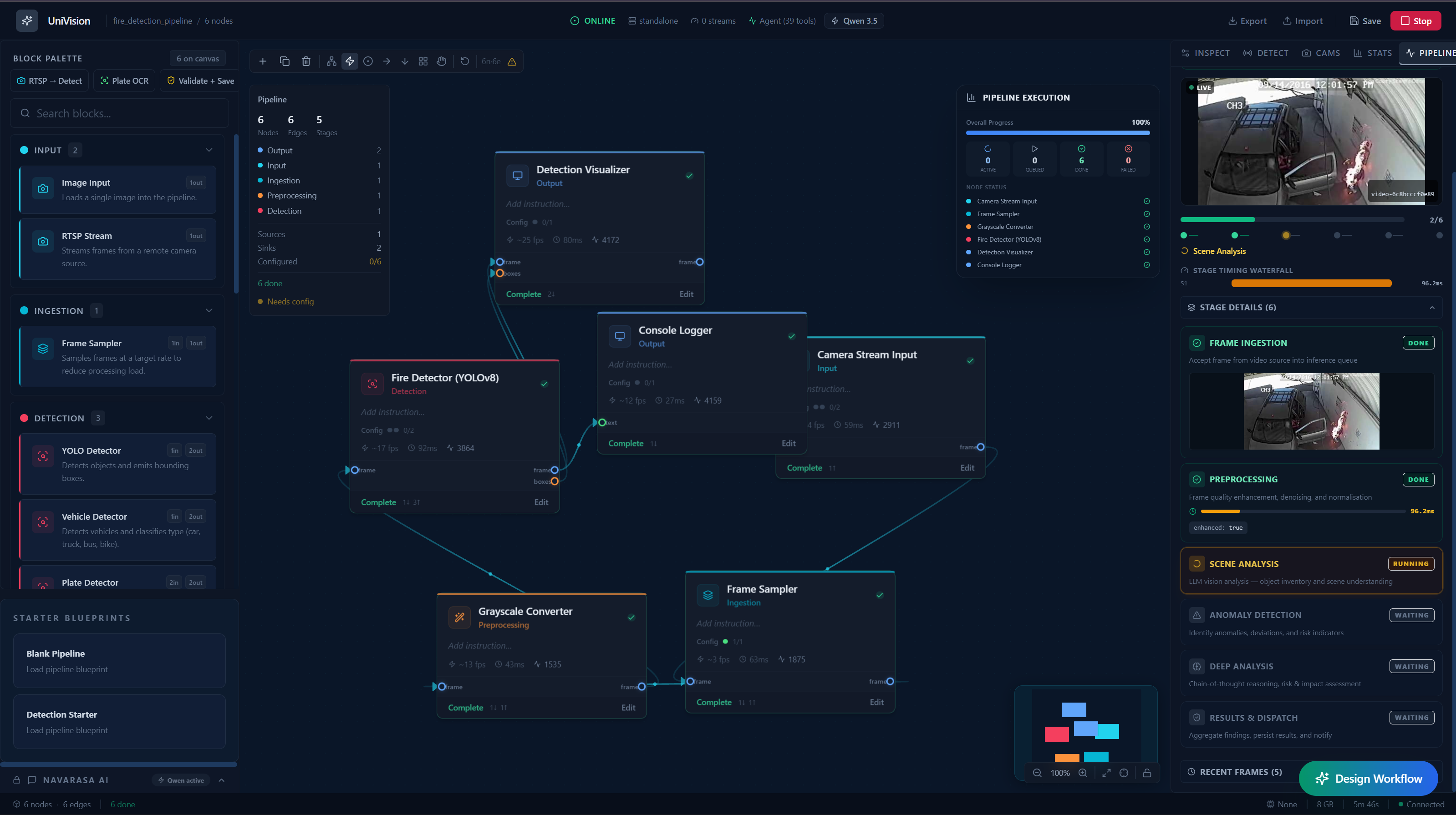
Project Story: Uni-Vision – Securing India from Above and Within
The Vision
In a rapidly developing and vastly diverse nation like India, monitoring safety and infrastructure at scale is a monumental challenge. From the bustling streets of Mumbai to the sprawling farmlands of Punjab, potential disasters often happen unannounced, leading to loss of life, property, and crucial resources.
Our project, Uni-Vision, was born out of a critical need: to create an intelligent, omnipresent eye that doesn't just record the world, but understands it. By harnessing the power of advanced AI anomaly detection, processing both local CCTV footage and high-altitude satellite imagery, we aim to transform passive surveillance into proactive disaster prevention.
The Challenge
India's unique landscape presents specific, high-stakes challenges that human monitoring alone cannot scale to meet:
- Urban Density: A fire in a public market or an indoor hotel can spread in seconds, often escalated by delayed emergency responses.
- Agricultural Vulnerability: In agricultural heartlands like Punjab, sudden bug infestations can decimate seasonal crops, threatening the livelihood of thousands of farmers and the nation's food security.
- Aging Infrastructure: Decades-old bridges and expanding road networks frequently suffer from structural fatigue and potholes, leading to fatal accidents and logistical nightmares.
- Environmental Threats: Forest fires during dry seasons can ravage vital ecosystems and spread to nearby settlements before being reported.
The Solution: A Dual-Lens Anomaly Detection System
Uni-Vision is an AI-driven system designed specifically for the Indian ecosystem. It operates seamlessly across two primary visual domains to detect critical anomalies:
1. The Ground Level: CCTV Intelligence
Using existing public and private CCTV networks, our models continuously analyze video feeds to detect immediate, localized threats:
- Public Place Fires: Identifying smoke and fire signatures instantly in crowded public squares or markets.
- Indoor Outbreaks: Detecting sparks or fires in confined spaces like hotels and commercial indoors, entirely bypassing the delay of manual human reporting.
- Forest Fires (Ground View): Leveraging remote camera networks near forested areas to catch the earliest localized signs of a blaze.
2. The Macro Level: Satellite Imagery Analysis
By pulling in continuous satellite data, the system scales up to monitor vast geographical expanses and structural footprints:
- Crop Infestation Detection: Monitoring the fields of regions like Punjab, identifying discoloration and pattern changes indicative of bug infestations so farmers can act before the yield is lost.
- Infrastructure Integrity: Scanning crucial infrastructure—like aging bridges over rivers or heavily trafficked flyovers—to detect micro-shifts, cracks, or anomalies that precede a catastrophic collapse.
- Road Network Hazards: Analyzing satellite road topology to identify hazardous sinkholes and severe pothole formations across highways, enabling targeted municipal repairs.
- Forest Fire Detection (Macro View): High-altitude thermal and visual analysis to detect the rapid spread of forest fires, sending coordinates of the outbreak long before it becomes an uncontrollable inferno.
What Inspired Us
The recent tragedies involving urban fires in congested Indian cities, unchecked structural failures in rapidly expanding infrastructural areas, and devastating crop losses for farmers in Punjab deeply impacted us. We realized that India's true vulnerability lay not in a lack of cameras or satellites, but in the human inability to process millions of visual data streams manually. We sought to build an "always-on" AI guardian that bridges the gap between passive observation and active mitigation.
How We Built It
We architected a distributed AI pipeline capable of ingesting high-throughput CCTV streams concurrently with localized, high-resolution satellite imagery.
- Computer Vision Models: We fine-tuned several state-of-the-art object detection and segmentation architectures on Indian-specific datasets—recognizing everything from localized hotel fires to macroscopic crop discoloration.
- Alerting Logic Matrix: To prevent false positives while maximizing sensitivity, we implemented a dual-threshold confidence metric. A critical anomaly alert is triggered if the combined anomaly score $S$ exceeds a dynamic threshold $\tau$, modeled as: $$ S = \alpha \cdot P_{\text{spatial}} + \beta \cdot P_{\text{temporal}} \geq \tau $$ Here, $P_{\text{spatial}}$ computes the frame-level detection probability, $P_{\text{temporal}}$ calculates anomaly persistence across subsequent frames, and parameters $\alpha$ and $\beta$ are use-case specific weights (e.g., $\beta$ is heavily weighted for CCTV fire detection to avoid triggering on momentary flashes).
Challenges We Ran Into
Deploying computer vision models at this scale is fraught with operational hurdles:
- Diverse Environmental Noise: From torrential monsoons obstructing CCTV lenses to thick cloud cover masking satellite imagery, handling diverse Indian weather required rigorous data augmentation.
- Computational Bottlenecks (VRAM): Processing real-time video feeds demands incredible compute. Operating under strict GPU memory constraints pushed us to build a dynamic framerate sampling algorithm, lowering FPS during negative periods and instantly scaling up when $P_{\text{spatial}} > 0.4$.
What We Learned
Building Uni-Vision taught us how critical the final "last-mile" alert delivery is compared to merely identifying a problem. We learned to optimize large-scale tensor computations, deploy edge-friendly models, and most importantly, how deeply AI can serve as a social good. We also mathematically validated our pipeline, rigorously lowering our false positive rate to adhere to strict safety criteria: $FPR = \frac{FP}{FP+TN} < 0.05$.
Real-Time Action: Closing the Loop
Detection is only half the battle; rapid response is the other. The core of Uni-Vision is its intelligent alerting engine. The moment the AI model confirms an anomaly—be it a collapsing bridge warning, an infested crop sector, or a verified fire in a public place—it instantly dispatches contextual alerts to the relevant authorities, property owners, and everyday users.
The Impact
With Uni-Vision, we are building a safety net for a nation of over 1.4 billion people. By turning billions of pixels into immediate, life-saving actions, we envision an India where disasters are mitigated before they escalate, crops are saved, infrastructure is resilient, and our citizens are secure.

Log in or sign up for Devpost to join the conversation.