-
-

My Wild Patch app icon
-
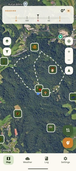
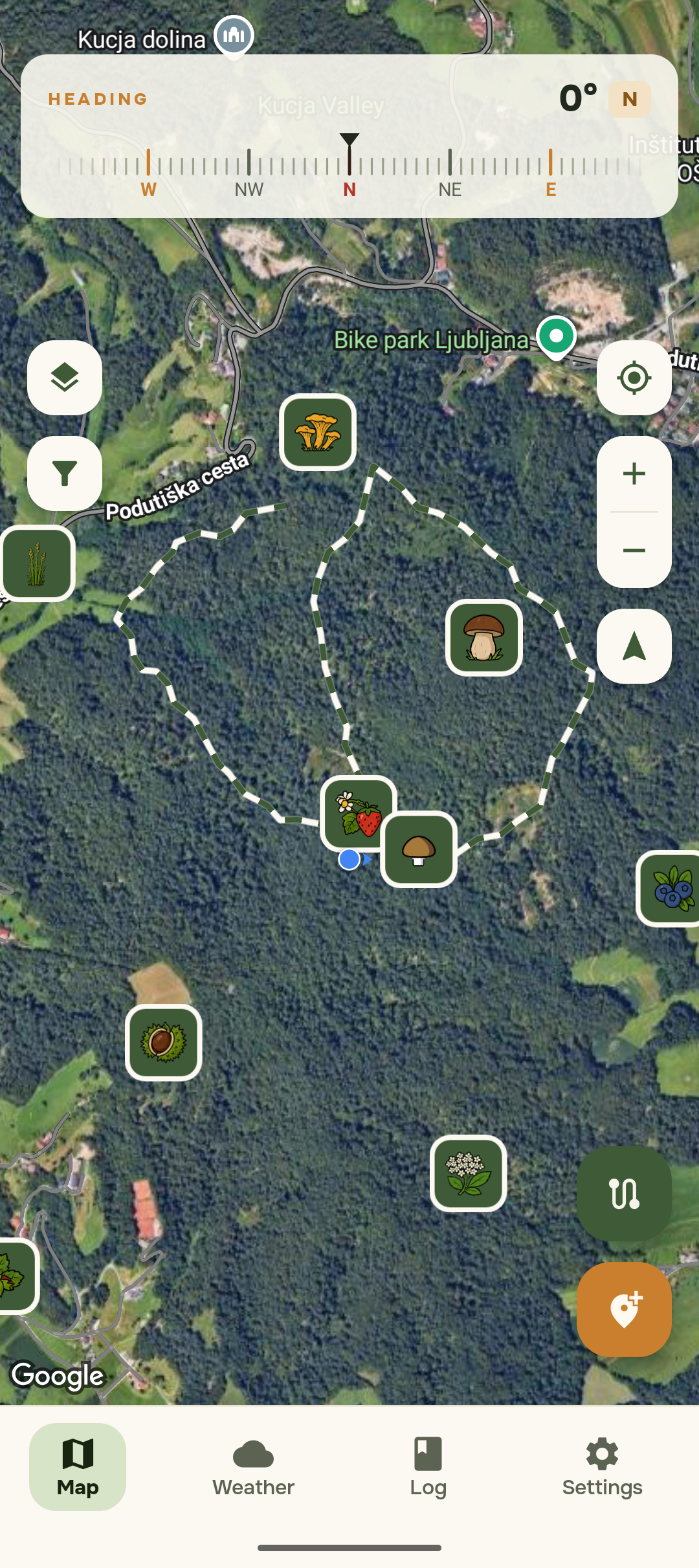
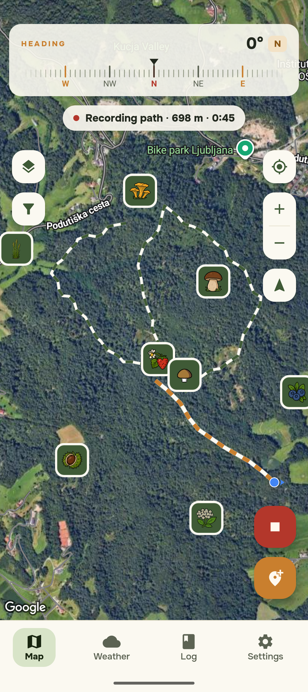
Map of saved foraging spots and recorded paths, each marked with a species icon on satellite view, with a compass heading bar on top.
-
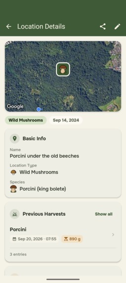
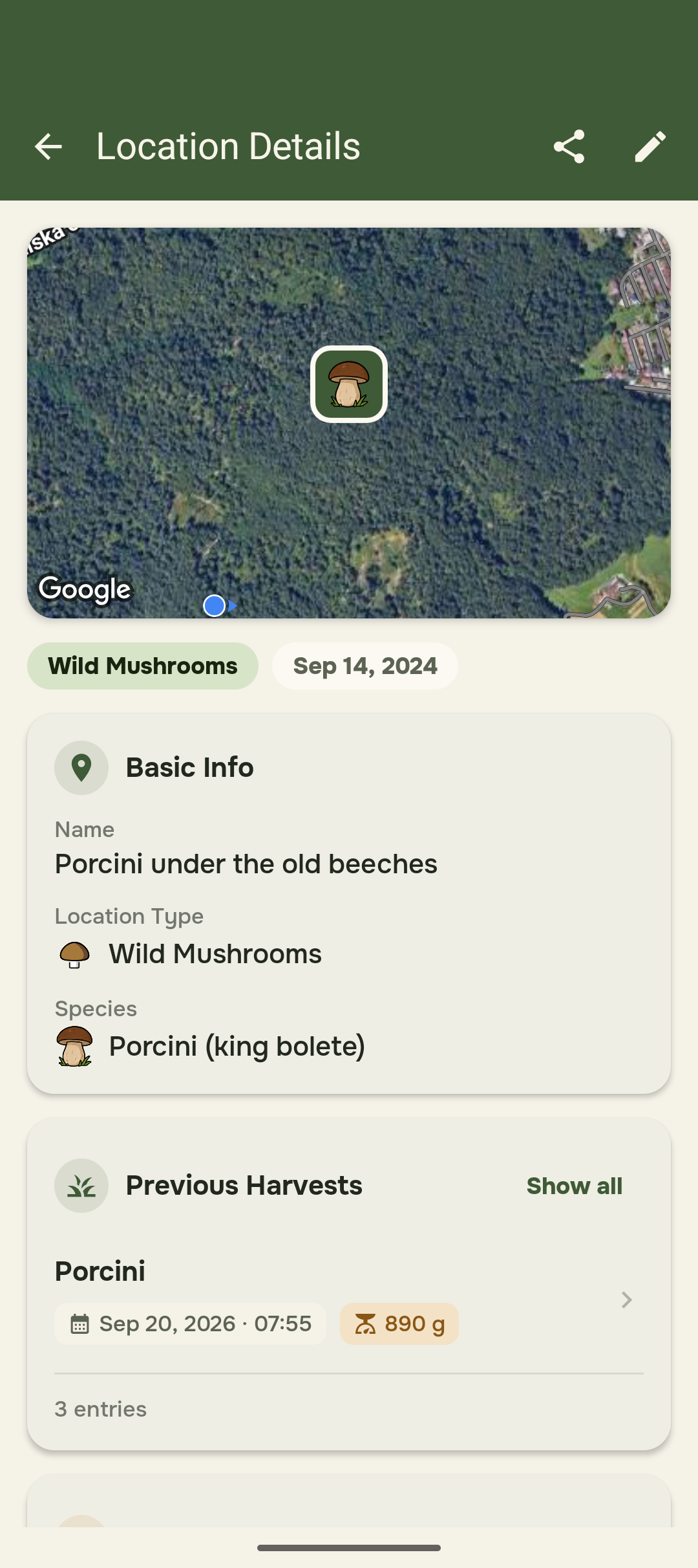
Location details for a porcini spot: map preview, location type, species, date found and the latest harvest.
-
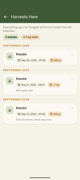
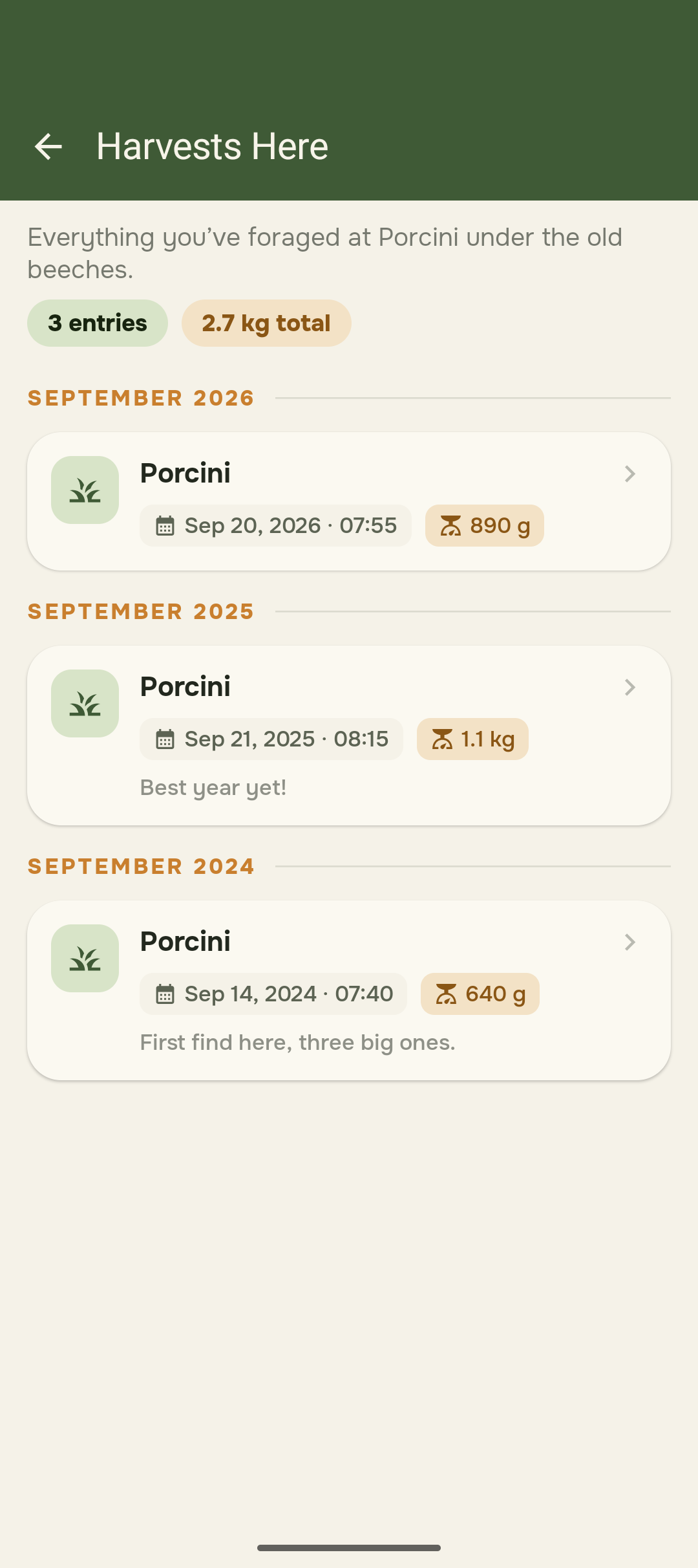
Harvest history for one spot: every harvest by date and weight, with notes and a 2.7 kg total across three years.
-
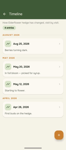
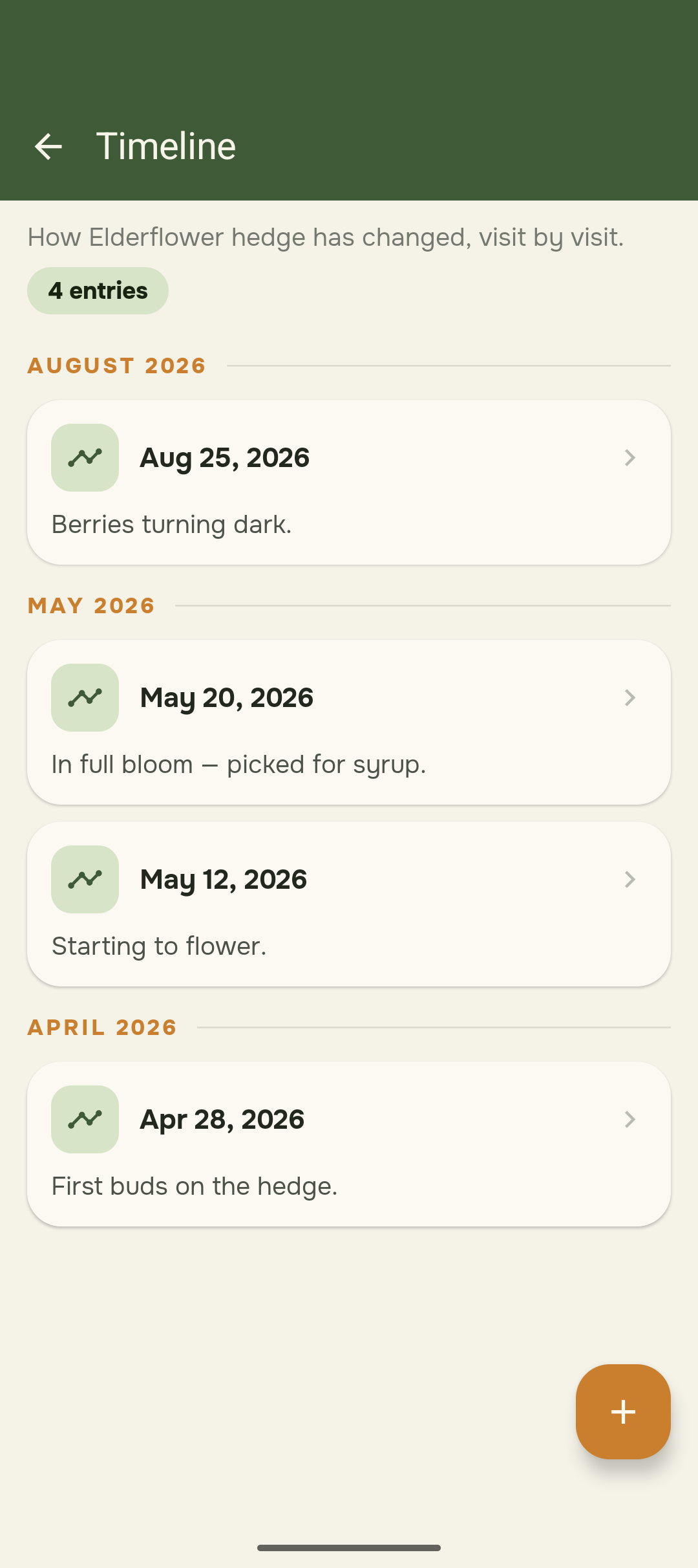
Seasonal timeline for an elderflower hedge: first buds, flowering, full bloom and ripening berries, visit by visit.
-
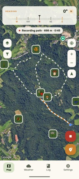
Recording a path live: an orange trail follows your GPS position while distance and elapsed time update at the top.
-
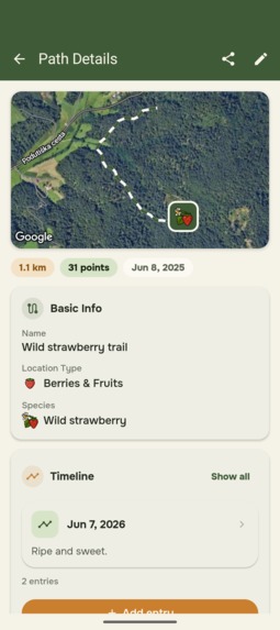
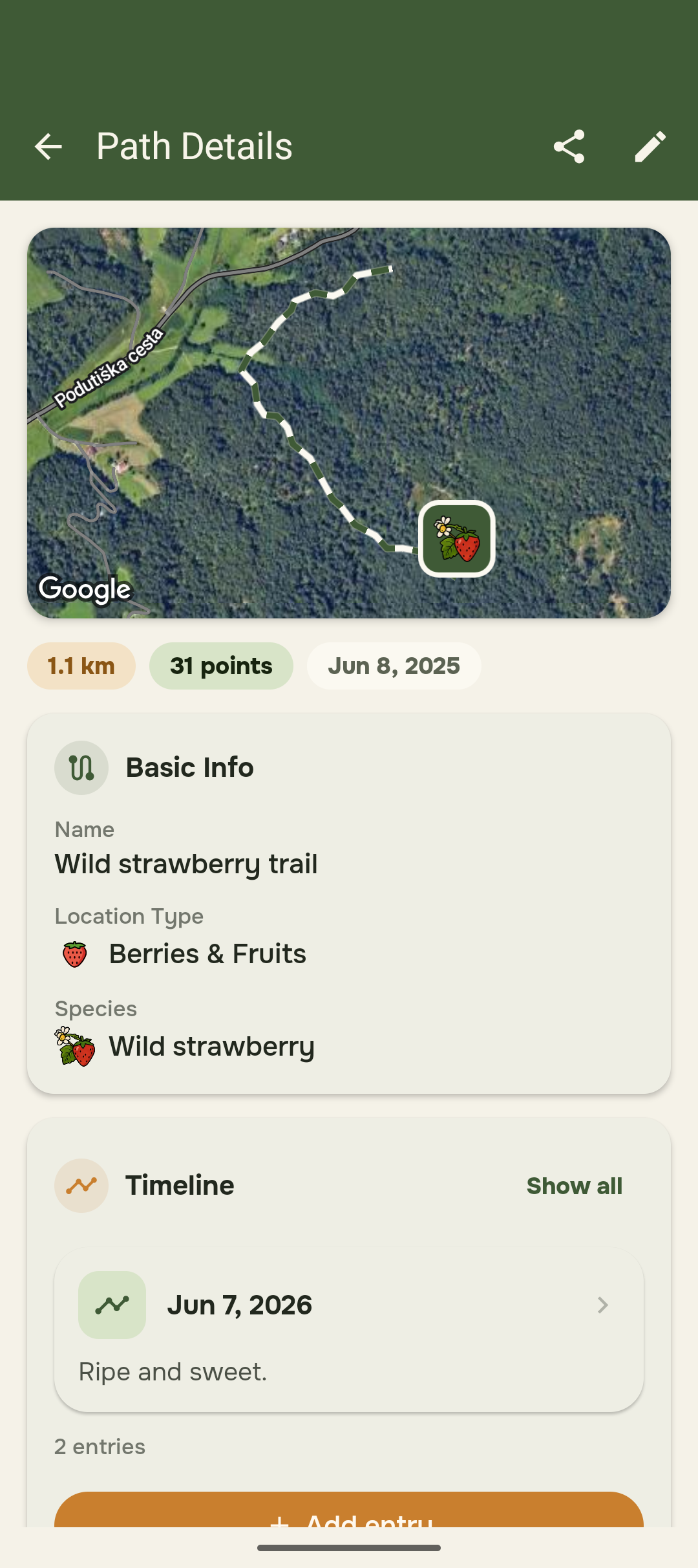
Path details for a wild strawberry trail: route on the map, length, number of points, species and timeline entries.
-
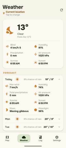
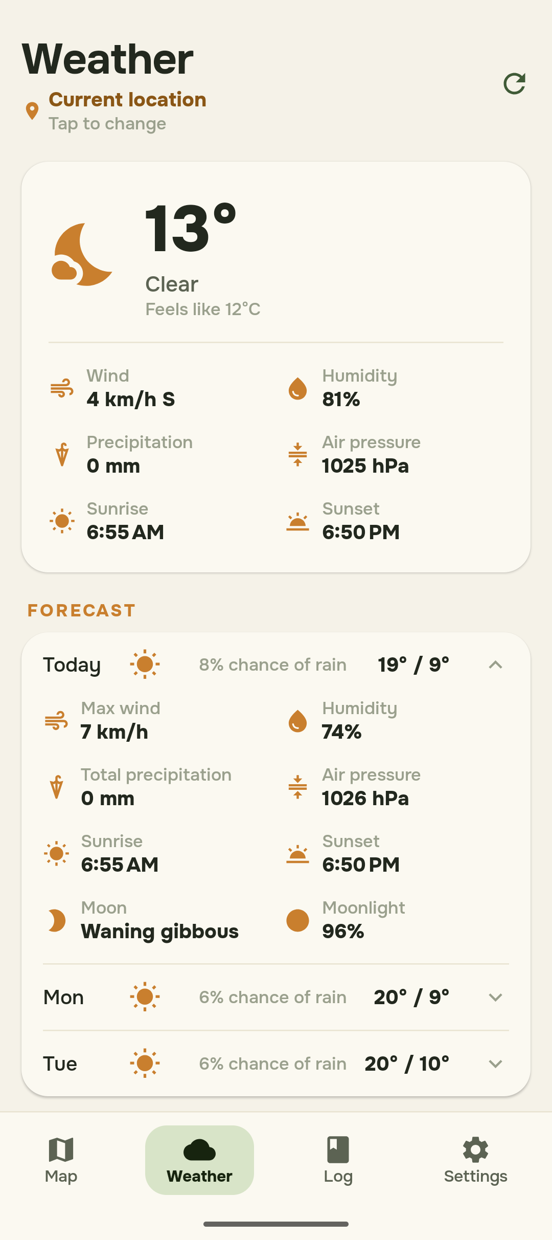
Weather for your current location: temperature, wind, humidity, pressure, sunrise and sunset, plus a 3-day forecast.
-
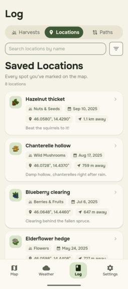
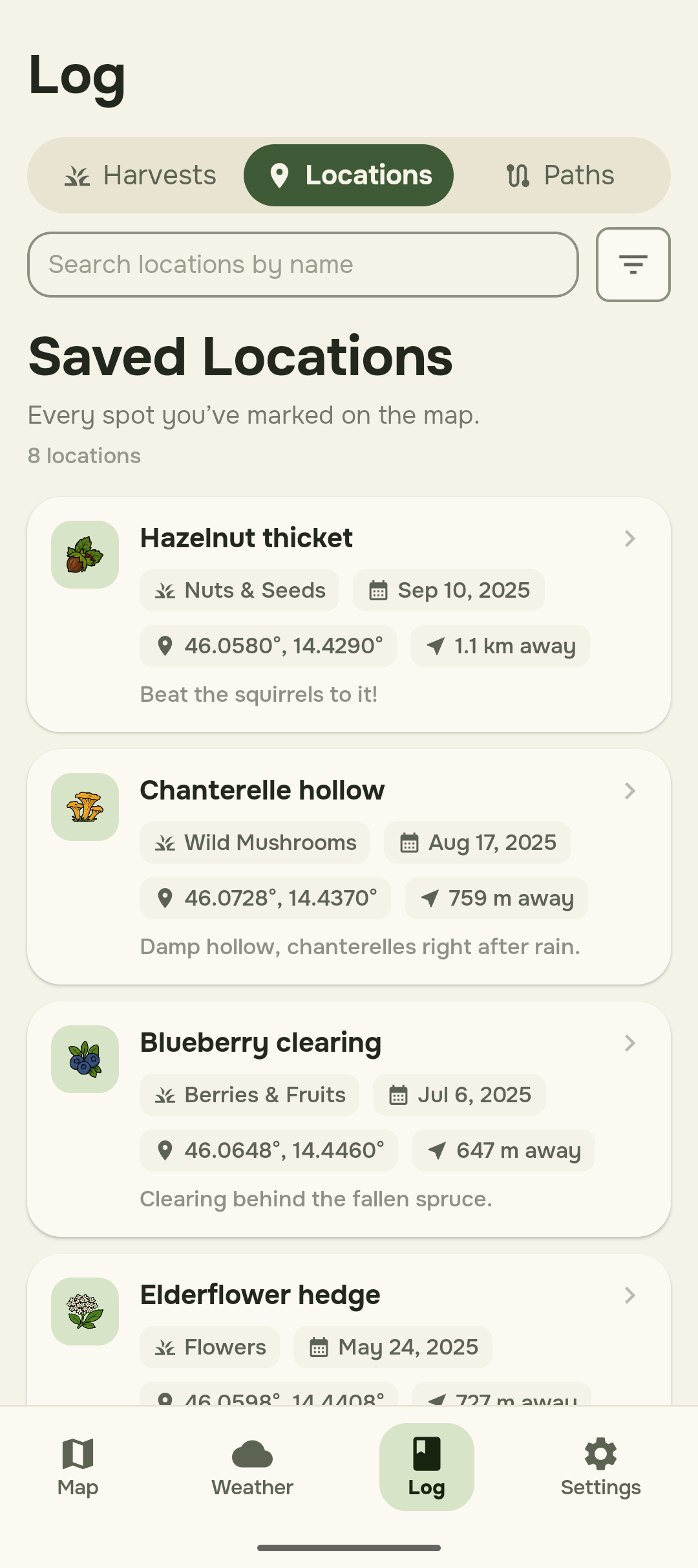
Saved locations: every spot with species icon, category, date found, coordinates, distance from you and your own notes.
-
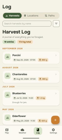
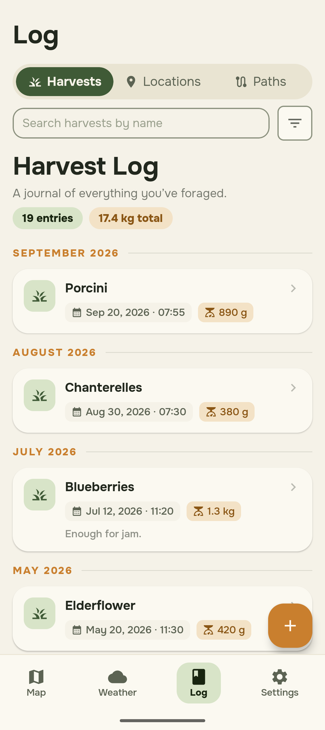
Harvest log: every harvest grouped by month, with date, time and weight, plus entry count and total weight.
-
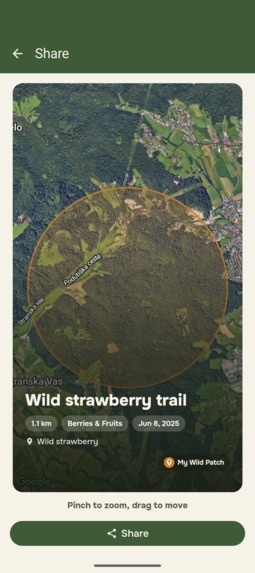
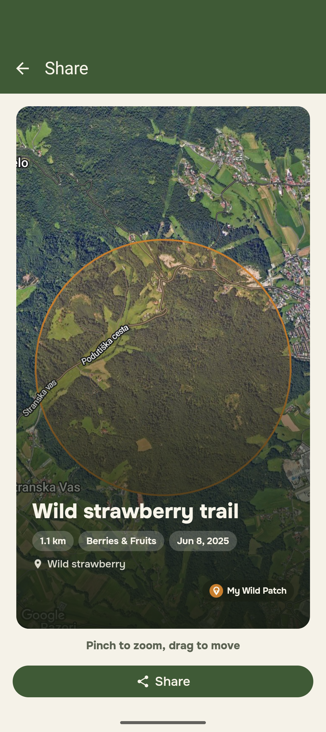
Share card for a path: map with an approximate area circle, name and details, ready to share without the exact spot.
-
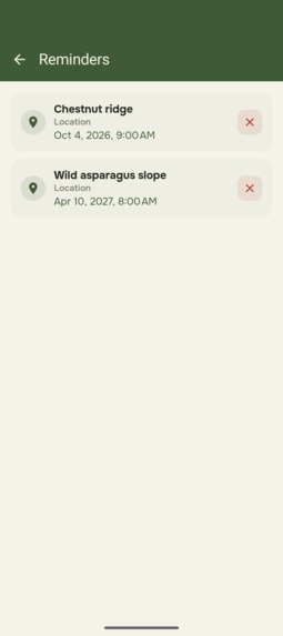
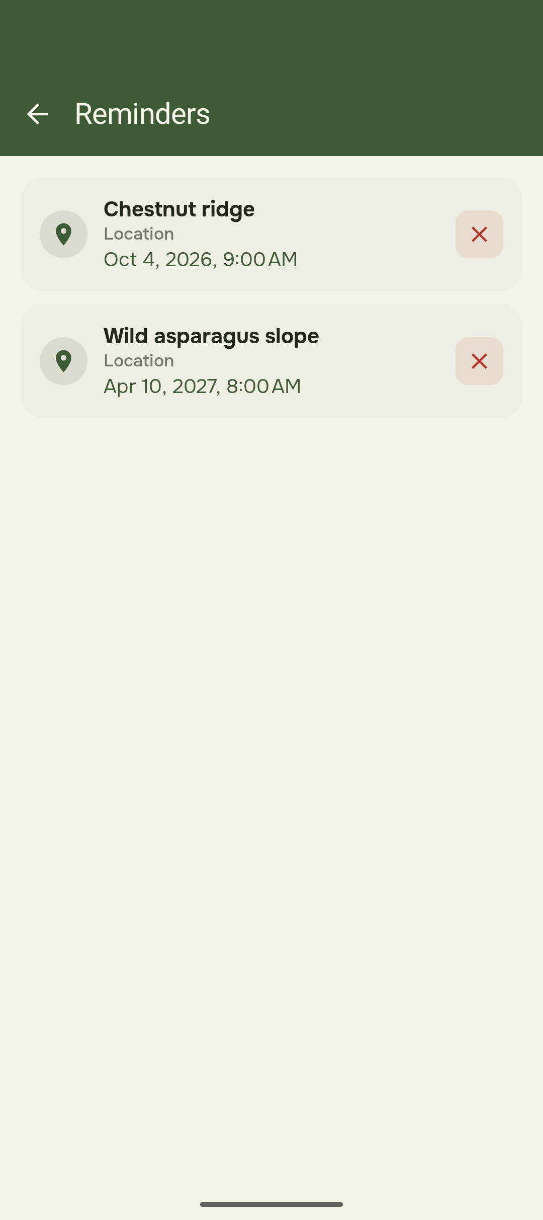
Scheduled reminders to revisit your spots, each showing its date and time, with a button to cancel it.
Inspiration
Foraging is hugely popular in Slovenia. Every year I go out for wild asparagus and chestnuts, and every year I run into the same frustration. I can never remember exactly where that one spot was, the patch where I picked twenty asparagus spears in a one go.
So I decided to build an app that saves the exact location, so that next spring I can walk straight back to it.
What it does
My Wild Patch lets you save any spot worth returning to: a chestnut tree, a porcini patch, a blueberry bush, a stretch of wild strawberries.
- Harvest log. On each location you record what you actually picked, so you can look back at previous years, compare yields, and see when in the season a spot is worth visiting.
- Recorded paths. When the find is a route rather than a point (a trail lined with wild strawberries, or a slope covered in chestnuts), you can record the whole path instead of a single pin.
- Map and compass. Saved locations are marked on the map, and a compass shows the direction you are heading. The map switches between terrain and satellite views, depending on whether you want to read the landscape or recognise it.
- Weather. Current conditions and a forecast, so you can decide whether today is the day.
Your saved spots stay on your device. Your spots are yours.
How we built it
My Wild Patch is Android-only for now. It is written in Kotlin with Jetpack Compose and follows an MVVM architecture, with Room for local storage and Google Maps for the map itself.
As a solo developer, I work with Claude, which speeds up the build considerably and, just as importantly, keeps the momentum going on a project with no one else to answer to.
Challenges we ran into
This idea is at least a year old. The hardest part was never the code. It was finding the time and the motivation to actually finish a hobby project.
The most unfamiliar work was marketing. I had never dealt with any of it before, and I had to step out of my comfort zone. I still have a lot to learn there. Wiring up the various SDKs and APIs was demanding too, but that part was fun.
Accomplishments that we're proud of
Actually shipping a hobby project instead of leaving it on the shelf forever, which is where projects like this usually end up. And getting every SDK and API integration working to bring the app to where it is now.
What we learned
That anything can be done once you commit to a goal. I have always worked in teams of several people; this is the first app I have built and published to a store entirely on my own.
What's next for My Wild Patch
- Seasonality calendar showing what is in season nearby.
- Offline maps, since signal disappears the moment you are properly out in nature.
- Sharing spots with friends via deep links.
- A home-screen widget with seasonality information and the saved location worth checking next.
- Statistics charting your harvests across the years, so you can see whether a spot is improving, holding steady, or quietly being picked out by someone else.
- Design refinements, feature upgrades, and, inevitably, bug fixing once more people start using it.
Built With
- appyx
- firebase
- google-maps
- gradle
- jetpack-compose
- kotlin
- revenuecat
- room
- weatherapi

Log in or sign up for Devpost to join the conversation.