-
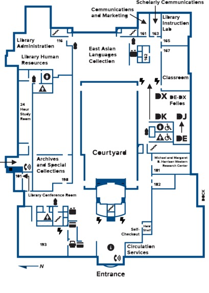
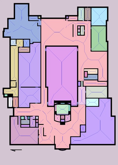
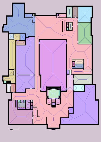
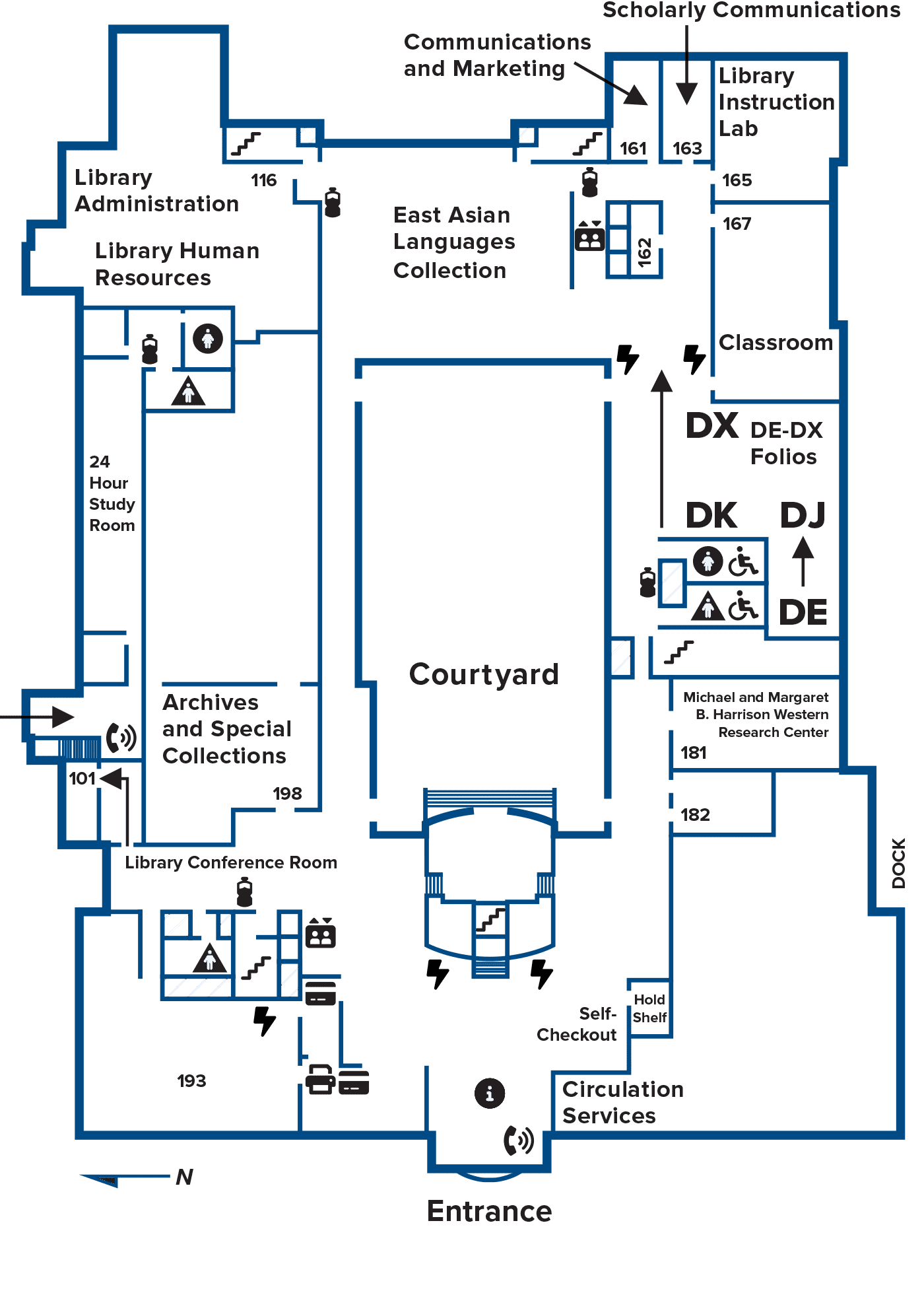
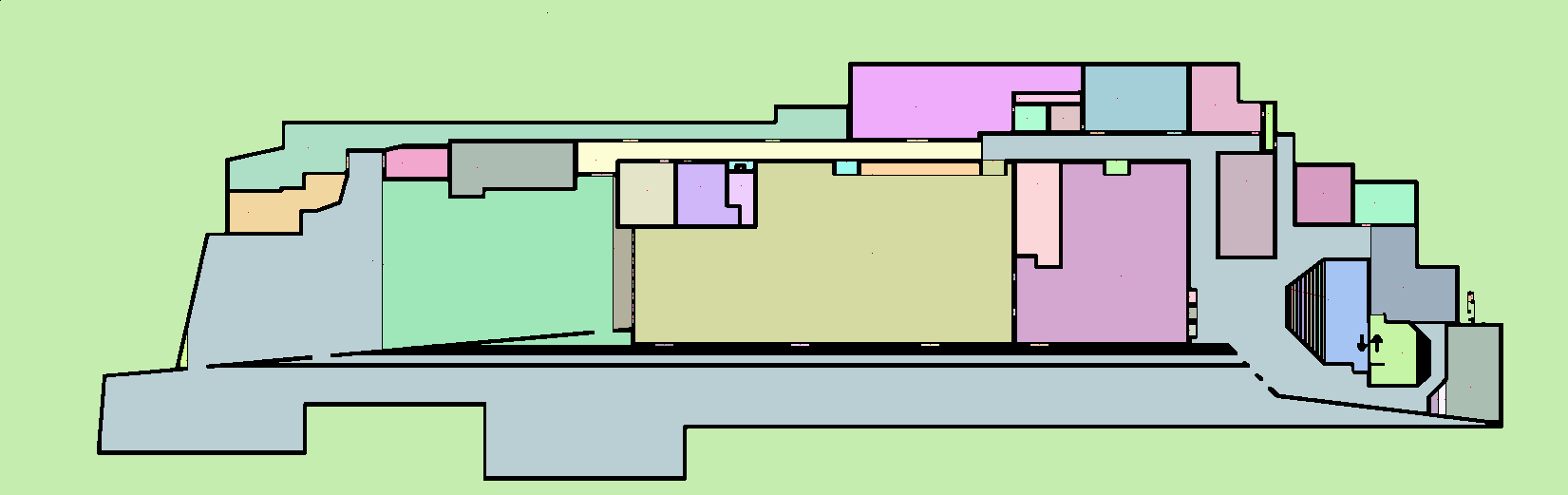
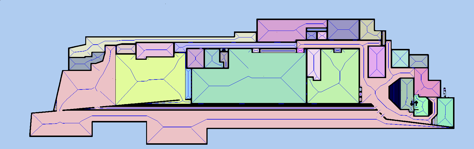
UC Davis Library 2nd floor
-
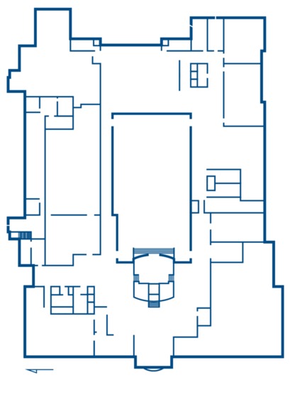
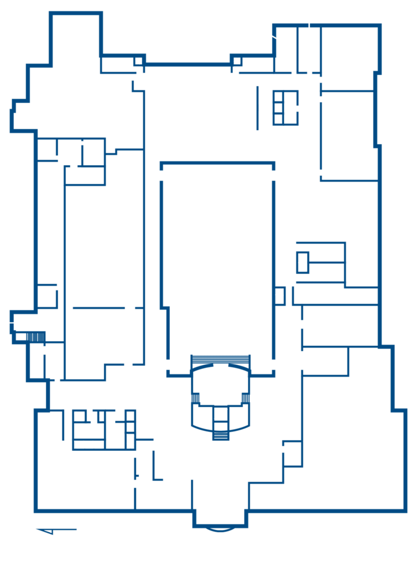
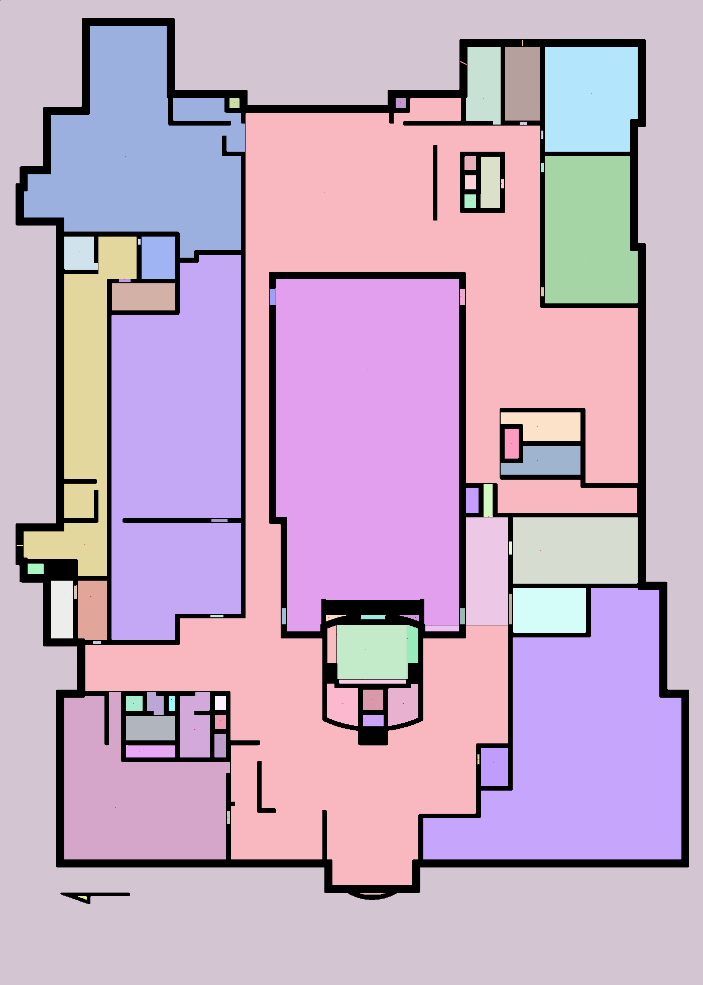
Extract Wall
-
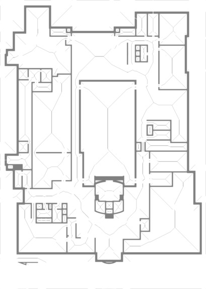
Mark intereted path that consisted "local max" distance to wall
-
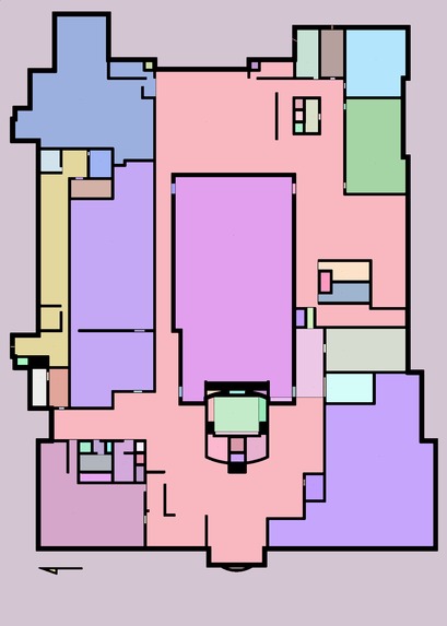
Find the doorway then detect and isolate area
-
Re construct the path
-
Clean outside building path and re open the doorway
-
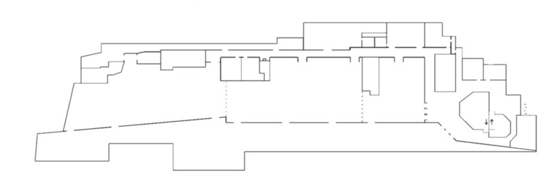
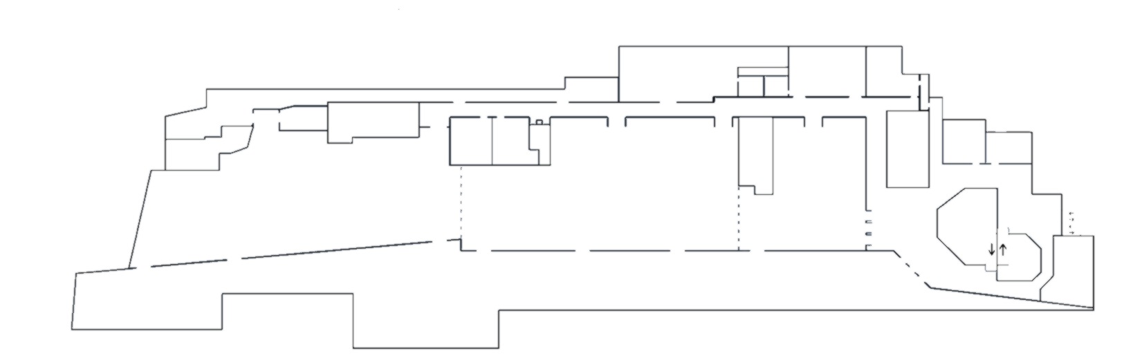
CalHack cityview - extracted wall
-

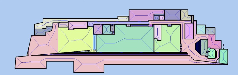
CalHack cityview - isolated area
-
CalHack cityview - potential path


Inspiration
Inspired by the fixed floor plan on buildings that tell you where you are but you still have to read it to find the way.
What it does
Automatically analyze a floor plan, create a navigation point/network on the floor plan to simplify the navigation and save runtime, and shortest path planning.
How we built it
We designed an algorithm to parse the map by first, extracting the walls from a floor plan; separating the map into different areas; and finding potential navigation points. The future step is to filter out the points to create a navigation network and pathfinding
Challenges we ran into
The main challenge was to parse the map and isolate each room.
Accomplishments that we're proud of
We parse the floor plan of UC Davis library and Calhack map on room isolation and achieved good result
What we learned
What's next for NAP (Navagate At this Place)
Complete the navigation network construction and provide an interface for people to try it out.

Log in or sign up for Devpost to join the conversation.