-
-

Team Logo
-
Overview
-

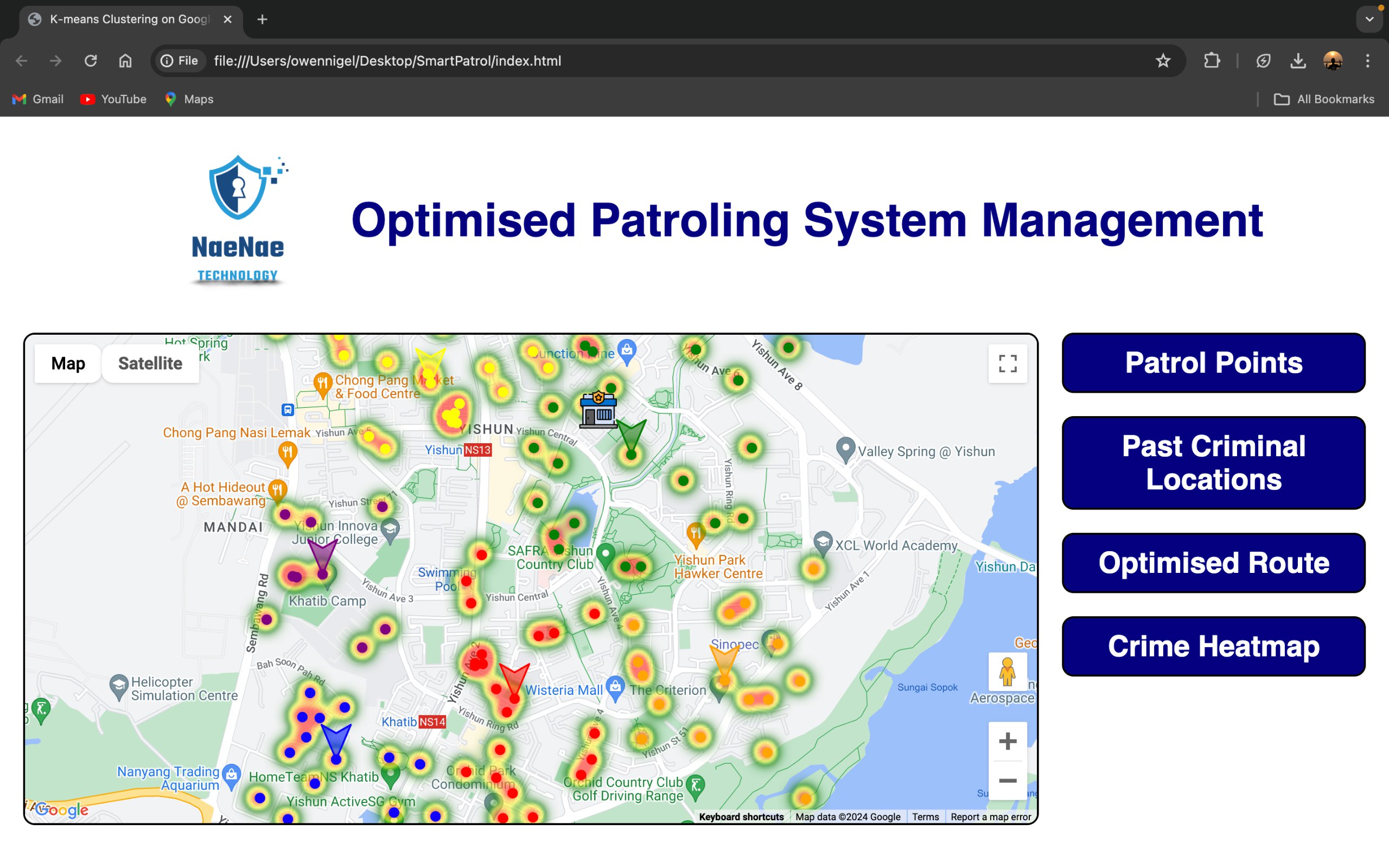
HeatMap
-
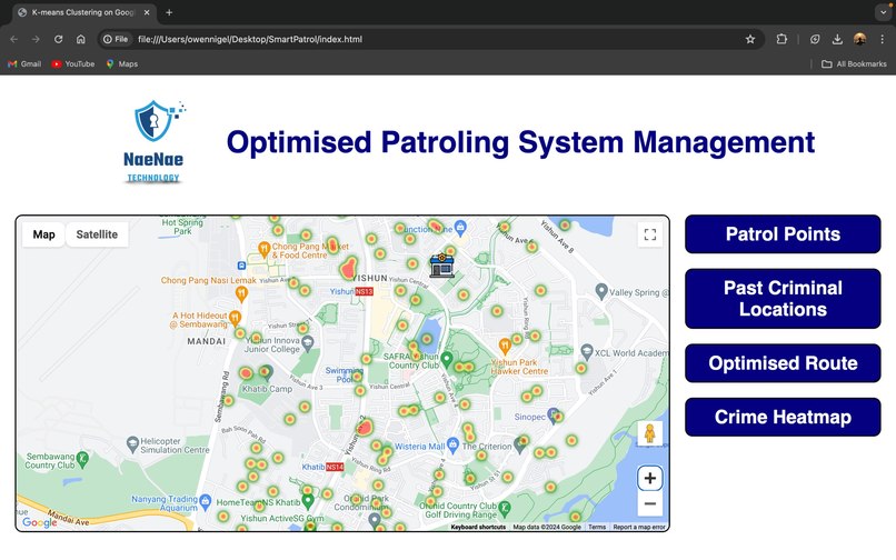
HeatMap
-
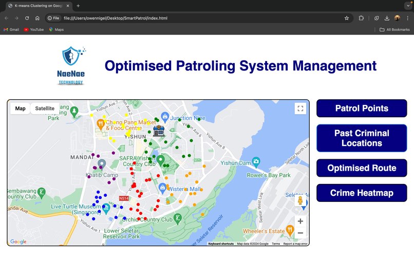
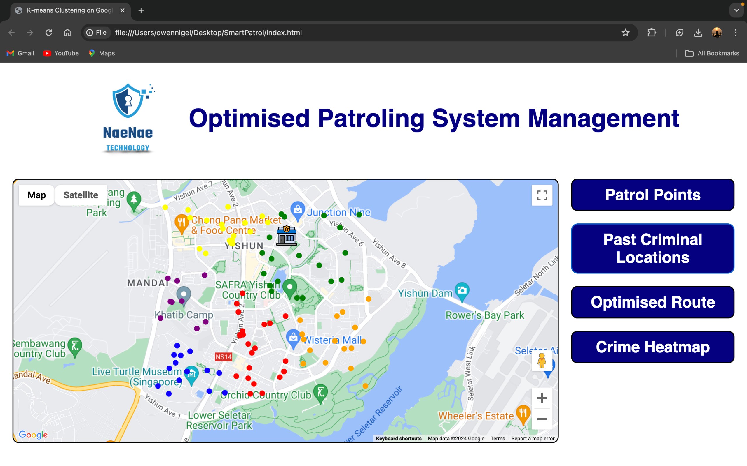
Crime Clustering
-

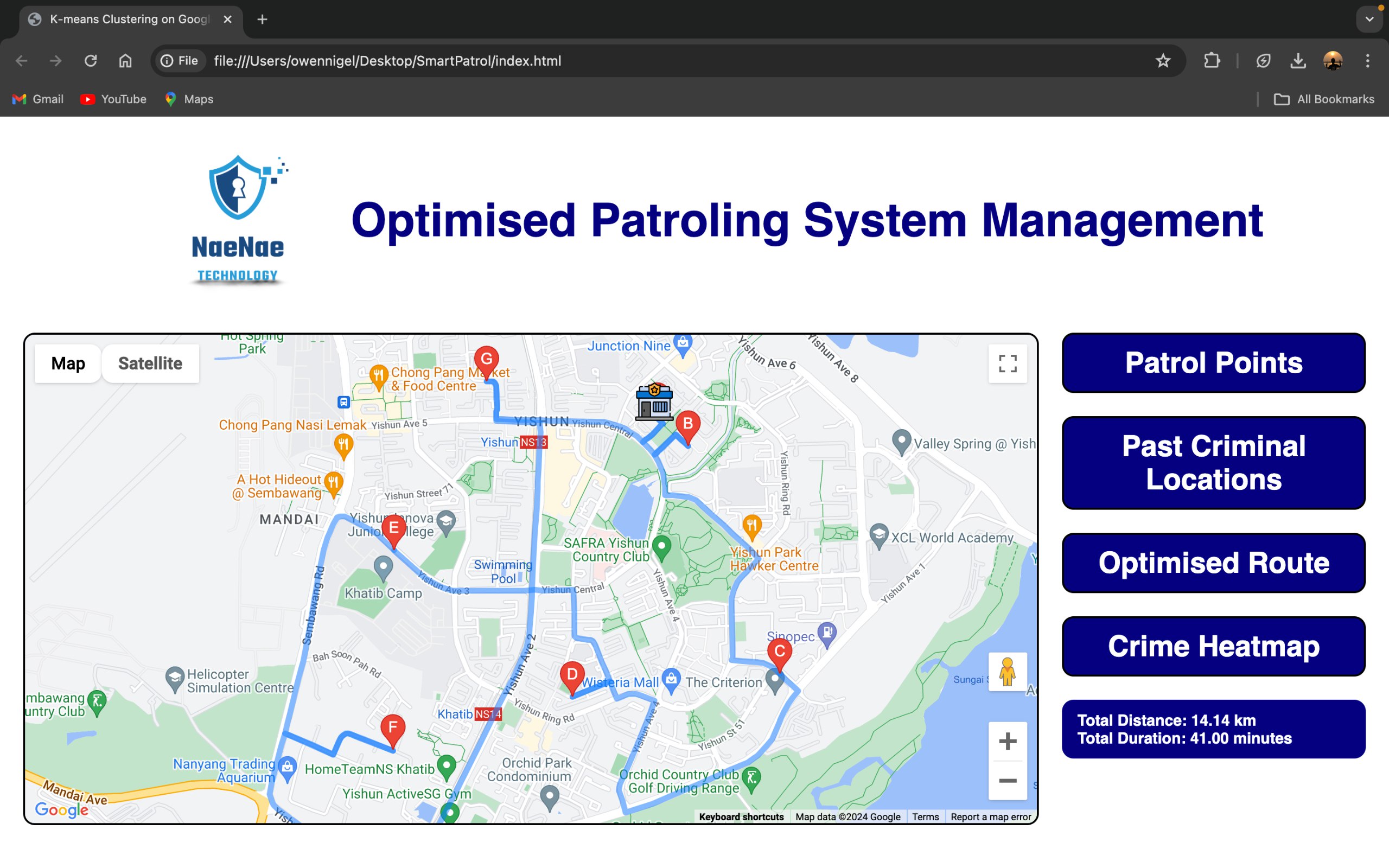
Patrol Route
-
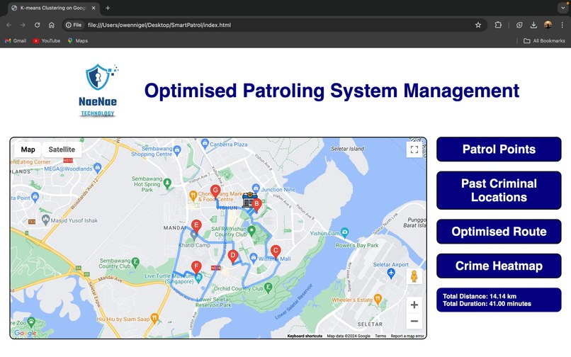
Patrol Route
-
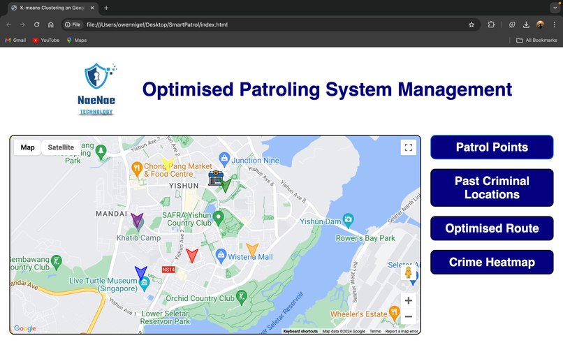
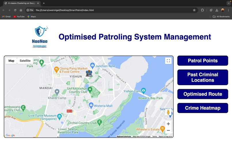
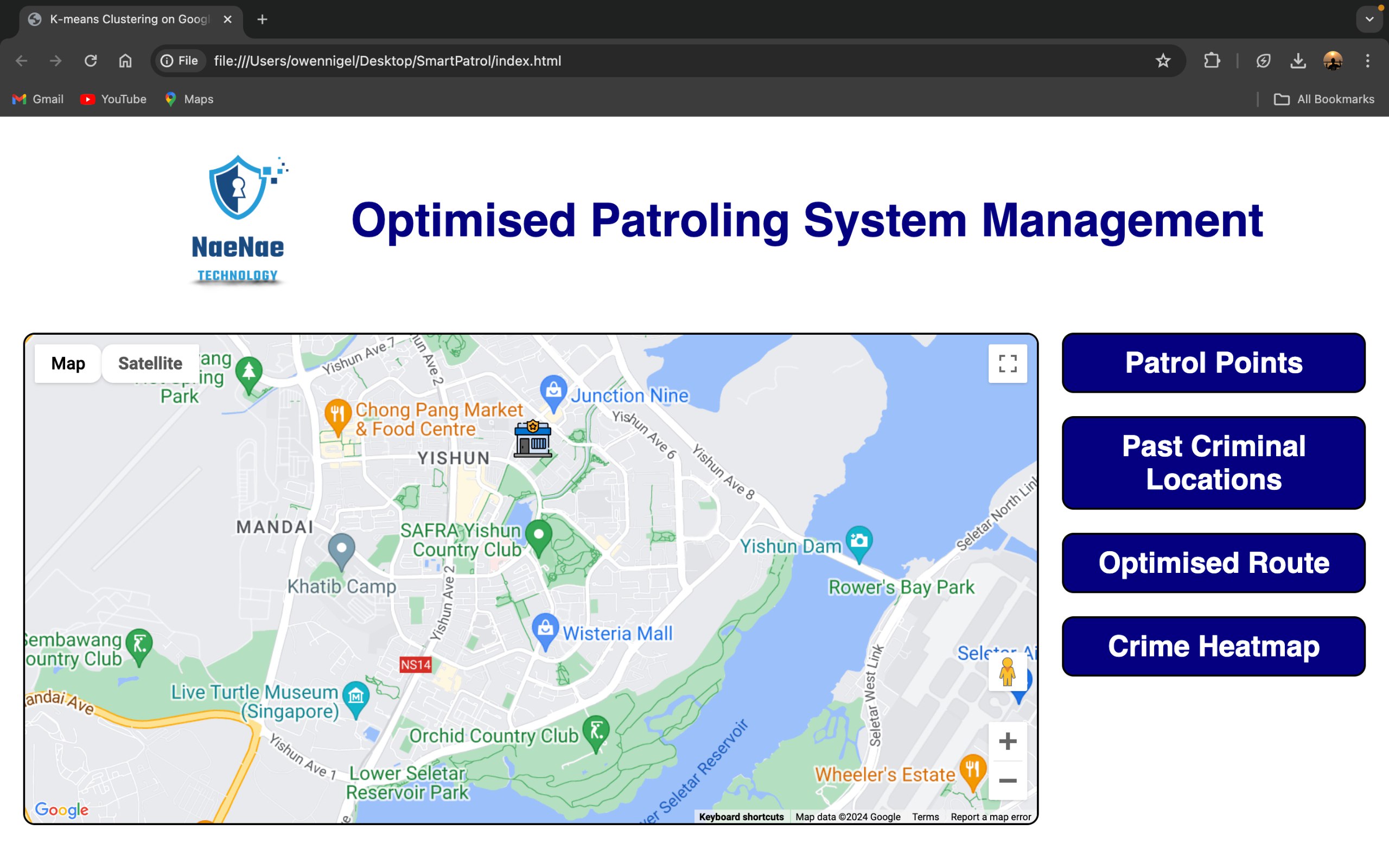
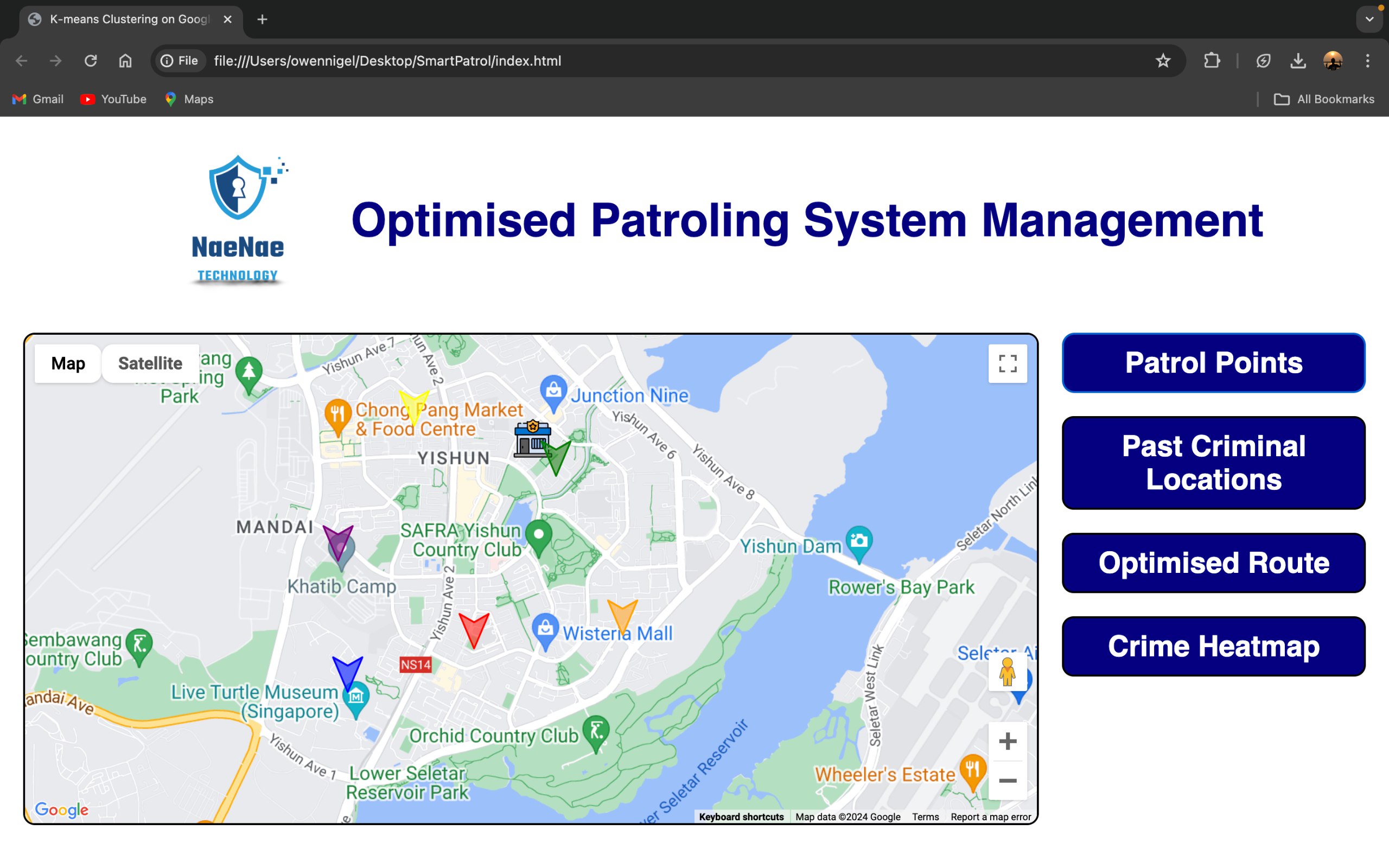
Patrol Locations


Inspiration
The increasing complexity and diversification of security issues have presented law enforcement agencies with significant challenges in allocating resources effectively to combat and prevent crime. We were inspired by the need to enhance domestic security through innovative technology solutions. By leveraging advanced data analysis and optimization techniques, we aim to empower law enforcement agencies to respond more efficiently to crime hotspots and improve public safety.
What it does
Our solution integrates crime hotspot analysis with patrol route optimization to allow law enforcement agencies to prioritize higher crime risk areas and shorten emergency response times. Using K-Means Clustering, we identify and analyze crime hotspots, and with the integration of Google Maps API, we optimize patrol routes for law enforcement officers. This ensures that resources are allocated more effectively, enabling quicker responses to incidents and better overall public security.
How we built it
We built our solution using a tech stack comprising HTML, CSS, JavaScript, and the Google Maps API. The process involved the following steps:
- Data Collection: We gathered crime data from various sources to understand crime patterns and identify hotspots.
- Data Analysis: Using K-Means Clustering, we analyzed the crime data to identify and categorize crime hotspots.
- Route Optimization: We integrated the Google Maps API to map out optimal patrol routes that prioritize high-risk areas based on the identified hotspots.
- Front-End Development: We developed a user-friendly interface using HTML, CSS, and JavaScript to display the analysis and optimized routes to law enforcement agencies.
Challenges we ran into
One of the primary challenges we faced was handling and processing large datasets of crime information to identify hotspots accurately. Ensuring the integration of K-Means Clustering with real-time data analysis and the Google Maps API also posed technical difficulties. Additionally, creating an intuitive and user-friendly interface for law enforcement officers required careful design and testing.
Accomplishments that we're proud of
We are proud of successfully developing a solution that seamlessly integrates advanced data analysis with practical applications for law enforcement. Our ability to accurately identify crime hotspots and optimize patrol routes in real time is a significant achievement. The positive feedback from initial testing with law enforcement agencies validates the effectiveness and potential impact of our solution in enhancing public security.
What we learned
Throughout this project, we learned the importance of accurate data analysis and the challenges involved in real-time data processing. We gained valuable experience in integrating machine learning algorithms with practical applications and the use of APIs to enhance functionality. Moreover, collaborating with law enforcement agencies provided us with insights into their operational needs and how technology can address those needs effectively.
What's next for NaeNae
Moving forward, we aim to further enhance our solution by incorporating predictive analytics to anticipate crime trends and proactive measures. We plan to expand the data sources and improve the accuracy of our clustering algorithm. Additionally, we will focus on scaling the solution to support multiple regions and integrating it with other emergency response systems for a more comprehensive public safety platform.


Log in or sign up for Devpost to join the conversation.