-
-
Example Images
-
Example Images
-
Example Images
-

Example Images
-

Example Images

Think about the last time you walked somewhere using Google Maps.
It gave you the fastest route. But the fastest for who?
Although Google Maps does include SOME accessibility features, they don’t cater directly to everyone
My mother is partially blind And although her vision isn’t completely gone, She is often extremely anxious whenever she travels to unfamiliar places
My mum’s not alone.
In 2021 it was reported almost 25% of people in Northern Ireland have some sort of physical disability. This is primarily due to Belfast’s rapidly aging demographic, which is rising much faster than the UK average.
So it’s clear the city needs better navigable infrastructure now.
In Belfast, over 70% of commutes are made by car, in the UK and Ireland, comparable cities have a rate of around 50%.
So how can we help make Belfast a fairer city by reducing inequality, as well as help solve Belfast’s rapid car and traffic problem?
Well we think we have a solution. Well, at least a no-cost step in the right direction.
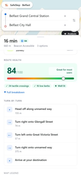
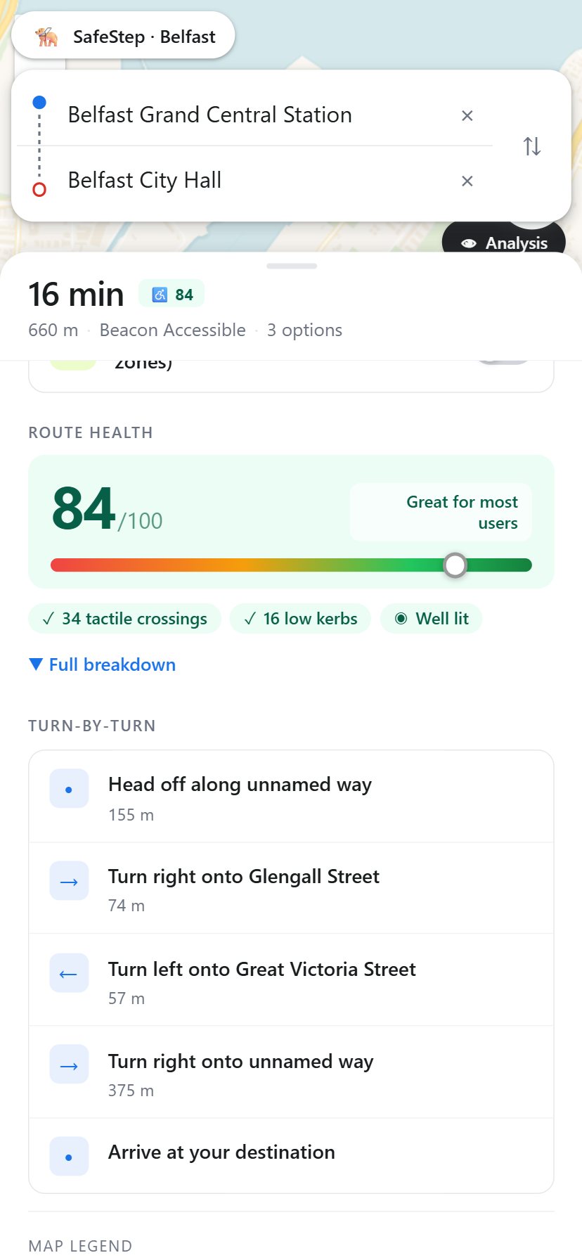
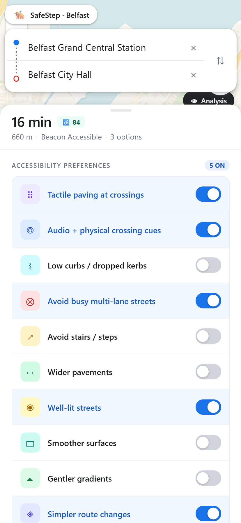
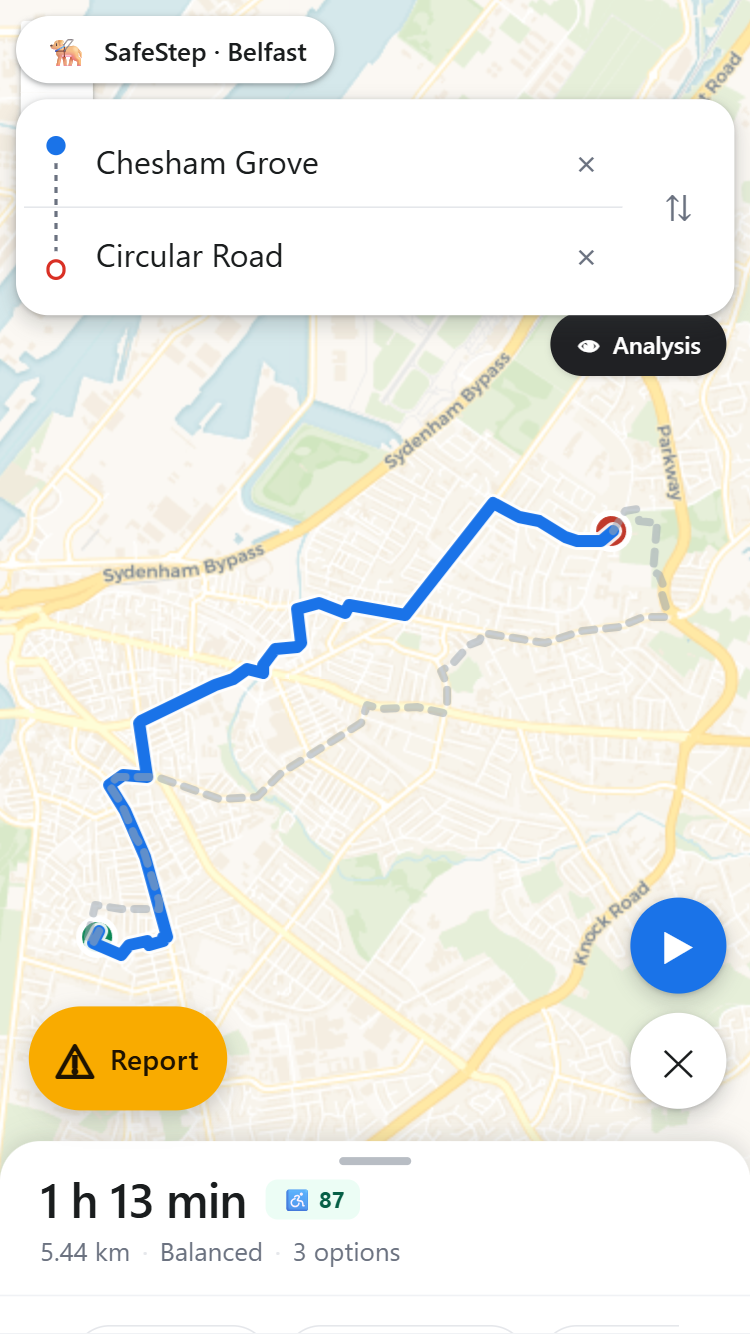
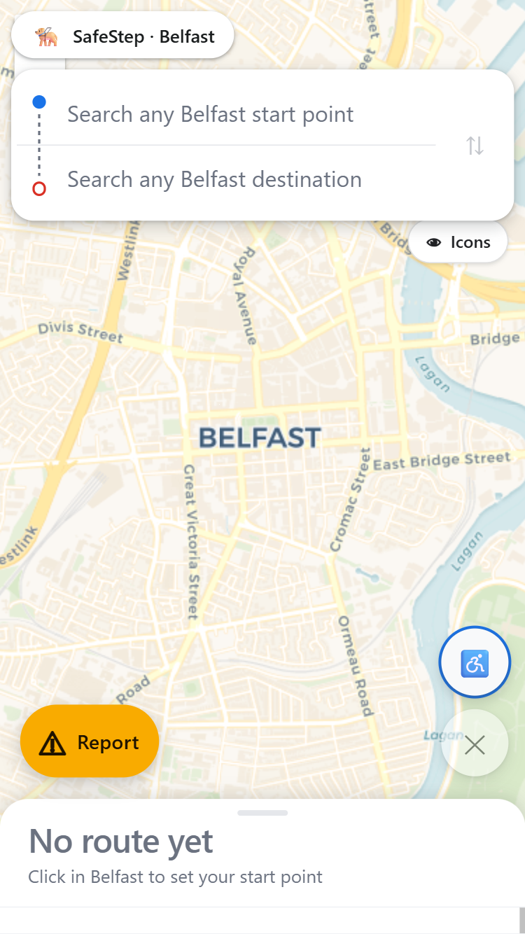
This is a walking navigation app built specifically for Belfast.
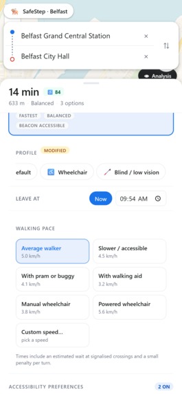
You simply enter your start and destination and our custom A* routing algorithm will do the rest, I cover this more in our coding video but we assign weights to the various parameter to determine our path
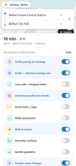
What sets us apart though is instead of just creating one route, our app gives you options, built around how you want to move through the city
You could toggle if you want wheelchair accessibility, and we’ll avoid high kerbs and unpaved surfaces, routing you to smooth footpaths.
Toggle steep hills and now a mother pushing a pram or an old man walking can know the easiest and safest route to take in a neighbourhood.
There’s also some more fun ones too, like greenery, encouraging the algorithm to go through places like the botanic gardens and the lagan rather than multi lane roads.

Log in or sign up for Devpost to join the conversation.