-
-
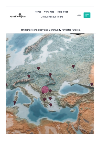
Website FrontPage
-
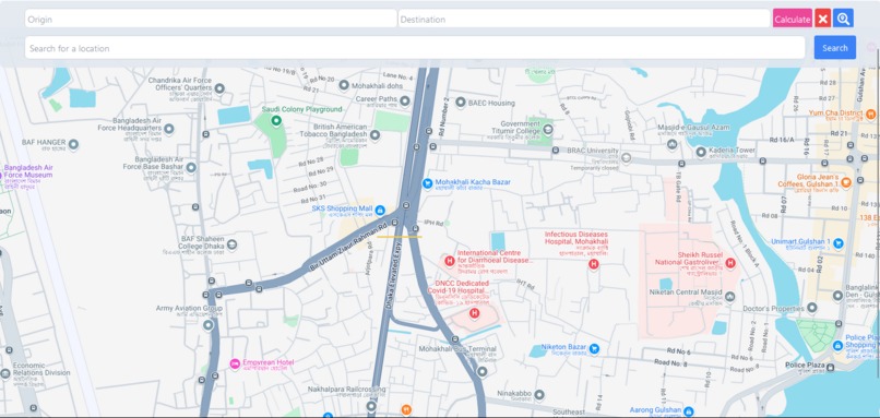
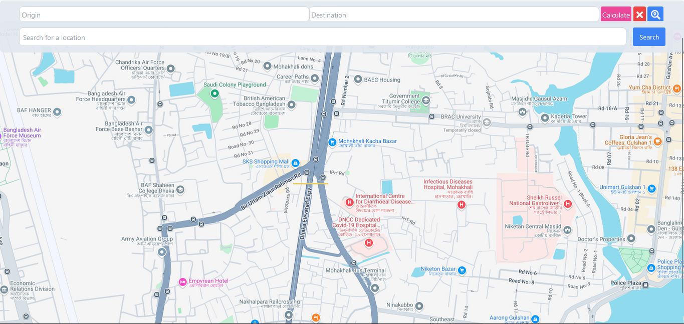
Google map implemented for location based search and see the update weather of that location and also see the flood analysis graphs
-
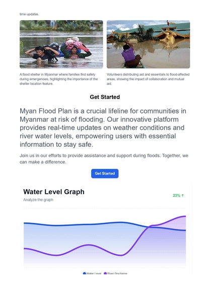
Some images of flood in Myanmar and flood analysis graph
-
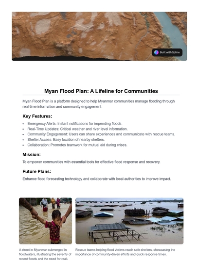
Some images of flood in Myanmar
-

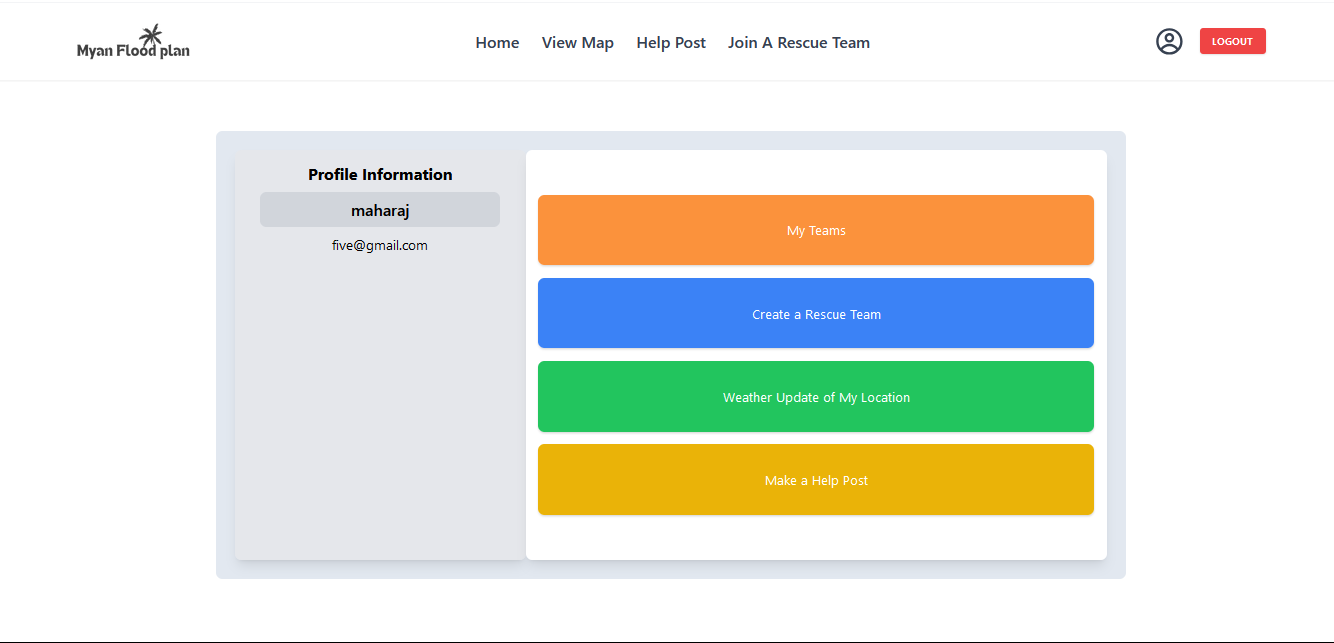
profile section
-
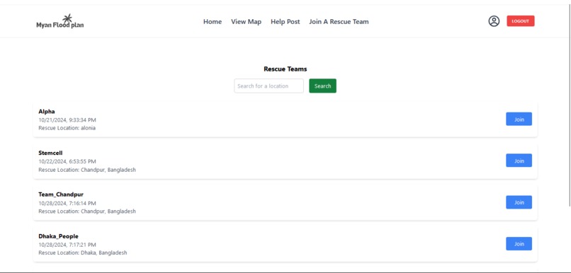
join a rescue team and help people
-
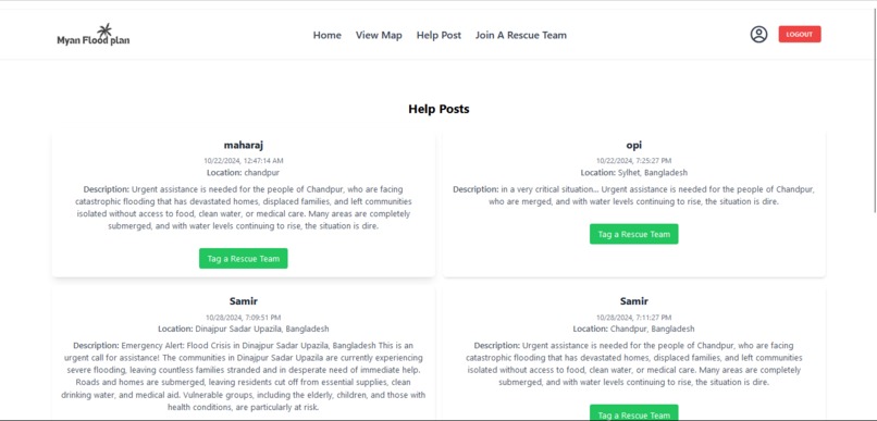
Some posts for Rescue team, the people who have been bounded in a area by flood have posted for finding and rescue them


Inspiration
Myan Flood Plan was created to help communities in Myanmar deal with the serious effects of flooding. The lack of a proper flood management system has made people suffer even more during these disasters, often leading to tragic loss of life. We saw how difficult it was for individuals and families during floods and realized that timely information and coordinated help could save lives.
We were inspired by local volunteers who showed how strong community support can be. However, without a system to connect people, many remained vulnerable. We wanted to create a platform that uses technology to provide real-time updates, connect individuals, and encourage teamwork during emergencies.
Our aim with Myan Flood Plan is to empower communities to respond better to floods. We want to ensure that everyone has access to the information and resources they need to stay safe, helping to build a stronger and more resilient future for everyone.
What it does
Introducing Myan Flood Plan—a vital lifeline for communities in Myanmar facing the ever-looming threat of flooding. Our innovative platform is designed to provide real-time updates on critical weather conditions and river water levels, empowering users with the essential information they need to stay safe and make informed decisions.
Emergency Alarm System: At the forefront of Myan Flood Plan is our Emergency Alarm System, which notifies users of impending floods through instant alerts. This proactive feature ensures that communities are informed well in advance, allowing them to take necessary precautions and evacuate if needed.
Community Engagement: Myan Flood Plan fosters a vibrant community where users can share their experiences, needs, and updates during flood events. By enabling individuals to tag distressed areas, we facilitate direct communication between those affected and rescue teams, ensuring swift and effective responses to emergencies. This communal approach not only fosters awareness but also strengthens the bonds among community members.
Shelter Access: Our platform offers more than just information; it acts as a resource for those in need. Users can quickly locate the nearest shelters and receive critical updates about those locations, ensuring they have access to safe havens when it matters most. By streamlining the process of finding shelter, we aim to alleviate the stress and uncertainty that often accompanies natural disasters.
Collaboration and Mutual Aid: Myan Flood Plan promotes collaboration among users, allowing them to form teams with neighbors for mutual aid. This spirit of solidarity is vital during crises, as individuals come together to support one another, share resources, and coordinate rescue efforts. In times of distress, community strength can make all the difference.
Transforming Disaster Response: Join us in our mission to transform disaster response and recovery into a community-driven effort. With Myan Flood Plan, we are dedicated to ensuring that no one is left behind when every second counts. Our goal is to create a proactive approach to flood management, enabling communities to build resilience against future flooding events.
A Call to Action: Let’s turn hope into action and protect lives with Myan Flood Plan. Together, we can make a meaningful difference in the lives of those affected by flooding, fostering a safer, more connected, and resilient Myanmar. Join us in this critical initiative and be part of the change.
How we built it
In building Myan Flood Plan, we integrated several key technologies to provide timely and accurate information. We used the Google Maps API to pinpoint and display vital locations such as flood-affected areas and nearby shelters. This allows users to easily navigate to safety during emergencies.
To provide real-time weather updates and forecast alerts, we leveraged the OpenWeatherMap API. This ensures that users are always informed about current and predicted weather conditions, enabling them to make better decisions in advance of potential floods.
We also incorporated local data sources to identify and display shelter locations during times of crisis, offering users essential guidance to the nearest safe havens.
Challenges we ran into
One of the main challenges we faced was integrating Google Maps in a user-friendly way, ensuring the information was clear and easy to access during a crisis. Making the live data—such as weather updates and shelter locations—intuitive and useful was a key priority, but it required careful design and development.
Another significant challenge was the time constraint. I had to balance this project with my semester finals, leaving me with very limited time to complete it. Despite these obstacles, we managed to build a functional and effective platform.
Accomplishments that we're proud of
We’re proud of successfully building a platform that can make a real difference in flood-prone areas. Integrating Google Maps and OpenWeather APIs provided accurate, real-time information on weather conditions and shelter locations, which is vital in emergencies. Despite time constraints and balancing academic responsibilities, we created a user-friendly interface that enables communities to share flood updates and receive essential rescue information. Most importantly, we’ve built a system that helps people stay safe, find shelters, and assist one another during critical moments.
What we learned
Throughout the development of Myan Flood Plan, we learned the importance of balancing real-time data with ease of use. We deepened our understanding of API integration, especially with Google Maps and OpenWeather, ensuring seamless user experiences. Time management and adaptability were also key lessons, as we had to juggle this project alongside other commitments, such as exams. Overall, the experience showed us the power of technology in disaster management and the critical need for reliable, accessible solutions.
What's next for Myan Flood Plan
our next goal to collect all the shelters in a location and add to database. Therefore when user find for shelters in the critical situation then we will provide them our information through google map. we also plan to integrate Elon Musk's Starlink to ensure uninterrupted internet access during floods, enabling real-time updates and communication even in remote or cut-off areas. We also aim to improve flood forecasting with advanced predictive analytics and add a multilingual interface for broader accessibility. Expanding community features to allow live chats and direct communication with rescue teams is a key priority. Additionally, we hope to collaborate with local authorities to integrate official data, further enhancing the platform's impact and helping protect more lives during flood events.
Built With
- appwrite
- gomapsapi
- javascript
- open-meteoapi
- openweaterapi
- react
- tailwind
- vercel

Log in or sign up for Devpost to join the conversation.