-
-
-
Safety Zone Alert
Inspiration
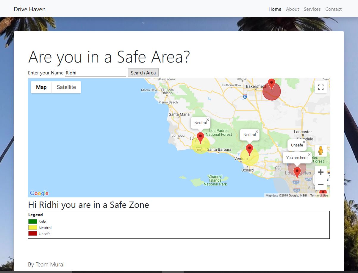
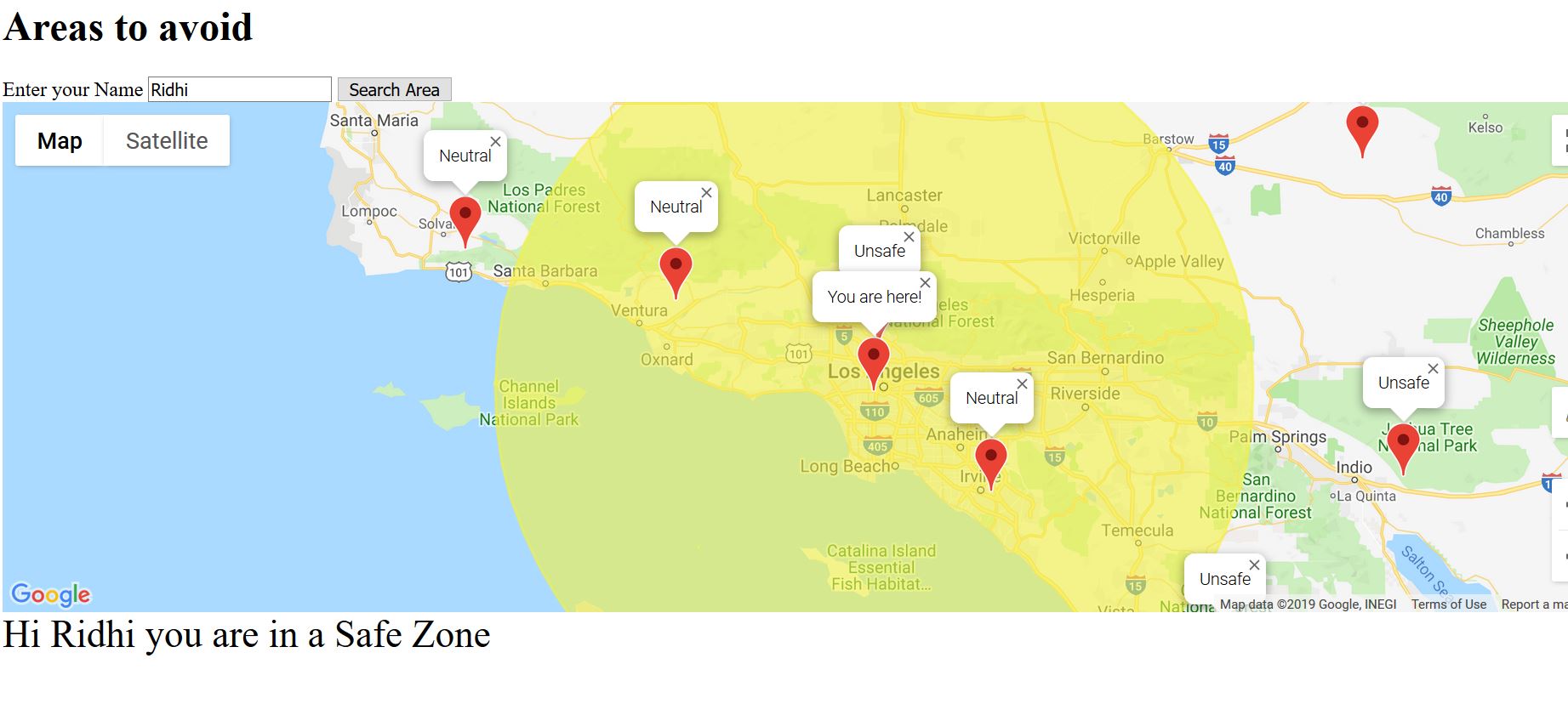
We love road trips. When driving long distances, apart from knowing the route to our destination, we are often unaware of the safety of different locales we travel through. Having this additional information can help us make better decisions when determining our driving routes.
What it does
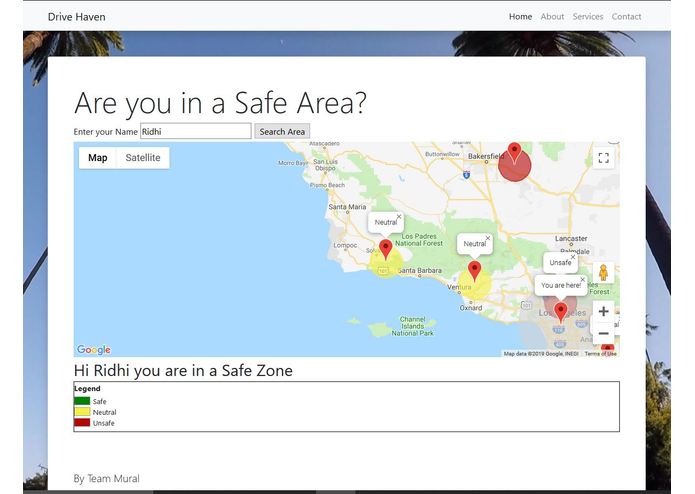
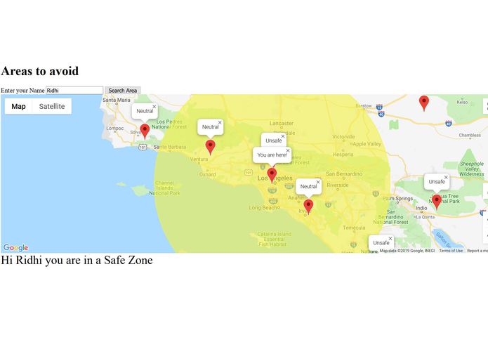
We integrated crime information from data sets and our web programming skills to create an API that can locate where you are currently and evaluate the safety of your surrounding area.
How I built it
Web API: Javascript, HTML, CSS, Bootstrap and Google API; Datasets: Kaggle FBI Crime Datasets for California and Python
Challenges I ran into
Deciding parameters for classifying high risk and low risk zones; Integrating data with Javascript
Accomplishments that I'm proud of
We found data and crime rates and cleaned it so that it could give an accurate information to the user
What I learned
Learnt how to use google Map APIs and data retrieval from Kaggle. Client Server Communication
What's next for mural
Making the app more responsive and creating an alert system so that the emergency contacts of the user get to know if they are in a high risk zone, only with the user's permisiion


Log in or sign up for Devpost to join the conversation.