-
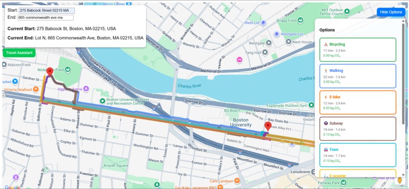
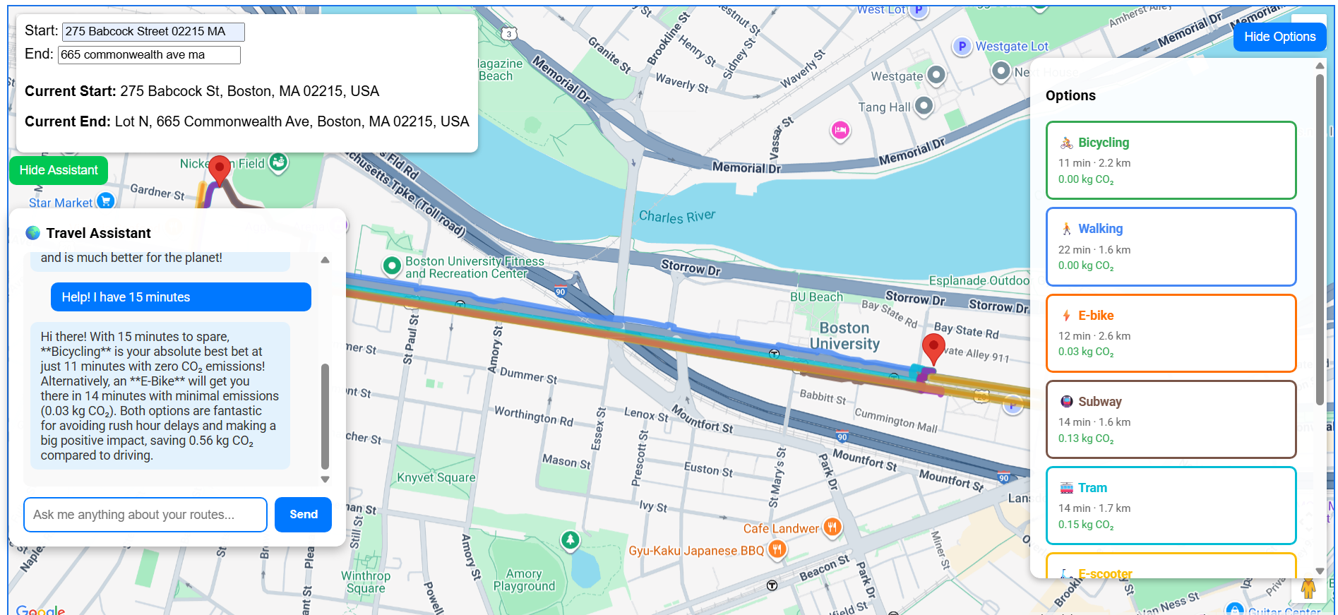
Map
-
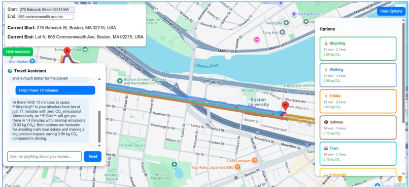
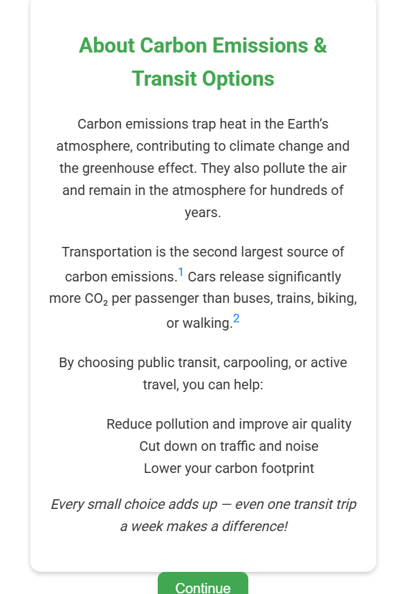
Map with assistant
-
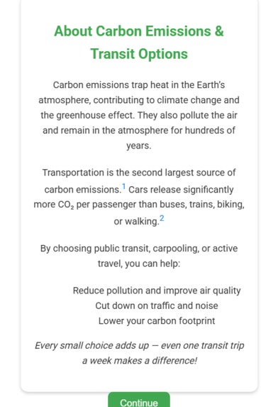
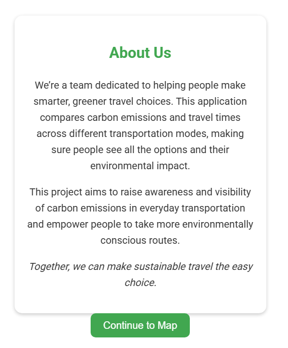
First pop up
-

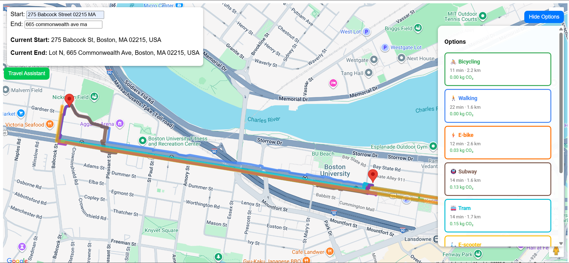
Second pop up
Inspiration
What it does
Our web app empowers users to decrease their carbon footprint. After inputing their starting location and destination, they will be presented with a variety of modes of transportation ordered by carbon emissions and time.
How we built it
We leveraged Google Maps' API for distance and route data and Gemini to get a travel assistant, then we built in simple JS, HTML, and CSS to add all the other features.
Challenges we ran into
A couple times we hit merge conflicts, and learning to work with Google Maps' API was a process, but we overcame both these issues through collaboration and effort.
Accomplishments that we're proud of
We think this entire project is an accomplishment, as it promotes sustainable travel habits in an intuitive, educational, and non-pushy way.
What we learned
We learned about API usage, node.js map manipulation, and that some of our preconceived notions on what sustainable travel looks like were incorrect.
What's next for MoveGreen
We'd love to research more on the subject, refine our numbers/calculations, and deploy this into a full-scale website that can be eventually be integrated into Google Maps itself.


Log in or sign up for Devpost to join the conversation.