-
-
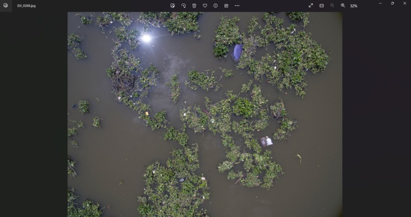
Original image
-
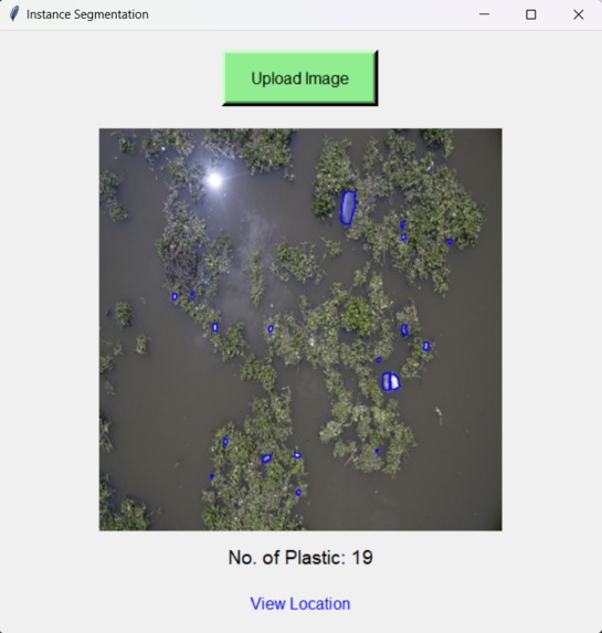
Detecting plastic and counting it. It also gives the live link to the location of the place in image
-
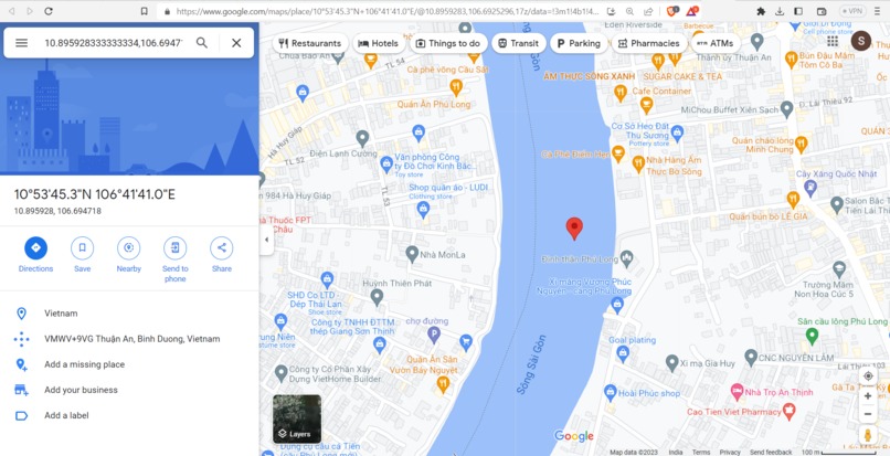
live location of the place where plastic was detected


EcoDroneWasteScan: Aerial Eyes for Cleaner Rivers
Project Inspiration
The inspiration for the EcoDroneWasteScan project came from the growing concern about plastic pollution in rivers and its detrimental impact on the environment. Plastic waste is a significant global issue, and rivers often act as conduits for plastic debris, ultimately ending up in oceans, harming marine life, and polluting ecosystems. To address this problem, we aimed to develop an innovative solution that utilizes drone technology and machine learning to monitor and count plastic waste in rivers.
What We Learned
Throughout the development of EcoDroneWasteScan, our team gained a deeper understanding of the potential applications of artificial intelligence and aerial imagery in environmental conservation. We learned how to harness the power of machine learning algorithms to recognize and identify plastic waste in drone images. Additionally, we discovered the importance of real-time data processing and location-based services to provide live information about the concentration of plastic waste in various river locations.
Building the Project
The EcoDroneWasteScan project involved multiple stages of development:
Data Collection: We collected a vast dataset of drone images taken from different rivers worldwide. These images captured various scenarios of plastic waste, including single-use bottles, bags, and other debris.
Image Annotation: To train the machine learning model, we manually annotated the images, marking the locations of plastic waste in the river scenes. This annotated dataset served as the foundation for training our object detection model.
Machine Learning Model: We employed state-of-the-art object detection algorithms, utilizing convolutional neural networks (CNNs), to train the model on the annotated dataset. The model learned to detect and count plastic waste instances in the river images.
Real-time Processing: To enable live location tracking, we integrated the machine learning model into the drone's onboard computer. As the drone flew over the river, it captured live images, which were instantly processed by the model to count the plastic waste.
Location Services: We incorporated GPS and mapping technology to provide real-time location data of the plastic waste concentration. Users could access an interactive map that displayed the counts and locations of plastic waste detected by the drone.
User Interface: To make the project accessible to users, we developed a user-friendly interface, allowing stakeholders, environmentalists, and concerned citizens to view the results and track the changes in plastic waste over time.
Challenges Faced
The EcoDroneWasteScan project presented several challenges:
Data Variability: The drone images varied significantly in terms of lighting conditions, angles, and plastic waste types. Ensuring the model's accuracy across diverse scenarios required extensive data preprocessing and augmentation.
Real-time Performance: Processing images in real-time on the drone's limited computing resources was a challenge. We had to optimize the model's architecture and utilize hardware acceleration to achieve fast and efficient inference.
Mapping and Location Accuracy: Integrating precise location data with drone imagery required careful calibration and synchronization. Ensuring accurate mapping and GPS data alignment were crucial for the project's success.
Environmental Conditions: External factors like weather conditions and river water turbulence affected the drone's flight stability and image quality. We had to develop a robust flight control system to handle such environmental challenges.
Conclusion
The EcoDroneWasteScan project represents a significant step forward in addressing the problem of plastic waste in rivers. By combining drone technology, machine learning, and real-time data processing, we have created a powerful tool for environmental monitoring. With the ability to count plastic waste in rivers and provide live location information, EcoDroneWasteScan empowers environmentalists and communities to take targeted actions towards cleaner rivers and a healthier planet. We believe that such innovative applications of AI and drone technology can have a profound and positive impact on safeguarding our environment for future generations.

Log in or sign up for Devpost to join the conversation.