-
The main Bit
Inspiration
What if a community isn't receiving the healthcare it needs simply because it barely exists on the maps used to plan those services?
That question was what got us started.
Most healthcare planning relies on existing records of settlements, populations and medical facilities. But those records aren't always complete or up to date, especially in remote areas. A blank space on a map doesn't necessarily mean nobody lives there.
We wanted to flip the usual approach. Instead of expecting people to find healthcare, what if we could help healthcare find people?
That's where Missing Millions came from.
What it does
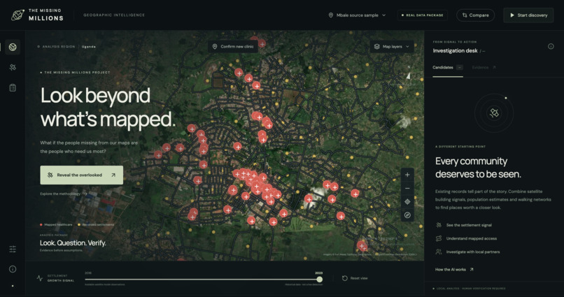
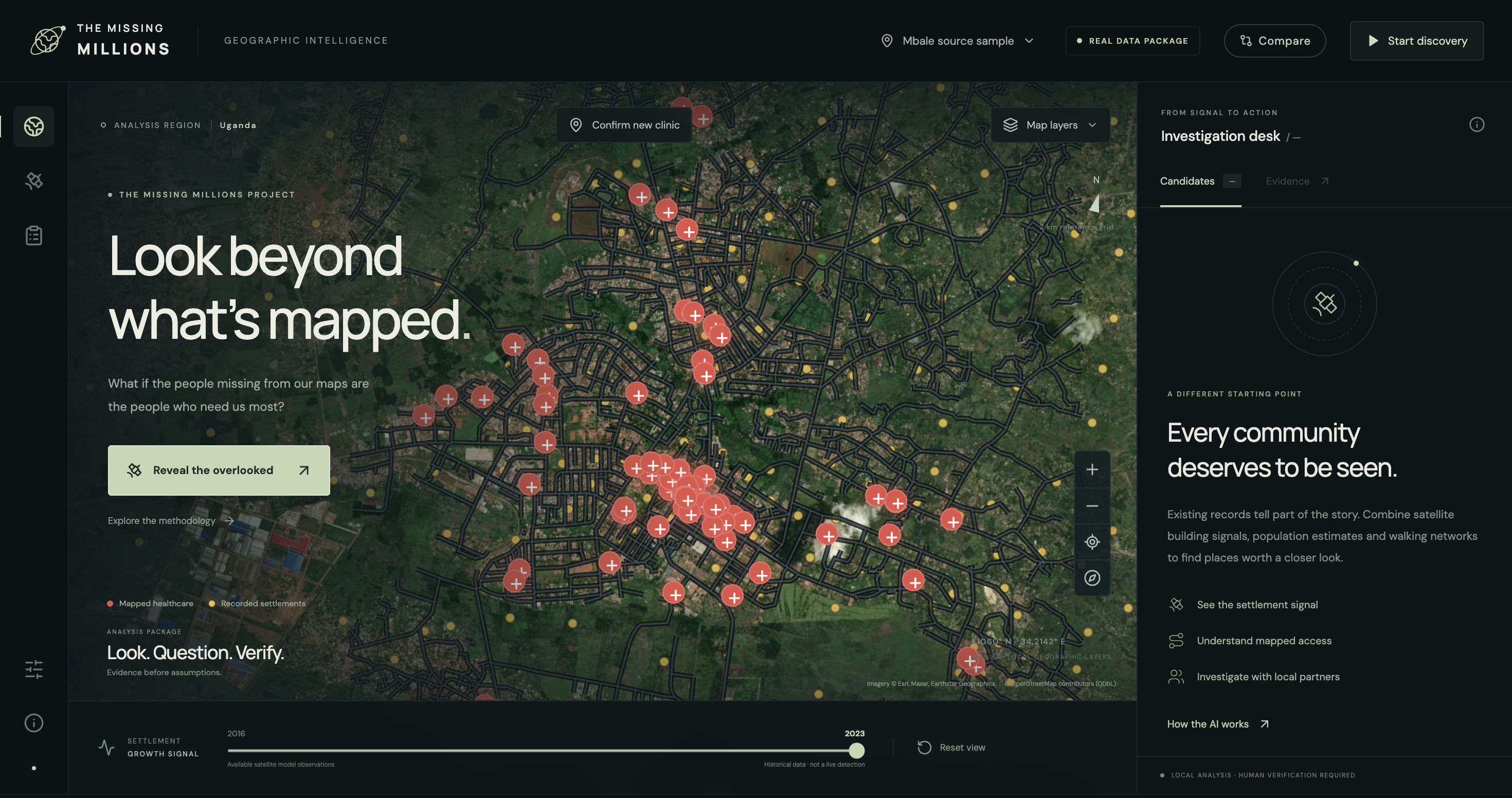
Missing Millions uses satellite-derived data and machine learning to identify communities that may have been overlooked in existing healthcare planning.
The system looks for clusters of buildings that aren't clearly represented in settlement records. It then combines population estimates, road networks and healthcare facility locations to work out which communities might face significant difficulties accessing medical care.
Rather than just putting markers on a map, we wanted to go a step further. Missing Millions helps identify which areas deserve investigation and explores where resources like mobile clinics could potentially make the biggest difference.
Importantly, we don't assume that every unmapped settlement lacks healthcare. The goal is to highlight possible gaps, explain the evidence behind them and make it easier for people on the ground to verify what is actually needed.
How we built it
We built the project around several geospatial datasets that each tell us a different part of the story.
Google's Open Buildings dataset provides ML-generated building footprints from satellite imagery. We use geographic clustering to group nearby buildings into potential settlements and compare them against existing OpenStreetMap data.
We then bring in WorldPop population estimates to approximate how many people might live in those areas. By combining road networks with recorded healthcare facility locations, we can estimate how long it might take residents to reach medical care.
The interesting part was connecting all these pieces. Finding buildings is one thing, but understanding whether those buildings represent a community that may be underserved requires looking at the wider picture.
Our approach combines machine-learning-derived geographic information with spatial analysis, routing algorithms and evidence-based prioritisation.
Challenges we ran into
One of the biggest challenges was realising how difficult it is to establish something that sounds simple: whether a community actually has access to healthcare.
A satellite image might show a cluster of buildings, but it can't tell us with certainty whether people live there. Similarly, a healthcare facility might appear on a map without necessarily being operational or providing the services people need.
Road data introduced another complication. Two places might be relatively close geographically but much further apart in terms of actual travel time.
We also had to be careful when combining datasets at different resolutions and from different years. Even population estimates aren't exact counts, and overlapping settlement boundaries can lead to double-counting if they're not handled properly.
The biggest challenge was making sure the system didn't present uncertain predictions as facts. We wanted it to be useful without pretending to know more than the data could tell us.
Accomplishments that we're proud of
What we're most proud of is taking a problem that initially seemed like a mapping exercise and turning it into something focused on real people.
The idea isn't just to detect buildings from space. It's to connect settlement information with healthcare access and identify places that might otherwise be missed when resources are allocated.
We also like that the project doesn't treat AI as a replacement for human judgement. It uses AI to identify where further investigation could matter, while leaving important decisions to healthcare workers and local organisations.
For us, that's what makes the project exciting. The technology is there to draw attention to people who might otherwise be overlooked.
What we learned
The biggest thing we learned is that having more data doesn't automatically mean having a better understanding of a problem.
Satellite imagery can reveal patterns that existing records miss, but those patterns still need context. Something that looks like an obvious gap to a model might have a perfectly reasonable explanation on the ground.
We also learned that machine learning doesn't necessarily need to make the final decision to be valuable. Sometimes identifying the right place to investigate, or showing where our information is incomplete, is just as useful.
More than anything, this project changed how we think about accessibility. A service can technically exist and still be practically unreachable for the people who need it.
What's next for Missing Millions
The next step is to test Missing Millions against more complete settlement and healthcare records, and eventually work with local organisations to validate potential gaps on the ground.
We'd like to improve the accessibility estimates by accounting for terrain, seasonal road conditions and different forms of transport. We also want to develop the human-feedback process further, so verified findings can improve future predictions.
Another direction we're interested in is outreach planning: helping healthcare organisations explore where mobile clinics or vaccination teams could reach the greatest number of underserved people.
Longer term, there's no reason the underlying approach has to stop at healthcare. The same idea could help identify communities with poor access to clean water, electricity or other essential services.
But the goal isn't to cover every possible problem. It's to make sure the information we uncover can lead to something useful happening in the real world.
Missing Millions is built around one simple reversal: people shouldn't always have to find help. Help should get better at finding them.

Log in or sign up for Devpost to join the conversation.