-
-
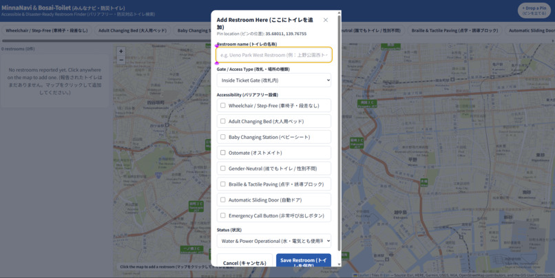
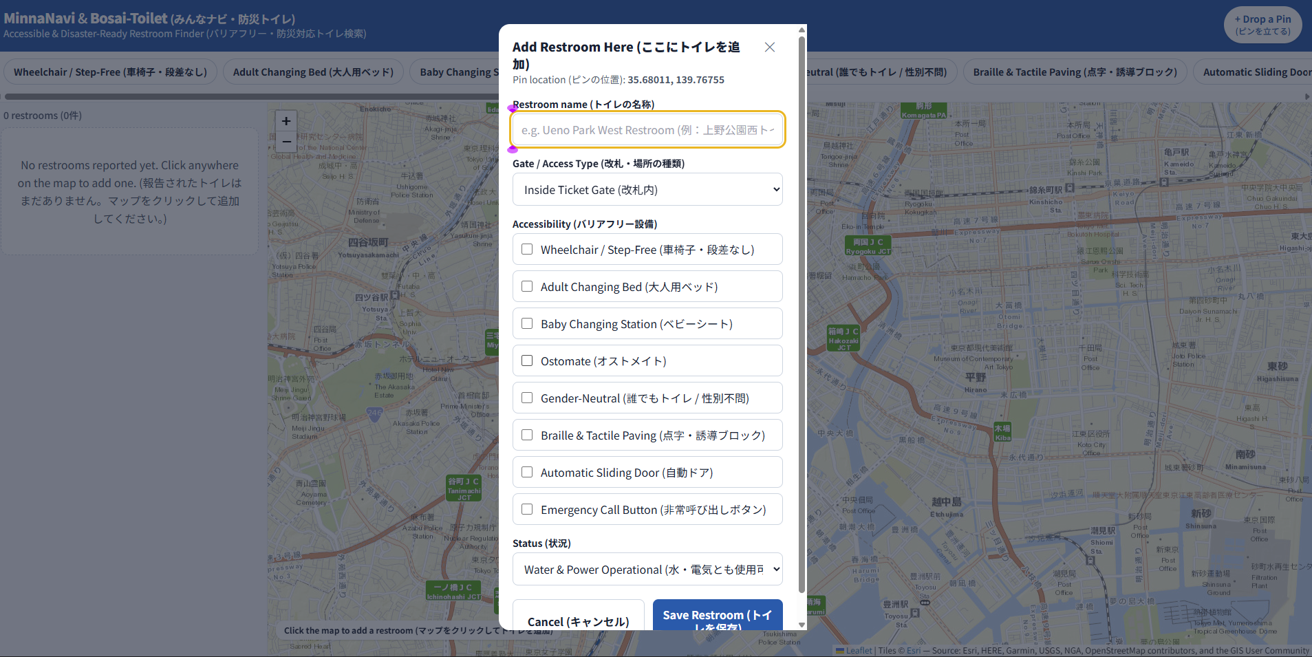
Options for pin and all of the accessibility options included
-
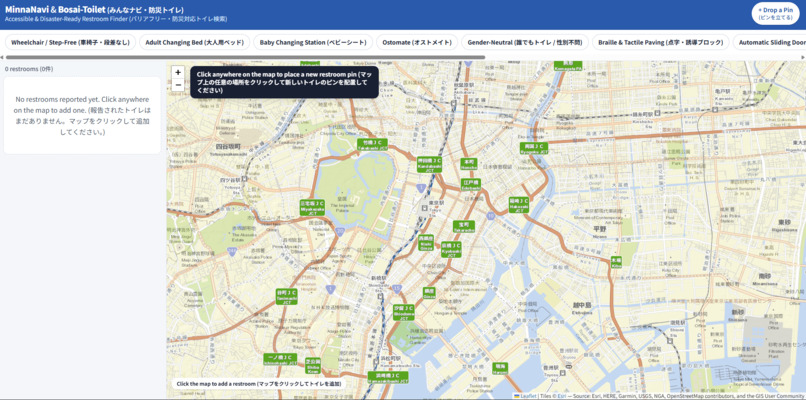
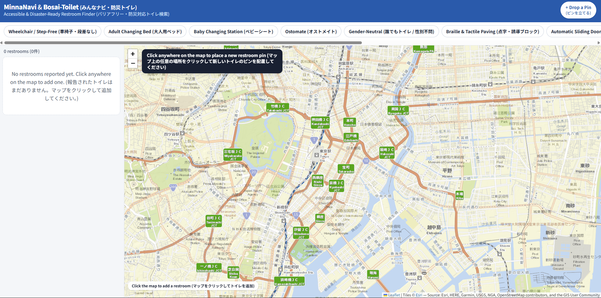
Basic interface of the map
Inspiration
Tokyo is one of the most sophisticated places in the world but its digital navigation infrastructure does not help out specific groups of people who really need it. Standard map apps identify that a station or building has a restroom inside but they do not include important accessibility details like whether a facility has an adult changing bed, ostomate washing equipment, or step free access. For individuals with severe mobility problems or complex care needs, traveling without being sure that specialized facilities exist on their route creates severe anxiety and limits their freedom.
Furthermore, in Japan there is always the constant threat of earthquakes. During these times, train stations are closed for safety and thus the restrooms inside stations are also off limits (station restrooms are one of the most used restrooms). This leaves commuters and local residents on the street level suddenly cutoff from station restrooms, completely unaware of which nearby facilities remain open and working.
I know this problem is real because my experience and testing of major navigation apps confirmed they do not have search filters for adult changing beds or ticket gate barrier status or municipal disaster preparedness protocols explicitly showing station gate closures during emergencies. Therefore, I decided to create a prototype version of an app that addresses both of these issues simultaneously.
What it does
MinnaNavi and Bosai-Toilet provides a free mapping tool optimized for Tokyo's complex layout. The app enables users to view and contribute accessibility data including adult changing beds, baby changing stations, ostomate facilities, step-free access, all-gender options, and emergency assistance buttons. Importantly, in the app, every facility is categorized by its precise location relative to transit barriers such as inside ticket gate, outside ticket gate, public park or street level, shopping mall, or local business. This categorization prevents stranded commuters from attempting to reach locked facilities during station shutdowns. Furthermore, the app tracks current operational utility status based on user inputs, allowing residents and city planners to immediately see the working infrastructure during post-earthquake outages or disruptions for other reasons. Anyone can contribute a new location instantly by using the drop a pin function to select coordinates directly on the interactive map, ticking off facility features, and saving it live to the map interface for immediate availability.
How we built it
The main application logic is built using HTML5 and vanilla JavaScript ES6+ to eliminate the need for heavy frameworks. Tailwind CSS is used with a Content Delivery Network for responsive mobile design and accessible layout structure. The interactive map visualization was made by Leaflet.js, utilizing a specialized keyless Esri ArcGIS topographic tile server. This choice ensures the mapping layer operates without API keys, usage authentication headers, or service caps, keeping the entire application free to run today. Application state and user interactions are tested using browser LocalStorage, with version control managed via GitHub and global static hosting provided by Vercel for HTTPS delivery.
Challenges we ran into
The most significant technical challenge was integrating an interactive, high-resolution topographic map layer for central Tokyo that operated entirely without paid API keys, user authentication requirements, or usage quotas. Initial prototypes utilized standard global tile sets that failed to provide the necessary clarity for complex station entrance layouts without costs. I then found a Leaflet-compatible, free tile provider that remained compliant with open mapping standards, and selected keyless Esri topographic tiles that resolved this constraint.
Accomplishments that we're proud of
Delivering a functional, interactive GIS application for mapping local infrastructure without spending anything on infrastructure costs (APIs, hosting, keys, or databases). This proves that important neighborhood accessibility tools can be built and deployed if you really want to. Furthermore, achieving seamless dual-language support across the entire application interface allows both local residents and foreign travelers to access and contribute vital facility data without issue.
What we learned
For local applications, minimizing backend dependencies on servers and paid APIs significantly improves reliability during grid failures and long term sustainability. By building this project, it reinforced that standard navigation systems have severe blind spots for accessibility categories, leaving populations with specialized requirements in an information vacuum that community based mapping tools can effectively bridge.
What's next for MinnaNavi and Bosai-Toilet / みんなのナビと防災トイレ
If development continued, the highest priority would be migrating from LocalStorage to a cloud database solution such as Supabase or Firebase to permanently synchronize all crowdsourced pins across users globally in real time. I would also prioritize Progressive Web App functionality, utilizing Service Workers to cache map tiles and local coordinate data directly onto the user's mobile device, enabling offline navigation capability during severe post-earthquake network grid failures.
Built With
- esri
- github
- html5
- javascript
- leaflet.js
- tailwind
- vercel

Log in or sign up for Devpost to join the conversation.