-
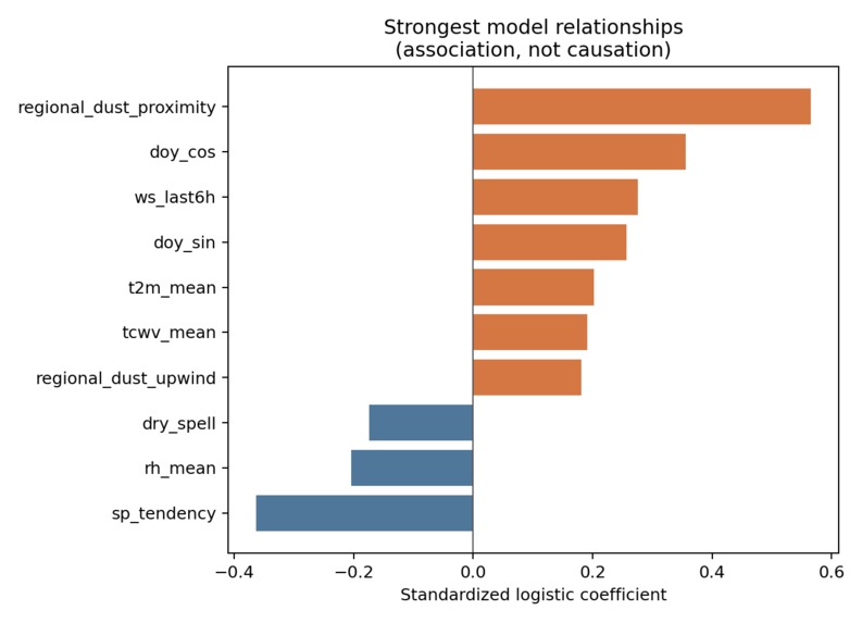
Model 1
-
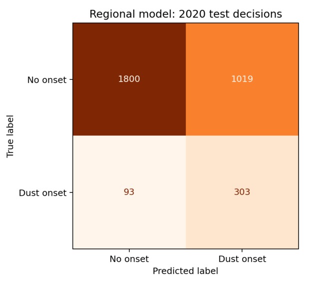
Model 2
-
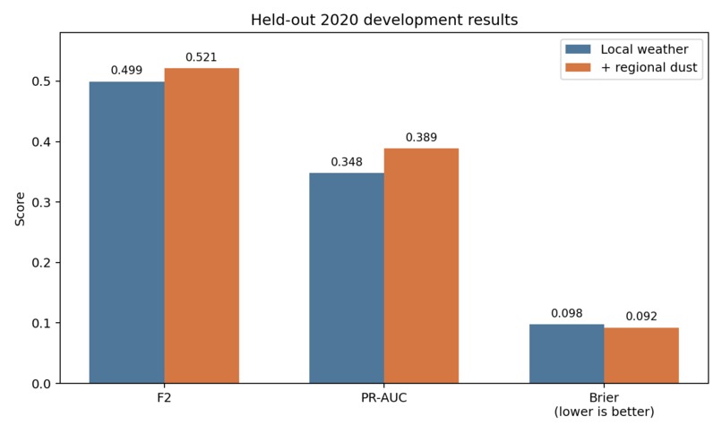
Model 3
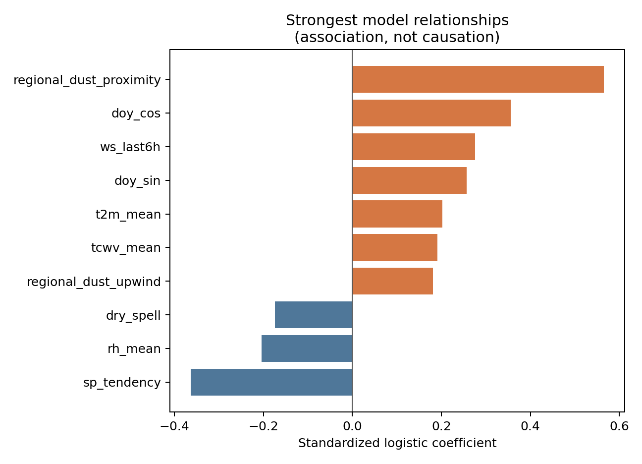
Inspiration
I wanted to test whether satellite-based surface reflectivity information could improve dust storm onset prediction in Saudi Arabia.
What it does
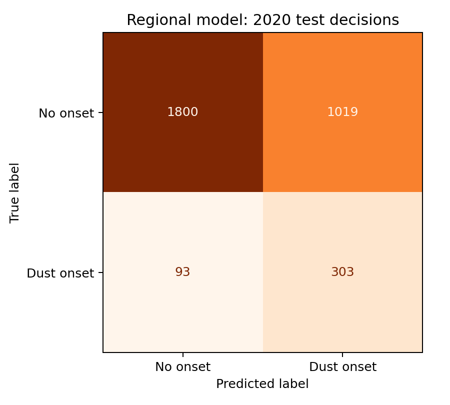
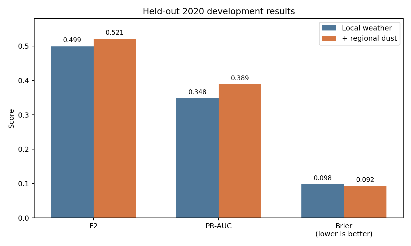
This project predicts dust storm onset 24 hours in advance. It compares an XGBoost model using regular environmental variables with one that also includes satellite albedo information.
How I built it
I used data from three dust-prone stations in Saudi Arabia between 2018 and 2020. The inputs include ERA5 weather variables, NDVI, soil properties, and MODIS albedo anomaly derived from a 200 km seasonal baseline.
I trained an XGBoost model and evaluated it using the (F_2) score. I then compared its performance with and without the satellite albedo information.
Challenges I ran into
The project required combining weather, vegetation, soil, and satellite data. I also had to derive the MODIS albedo anomaly using a 200 km seasonal baseline.
Accomplishments that I'm proud of
I combined several different types of environmental data into one model and created a direct comparison of dust storm prediction with and without satellite albedo information.
What I learned
I learned how satellite-based surface reflectivity information can be added to a machine-learning model and tested alongside weather, vegetation, and soil variables. I also learned how the (F_2) score can be used to evaluate dust storm onset prediction.
What's next for Minimizing Dimensions for Reconstruction in complex data
The next step is to use the comparison results to determine whether satellite albedo information meaningfully improves prediction of dust storm onset 24 hours in advance.
Built With
- data-analysis
- era5
- machine-learning
- modis
- nvdi
- python
- remote-sensing
- satellite-data
- weather-data
- xgboost


Log in or sign up for Devpost to join the conversation.