Inspiration
Underground coal mining can cause gradual deformation of the ground surface above mine panels. If this deformation is detected early, potential subsidence-related risks can be identified before they develop into more serious safety concerns.
Existing approaches such as manual surveying, GNSS and satellite-based monitoring can provide valuable information, but they may not provide continuous, dense and localized monitoring across large areas.
This inspired us to build MineSentinel — a low-cost, distributed surface monitoring system designed to continuously monitor ground behaviour and detect early signs of mine subsidence and deformation.
Our goal was to build more than a conventional IoT monitoring system. MineSentinel combines distributed sensing, wireless communication, two-stage AI analysis, multi-sensor data fusion and real-time visualization to create an intelligent early-warning system for subsidence risk.
How We Built It
MineSentinel follows a simple:
Sense → Analyze → Detect → Alert
architecture.
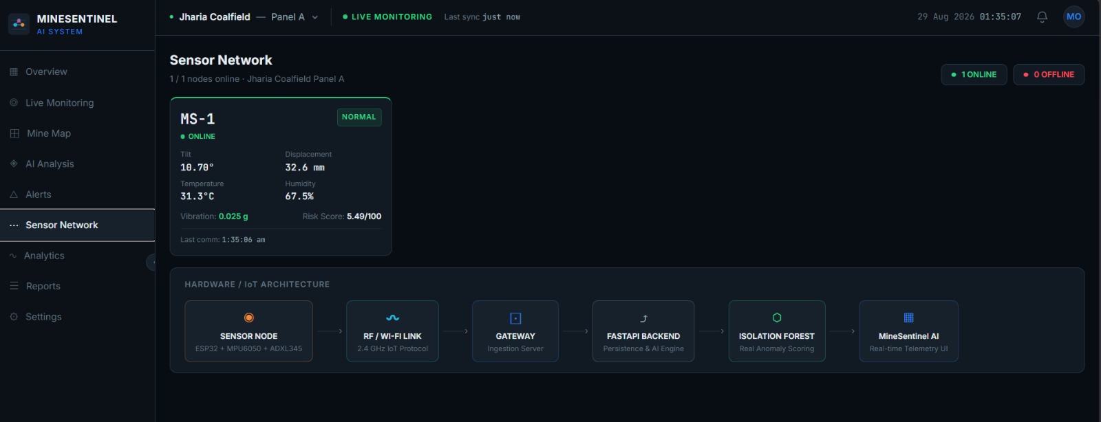
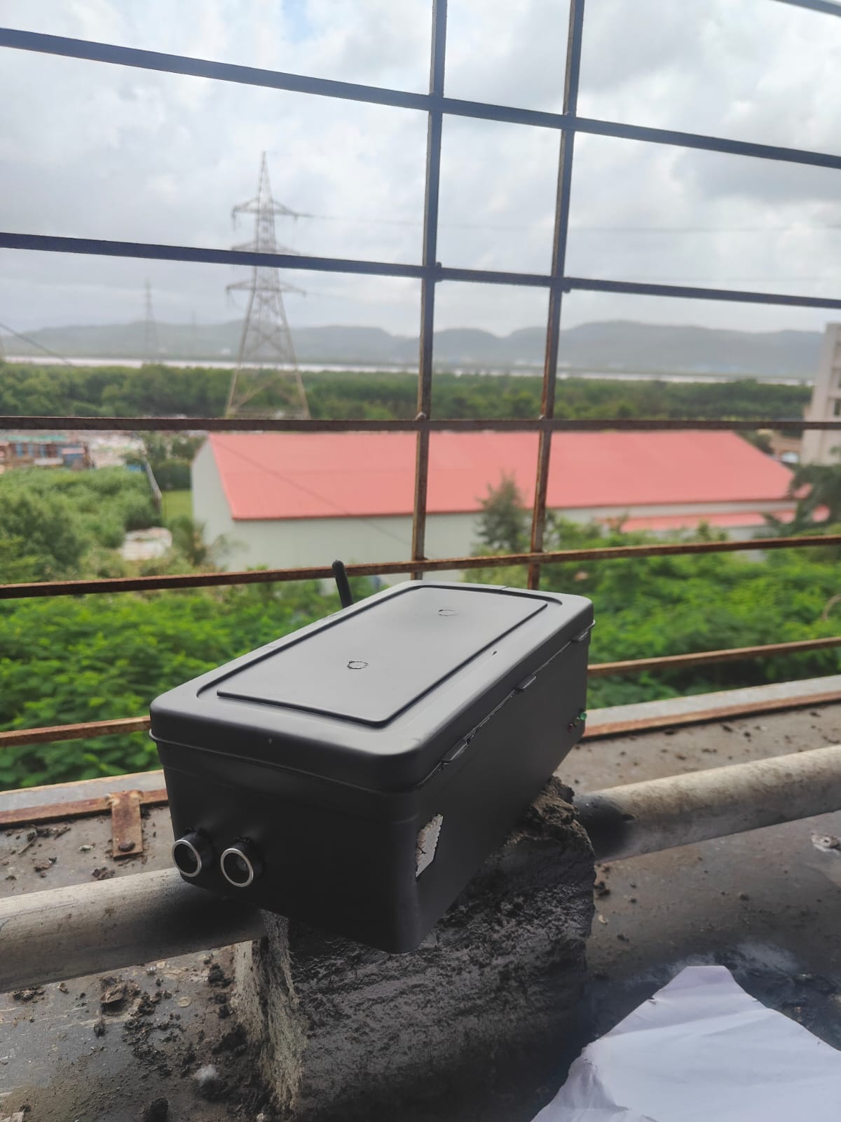
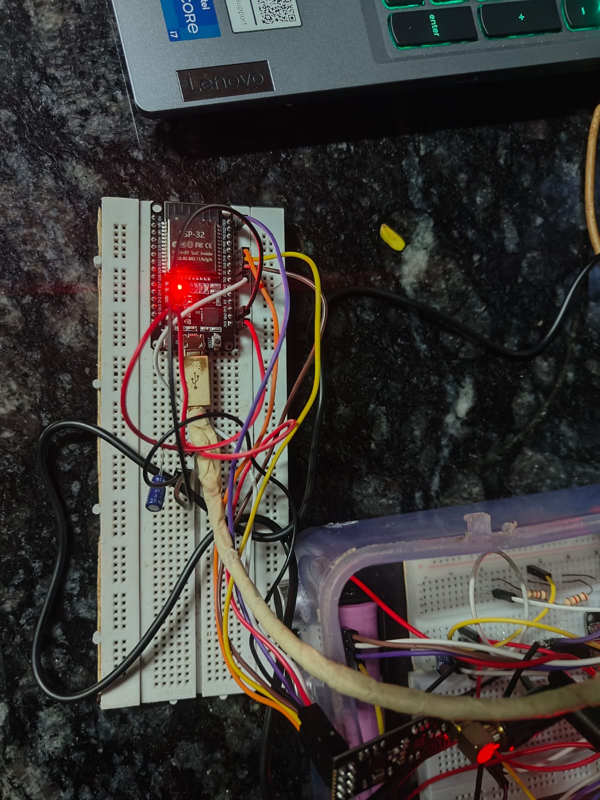
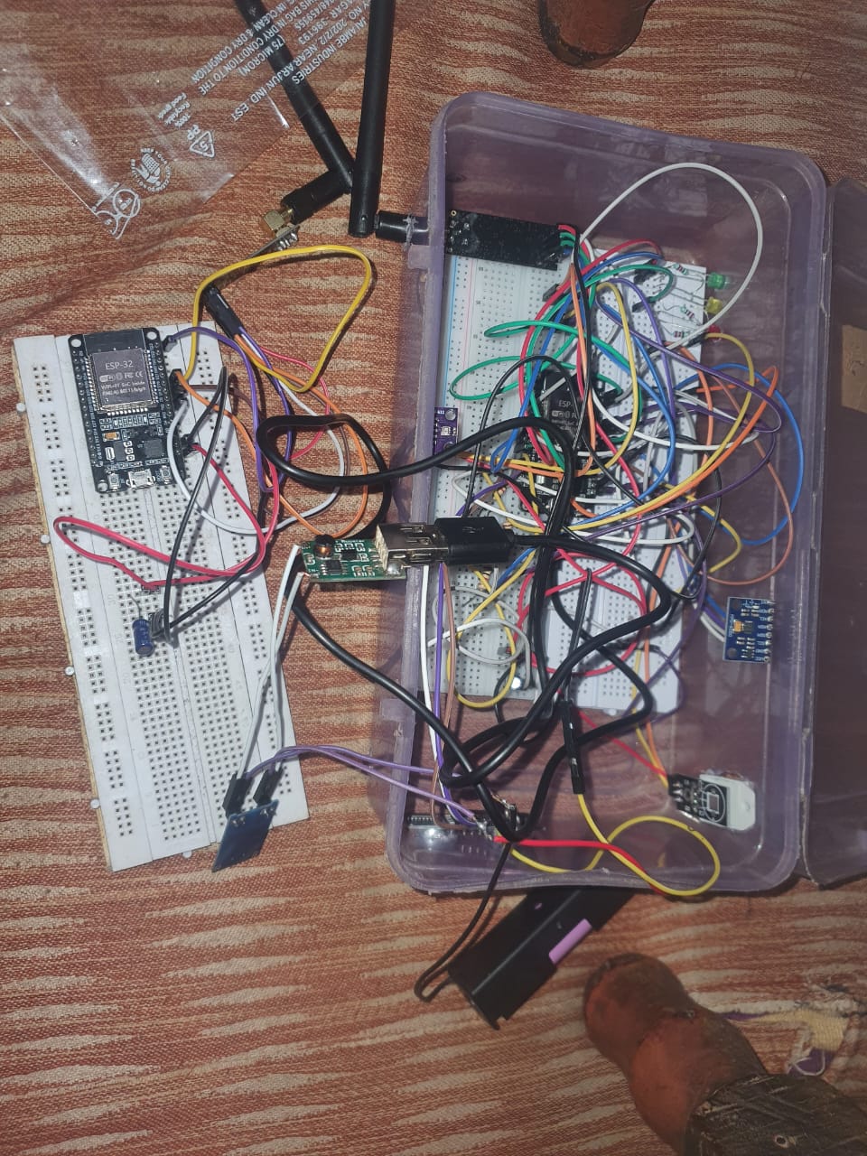
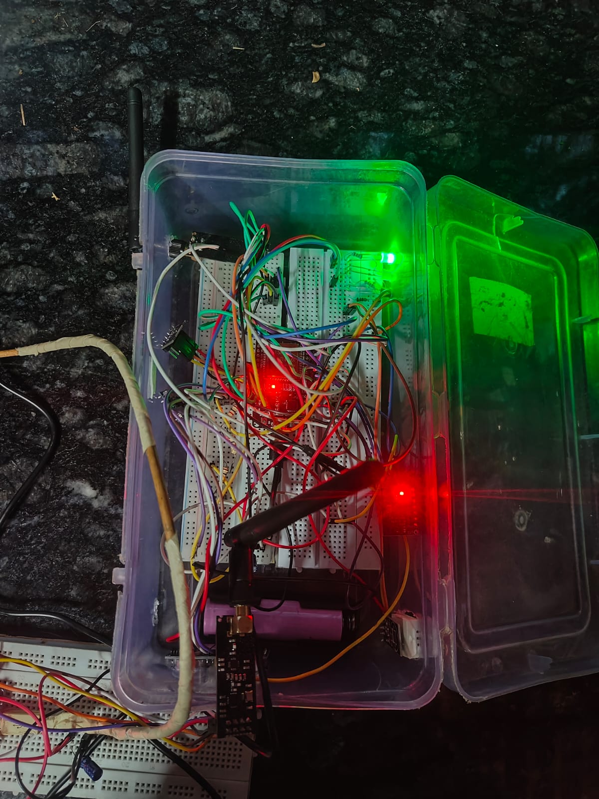
Multiple sensor nodes based on ESP32 continuously monitor parameters associated with ground deformation, including tilt, vibration and relative displacement.
The sensor nodes communicate wirelessly with a central gateway, which transfers the collected information to the software and AI layer.
Before analysis, the incoming sensor readings undergo calibration, filtering and preprocessing to remove noise and establish the normal behaviour of each monitoring node.
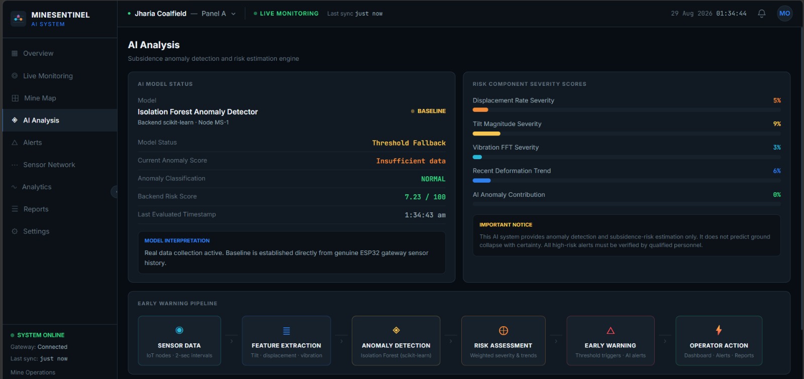
The system then uses a two-stage AI pipeline.
Stage 1 — Deformation Anomaly Detection
Isolation Forest is used to identify unusual changes in sensor behaviour compared with the established baseline.
The model continuously evaluates changes in parameters such as tilt, displacement and vibration to identify patterns that may indicate abnormal ground movement.
This allows MineSentinel to detect the early onset of abnormal surface deformation rather than depending only on fixed threshold values.
Stage 2 — Subsidence Risk Classification
The detected deformation pattern is then evaluated using multiple parameters, including:
- Tilt
- Relative displacement
- Vibration
- Rate of change
- Duration and persistence
- Historical behaviour
- Neighbouring-node behaviour
- Spatial correlation
These features are provided to a supervised XGBoost classification model, which categorizes the detected deformation into different subsidence-risk levels:
SAFE → WARNING → HIGH → CRITICAL
This second stage helps distinguish isolated disturbances from persistent and spatially consistent deformation patterns that are more strongly associated with potential subsidence development.
Therefore, instead of depending on a single sensor or threshold, MineSentinel combines temporal behaviour, spatial correlation and multiple sensing parameters to identify and classify subsidence-related ground deformation.
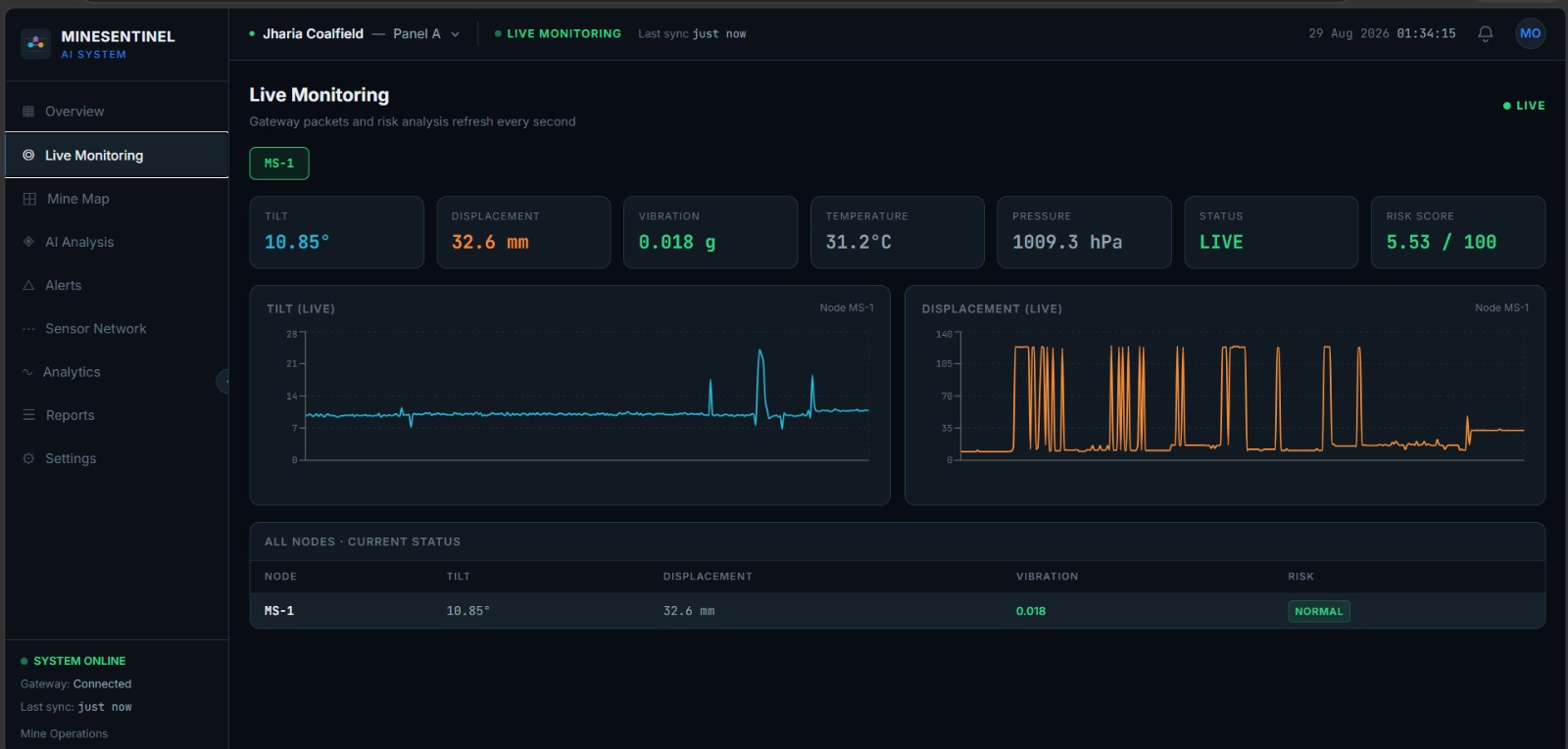
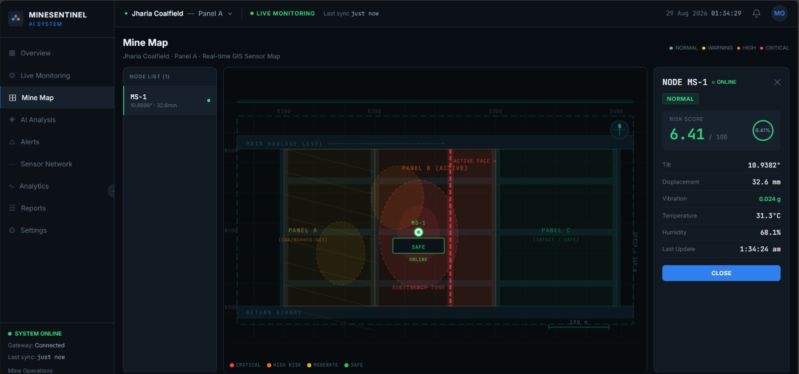
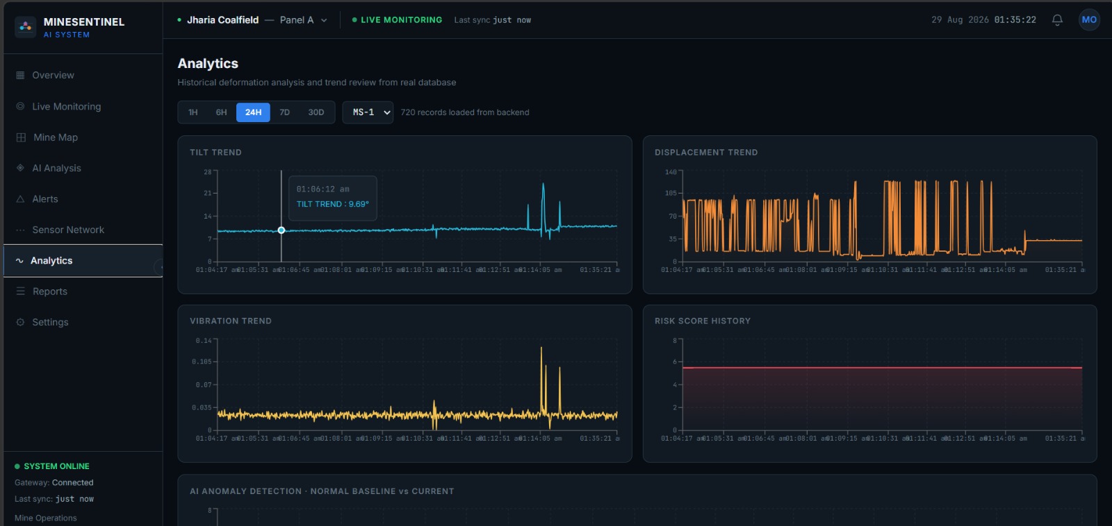
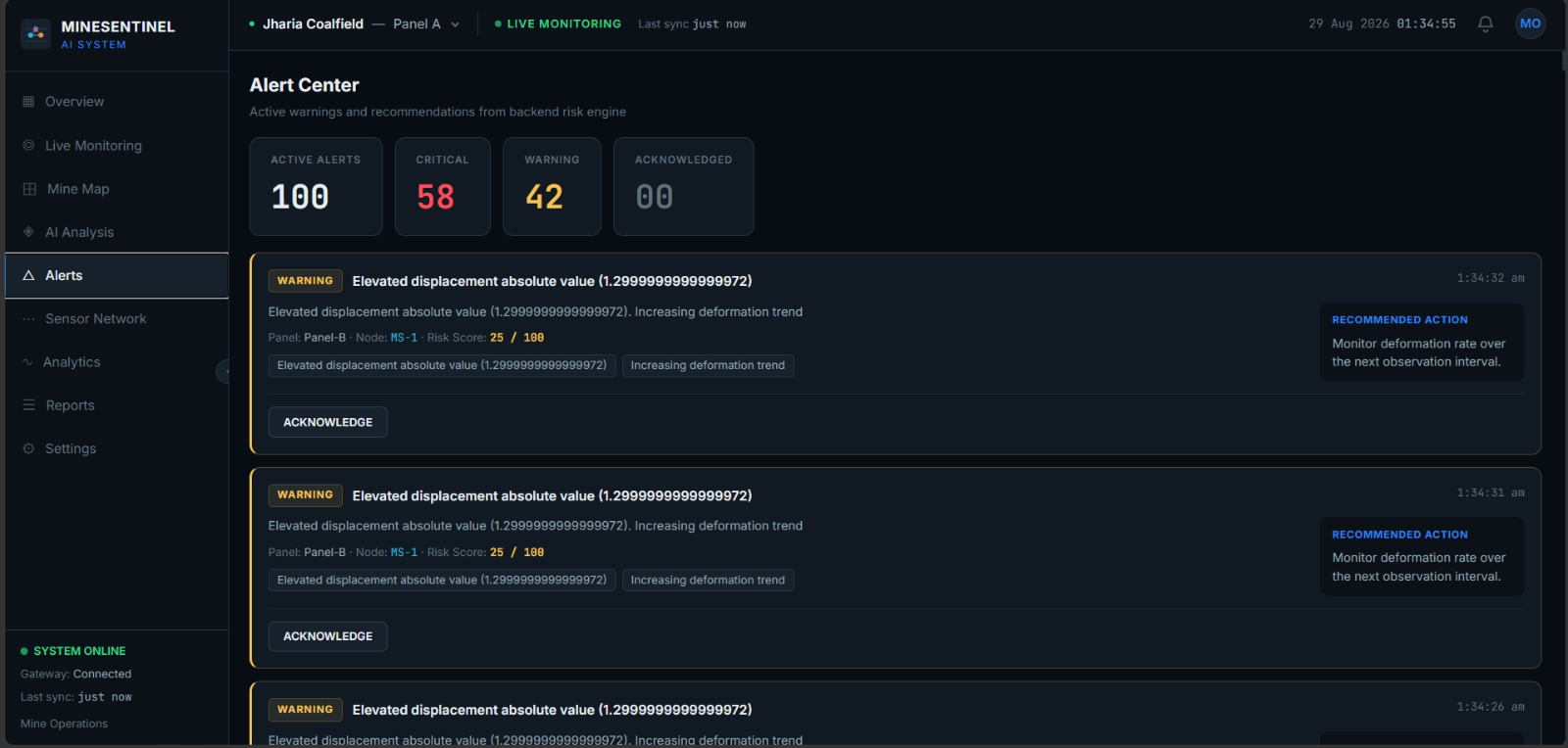
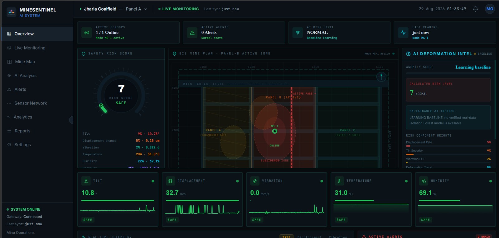
The processed information is displayed on a real-time monitoring dashboard, where users can view:
- Live sensor readings
- Node health
- Ground deformation trends
- Detected subsidence zones
- Risk levels
- Historical trends
- Alerts and warnings
When the system identifies persistent deformation patterns associated with increasing subsidence risk, it can generate an early warning alert.
What We Learned
During development, we learned that mine subsidence is a process rather than a single sensor reading.
A sudden change in one sensor may not necessarily represent subsidence. It can be caused by temporary vibration, external disturbances, sensor noise or other short-term changes.
This led us to design MineSentinel around multi-parameter and multi-node analysis rather than relying on one measurement.
The major concepts we incorporated include:
- Sensor calibration and noise filtering
- Baseline-based deformation monitoring
- Isolation Forest for abnormal deformation detection
- XGBoost for subsidence-risk classification
- Multi-sensor data fusion
- Persistence and trend analysis
- Spatial correlation between neighbouring nodes
- False-alarm reduction
- Real-time wireless communication
- Continuous surface monitoring
- Offline-capable monitoring
- Scalable distributed sensor networks
The key learning was that combining what is changing, how fast it is changing, how long it persists and whether neighbouring nodes show similar behaviour provides a stronger basis for detecting developing subsidence patterns.
Challenges
One of the major challenges was designing a low-cost sensor node capable of continuously capturing meaningful ground behaviour.
Sensor readings can be affected by noise and environmental disturbances, making calibration, filtering and baseline establishment important parts of the system.
Another challenge was maintaining reliable wireless communication between distributed sensor nodes and the central gateway.
We also had to design the AI pipeline so that it could distinguish between short-term disturbances and persistent deformation patterns.
Developing the two-stage AI architecture was another key challenge. Isolation Forest was used to identify unusual deformation behaviour, while XGBoost combines multiple deformation-related features to classify the corresponding subsidence risk.
A further challenge was balancing:
Low Cost + Continuous Monitoring + Scalability + Reliability + Early Detection
MineSentinel addresses this by using affordable prototype components while keeping the overall architecture modular, allowing individual sensing and communication components to be upgraded as required.
Our Vision
Our vision for MineSentinel is to create a low-cost, dense and continuous surface monitoring network for underground coal mines.
Instead of depending only on periodic observations, MineSentinel aims to provide continuous monitoring of ground behaviour across multiple locations above underground mine panels.
The system can evolve toward:
- High-density sensor deployment
- AI-based subsidence prediction
- Automated subsidence-zone mapping
- GIS-based risk visualization
- Advanced spatial-temporal analysis
- Integration with GNSS measurements
- Integration with satellite-based InSAR monitoring
- Integration with professional geotechnical instruments
- Site-specific AI calibration
- Automated emergency warning systems
Ultimately, MineSentinel aims to transform mine-subsidence monitoring from periodic observation into continuous, intelligent and proactive risk detection.
From sensing ground movement to detecting subsidence risk — MineSentinel turns distributed data into actionable early warnings.
Built With
- arduino
- c++
- data-visualization
- esp32
- fastapi
- gis
- iot
- isolation-forest
- javascript
- leaflet.js
- machine-learning
- nrf24l01
- numpy
- pandas
- python
- react.js
- rest-api
- scikit-learn
- sensor
- sqlite
- tailwind-css
- wireless
- xgboost

Log in or sign up for Devpost to join the conversation.