-
-
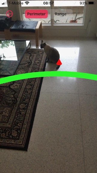
My lovely assistant >6ft away
-
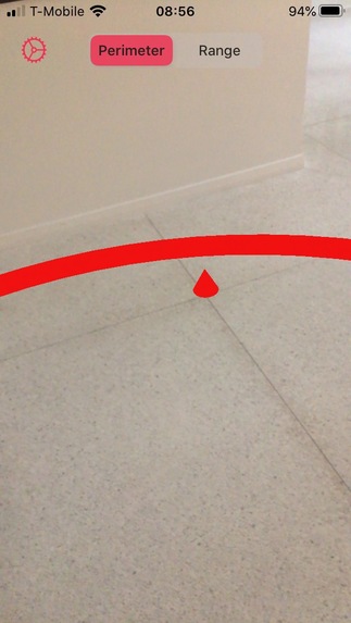
Inside the perimeter


Inspiration
Governments around the world recommend social distancing as an easy way to help slow the spread of the virus and flatten the curve. The usual guideline is for a minimum separation of about 6ft or 1.8-2.0m between people. But how well can you judge that distance? In my own experience, this gap was further than I had initially realized.
What it does
This app uses AR to help quickly visualize that separation distance. One simply has to tap a location to set the ground plane and then the app visualizes both a ring of bollards around that point and a ring around the user's current estimated position. The color of the user's ring changes from green (OK) to yellow (warning) to red (danger) as the distance between the user and the reference location closes.
How I built it
This app is built in Swift using ARKit for the recognition and SceneKit for the 3D drawing.
Challenges I ran into
- ARKit ground plane and distance estimations often require a bit of refinement.
- User-centric AR objects, such as the ring, tend to be harder to judge than I expected without additional AR objects in the scene.
- Plane and occlusion detection are still a bit problematic
What I learned
This was my first time working with ARKit, so definitely that!
What's next for Mind the Gap
Hopefully it will be on the AppStore soon, but there's still a bit of polish required.
In the meantime, you can follow the progress at keepitsix.com. I'd love to have some beta testers, if anyone is interested. Just email me at beta@.
Built With
- arkit
- scenekit
- swift


Log in or sign up for Devpost to join the conversation.