-
-

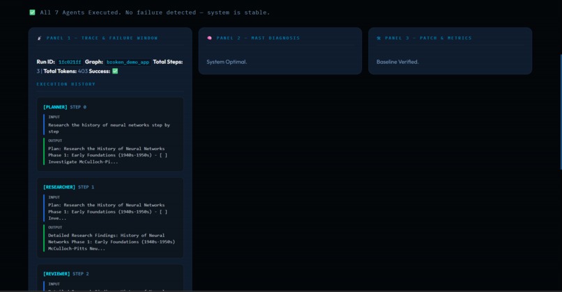
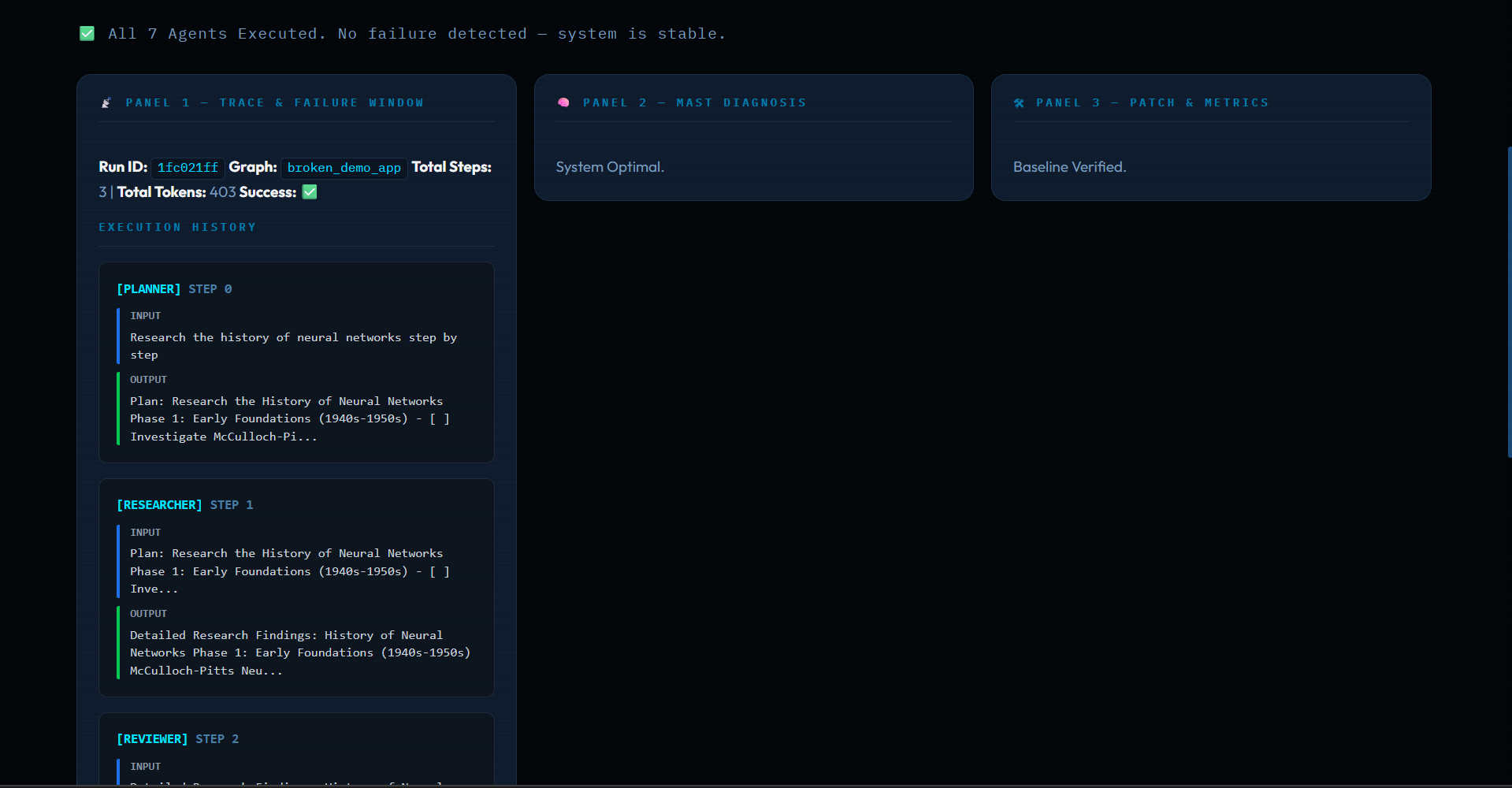
TRACE EXECUTION PANEL
-
3-PANEL SYSTEM VIEW
-
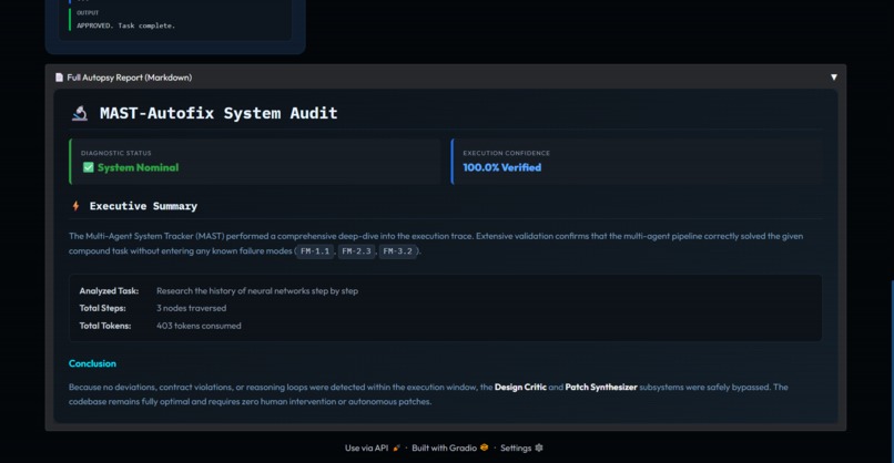
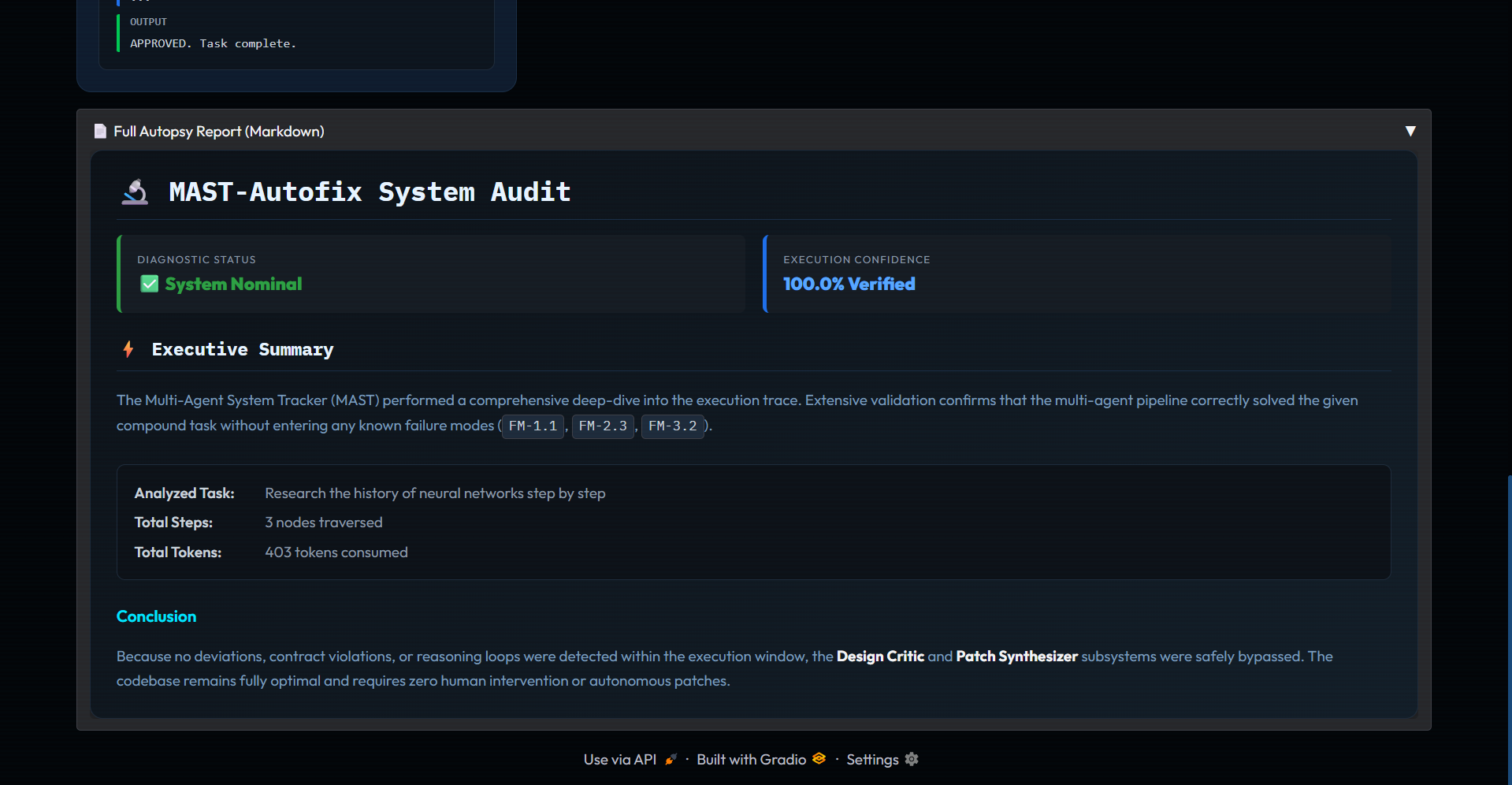
AUTOPSY REPORT
-

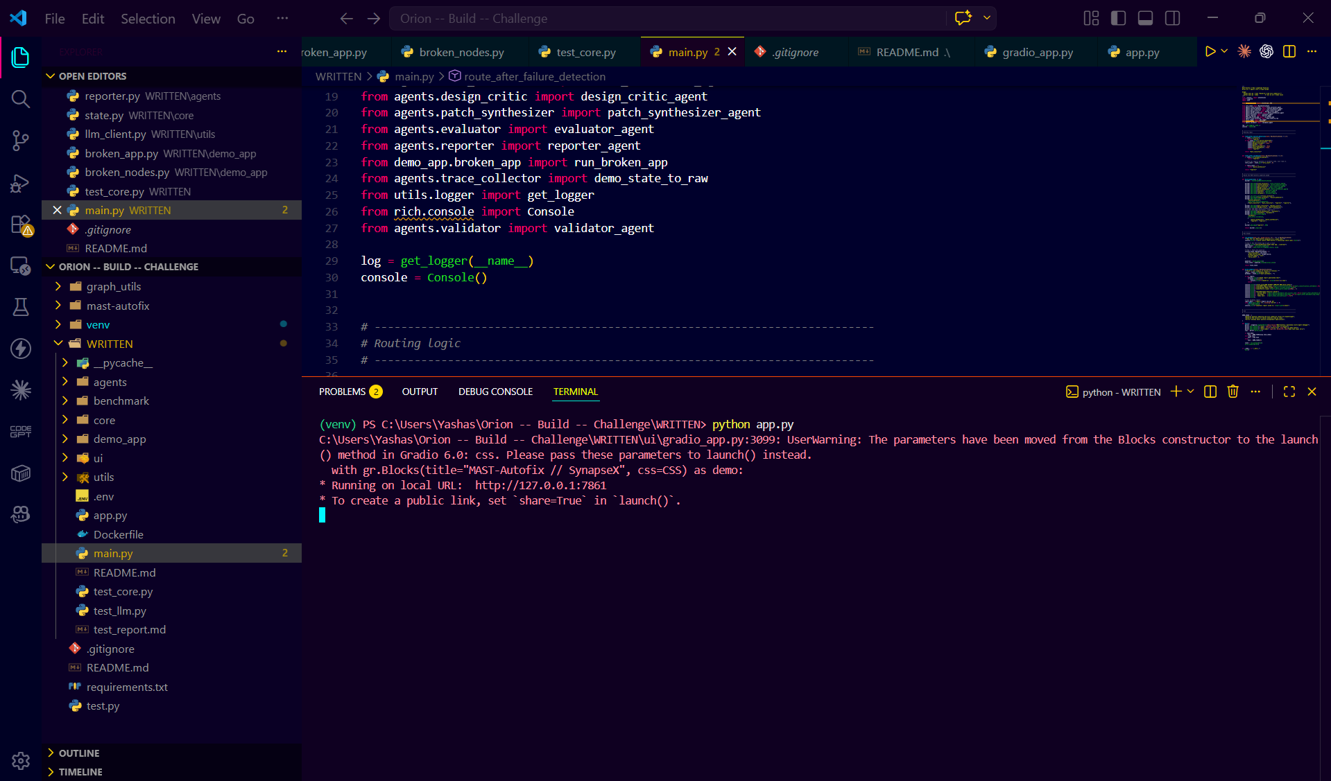
Code running file (TERMINAL / RUN)
-
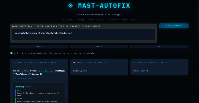
HERO UI (Landing / Main screen)


🚀 Inspiration
Geospatial data is critical for navigation, logistics, and urban planning. However, ensuring its quality at scale remains a major challenge due to inconsistencies, missing attributes, and structural errors.
We were inspired to build a system that goes beyond simple validation — one that can intelligently analyze, detect, and explain issues in map data using a combination of rule-based logic, machine learning, and contextual reasoning.
💡 What it does
MAST (Multi-Agent System for Map Quality Assurance) is an AI-powered system designed to automatically validate and analyze geospatial data.
It detects issues such as:
- Geometry inconsistencies
- Missing or incorrect attributes
- Structural anomalies
- Contextual mismatches
The system classifies issues into PASS, WARNING, or FAIL, and provides detailed explanations for each decision.
🧠 How we built it
The system follows a multi-stage pipeline:
Geometry Validation Layer
Rule-based checks to validate spatial structures and constraints.Feature Extraction Layer
Extracts meaningful attributes and metadata from map data.ML Anomaly Detection
Identifies unusual patterns using machine learning techniques.Contextual Reasoning Engine
Evaluates features in context to determine real-world correctness.Decision Fusion Module
Combines outputs from all components into a final verdict.Explanation Layer
Generates human-readable explanations for each decision.
⚙️ Challenges we ran into
- Balancing deterministic rules with probabilistic ML outputs
- Designing a scalable multi-agent architecture
- Ensuring meaningful and interpretable explanations
- Handling noisy and incomplete geospatial data
🏆 Accomplishments that we're proud of
- Built a complete end-to-end validation pipeline
- Designed a modular multi-agent architecture
- Achieved consistent and explainable results
- Successfully scaled the system for multiple inputs
📚 What we learned
- Importance of combining rule-based and ML approaches
- Designing robust multi-agent systems
- Trade-offs between accuracy and interpretability
- Real-world challenges in geospatial data validation
🔮 What's next for MAST
- Integration with real-time map APIs
- Advanced LLM-based explanation generation
- Scalable deployment using cloud infrastructure
- Enhanced visualization dashboards for insights

Log in or sign up for Devpost to join the conversation.