
Inspiration
We were greatly inspired by the efforts of the navy and marine soldiers across the world to safeguard their borders despite the risk of natural calamities. We wanted to make a utility that can be useful for the operational commanders in safeguarding the lives of the soldiers by evacuating ships in areas which are under risk.
What it does
Marine pal is a utility designed for the naval forces and operational commanders to find an overview about the real-time weather conditions and stay safe from natural calamities. Marine pal has 3 main features :-
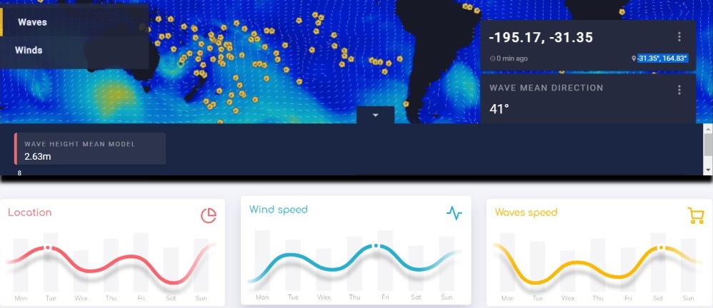
1) Collecting openly available meteorological and oceanographic information and visualizing it in a dashboard : We used web scrapping and also integrated various public APIs for collecting real-time information about weather and sea conditions. We visualized the data using maps and graphs and placed them on a dashboard. This dashboard can be used by the operational commanders to know about weather conditions in different parts of the sea.
2) Machine Learning for predicting the natural calamities : We tried to make an ML model that can predict natural calamities like storms and high tides using a number of factors. Due to the time constrains, we were not able to make a full fledged solution but still made a working Proof of Concept.
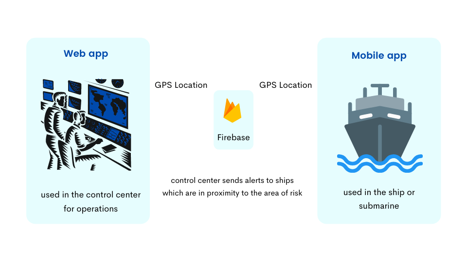
3) Geo-notifications for ships and submarines which are in proximity to an area at risk :We integrated a alerts system where the crew members inside a ship would receive an alert if their ship is in proximity to an area of risk. These ships can be evacuated as soon as possible from the location after an alert. We used geo-fencing and the push notification functionality in Firebase.
How we built it
We made a web application (used by operational commanders) as well a mobile application client (used by the ship crew). The web application consists of a dashboard which displays real-time visualization of various weather conditions in a pointed place. The web application can also send alert notifications to the devices in which the mobile application is installed. The mobile application logs the location of the user and saves it on Firebase Cloud Firestore. The lot,long coordinates are retrieved from the Firestore and displayed on the web application.
.png)
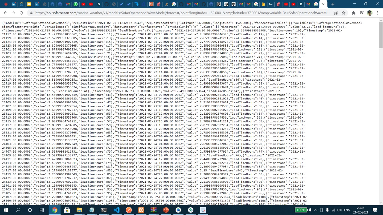
The API response from one of the public APIs is shown below for reference:
Finally, we built a map interface for the web app with MapBox SDK. This can find out various characteristics of wind using public APIs and also shows a timeline generated by our ML model:

Challenges we ran into
- We had very less time for recording the final video. We did not cover up all our functionalities in depth and this made us feel a bit worried.
- Using GPS to find the location of a user and storing it in a separate user branch in firestore took us a lot of time.
- Using the same firebase for both web and mobile platforms was challenging.
- Managing time and completing the project on time was challenging yet thrilling.
Accomplishments that we're proud of
- We are very proud to have addressed a solution to a problem which impacts the front line soldiers of the world.
- We are happy and satisfied with our team work.
What we learned
- We learnt to integrate public APIs in JavaScript.
- We learnt web scrapping to a remarkable extent.
- We learnt to use Mapbox SDK.
- We learnt to use Firebase.
- We came to know alot of information about the navigation systems used in ships.
What's next for Marine Pal - A utility for naval forces
- We will be trying to add more features in our web dashboard.
- We will also research about using our project for commercial and passenger ships.
Tracks
We are applying for the following tracks :-
- NSIN Challenge
- Social Good
- Beginner (We are sophomores)
- General

Log in or sign up for Devpost to join the conversation.