-
-
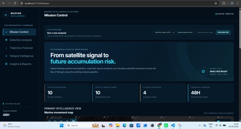
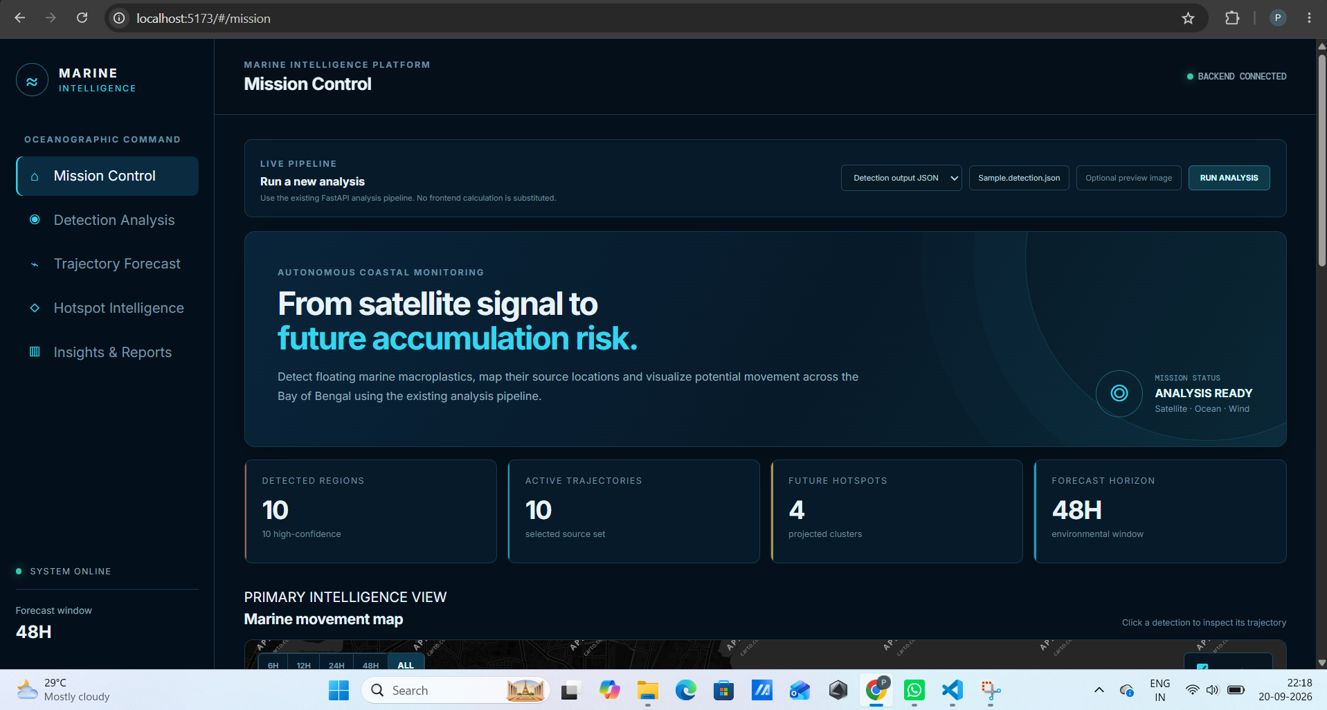
Mission Control: Overall view of marine plastic detection, movement, and future hotspots.
-
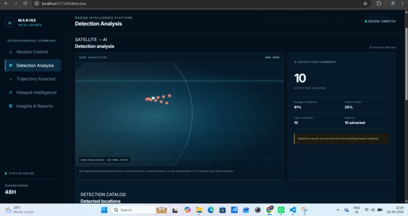
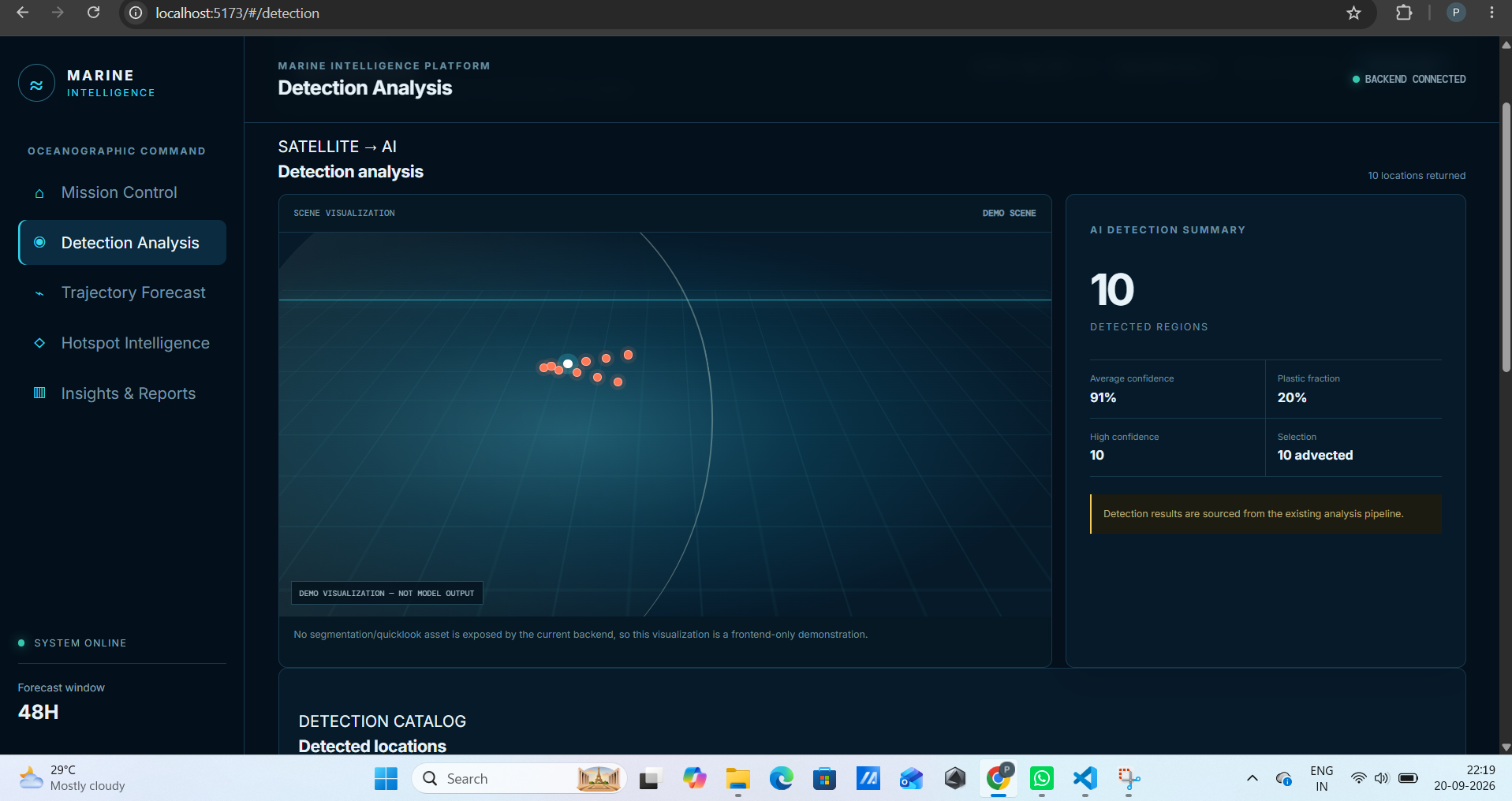
Detection Analysis: Shows AI-detected plastic regions and confidence levels.
-
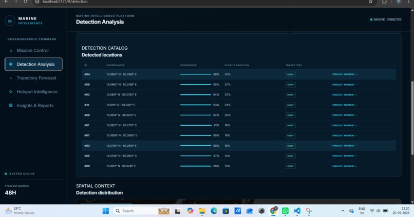
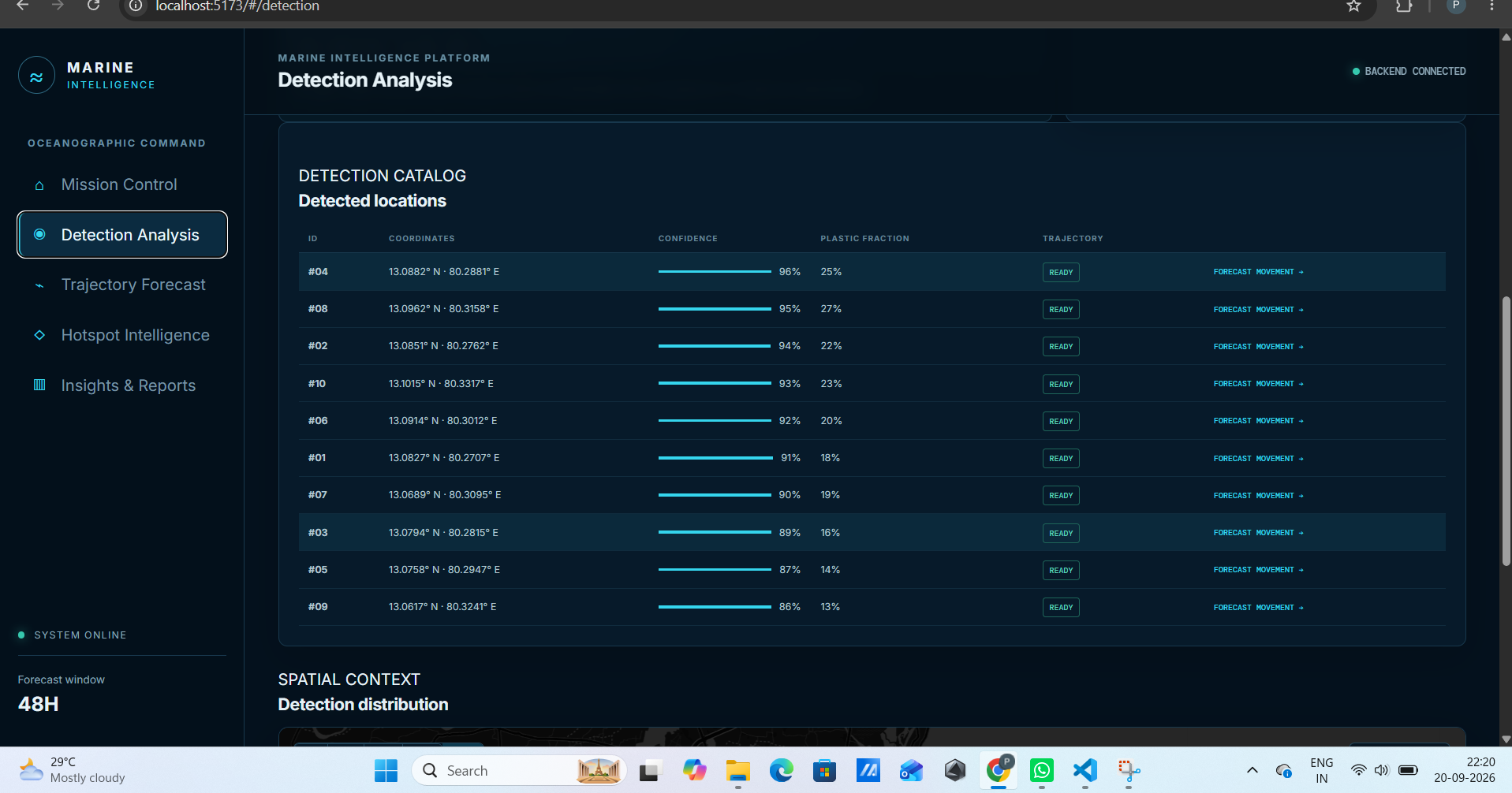
Detection Catalog: Lists detected locations, confidence, and plastic concentration.
-
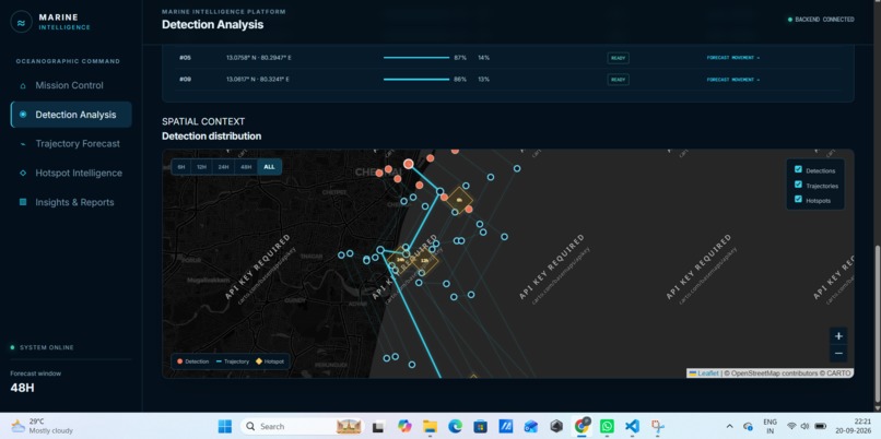
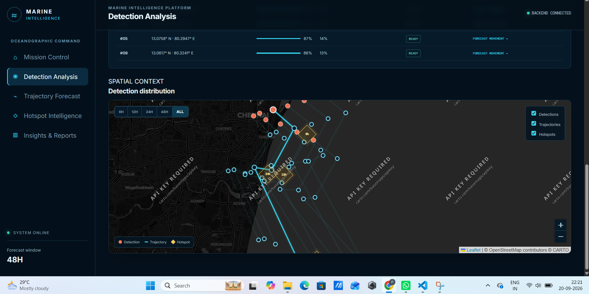
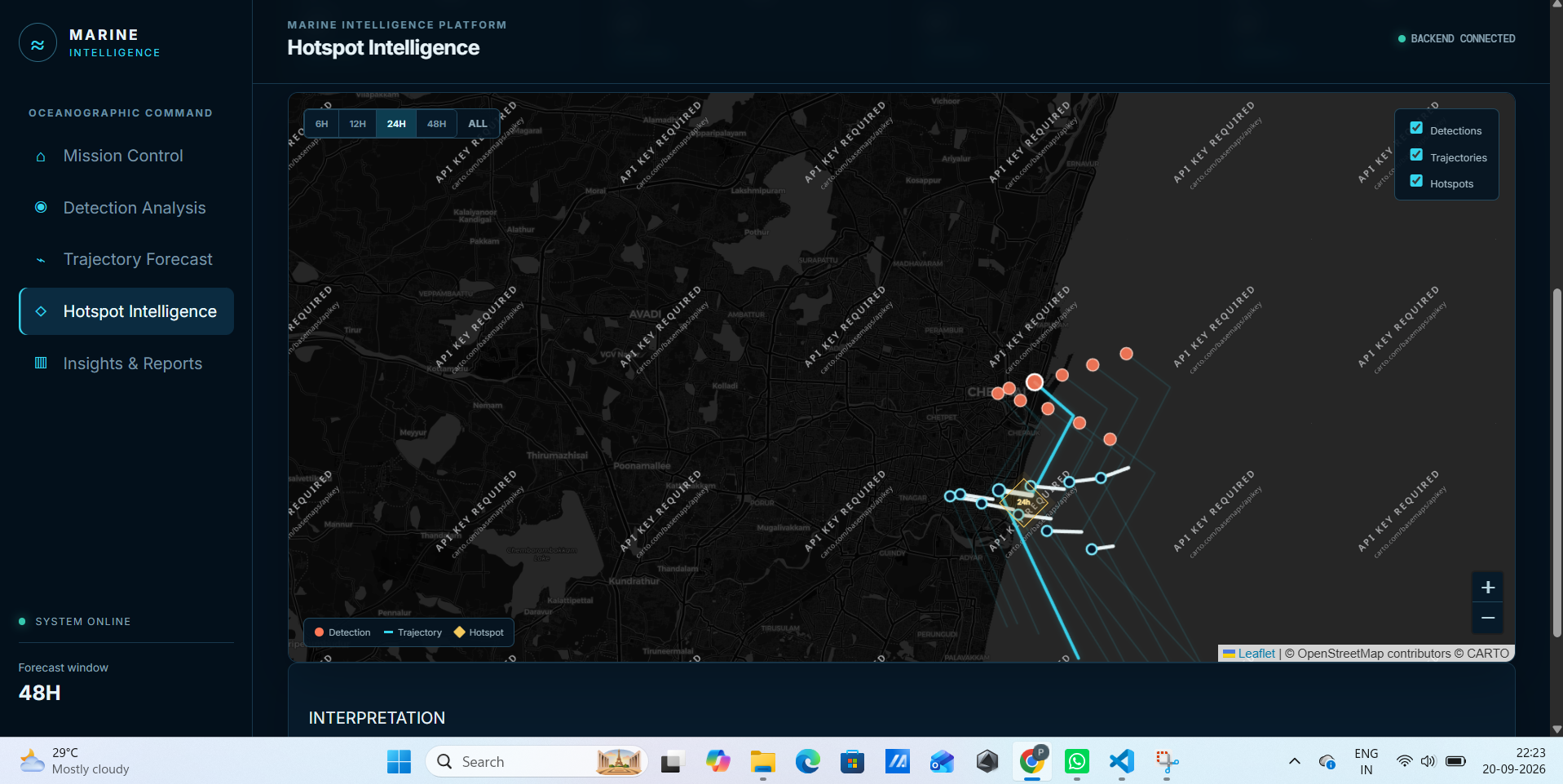
Detection Distribution: Map showing plastic detections, trajectories, and hotspots.
-
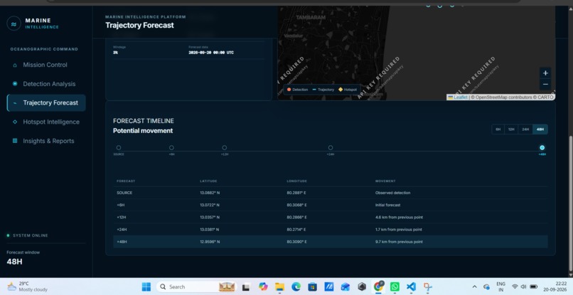
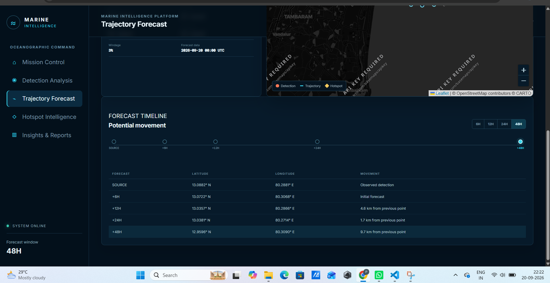
Trajectory Forecast: Predicts the future movement of detected plastic over 48 hours.
-
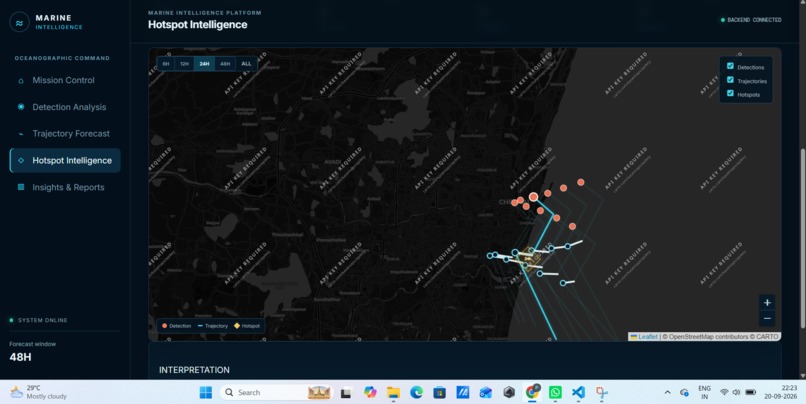
Hotspot Intelligence: Identifies areas where plastic is likely to accumulate.
-
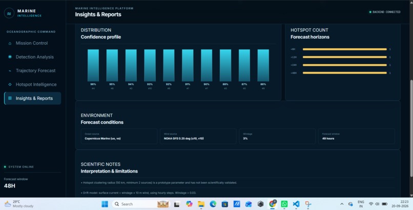
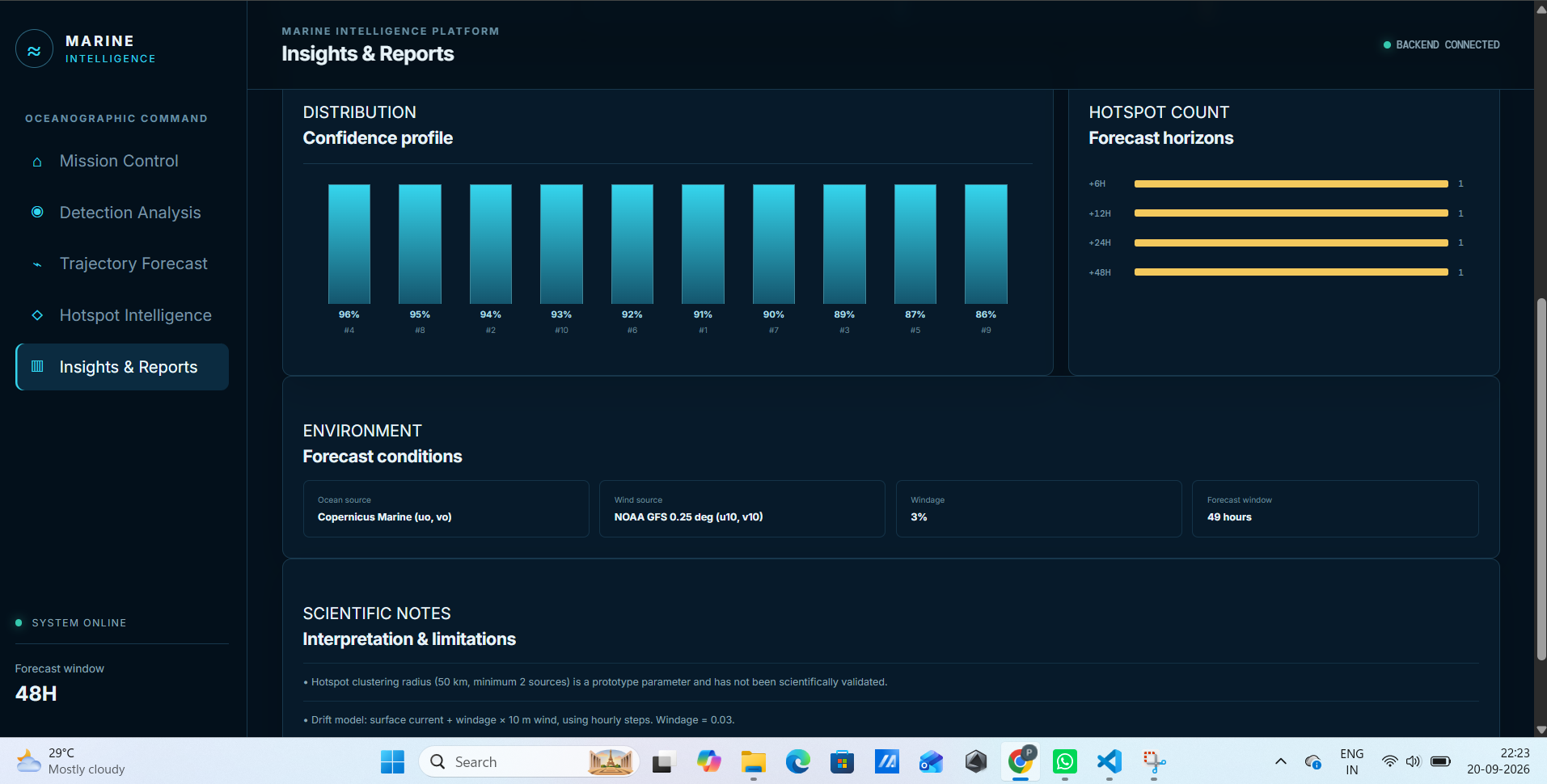
Insights & Reports: Summarizes detection confidence, hotspots, and forecast conditions.
Inspiration
Marine plastic pollution is difficult to manage because detecting plastic is only the first step. Floating plastic can travel significant distances due to ocean currents and wind, so the location where it is detected may not be where it is later.
We wanted to build a system that could move beyond simply answering “Where is the plastic?” and instead explore “Where could it move next?”
This led to Marine Intelligence, a platform that combines satellite-based plastic detection with ocean and atmospheric data to forecast the movement of floating marine plastic and identify potential areas of trajectory convergence.
What it does
Marine Intelligence starts with plastic detections from satellite imagery, including their latitude, longitude, confidence, and estimated plastic fraction.
These detections are combined with:
- Ocean currents from Copernicus Marine
- 10m wind forecasts from NOAA GFS
- A configurable windage coefficient
The system combines current and wind velocity to estimate movement and updates the prediction hour by hour as the plastic moves to a new location.
It generates forecasts for 6, 12, 24, and 48 hours, producing predicted coordinates for each horizon.
When multiple detections are available, their predicted positions are analyzed using DBSCAN spatial clustering. If multiple trajectories converge within the selected geographic threshold, the system identifies the region as a potential future hotspot.
The frontend presents detections, trajectories, forecast points, environmental conditions, and potential hotspots through an interactive marine-intelligence dashboard.
How we built it
The overall pipeline is:
Satellite Imagery → AI Detection → Detection Coordinates → Ocean + Wind Data → Trajectory Prediction → Spatial Clustering → Visualization
The trajectory module was developed in Python using Xarray, NumPy, and Pandas for environmental data processing.
Ocean-current velocity components (uo, vo) are obtained from Copernicus Marine, while wind components (u10, v10) are obtained from NOAA GFS.
For each hourly timestep, the model retrieves environmental conditions at the current predicted location, combines ocean and wind velocity using a windage coefficient, calculates displacement, and converts that movement into updated latitude and longitude.
Scikit-learn DBSCAN is then used to analyze spatial convergence between predicted positions.
The application is integrated using FastAPI and React, with an interactive map-based interface for exploring detections, trajectories, and potential hotspots.
Challenges we ran into
One of the biggest challenges was integrating environmental datasets with different formats, spatial resolutions, timestamps, and coordinate grids.
We also encountered missing ocean-current values near coastal and land regions. To handle this, the system searches nearby valid ocean data when a direct lookup is unavailable.
Another challenge was converting velocity values in meters per second into geographic movement while accounting for the change in longitude distance with latitude.
We also had to ensure that the trajectory was genuinely time-dependent. Instead of using the initial current and wind values for the entire forecast, the model updates environmental conditions at every timestep.
Finally, presenting predictions responsibly was important. The interface distinguishes between observed detections, forecast positions, and potential hotspots rather than presenting predictions as guaranteed outcomes.
Accomplishments that we're proud of
We are proud of bringing several different technologies and datasets together into a single working pipeline.
Marine Intelligence can take multiple plastic detections, combine them with real ocean-current and wind data, generate hourly trajectories for up to 48 hours, and analyze the resulting positions for potential convergence.
We also created a modular interface between the detection and prediction components. The trajectory system only needs structured detection information such as coordinates, confidence, and plastic fraction, allowing the detection and forecasting modules to be developed independently.
The interactive dashboard then turns these technical outputs into a visual story that users can understand: where plastic was detected, how it may move, and where trajectories may converge.
What we learned
This project taught us that environmental AI involves much more than training a detection model. Working with real-world environmental data requires careful handling of time, coordinates, spatial grids, missing values, and physical variables.
We also learned the importance of using appropriate forecast data when making forward-looking predictions and of keeping the assumptions behind a model visible to users.
Most importantly, we learned that complex scientific outputs become much more useful when they are presented as an understandable workflow rather than just a collection of coordinates and numbers.
What's next for Marine Intelligence
Our next step is to improve the trajectory model by incorporating additional physical factors such as wave-driven transport, Stokes drift, diffusion, particle characteristics, and coastal interactions.
We also want to move from a single predicted path toward probabilistic or ensemble trajectories, allowing the system to represent a range of possible future positions.
Future versions could continuously process new satellite observations, update existing trajectories, monitor coastal regions, and generate alerts when multiple trajectories begin converging.
Our long-term vision is to develop Marine Intelligence into a decision-support platform for continuous marine plastic monitoring, helping users move from simply detecting marine plastic to understanding and responding to its potential movement.
Built With
- computer-vision
- copernicus-marine
- dbscan
- fastapi
- geospatial-analysis
- javascript
- leaflet.js
- machine-learning
- noaa-gfs
- numpy
- pandas
- python
- react
- satellite-imagery
- scikit-learn
- xarray

Log in or sign up for Devpost to join the conversation.