-
-

Logo for Mapping Blackness
-

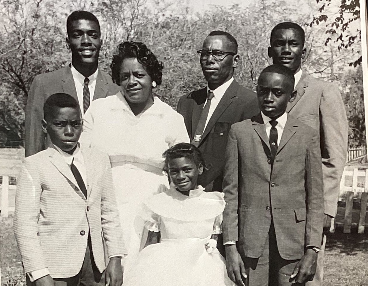
Boozer Family, 1962. Okemah, Arizona
Inspiration
Mapping Blackness is an immersive documentary, digital archive, and an interactive digital map, preserving the histories, stories, lives, and memories of historically black communities across the United States. In an era where black history is literally being erased from history books, curriculums, and universities, and discussing true black history is becoming forbidden, Mapping Blackness stands out as timely, urgent, and critical in getting our stories out, preserved, and documented. This project highlights that black towns have been the backbone of America. One such town, Okemah, Arizona, with the motto “Gone but not forgotten,” exemplifies this. Decimated by the advent of a highway and a shift to commercial zoning, Okemah’s story and others are brought back to life through Mapping Blackness. This is a living, breathing archive, constantly updated with new stories—inviting continuous engagement in learning and celebrating these remarkable communities and their intertwined histories.
Project Goal
The aim of Mapping Blackness is to put black communities on the map—communities often disconnected from municipalities, tax benefits, and other perks of suburban life. Frequently sidelined and situated behind railroad tracks, near pollution-filled factories, and garbage dumps due to historic redlining, Mapping Blackness seeks to showcase the life, families, pride, hope, beauty, strength, and legacy of these communities. Many of these stories are missing from history books, and countless everyday heroes who died fighting for their communities remain unrecognized. With gentrification encroaching, and the devastating impact of Covid-19, it's imperative to capture, celebrate, and learn from these legacies. Mapping Blackness will make these stories accessible, shareable, bite-sized, and interactive, perfectly suited for the age of social media and short attention spans. Driven by youth, the project ensures the stories of elders are heard and remembered. Techniques like mobile integration, community building, and community archiving will be employed to inspire a new generation to preserve their heritage. This will be achieved through an interactive platform featuring a large-scale clickable map with geotagging to showcase stories, photographs, narratives, 360 spaces, and 3D renderings of these communities.
Mapping Blackness MVP - What We Built
For our Mapping Blackness MVP, we focused on Okemah, Arizona. We developed an AR app using Geospatial Creator, which tells the story of Okemah through mini-documentaries about elders, 3D assets recreating old houses, and images of various locations. The Experience Manager Script in Geospatial Creator allows users to navigate through the Okemah experience, triggering narration and interactive media assets. This curated experience combines audio narration with a rich array of interactive media.
Challenges We Faced
Our journey wasn't without challenges. We encountered issues with photorealistic tiles and Cesium, particularly with object tracking. Integrating digital structures with physical ones to tell historical narratives was both challenging and enlightening.
Accomplishments We're Proud Of
We're incredibly proud of our ability to blend physical structures with a diverse range of digital mediums—including video, images, and 3D assets—for effective storytelling. Our multimedia approach has enabled us to tell richer, more dynamic stories.
What’s Next
Mapping Blackness is set to expand by adding more dynamic and user-generated content. We plan to create more mini-documentaries and 3D assets based on historical architecture in black communities. A significant part of our future work involves a user-generated section in the app, allowing users to submit historical artifacts. This expansion will enhance our storytelling capabilities, offering a more comprehensive portrayal of these communities' histories and legacies.
Built With
- arcore
- c#
- cesium
- geospatial
- google-cloud
- mapsapi
- unity


Log in or sign up for Devpost to join the conversation.