-
-

Our robot Atlas carries the heavens upon his shoulders for eternity.
-
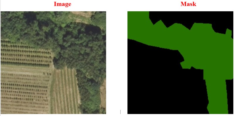
Image and Mask Example Images Generated
-
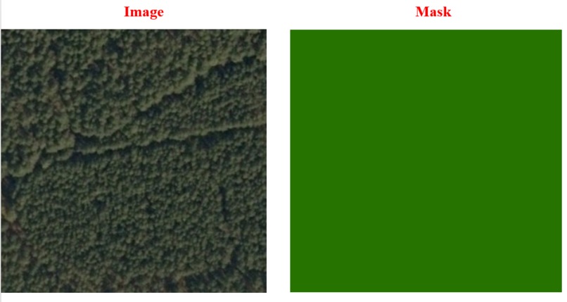
Image and Mask Example Images Generated
-
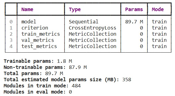
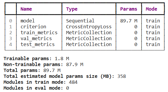
Finetuning
-

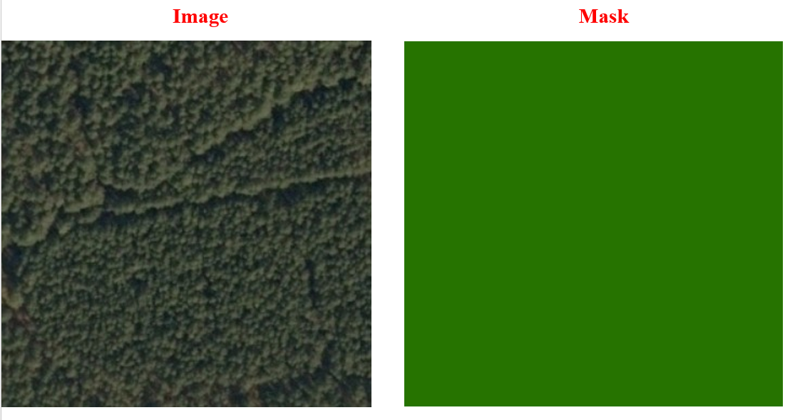
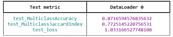
Testing Metrics


Inspiration
The ability to map the world with high precision and detail is critical for sectors like urban planning, environmental conservation, and disaster management. I was inspired to participate in the ML4Earth Hackathon to leverage cutting-edge foundation models for creating high-resolution maps from aerial imagery. The challenge of using AI to solve real-world problems motivated me to explore the full potential of these models.
What it does
The project focuses on creating high-resolution, detailed maps from aerial imagery. It accurately segments different land cover types such as buildings, roads, woodlands, and water bodies, providing valuable insights for urban development, environmental monitoring, and disaster relief efforts.
How we built it
We used the LandCoverAI dataset and built the model using torchgeo to load and process the data. The model is based on the Aerial_SwinB_SI architecture from the SatlasPretrain models, which we fine-tuned for segmentation tasks. To streamline the training process and handle large datasets efficiently, we implemented PyTorch Lightning for model training and added custom learning rate schedules to optimize different parts of the model, especially the pre-trained backbone.
Challenges we ran into
One major challenge was balancing accuracy and computational efficiency. Training foundation models on high-resolution aerial imagery datasets requires significant computational resources. Additionally, fine-tuning pre-trained models while gradually unfreezing layers to avoid overfitting was a complex task. Ensuring the final map outputs were accurate and scalable was another hurdle we had to overcome.
Accomplishments that we're proud of
We are proud of successfully adapting a pre-trained model to produce accurate high-resolution maps with a focus on real-world applications. The model demonstrated strong performance in segmenting different land types and handling large-scale datasets efficiently. The layered learning rate schedule we implemented also helped in fine-tuning the model without compromising performance.
What we learned
Through this project, we deepened our understanding of foundation models and their application to earth observation tasks. We also gained hands-on experience in fine-tuning models, optimizing for computational efficiency, and integrating different machine learning tools like torchgeo and SatlasPretrain. Additionally, managing large datasets and making the model scalable for real-world applications was an invaluable learning experience.
What's next for Atlosphere
The next step for Atlosphere is to scale the solution to cover larger areas with higher efficiency. We plan to further fine-tune the model to handle more complex environments and land types. Additionally, we aim to integrate the model into real-world applications, focusing on urban development, environmental protection, and disaster relief. Collaboration with local governments and organizations could help deploy this tool for maximum impact.


Log in or sign up for Devpost to join the conversation.