-
-

Front Page
-

Middle Page
-
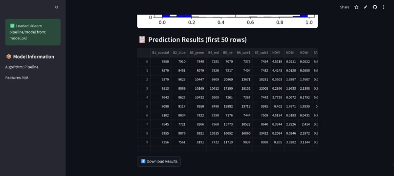
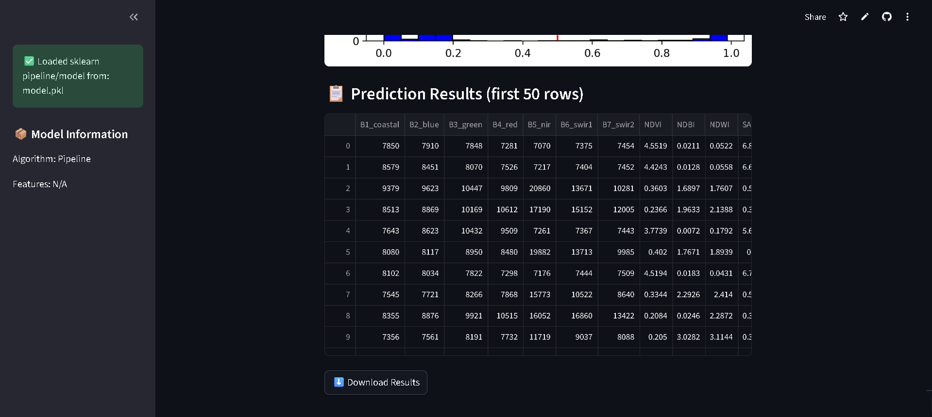
Final Output

Inspiration
Inspired by a “Billions” episode where satellite imagery revealed corporate activity, we explored how urban expansion patterns in Manila could uncover economic trends and investment opportunities.
What it does
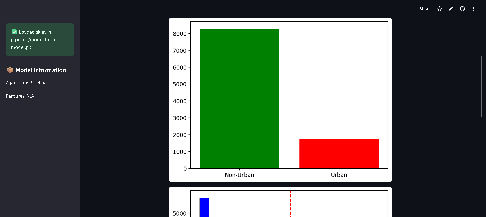
The system detects urban growth in Manila using satellite imagery and geospatial data, highlighting development hotspots and providing insights for real estate, financial forecasting, and urban planning.
How I built it
We combined remote sensing techniques with machine learning models such as Random Forests, SVC, Decision Trees, and KNN. Data preprocessing handled missing and extreme values, while Randomized Search with 5-fold cross-validation optimized model performance.
Challenges we ran into
Handling large, high-resolution satellite data required careful cleaning and normalization. Differentiating urban from non-urban areas in transitional zones was also challenging for model accuracy.
Accomplishments that we're proud of
The Random Forest model achieved 99.96% accuracy, 0.9982 F1-score, and zero missed urban areas, proving its reliability for detecting Manila’s urban expansion.
What we learned
We gained practical experience combining geospatial analysis with machine learning, emphasizing feature engineering, error analysis, and model optimization for real-world applications.
What's next for Manila Urban Expansion Detection
Future work includes predicting urban growth trends and integrating real estate price data to enable socially responsible investments, improve financial forecasting, and support sustainable city planning.
Built With
- numpy
- pandas
- plotly
- python
- rasterio
- scikit-learn
- streamlit

Log in or sign up for Devpost to join the conversation.