-
-
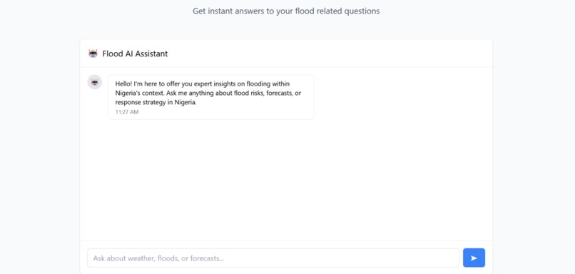
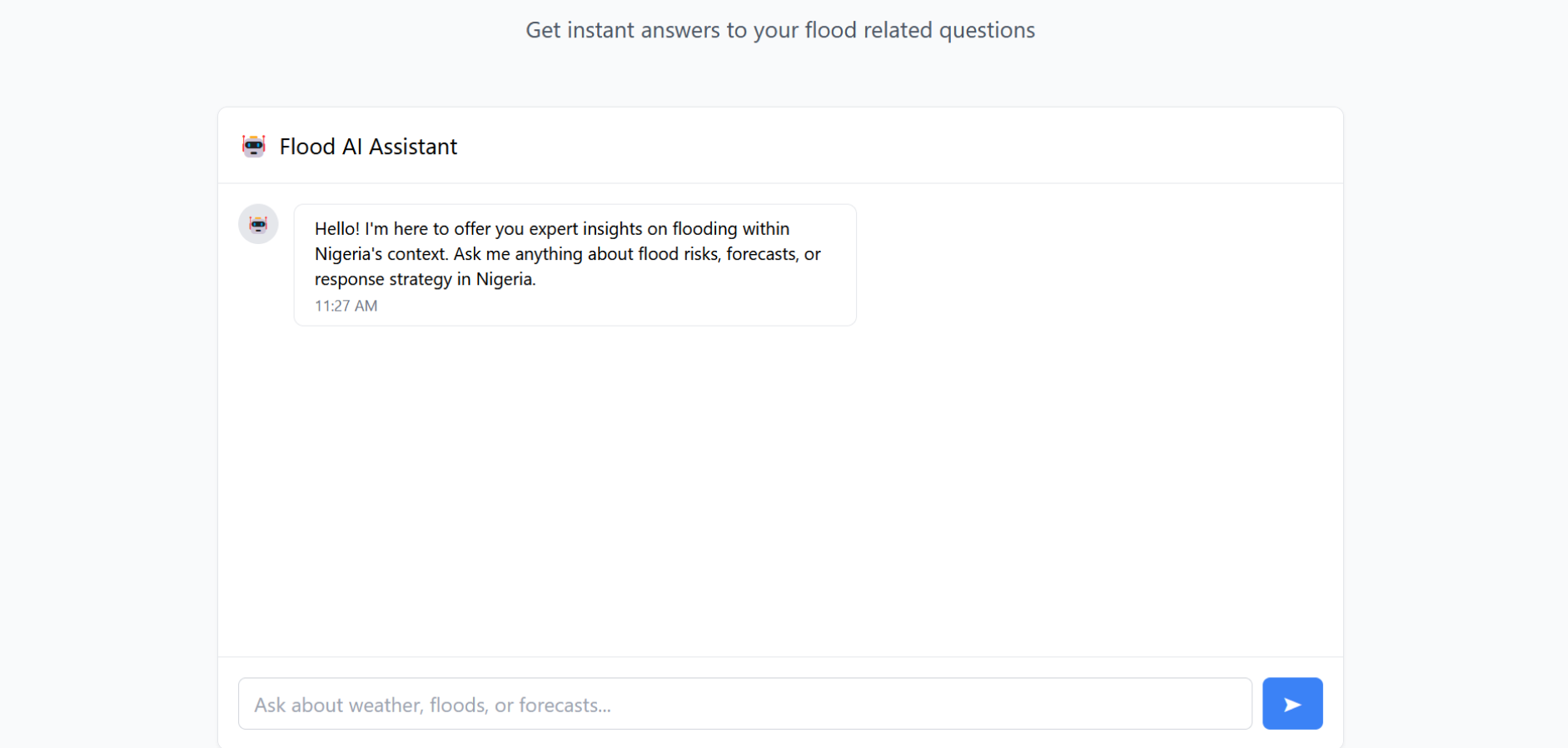
Flood AI Expert
-
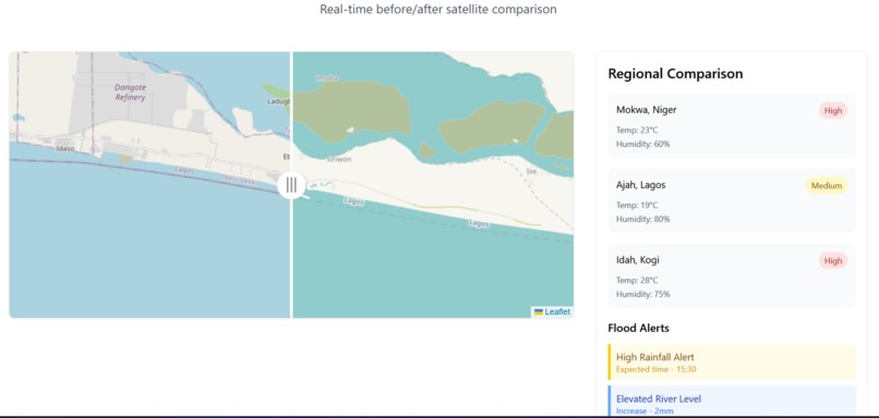
Damage assesment map
-
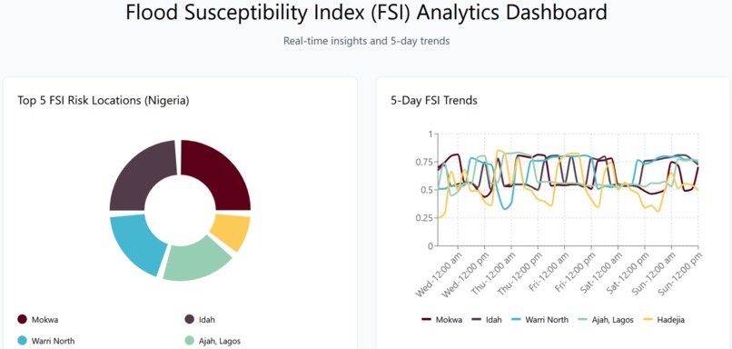
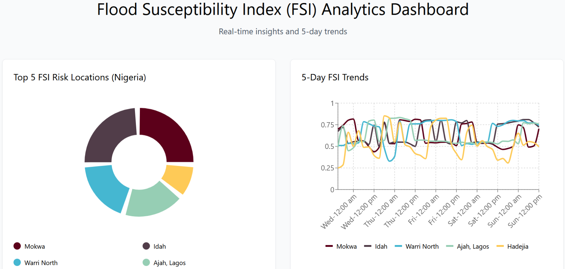
Flood forecast dashboard
-
Hero Section

Inspiration
Day by day, the impact of unforeseen weather conditions is increasingly present in our lives, affecting agriculture, logistics, and movement restrictions, while causing severe infrastructure damage. In Nigeria, for example, smallholder farmers in the North suffer irreversible losses from flooding, while in the west and other parts of the country, lives and properties bear the brunt of these disasters. This impact is widespread across the continent, as Kenya, Burundi, Somalia, and Northern Tanzania battle landslides (including missing persons) resulting from extreme flash flooding.
While extensive work in developed countries leverages advanced climate models to forecast flooding, these models are neither transferable nor practical for use within the African context. Additionally, existing solutions built within one region of Africa (e.g., Nairobi) are not scalable to other regions (e.g., South Africa) even within the same context (e.g., flooding). Another problem is the gap between reliable solutions and efficient responses: for example, flood prediction in Nigeria is neither real-time nor context-specific enough to trigger appropriate caution. Every time a report is released, it is vague and does not offer actionable insights to the target audience (how is this forecast relevant to a farmer, a landlord, or an insurance adjuster?). The other issue is that responses are not always targeted. After major flooding events occur, power and bandwidth infrastructures are also compromised, further hampering efforts to precisely locate casualties or prioritize targeted relief aid.
Luma solves the first problem by offering timely and contextually relevant flood forecasts using location-smart parameters. There are two major recipients of this product: The users, who receive reliable, decision-ready insights to act beforehand, and the clients (NEMA, local government heads, NGOs, etc.), who monitor flooding information, adequately assess post-flood damage, precisely locate casualties (using location cluster information), and leverage context-aware machine learning (ML) to offer strategic responses.
What it does
Luma offers decision-ready information on flooding for users in low-resource settings. Luma achieves this by combining three major algorithms: a flood forecast algorithm that offers precise and actionable flooding information to users and clients, a damage assessment algorithm that provides an accurate assessment of flooded areas to enable post-flooding action, and an AI advisor that offers contextually relevant strategies for prioritizing relief aid to casualties.
How we built it
On the technical side, Luma is built on top of three layers:
- The data layer
- The processor layer (controller)
The Machine Learning (ML) layer
The Data Layer harmonizes data from satellite (Sentinel), location, and environmental properties. These come from a variety of sources, including remote buckets and readings that can be captured via mobile devices.
The Processor Layer is responsible for processing and rendering data in various formats. The remote processing component computes remote data and sends the values to the edge device (edge processor), which in turn leverages mobile-recorded versions to interpret decision-ready insights. A good example use case is how our users leverage forecasts to determine if they are within the risk radius or not (in real-time). This layer is responsible for triggering alerts to users and clients when there is a strong probability of risk, and also renders data in interpretable formats.
The ML Layer builds upon all information relating to previous and current flooding activities (retrieval algorithm) to offer contextually relevant advisory services to key stakeholders (using a generative pretrained transformer).
Working Principle:
Data is fed to the processor layer (continuous monitoring), which constantly runs checks to see what locations are at risk, prioritizes them, triggers the alert system (where necessary), and sends information to the local processors (mobile devices) within the affected coordinates. Mobile devices instantly compute proximity risk and display a decision-ready notification to the user (the device owner). The user notifications contain decision-ready information, including risk safety tracking to ensure that they are not within another risk radius. On the client side, there is a dashboard where data is rendered to ensure eagle-eyed monitoring, accurate damage assessment, and empowers them to prioritize response strategies.
- Note: Previously, it would have been possible for a user to evacuate a flood-risk location only to unknowingly end up in another flood-risk location. Our solution eliminates this risk by offering users in-device, real-time location insights to help them reach safety.
Communication:
Luma communication protocol is optimized across all layers:
- Data Layer: Returns JSON (not heavy .tiffs or full maps), which travels lightweight. GeoJSON vector is used to compute location risk on the fly (on edge device).
- Processor Layer: Uses offline capabilities (mobile device) and asynchronous updates between remote and local layers when a connection is available. SMS alerts via Twilio for ultra-low bandwidth delivery.
- UI Layer: Minimal UI with progressive rendering, depending on connection speed and device capacity.
- ML Layer: Uses asynchronous processing for retrieval and generation on the client side. Where necessary, it also leverages cached data from the dashboard (remote processing layer) for context to reduce back-and-forth request traffic.
Challenges we ran into
Unavailability of continuous satellite data for accurate damage assessment: While we are able to access imagery to estimate the area extent covered by flooding, the data is not available in the same required format for all regions. Some of the issues with optical imagery are due to cloud cover (especially during the rainy season). We have addressed this by leveraging synthetic aperture radar (SAR), which transmits within the radio wave region and penetrates clouds.
Context Relevant Forecast: During our initial research, we found that prevalent flood models were treated as black or white classification models (i.e., weak, moderate, and high risk). They also failed to distinguish between flood susceptibility and flood risk (which are essentially two different things), which has made them unsuitable for decision-making. Our first consideration was this approach, but after carefully understanding the user needs, we decided to develop a more efficient flood score index(FSI). FSI is a continuous value that offers more fine-grained and context-relevant information.
FSI is developed from embedded knowledge in existing research papers, but since this is fairly new in practice, we are currently evaluating performance with current weather conditions.
Accomplishments that we're proud of
We are proud of our progress; at the moment, we have:
- Developed and deployed precise, reliable, and decision-ready flood forecast algorithms across Nigeria.
- A remote processor layer that computes flood masks and land area affected from Sentinel imagery (with some improvements, we hope to be able to adequately account for the loss of properties or facility damage).
- A context-aware AI assistant (analyses the situation using all relevant data points) that helps clients and key stakeholders prioritize aid and evacuation strategies in the presence of limited resources.
- We are excited that all solutions have been deployed and optimized to work efficiently on minimal compute, asynchronously, and our stack leverages MQTT (message querying telemetry transport) to cater to latency between remote and edge processors in low-bandwidth (resource-constrained locations.
What we learned
- Context and accessibility are more important than building a flashy solution.
What's next for Luma
While we are excited about the opportunities that Luma can offer, our mid-term forecast is targeted at focusing on three targets in the following order, which have been listed:
1.) Optimize the damage assessment algorithm to precisely count and estimate the number of properties and clusters of people within the affected area ( current approach returns flood masks and estimates the land area affected. We want to be more precise).
2.) Extend Luma flood solution to cover not just monitoring flooding, but landslides and additional unforeseen circumstances that could be preempted via satellite imagery and location smart insights (essentially, we are looking at continuous monitoring and insights leveraging available data from space).
3.) Scaling to neighbouring African countries. Our goal is to ensure that this solution is scalable anywhere. Once we have successfully benchmarked our pilot, we will scale to Nairobi, Kenya, and other countries requiring this solution.


Log in or sign up for Devpost to join the conversation.