-
-
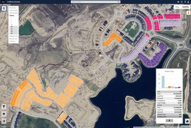
LotWorks Develop Screen 2
-
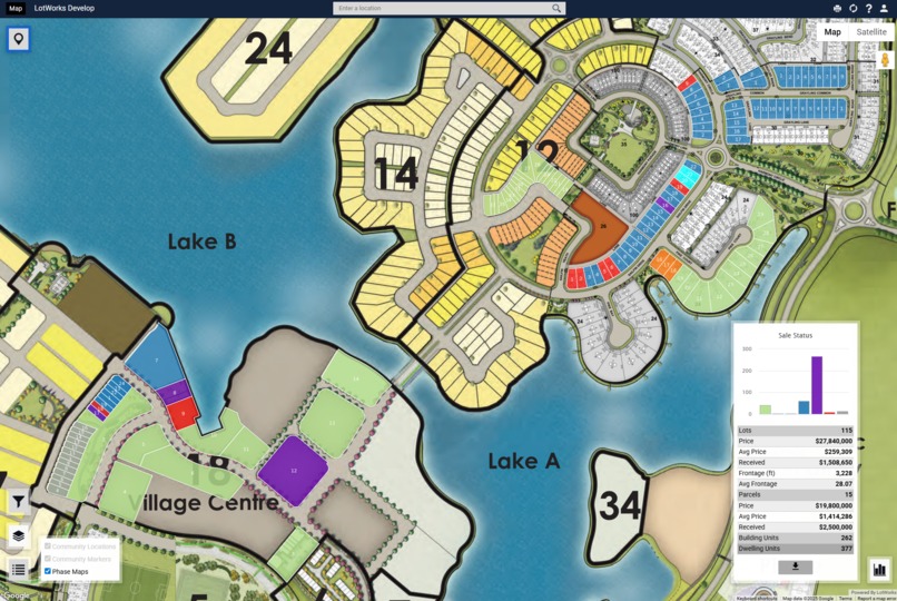
LotWorks Develop Screen 1
-

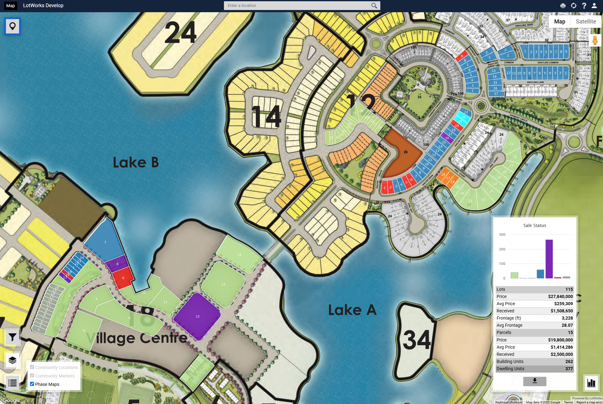
LotWorks Develop Screen 3

We are the makers of LotWorks, a suite of products that helps land developers and homebuilders manage their business more efficiently. LotWorks Develop is our flagship product, and the map interface is both the centerpiece and the cornerstone of the product.
Inspiration
Historically, the residential construction sector has shown resistance to technological advancements, often relying on traditional practices like paper maps and spreadsheets, emails and phone calls for critical operations.
Our aim has always been to present our customers with a much better way to visualize and manage their inventory.
We initially built out maps using raster imagery and DHTML in 2004. The presentation layer got an upgrade when Adobe Flash came along, but this still required our customers to point-and-click to plot a “lot” on the map. We knew we needed to evolve. Fortunately, evolving browser standards meant we could look at better options.
Around 2014 we fully committed to the idea of a full GIS implementation. In choosing the tools we’d use, we wanted a platform that was widely accepted, very intuitive, and reliable. Knowing that Google had made Maps a central part of their business model, it was ultimately an easy choice. We found that Google Maps Platform had a well-documented Maps Javascript API that would help us integrate tiled data/image layers from our maps service with Google’s familiar interactive browser experience.
At the time we switched to Google Maps, no other competitors were presenting real-time lot inventory in a geospatial solution. Typically, they used some variation of flat images or SVGs.
Development Notes
We knew our maps solution had to be scalable, and that it would need to serve two audiences: high-volume public websites and low-volume administrative dashboards.
On initial launch, our dynamic on-the-fly filters, visualizations and backend calls were a consistent performance bottleneck during high-traffic hours. We mitigated this by dockerizing our Maps service and employing caching using Fastly and Google Cloud Platform.
While our project is aimed at North America, we could easily deploy our Maps service to the global market if and when our business takes us there.
OF NOTE: Google Maps and our integrated Maps Service quickly became the most used feature in our product, representing >60% of all app clicks.
We have been a Google Maps for Work Technology Partner since 2016.
Built With
- carto
- docker
- fastly
- gcp
- gdal
- javascript
- maptiler
- netlify
- postgis


Log in or sign up for Devpost to join the conversation.