-
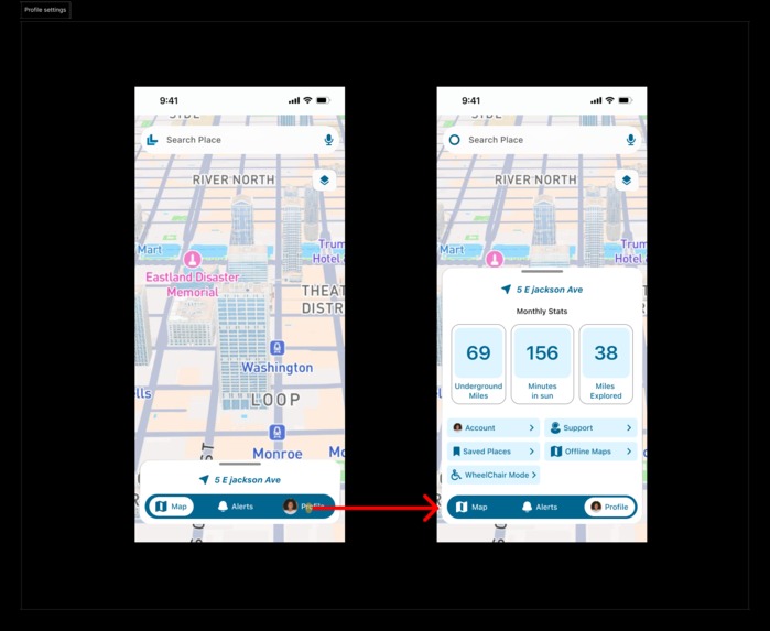
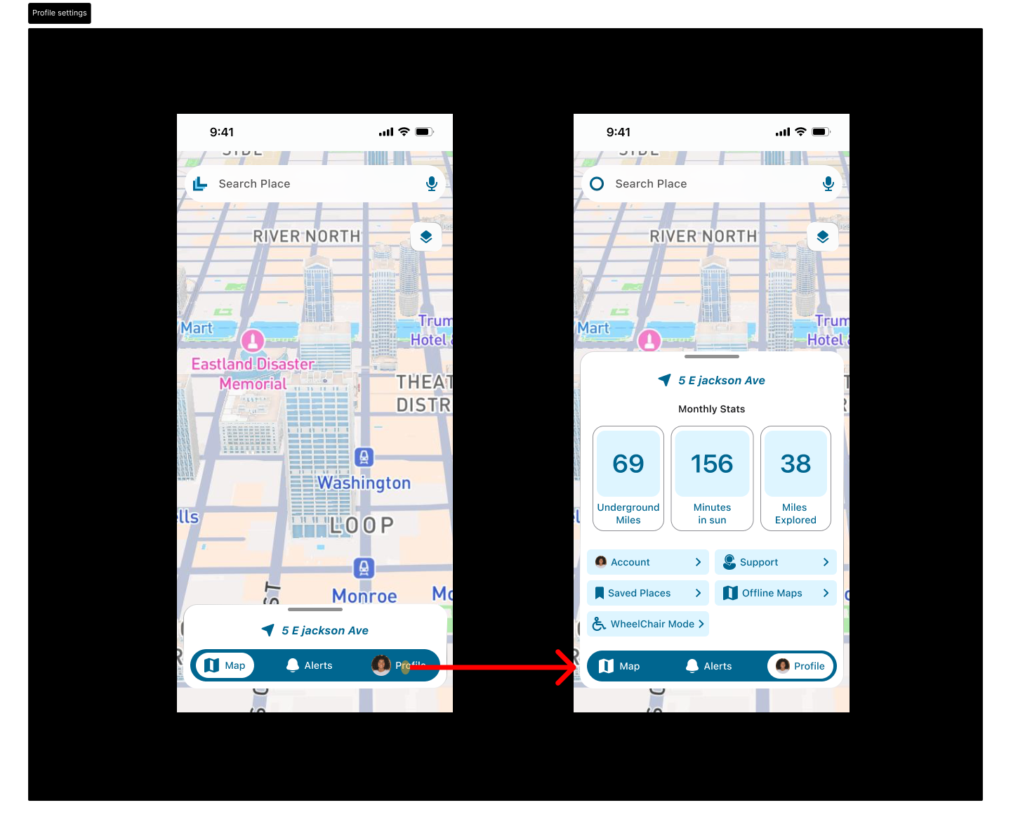
User Profile
-
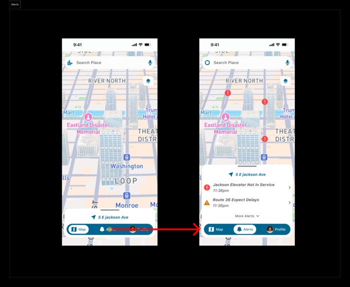
Alerts
-
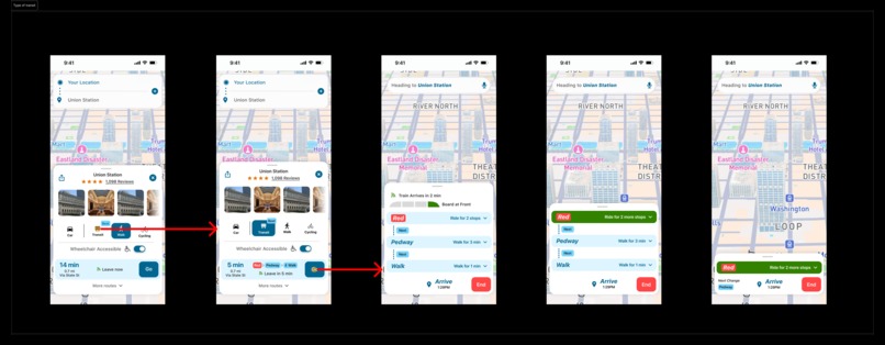
Type of transit
-
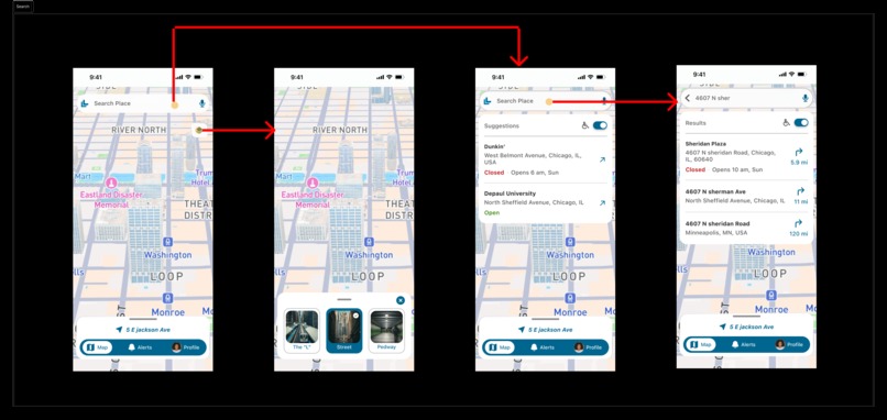
Search
-
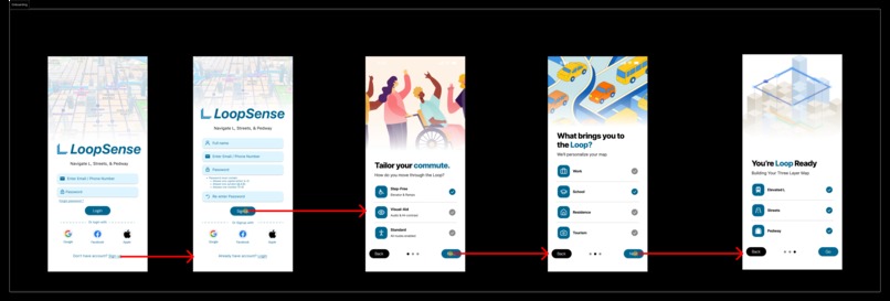
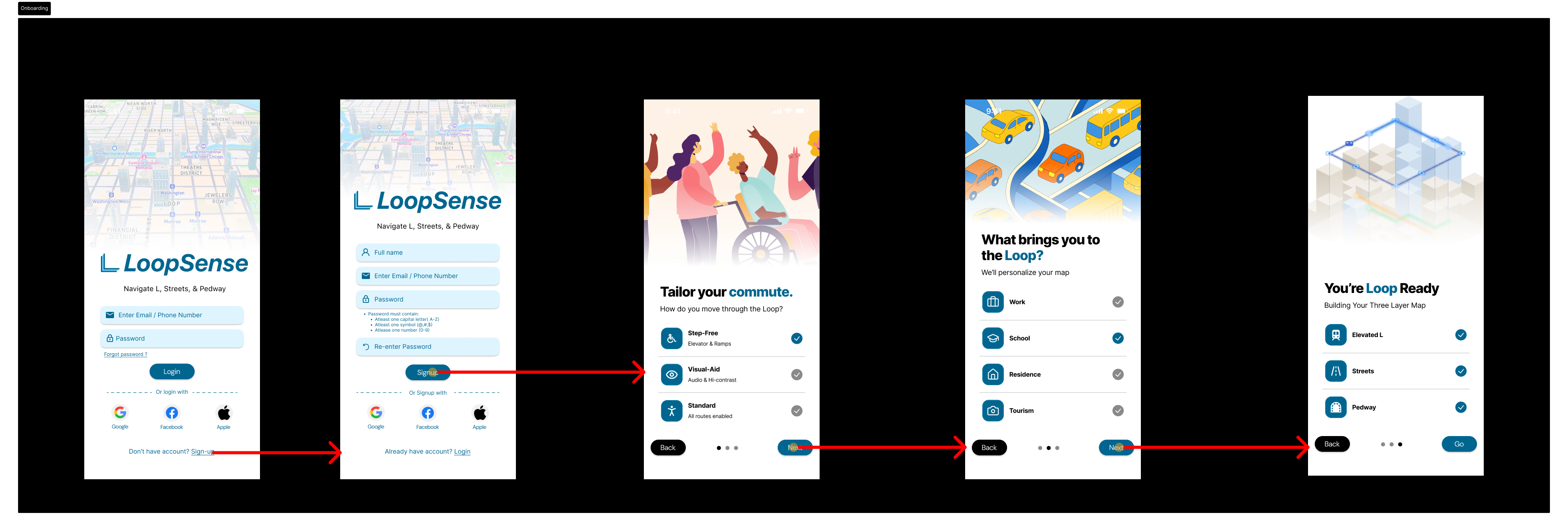
Onboarding
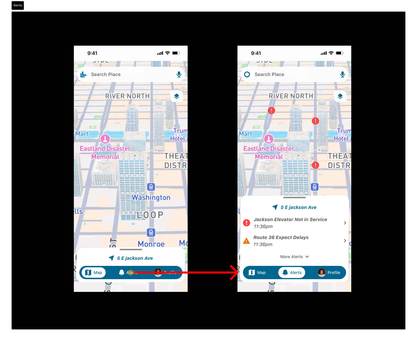
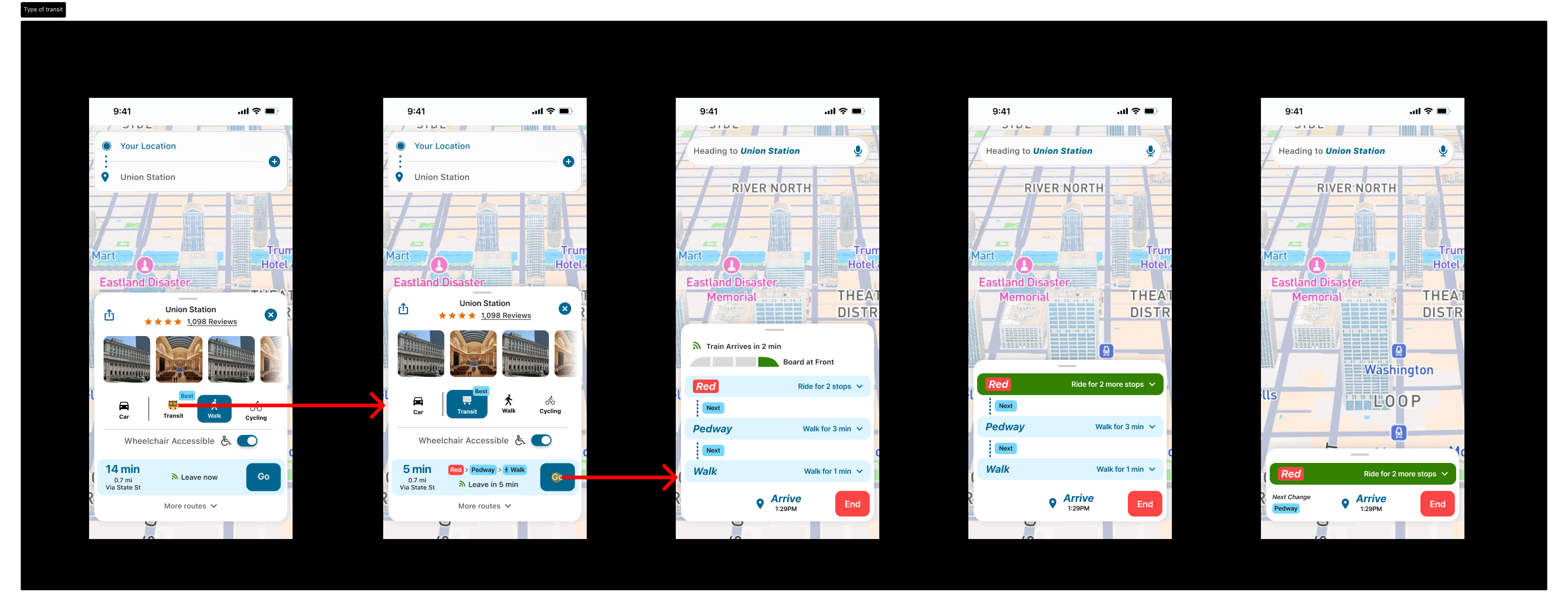
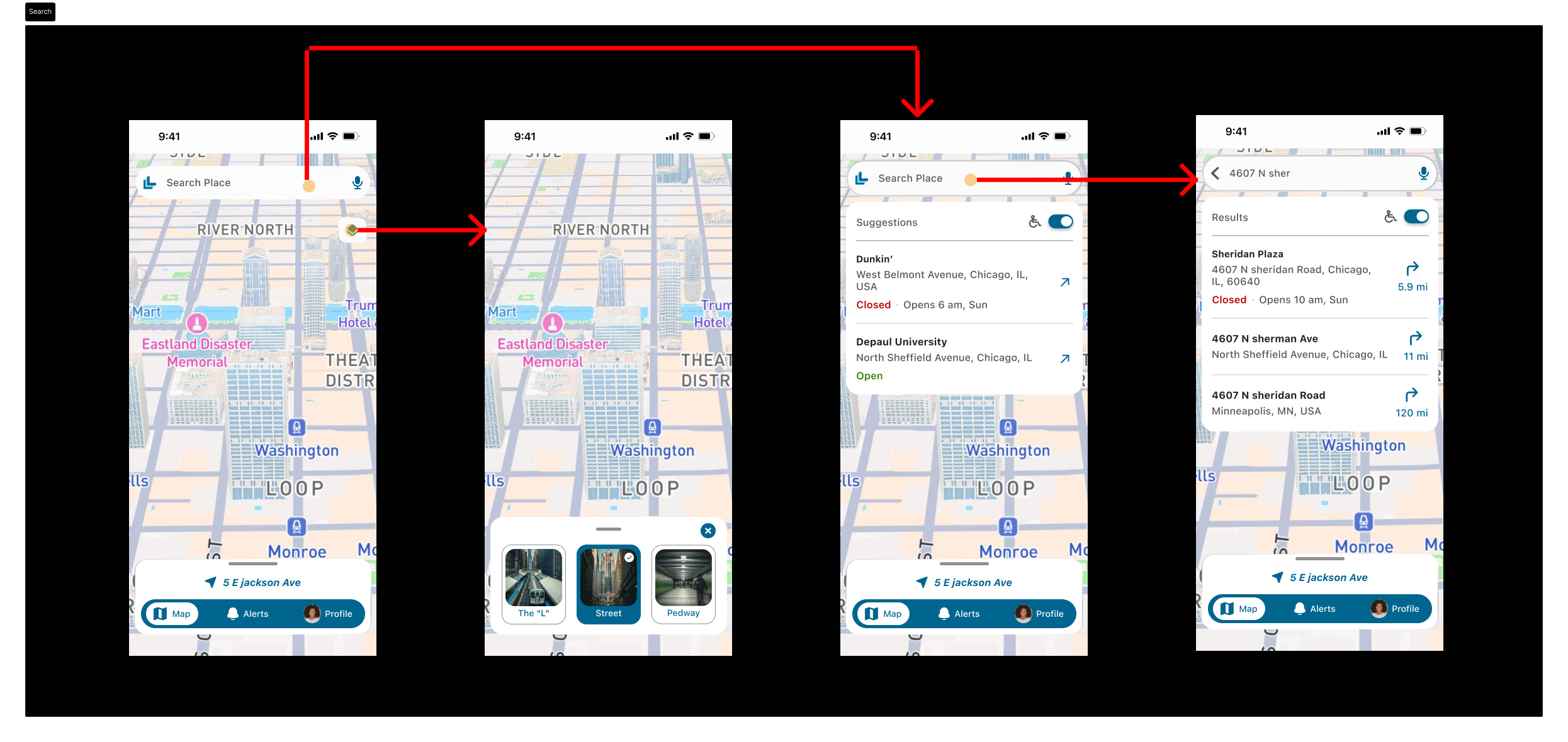
Chicago isn't a flat map, it's a 3D puzzle. Between the Elevated L, the Street, and the Underground Pedway, Google Maps gets confused. We were inspired to build a tool that understands the "Z-axis" of the Loop so commuters don't get stuck in the cold or lost in a tunnel. This is where LoopSense came in, it is a vertical navigation app with features like: 1. Vertical Switcher: Toggle between [ L | STREET | PEDWAY ], 2. Wind HUD: Alerts you to "Death Corners" where wind speeds spike, 3. Sunny-Side Routing: Finds the sidewalk not covered by "L" train shadows, 4. Live Access: Real-time alerts for broken elevators and bridge lifts.
We used Figma for the UI. For the backend logic, we used Groq. The biggest challenge was GPS failure. When you go into the Pedway, your "Blue Dot" disappears. We solved this by switching the UI to a "Schematic Mode"- a high-contrast blueprint that focuses on landmarks and local nicknames rather than a shaky GPS signal.
We built a working Vertical Layer Switcher that feels like a physical tool. We also successfully integrated the CTA’s live elevator API. We want to ensure that wheelchair users never hit a "dead-end" station. We learned that accessibility is environmental. It’s not just about ramps; it’s about knowing which bridge is up or which street corner is too windy to cross.
We plan to expand our accessibility features to help people navigate better. Some features we are looking to incorporate are human agents or volunteers that connect with BLV on phone and help them navigate, break the tasks (reaching a destination) into smaller, manageable steps so that people with cognitive disabilities can benefit from it. Another thing we are looking into is to have bigger buttons and brighter UI for people with motor/ physical disabilities. Additionally, including haptic features for the deaf is in our future scope. We want to design "Glove-Friendly" buttons for users in -10°F weather.
Built With
- bus-tracker
- chicago-open-data-portal
- cta-customer-alerts
- cta-elevator-api
- cta-train-tracker
- ctagtfsdata
- fastapi
- github
- groq
- javascript
- open-weather
- python
- react
- vscode