-
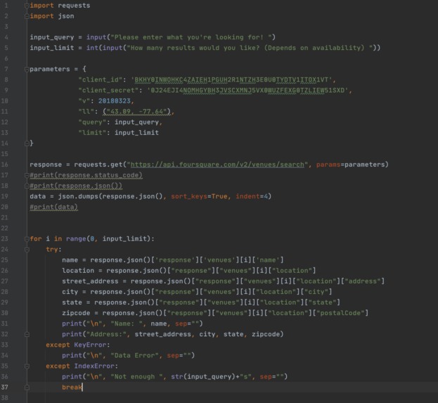
It Works! YAY
Inspiration
We wanted to come up with a meaningful project that a student could use to figure out what's around! This highlights all business around - especially local business that we probably didn't know of (before this API ;P)
What Does Local Business API Do?
It takes a latitude and longitude and give you a place in the category you want. Currently RIT's is hardcoded but we hope to expand that for the future.
Resources Used
Using a tutorial from Python about APIs from DataQuest, Google and wonderful help from ClayHacks Mentor- Sir Graystripe.
How Did We Develop It?
We built the API using Python, JSON and Parsing JSON
Challenges We Faced
Finding a compatible database. Being able to parse them and getting past minor data errors from the database
What Did We Learn?
How APIs work and parsing!!
What's Next For Local Business API
Making it more efficient! Make sure it can work in different areas other than Rochester. It's currently optimized for RIT!

Log in or sign up for Devpost to join the conversation.