-
-

Welcome to LocAid!
-
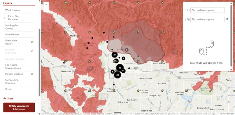
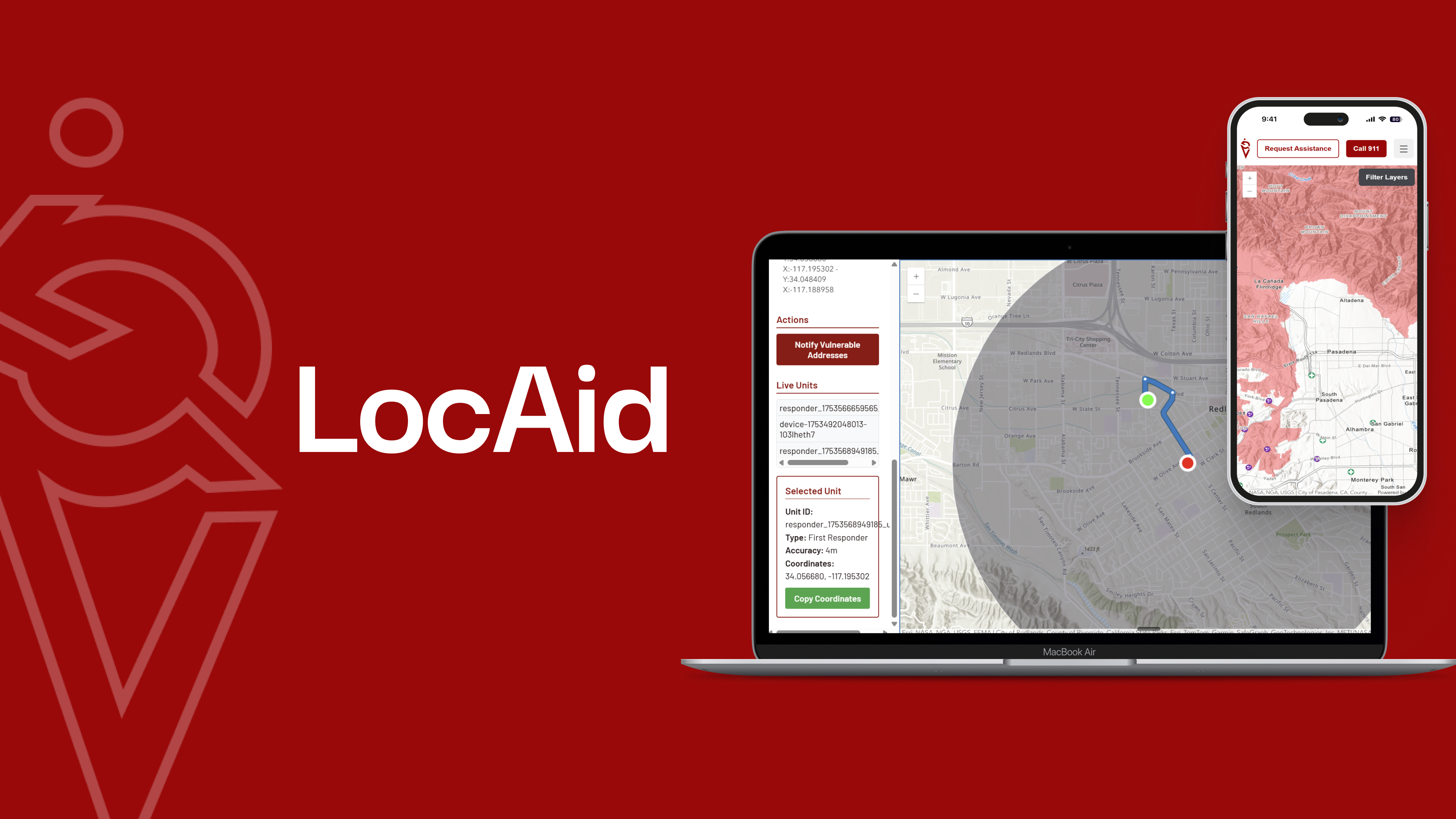
First responder dashboard
-
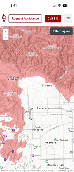
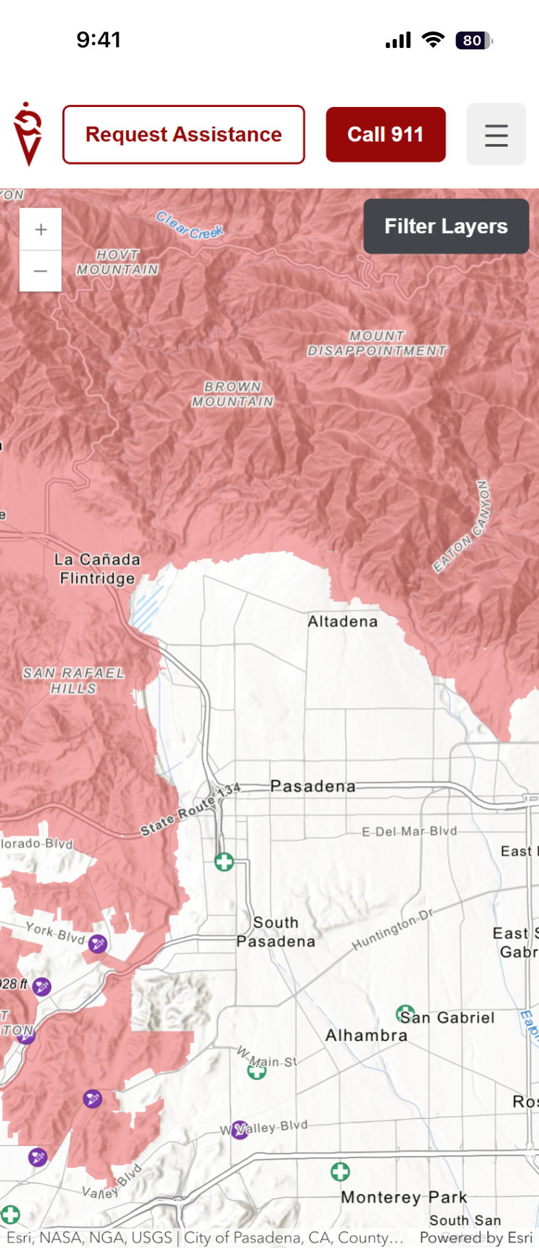
User dashboard
-
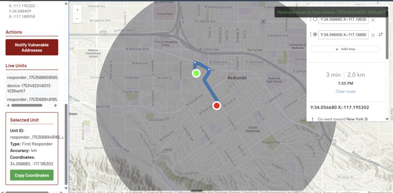
Routing capability on first responder web view
-
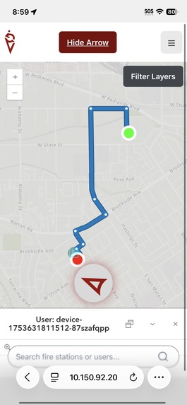
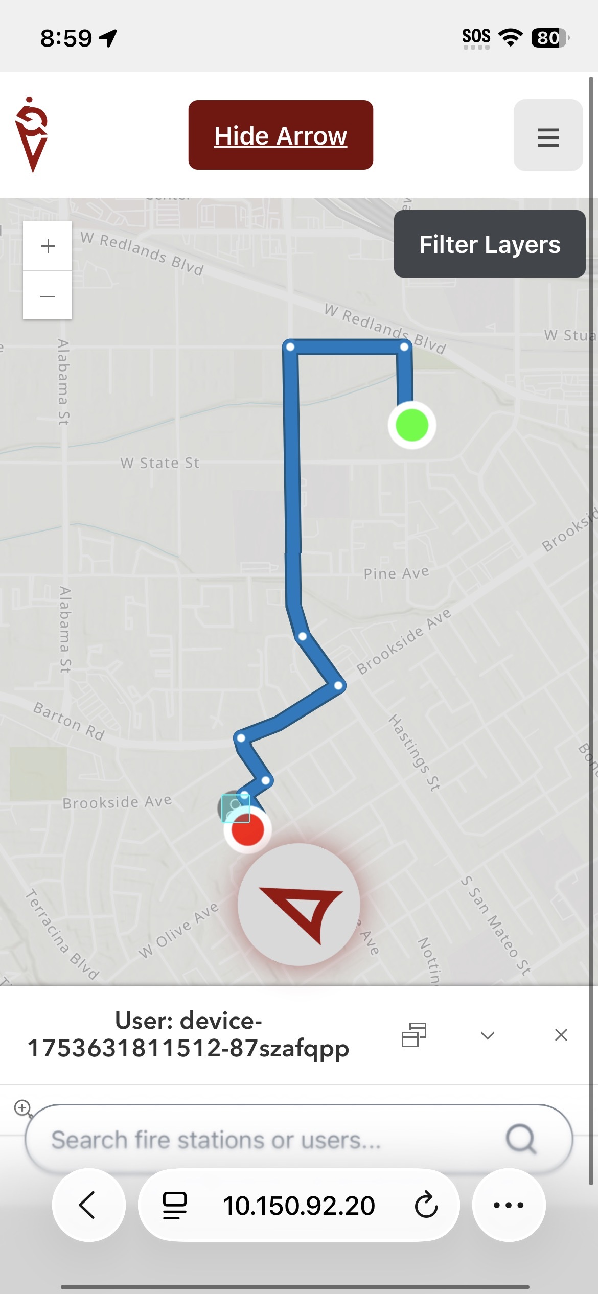
Routing capability on first responder mobile view


Inspiration
Since the 19th century, the principle of “women and children first” has guided emergency evacuations, yet this longstanding approach often neglects a critical and vulnerable group: individuals with mobility disabilities. The recent Eaton fire tragedy, where two homebound disabled men tragically died despite multiple 911 calls, highlights the urgent need to rethink emergency response protocols. Currently, preparedness resources for people with mobility impairments are limited mostly to pre-disaster advice from the CDC and smaller advocacy groups, without any integrated system to assist first responders in locating, prioritizing, and evacuating these individuals in real-time. This gap reveals a vital deficiency in emergency management—one that endangers lives by failing to provide tailored rescue support to those who cannot easily self-evacuate.
What it does
LocAid is a web app that connects disabled individuals with first responders during emergencies and natural disasters. Individuals are able to easily share their location and request emergency services, with maps that highlight accessible routes and show current disasters. First responders have access to a visual dashboard showing users' locations and can quickly dispatch teams for support, using a mobile-friendly view with live location tracking to locate the individuals in need.
How we built it
LocAid was built using the ArcGIS Maps SDK for JavaScript, with a focus on accessibility and clean design through Calcite Components. We used Vite as our build tool to enable fast development and optimized bundling. In addition to a Survey123-based user login screen, the app loads dynamic data layers from ArcGIS Online and allows users to interact with them through a responsive web map. We used hosted feature layers for real-time updates, and integrated custom controls for filtering and toggling visibility of key data sources.
Challenges we ran into
The Calcite design system was difficult to get used to and took time away from development to style elements as we wanted. There was also initially less data available than we were hoping, but we also ended up having the opposite challenge of too many layers and the maps being too busy. We initially tried using a REST API to network between users and the dashboard, but then decided on a WebSocket because we needed more consistent communication.
Accomplishments that we're proud of
Our team worked very efficiently and we were able to get the base app functional very quickly, allowing us to focus on fine-tuning and additional features. We were able to implement live location tracking between multiple devices, as well as direct to the closest user in the first responder mobile client. The two dashboards we have for first responders and disabled users are built for different purposes and connect seamlessly for an easy functional experience.
What we learned
Since all of us are in product engineering, none of us have had the chance to work directly with Esri's software or APIs. We learned how to interface with Esri's software, and the cool capabilities out there! We were also able to exercise teamworking skills and learned more about one another through the process.
What's next for LocAid
The current functionality of the app allows first responders to quickly locate the nearest individual in an incident. In the future, we will enable responders to select individual incidents and mark when they are resolved. Live disaster tracking is also very important for both first responders and individual users, so in addition to integrating ArcGIS Velocity, users will also be able to report incidents and disasters. We also want users who request help to be easily discernible, so we would place an additional emphasis on the locations of users in need.
Built With
- css
- esri
- figma
- html
- javascript
- node.js
- vite


Log in or sign up for Devpost to join the conversation.