Inspiration
There are 179 people injured per day because of traffic crashes in the state of Virginia. Virginia reports an average of 2.3 deaths per day due to traffic related incidents. Accidents could be avoided if drivers practiced safer driving habits, and were more aware of hazards and conditions around them.
What it does
LiveDrv is an application that will use state provided data on historic traffic crash locations, active construction zones, and current driving behavior, such as speed, to reward users with points. Users are incentivized to leave their phones alone while driving, and will receive audio warnings of upcoming road conditions or situations to be aware of.
With the partnership of state and local entities, as well as commercial businesses, the application could become an official way to recognize good drivers, and reward them with tangible goods such as: free parking, positive driving record points, or even free coffee. The goal for the application, is to use as much official data and driving behavior as possible, to reward good driving habits, provide drivers with hands-free information, and prevent distracted driving on Virginia roadways.
Gamification works for modifying behavior.
By rewarding points and badges to the users, the app encourages less distracted driving, while simultaneously providing warnings and road condition information to drivers. Warnings could include state and local police officers making stops, or responding to vehicle accidents, VDOT road workers, and other official workers on or near roadways.
By partnering with state and local government, and even commercial businesses, rewards could be offered to drivers to continue to reinforce good driving habits.
How we built it
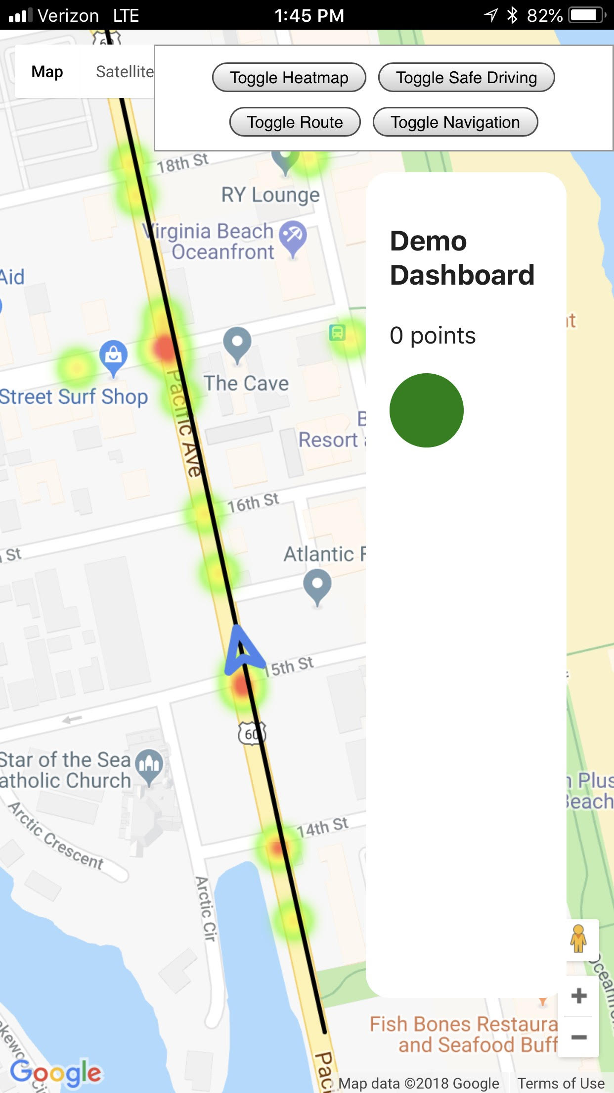
We used the Crashes shapefile provided on the www.smarterroads.org website to gather historic crash data based on locations. The shapefile information was parsed with python, and a sample set of accidents involving pedestrians was used for demonstration purposes.
The demo is built using Glitch to provide a quick progressive web app experience to demonstrate how the location data will be assessed on a map, and how point tracking will be used. The Google Maps JavaScript API provides access to the map information needed.
Challenges we ran into
It would be beneficial to app developers if all state open data was provided in JSON, or similar format, and had an API to query for updates.
What's next for LiveDrv
Further development on LiveDrv would include integrating with native mobile navigation apps, such as Google Maps and Waze. More official state and local data will be added, and the ability for approved official users to dynamically update their location in real time, and remove as applicable. This would become one of the greatest safety improvements because drivers could be notified about active road workers, police vehicles etc. before they encounter those conditions. With enough data, drivers could receive audible alerts for lane changes, and even speed conditions as they approach those hazardous conditions.


Log in or sign up for Devpost to join the conversation.