-
-

Sylvester Route optimized
-
Inspiration
We wanted to create an infrastructure-based code that could integrate with the existing college apps to help make their functions more streamlined and/or user-friendly
What it does
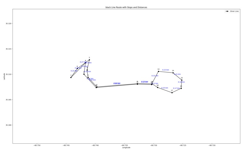
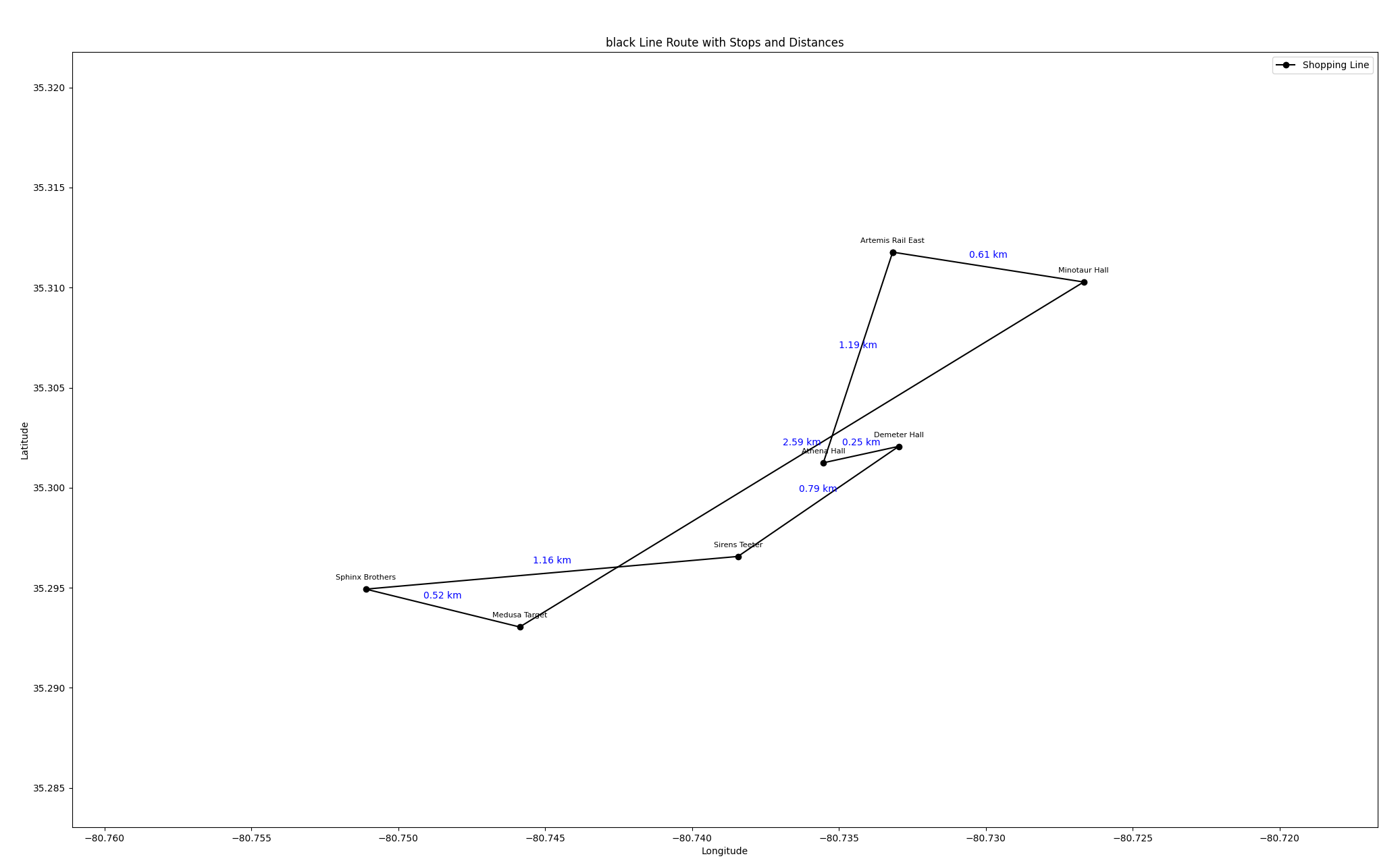
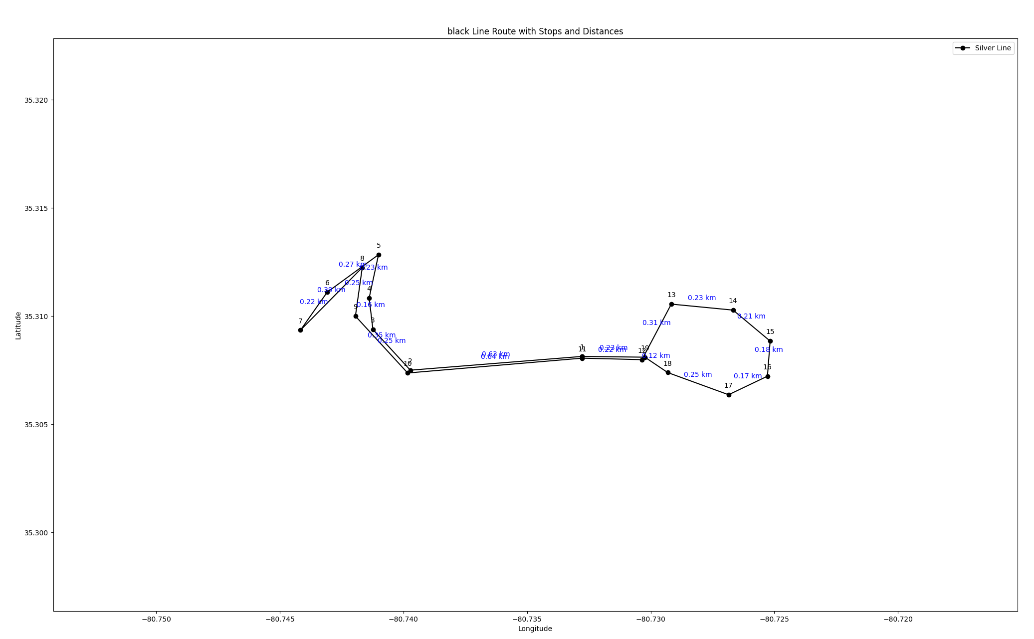
This algorithm takes the necessary data from the campus bus-mapping app to then plot and map the optimized route patterns for the on-campus public transportation to take.
How we built it
We used an API, to get the necessary nodes for the scatterplot graph. We wrote a distance optimizer algorithm to find the distance between concurrent points and choose the ones with the shortest distance that adheres to a loop-like path.
Challenges we ran into
Finding and training a distance optimization algorithm. Routing the paths in a logical and connected loop path. Scaling the different routes and merging them into one graph.
Accomplishments that we're proud of
Being able to optimize a total of 49 stops and 6 routes in the span of 24 hours. Merging all 6 routes into 1 graph with proper scaling. Incorporating a fantasy theme into the presentation of our algorithm/product.
What we learned
How to apply very computationally-heavy algorithms into non-technical fields. Scaling, plotting, and optimizing multiple scatter-plots
What's next for Light Speed
Better GUI to make it more user-friendly Make it more flexible across more campuses Better presentation and maybe appearance of the app.


Log in or sign up for Devpost to join the conversation.