-
Logo
-
-
-
-

-
-

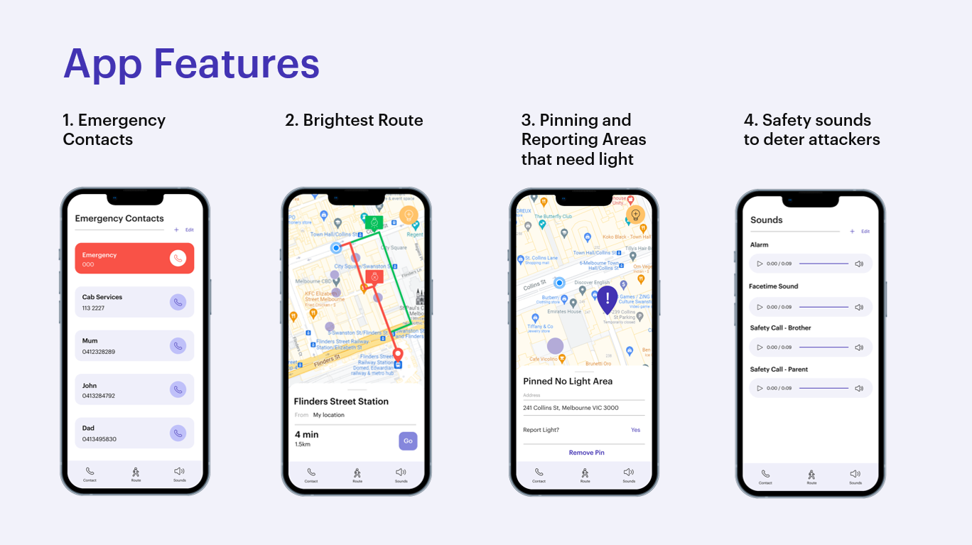

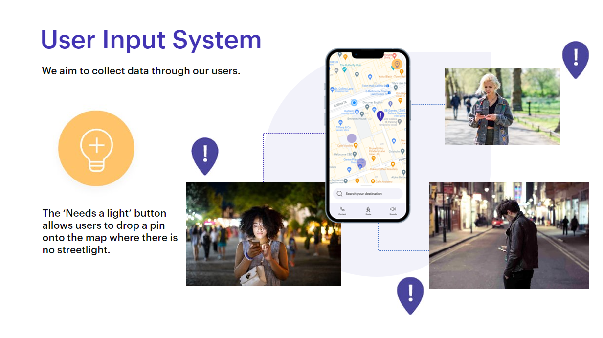
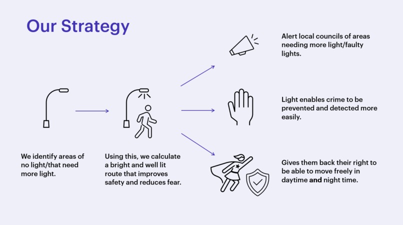
Almost half of Australian women do not feel comfortable walking home at night, compared to less than one fifth of men. Poorly lit areas correlate with where women experienced cat-calling and unsolicited advances, feeding into this sense of insecurity and fear. Our solution locates the darkest streets and calculate a route around these that is brightly lit to avoid these areas. The app relies on a user data, where users will pin and report locations of bright or dark areas. We aim to partner with local councils who will receive this report, and can use this information to install more lights.
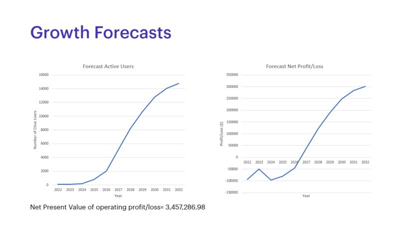
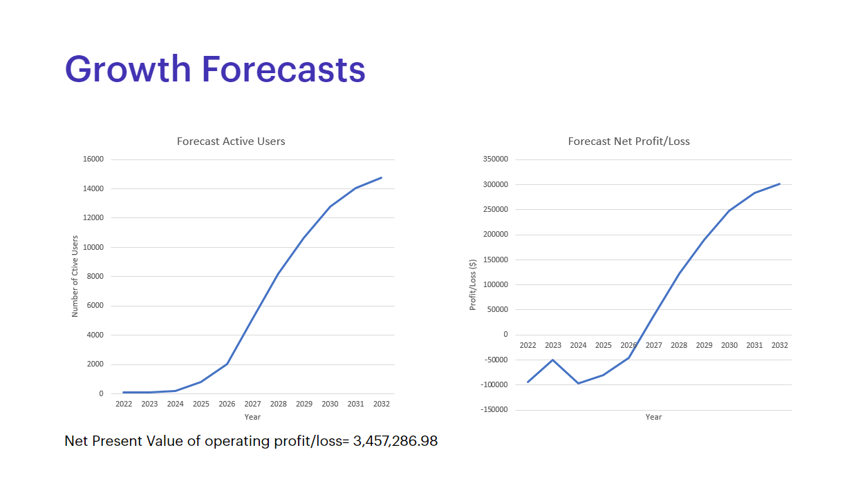
As we are relying on user contribution, the app will take around 1-2 years to fully work.
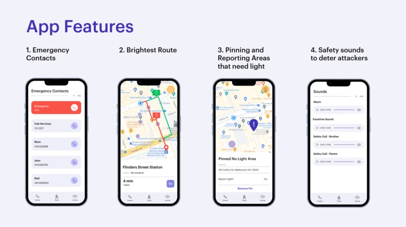
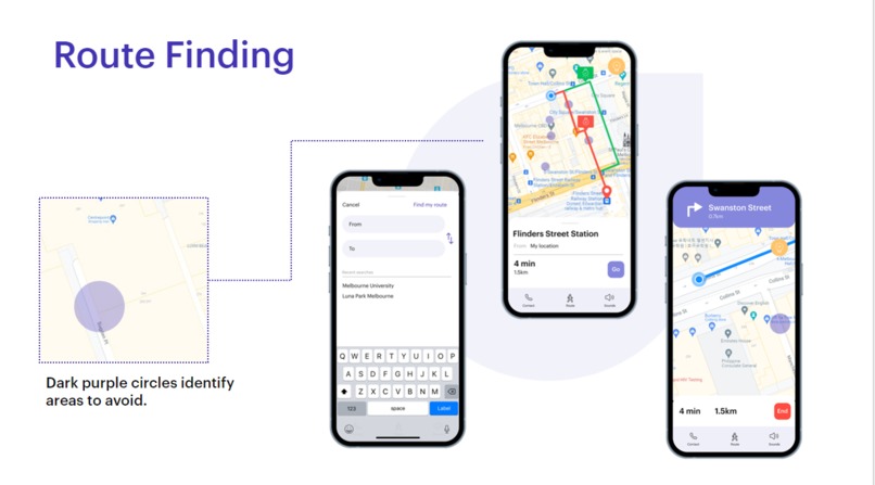
Users have the opportunity to pin areas that are poorly lit. When a user pins a poorly lit area, they are given the option to report this area, which will notify the local council. If multiple people want to pin the same area, they can add their vote to a pin, demonstrating that this is an area that many people want to be lit. Using this data, as with a typical map, the user will enter their start and end location, and will be given a route that avoid these dark and potentially unsafe areas.
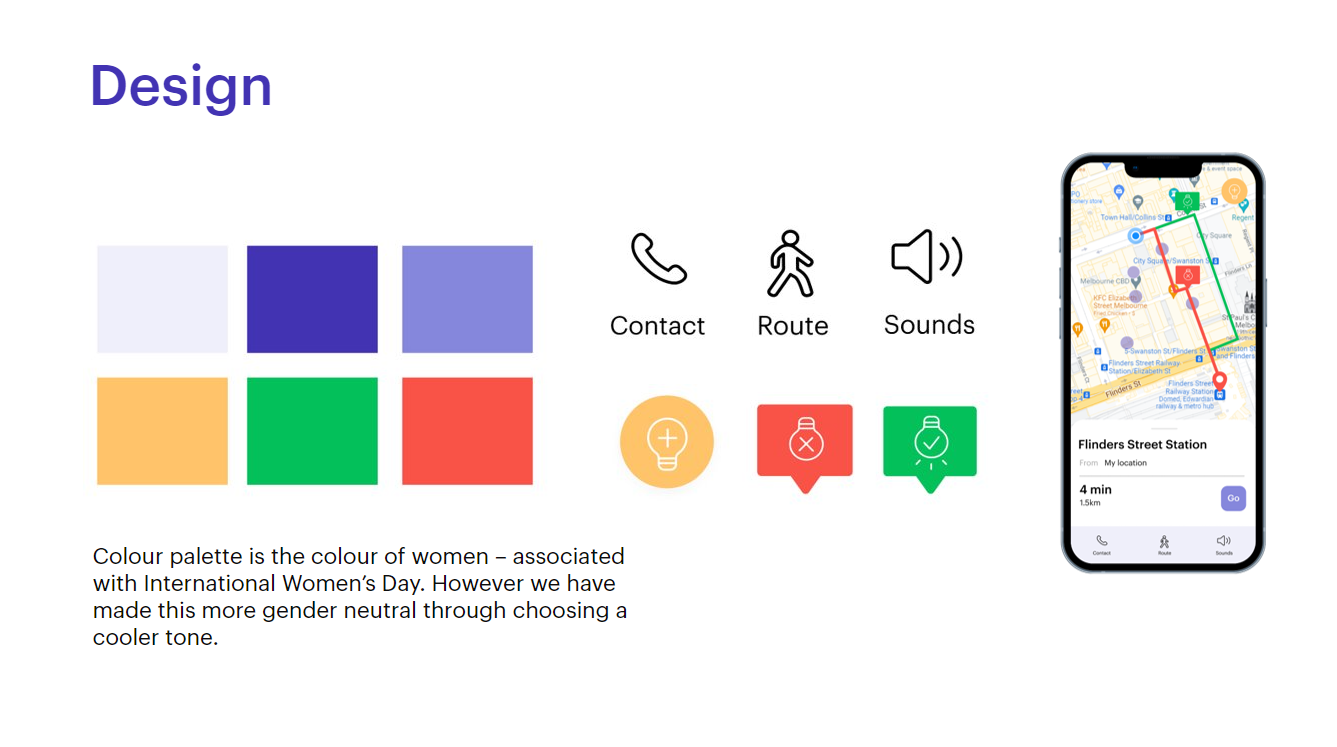
As the app will constantly be open as the user follows the route, we have included safety features such as emergency numbers and alarm noises that are easily accessible in the event that there is an incident.
The main challenge was creating the mapping function using Google Maps API. As we did not have the data available at this point in time, we have created a sample set of data points by identifying longitude and latitude points to act as dark areas, and then a sample route that will lead the user to their location. We used Figma to design the mockups, UI/UX of the app by creating custom icons to improve the accessibility.
Built With
- api
- css
- figma
- html
- javascript
- photoshop


Log in or sign up for Devpost to join the conversation.