-

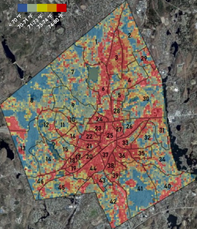
Heat Map via:(https://www.worcesterma.gov/uploads/b3/49/b349ee5fb569021ece3ed3c914625074/gwac-urban-climate-consulting-presentation.pdf)
-
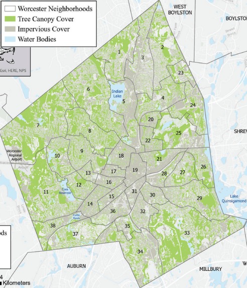
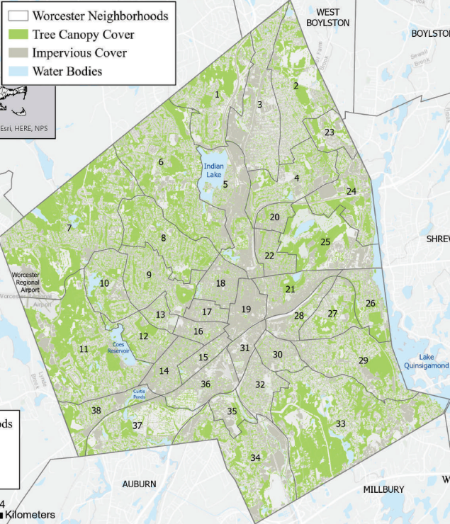
Tree Coverage Map via: (https://commons.clarku.edu/cgi/viewcontent.cgi?article=2713&co ntext=asdff)
Inspiration
Our main inspiration was being Worcester residents ourselves, and cooking without air conditioning here in the summer. We have first-hand experience with negative affects of artificially enlarged temperatures and also are the generation on the brunt of global warming.
What it does
Our project enables Worcester residents to see their location on both the heat and tree coverage maps, allowing them to visualize the tree coverage situation in their neighborhood and the negative effects it is having on their quality of life and the environment as a whole. Our program also provides information to users on how to utilize Worcester City resources to plant trees in public spaces and get in touch with their representatives to support policies to protect and grow tree coverage in Worcester.
How we built it
We built this in Python using tkinter for a GUI. We call to an api to get the user's ip, then use that to call a different api to pull the user's latitude and longitude. Using the the lat long bounds of Worcester we are then able to translate degrees into pixels on our identically sized maps and place a corresponding dot to accurately display where in Worcester the user is on both maps. The GUI has a second page to educate the user and provide external resources.
Challenges we ran into
By far the biggest challenge we ran into was our original idea. Leafy Lessons was originally going to be a program that takes the users location and asks questions to then recommend plants for a home garden to the user, providing know-how on care and images to allow the user to find plants right for them. We loved this idea and sunk an all-nighter into it, making strong headway before realizing the api necessary for it had many features locked behind a pay wall. This meant Saturday morning we had to not only start anew, but with an entirely new idea. Challenges we ran into after that were learning how to use tkinter, learning how to geocode using ips, and convert latitude and longitude to coordinates on custom maps.
Accomplishments that we're proud of
We are very proud of the fact we got a finished product on our first ever hackathon, especially when we had to idea pivot in the middle. We are also very proud of our new idea, how it is a product designed for local Worcester residents, and how the maps turned out.
What we learned
We learned SO much about tree coverage and artificial heat in urban landscapes, and even better learned about these topics specifically in the context of Worcester. We also learned how to use tkinter, how to geocode using ip addresses, and how to switch real life lat long into pixel coordinates on custom maps.
What's next for Leafy Lessons
If we had more know-how we would have preferred to create a website with html and java, giving more features and having a less rudimentary GUI. This would also make taking the user's location more stream lined and efficient. On a broader scale, having resources like these for residents in every major city in the US would be a major benefit to their local residents and the fight for the climate as a whole.
Built With
- httpbin
- ip-api
- python
- tkinter

Log in or sign up for Devpost to join the conversation.