-
-
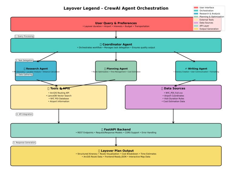
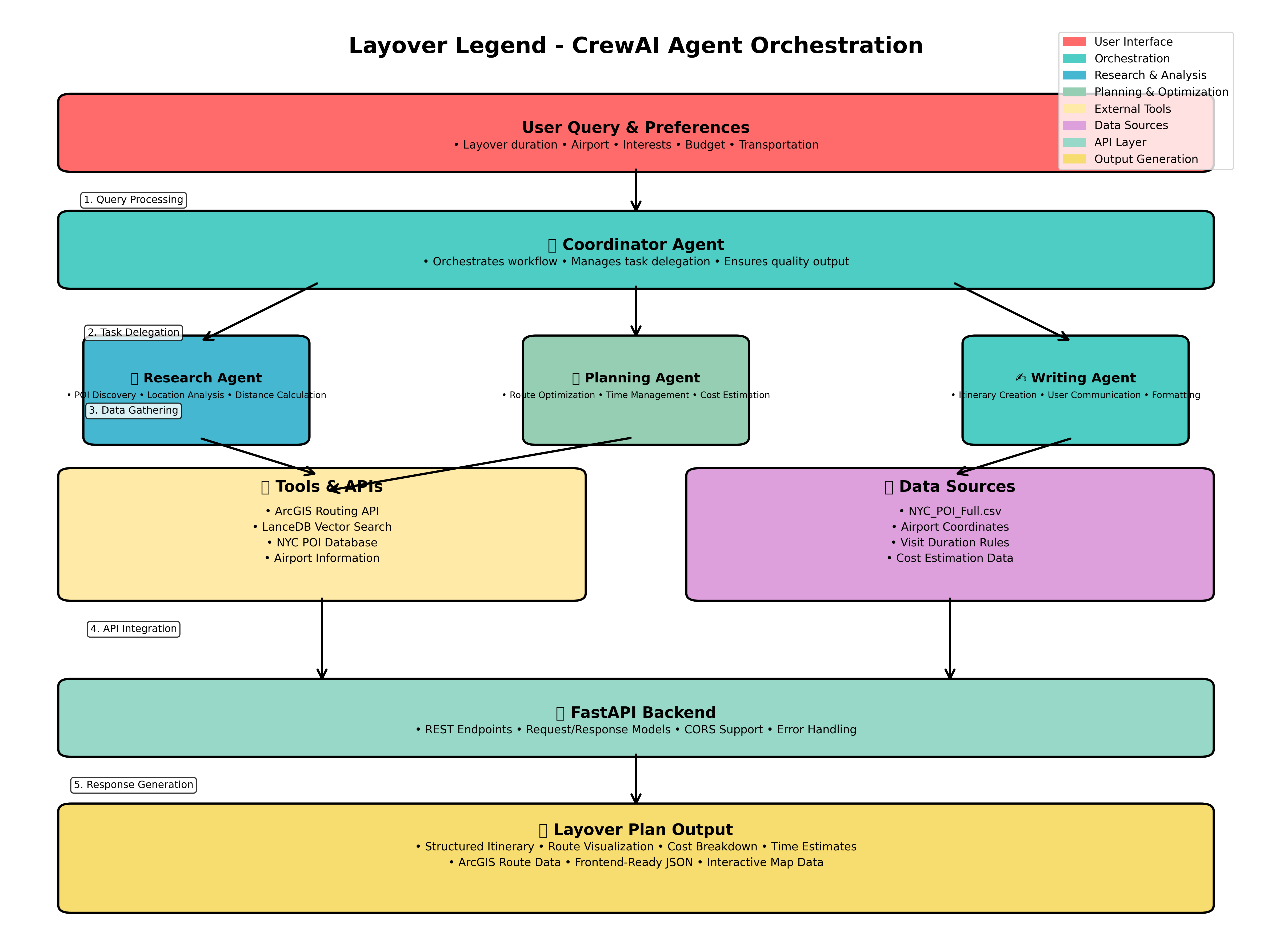
Design Diagram
-
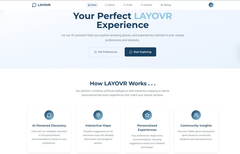
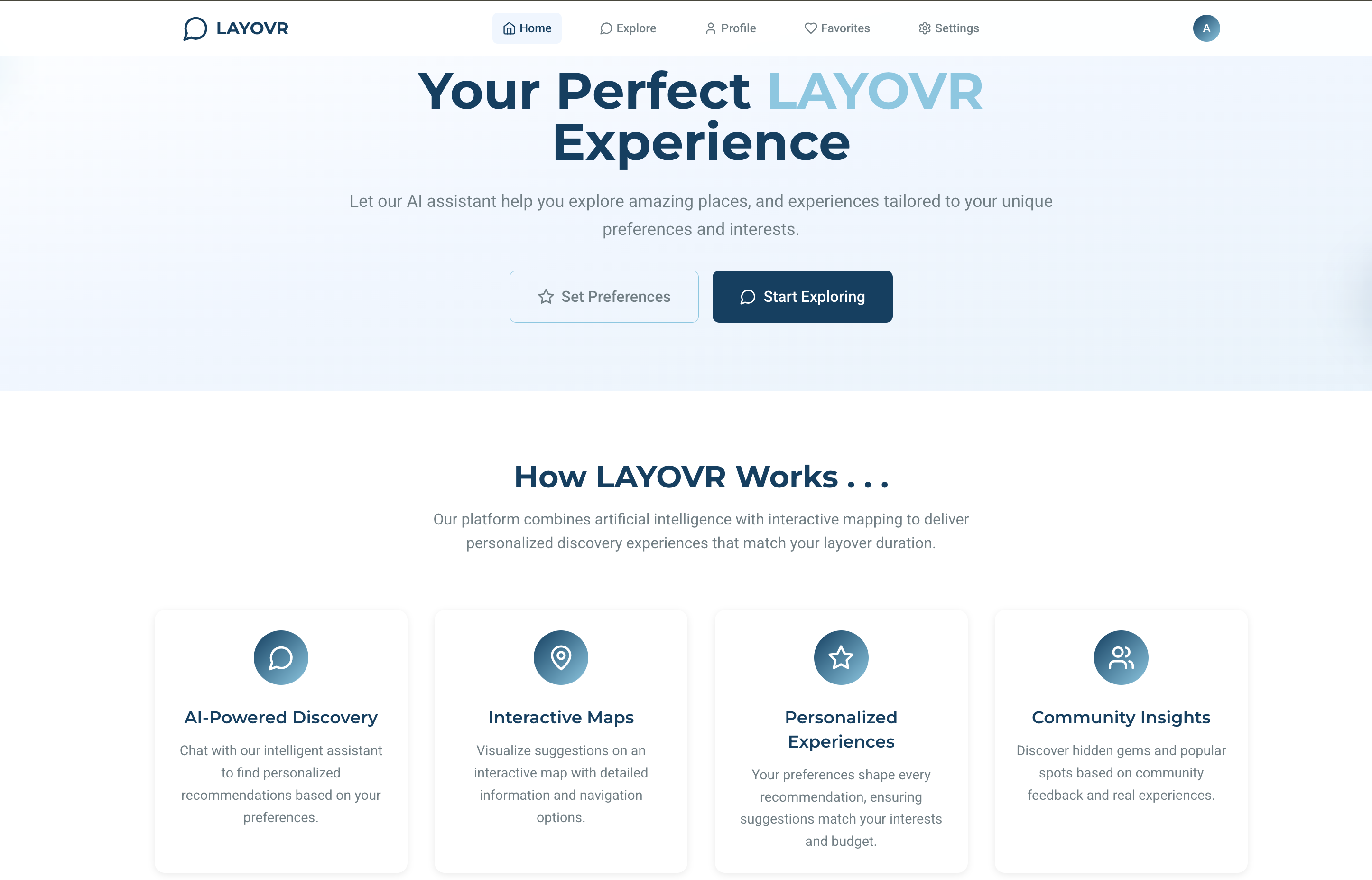
Homepage
-
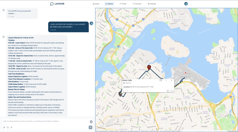
Explore Page
-

Profile Page
-
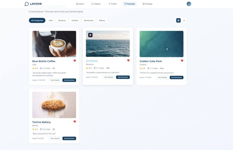
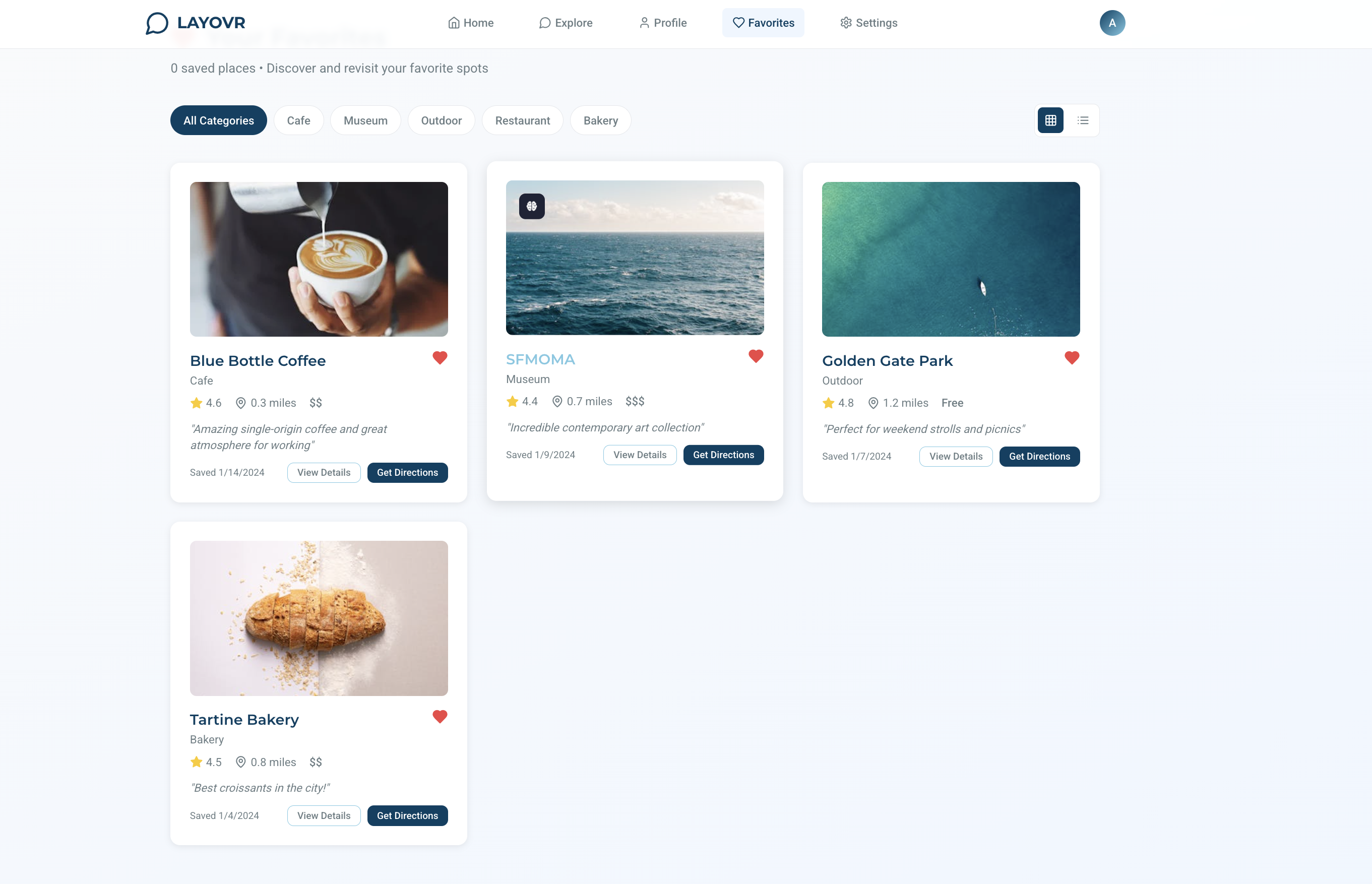
Favorites Page
-
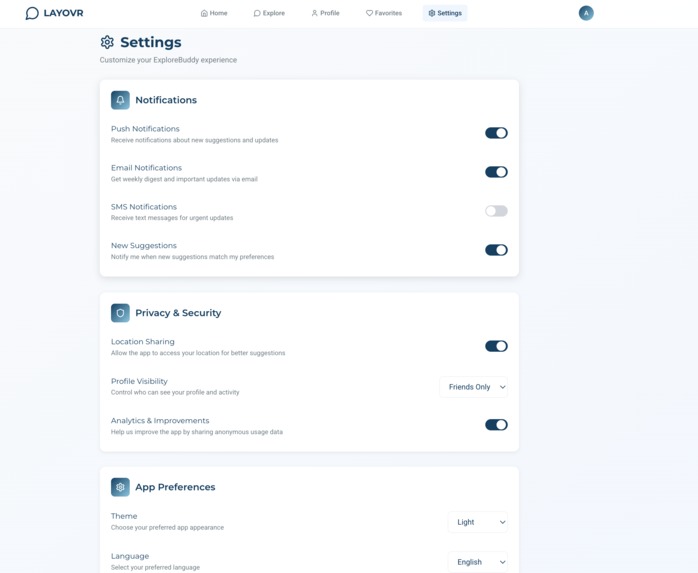
Settings Page


LAYOVR ✈️🌆
Turn your layover into an adventure.
💡 Inspiration
We were inspired by the frustrating experience of sitting in an airport with hours to spare, unsure if it’s safe—or even worth it—to leave and explore. Travel apps can recommend places, but they rarely account for critical real-world factors like traffic, TSA wait times, or return buffers. We wanted to build a smarter system that actually understands time and space—one that could help users explore confidently and return on time.
⚙️ What it does
LAYOVR is a location-aware web app that turns a user’s airport layover into a personalized micro-itinerary.
- Users set activity preferences (e.g., cafes, museums, parks) and travel mode (walking, driving).
- They enter their layover duration and the app returns a looped itinerary with stops and travel times.
- Esri’s Geocoding API turns those POIs into coordinates.
- The Routing API calculates real-time drive or walk times between each stop, accounting for traffic and including a built-in 90-minute return buffer.
- The chatbot interface (LAYOVR Larry!) walks the user through the itinerary, making the experience conversational and easy to follow.
🛠️ How we built it
- Frontend: React + Esri JavaScript Map SDK for map display, preferences UI, and chatbot pane.
- LLM Integration: A prompt-engineered chatbot filters POIs based on user interests using descriptions from Esri Business Analyst.
- Esri Geocoding API: Converts names and places into precise coordinates.
- Esri Routing API: Builds a looped route from airport → stops → back, using real-time travel times and selected mode.
- Data: POIs sourced from Esri’s Business Analyst dataset, tagged with categories and descriptions to inform both the LLM and routing logic.
🧱 Challenges we ran into
- Building a smooth experience that integrates multiple Esri APIs in real time.
- Getting our chatbot to stay grounded in spatial logic—so it didn’t hallucinate unrealistic routes or unreachable stops.
- Syncing user preferences with relevant POIs and routing data dynamically.
- Ensuring accurate time budgets with built-in buffers to avoid cutting it too close on the return to the airport.
🏆 Accomplishments that we're proud of
- A fully functional prototype with live map routing and LLM-generated itineraries.
- Seamless integration of Esri tech into a clean, mobile-responsive web experience.
- A creative use case that turns Esri’s geospatial power into a real traveler tool.
- Creating a chatbot that doesn’t just recommend—it navigates.
📚 What we learned
- How to combine Esri’s Geocoding and Routing APIs in a practical, user-centered application.
- How to connect an LLM to curated, structured geographic data to keep it grounded and useful.
- The difference between recommending places and enabling feasible travel within constraints.
- That UX design is just as important as backend logic when trying to earn user trust in a time-sensitive app.
🚀 What's next for LAYOVR
- Add airport detection using device GPS to auto-center the map.
- Incorporate layover data from flight APIs for automatic layover tracking.
- Expand POI data with user reviews or photos.
- Add transit options like subway and rideshare integration.
- Make it multilingual for global travelers.
- Package as a mobile-first progressive web app (PWA) for offline support and fast load times.
Built with ❤️ and powered by Esri and The Science of Where™.
Built With
- agentic-ai
- business-alerts
- business-analyst
- crew-ai
- esri
- geocoding
- javascript
- llm
- routing
- typescript


Log in or sign up for Devpost to join the conversation.