-
lawnalyze logo
-
Loading screen
-

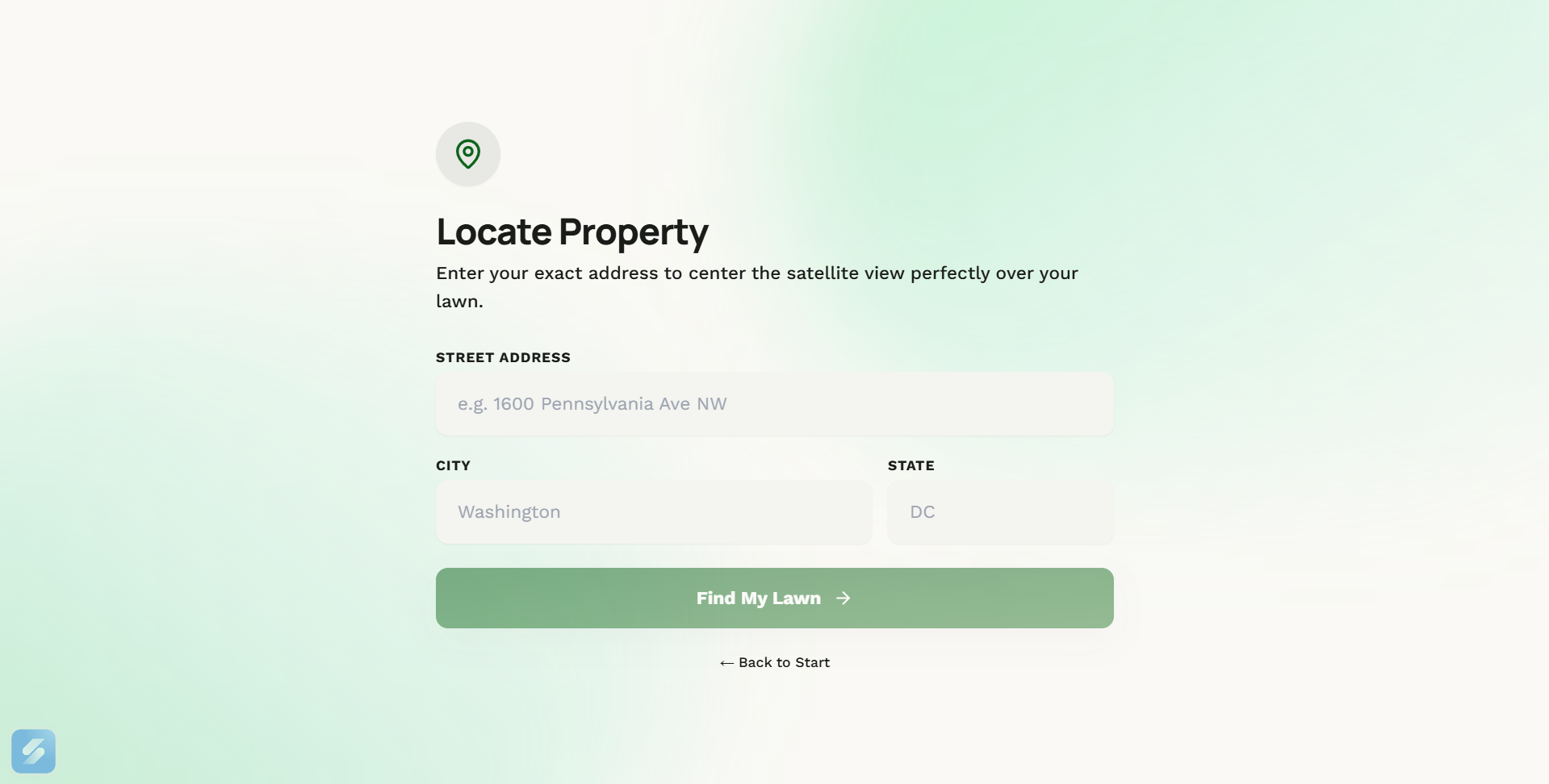
user input
-
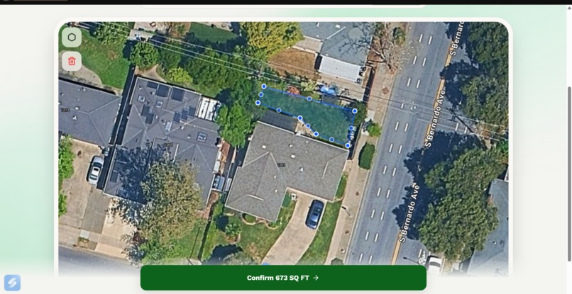
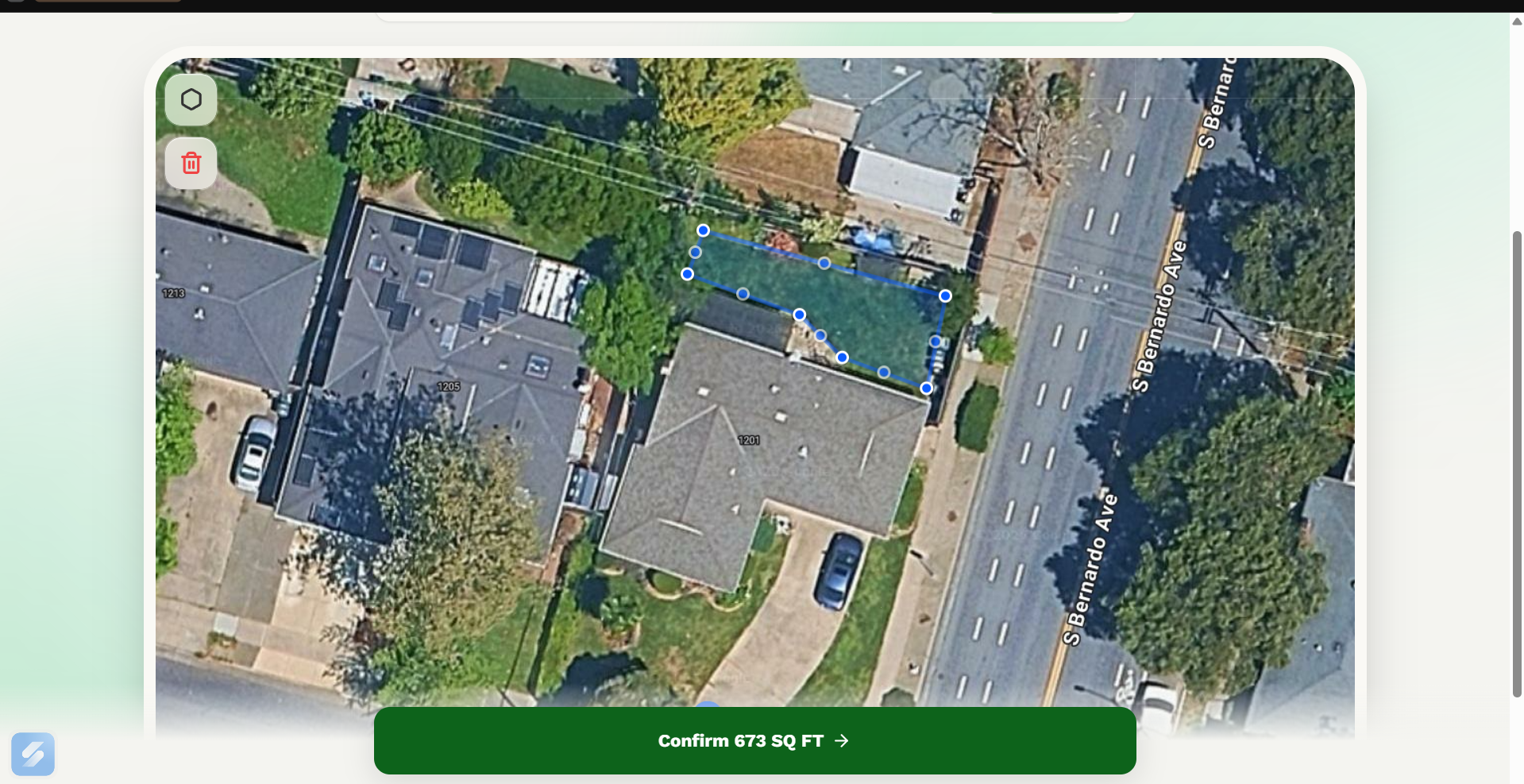
lawn selection screen
-
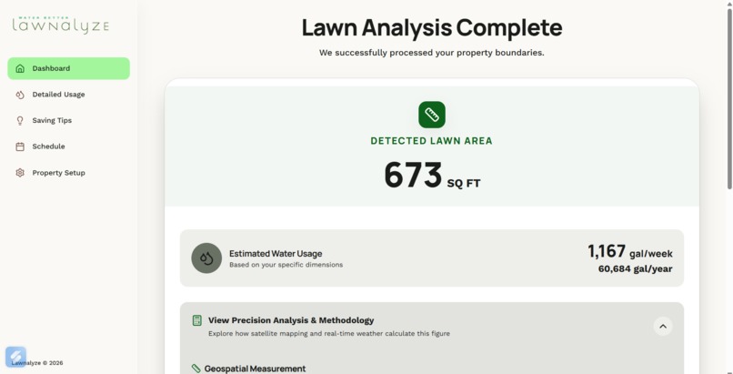
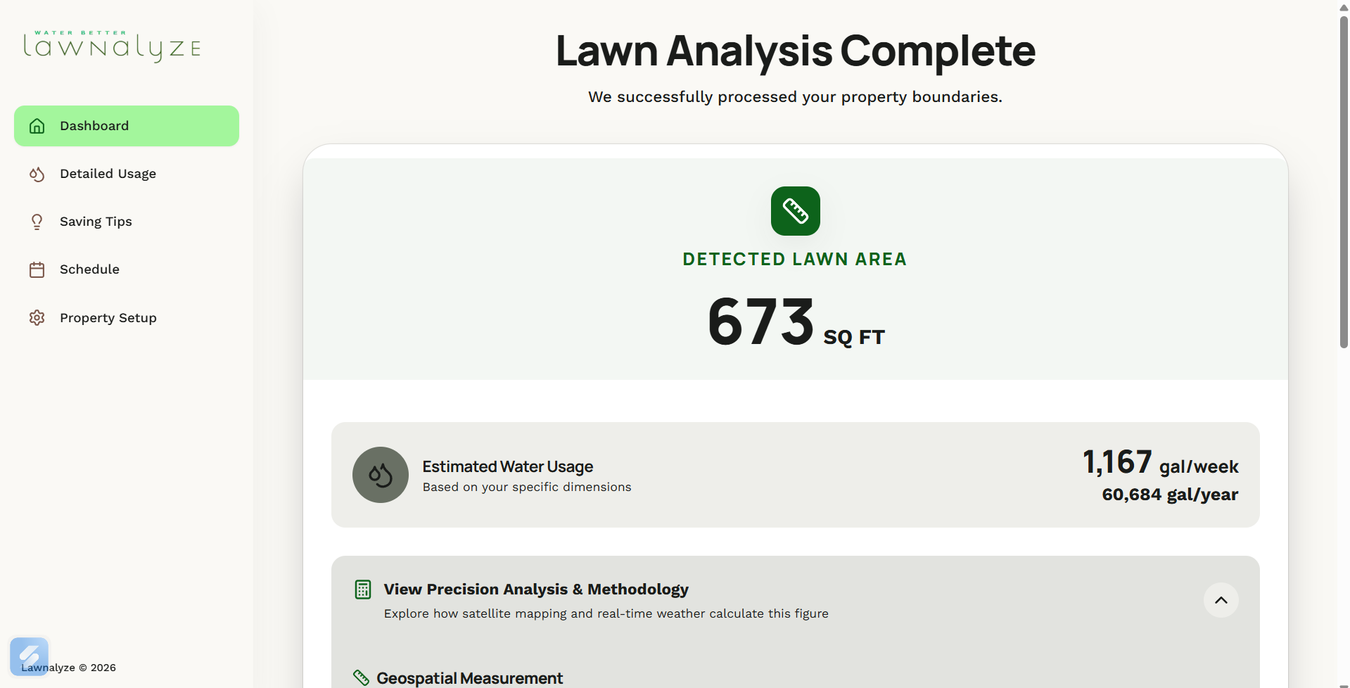
Lawn analysis screen
-
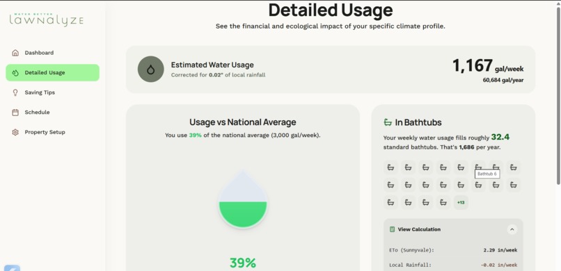
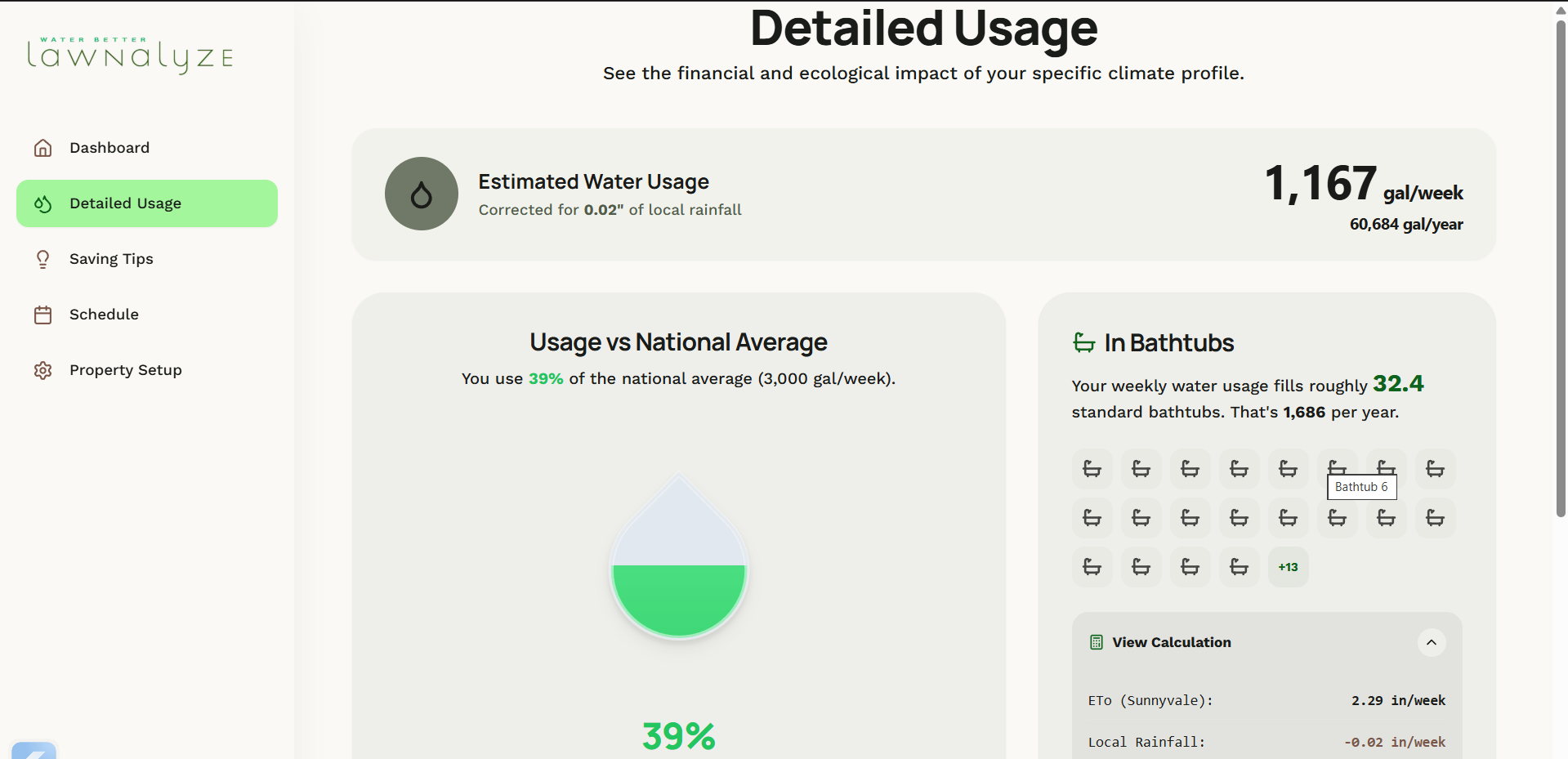
Water usage screen
-
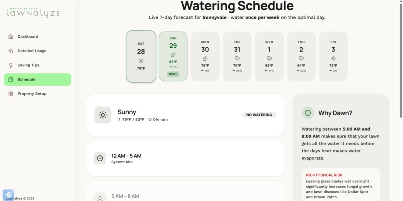
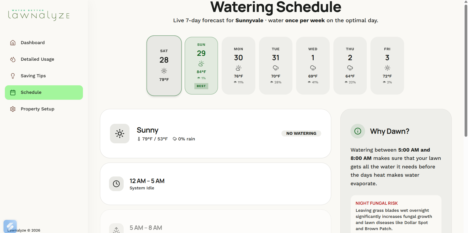
Watering schedule screen
-
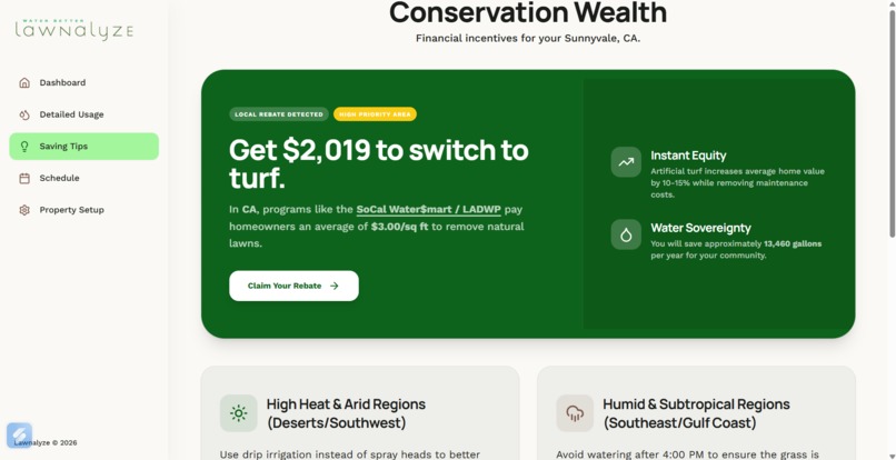
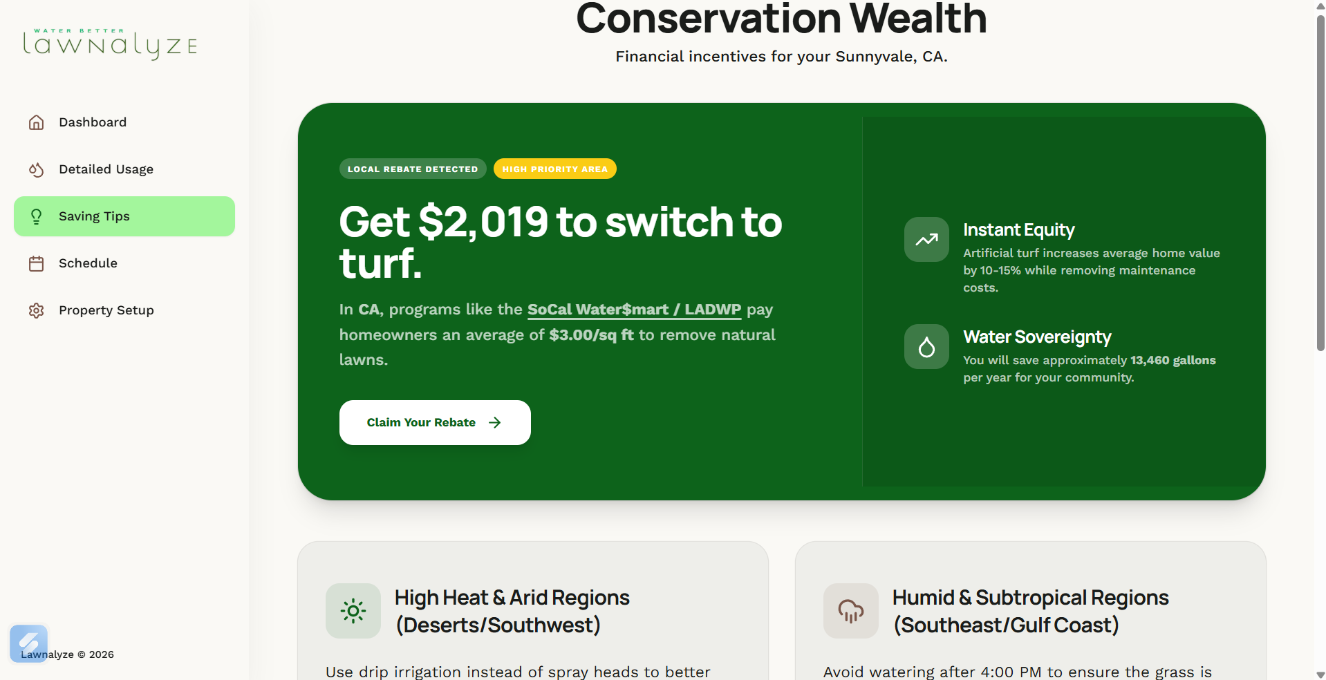
Conservation opportunities screen
Inspiration
We saw how many people had lawns but didn't know how much they were spending on it per year and how much water they were using and wasting. We wanted to fix that.
What it does
Lawnalyze takes the user's location to derive climate data and an interactive satellite map that the user can use to select where their lawn is.
How we built it
We built our app using vite and typescript on antigravity with gemini and claude models as well as making the original UI with stitch and updating it manually later. Also, for the logo, designs, and presentation, we made them by hand with canva.
Challenges we ran into
We ran into many problems/challenges such as not a good enough satellite image, inaccurate weather forecasting, and uncertainty of if the area calculation was accurate.
Accomplishments that we're proud of
We are proud of our idea since we think it could benefit millions and could make the future greener. We are also proud of our logo, designs, and presentation.
What we learned
We learned that working together to tackle multiple problems at the same time is the most efficient way to success.
What's next for lawnalyze
We are planning on implementing new features including a comparison of your garden with your neighbors, and a better algorithm for calculating water consumption and tips using public data of people in specific climates. We also intend on implementing dark mode.
Built With
- typescript
- vite


Log in or sign up for Devpost to join the conversation.