-
-
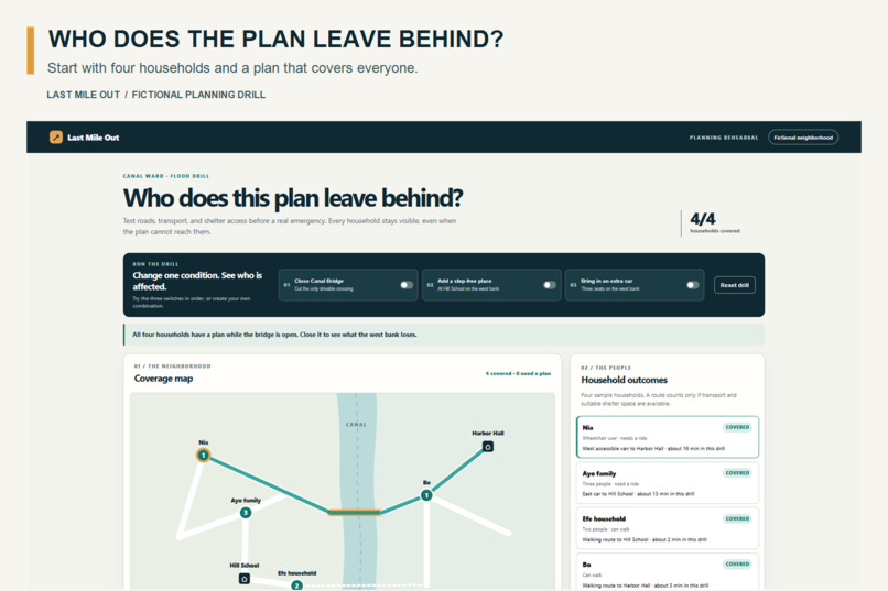
The planning question
-
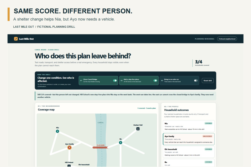
The hidden tradeoff
-
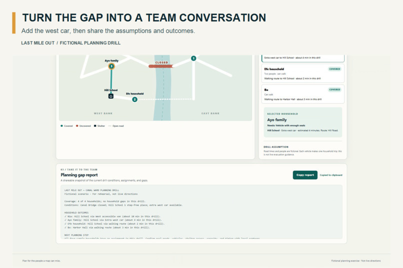
The shareable report
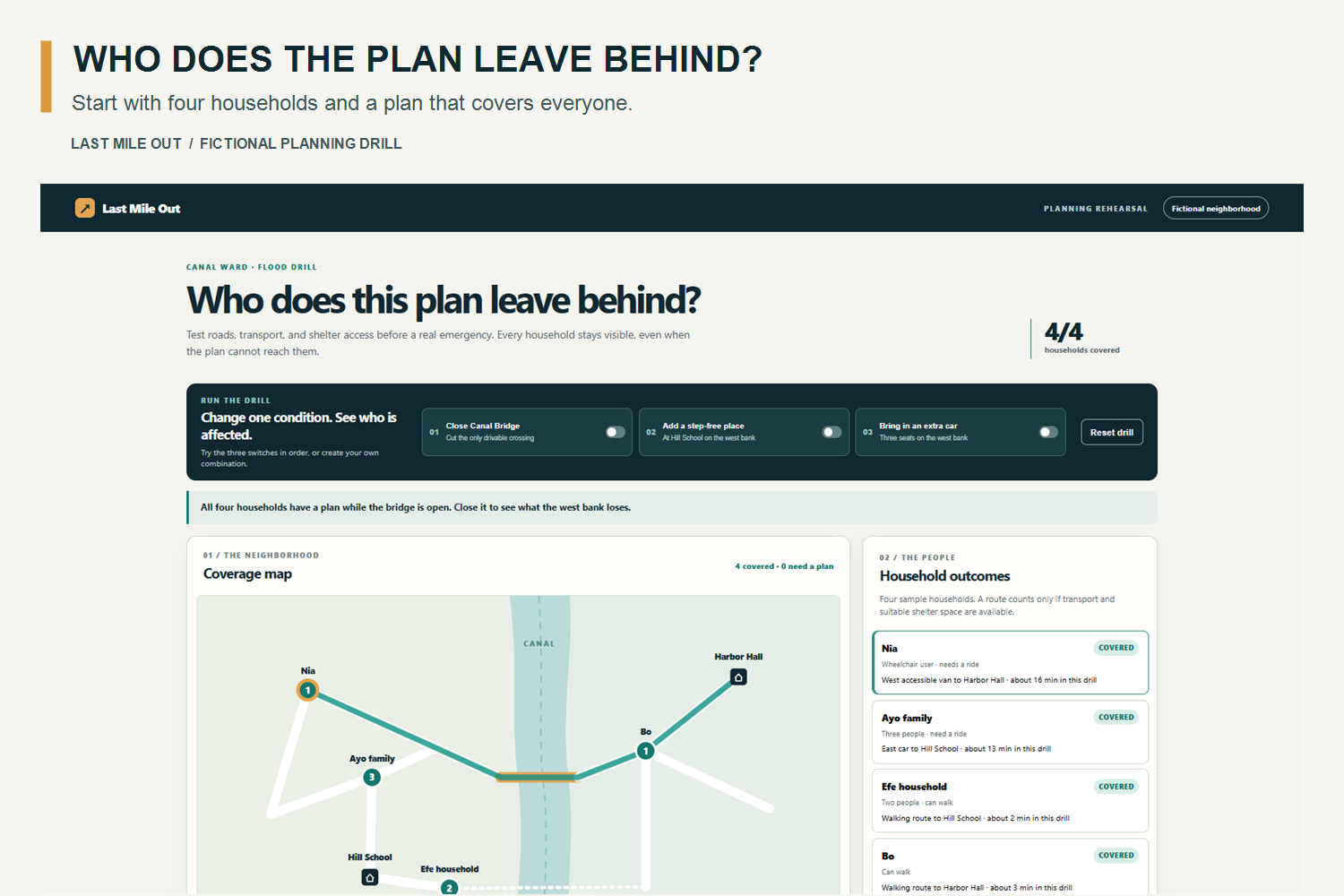
Inspiration
An evacuation plan can report that three out of four households are covered without showing which household is left behind. A 2026 U.S. Government Accountability Office report describes transportation and shelter barriers that people with disabilities can face during disasters. Ready.gov’s emergency planning guide calls for planners to consider accessible transport and shelter space. We wanted to make those planning tradeoffs visible.
What it does
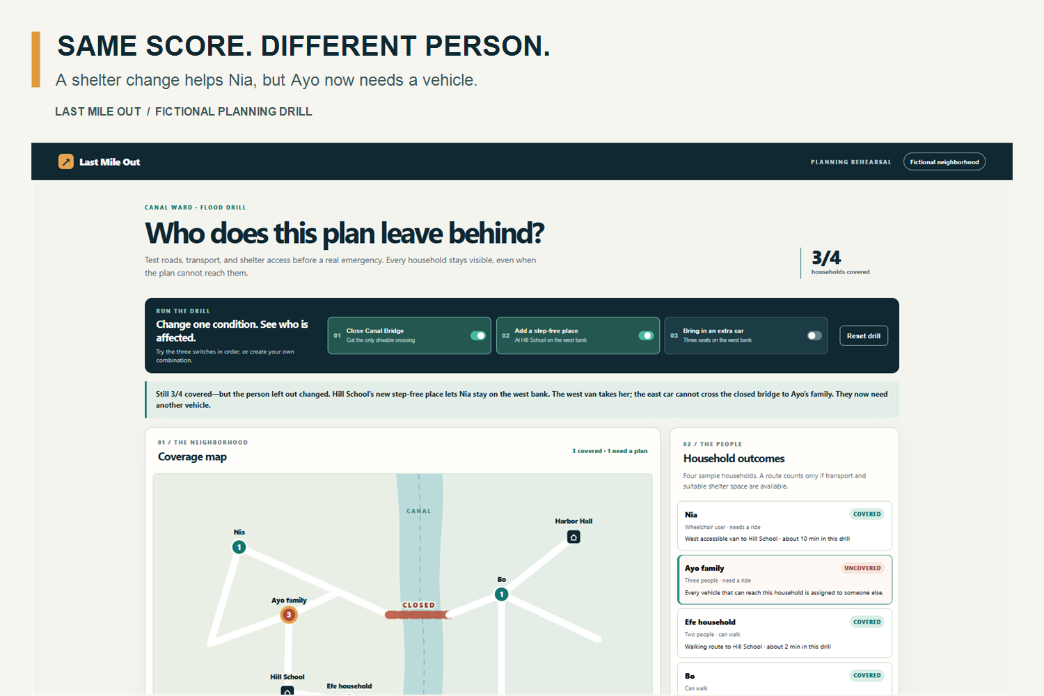
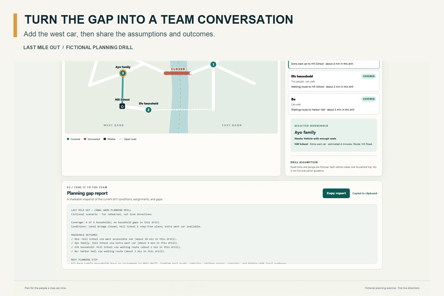
Last Mile Out is an interactive evacuation planning drill for a fictional neighborhood. Close Canal Bridge and Nia loses a step-free route. Add accessible shelter space and Nia receives an assignment, but Ayo’s family is left without transport. Coverage stays at 3 of 4, while the person left out changes. Add a west-side car and all four households receive an assignment.
The map, household explanations, coverage count, and copyable report update together.
How we built it
We built a browser app with JavaScript, HTML, CSS, and an SVG neighborhood map. A local route finder checks open, usable paths. An assignment engine considers shelter space, accessibility needs, and available vehicles. Automated tests check routes, capacity, access, and report output. We used Codex as a development collaborator and the Devpost Learn Skill Pack to guide the project.
The app needs no account, API key, or live service. All households, roads, shelters, and travel times in the drill are invented.
Challenges we ran into
The biggest challenge was explaining the tradeoff clearly. A stable “3 of 4 covered” score can disguise a meaningful change in who has a plan. Feedback during the build led us to make that handoff explicit in the interface. We also had to keep the map, assignments, explanations, and report consistent after every change.
Accomplishments that we're proud of
The central reveal is understandable in a short demo: changing shelter access helps Nia, yet exposes Ayo’s transport gap without changing the headline score. A planner can select a household to inspect its outcome and copy a report that records the scenario’s assumptions.
What we learned
A coverage total is only the start of the story. To review a plan responsibly, people need to see who is affected, why an assignment changed, and which resource is missing. User feedback helped us turn a calculation into an explanation.
What's next for Last Mile Out
A future version could let community organizers and emergency managers enter verified local scenarios and review assumptions with residents and disability advocates. This prototype does not model live roads, traffic, changing hazards, or confirmed shelter operations. It is a planning rehearsal, not live evacuation guidance.

Log in or sign up for Devpost to join the conversation.