-
-
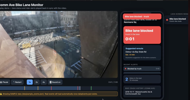
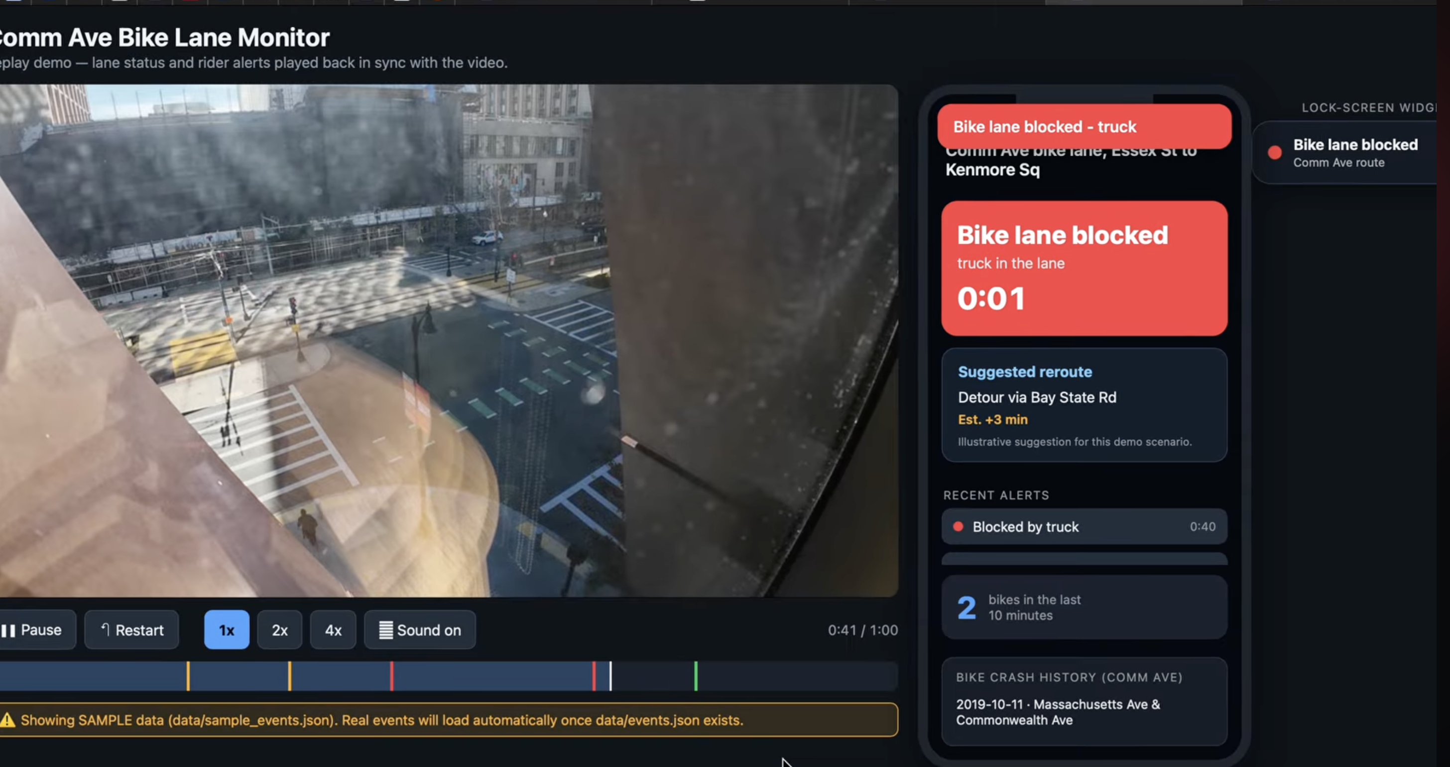
Detected potential bike lane blockage, historical crash, notification pop ups, lock screen,recommended route
Inspiration
Boston’s bike lanes are meant to keep riders safe, but a single parked car or delivery truck can push a cyclist into moving traffic with almost no warning. When we mapped the City of Boston’s Vision Zero records for just 1.2 km of Commonwealth Ave, between Essex St and Kenmore Sq, we found 61 documented bike crashes, and across the Boston region about 1,000 people a year were killed or seriously injured in traffic crashes from 2018 to 2022, according to the Boston Region MPO (that figure covers all road users, not only cyclists). We wanted to combine data and civic action: live camera detection and crash history that warn riders before they reach a blocked lane, and the same evidence shared with the city so loading zones and enforcement can be fixed at the source. Our goal is that every Boston rider knows whether the lane ahead is clear, and that the city has the evidence to keep it that way.
What it does
LaneWatch explores how cyclists could receive timely information about whether a bike lane is usable. It combines camera-based traffic and obstruction analysis with historical crash data to support safer cycling decisions.
Our demo simulates lane-status updates, lock-screen blockage notifications, a glanceable widget, and alternative route suggestions. Audible alerts are a planned feature to reduce the need to watch a screen. The prototype demonstrates the proposed experience using recorded footage; it is not a deployed mobile app or live notification service. An accompanying dashboard presents traffic counts, blockage observations, and historical crash context to help cities investigate where improvements may be needed.
How we built it
We collected street footage using a DJI Action 4 near Commonwealth Avenue and Granby Street, alongside Telraam sensor data. Our computer-vision pipeline detects and tracks road users, while analysis logic examines counts and potential bike-lane obstructions. We also incorporated Boston Vision Zero crash records for historical context.
We used Kiro IDE with four specifications covering computer vision, analysis, visualization, and the replay demo. This structure supported parallel development, while steering documents established shared conventions. A Google-services integration supported processing remotely stored footage, and Kiro assisted with testing and troubleshooting. We processed part of our footage during the hackathon. Sensor validation remains incomplete, and camera perspective and occlusion can produce missed detections or false blockage alerts. Our next steps are to complete validation and improve camera placement and lane-boundary calibration.
Challenges we ran into
Our biggest challenge was getting accurate counts from cameras. Because of where the camera was mounted, much of the activity on the opposite side of the street fell outside its useful view, so riders and pedestrians who should have been counted were missed or captured too poorly to classify. Reflections made this worse: glass windows in the camera’s view mirrored people and bikes, and the vision model sometimes treated those reflections as real pedestrians, which pushed some counts up while the missed activity pulled others down. Together, these issues made our raw counts less reliable than we wanted. The experience taught us that camera placement matters as much as the model itself, and it shapes our plan to use multiple cameras with better angles and to filter out reflections in future versions.
Accomplishments that we're proud of
We are proud that we built the prototype from end to end, connecting raw camera perception data to rider-facing lock-screen alerts and to executive-level analytics. During our field test, we captured two very different kinds of blockage: a brief 3-minute car stoppage and an extended 12-minute truck delivery obstruction, which together totaled 15 minutes of blocked lane. Those two events show why the system needs context, since a quick drop-off and a long delivery pose different risks to riders and call for different responses from the city. We also delivered a publication-quality, fully responsive web dashboard with a consistent color palette throughout and automated tests that pass, so the evidence behind every alert is clear and easy to check.
What we learned
The biggest lesson was that honest, transparent data builds more trust than impressive-looking numbers. During one window, our camera counted 55 bikes while the Telraam sensor logged only 4. Instead of smoothing over the difference, we investigated and found that Telraam had only 25% uptime, so the gap reflected limited sensor coverage and not a flaw in our counting. Cross-checking against a second source showed us exactly where each data stream is strongest. We built that same honesty into the product: the app alerts only when LaneMonitor actually detects a stopped vehicle, and the dashboard flags low sensor uptime and titles each chart with the real finding. A safety app has to be right when it speaks up, and our design makes sure riders can trust every alert they receive.
What's next for LaneWatch: Safer Bike Lanes
Looking ahead, we plan to grow the app so riders can trust it on every ride, starting with a corridor-wide camera mesh covering all of Commonwealth Ave and then extending to other high-density cycling routes across Boston. That coverage means a cyclist can check, at any point on their route, whether a vehicle is blocking the bike lane. We would add audible instructions, such as a short spoken warning and turn-by-turn voice guidance delivered through earbuds or a bike speaker, so riders can hear about a blockage and their new route without looking at their phone screen. We would also build a smart rerouting engine on open-source navigation tools such as OpenTripPlanner or OSRM, so the app recalculates a low-stress route in real time around active blockages. The same detections would feed a municipal API that gives city planners and Boston DOT automated obstruction heatmaps, helping them optimize commercial loading zones and enforcement schedules. As drivers and delivery companies see these blockages documented and acted on, cars and trucks are less likely to block the lane, which helps reduce bike crashes.


Log in or sign up for Devpost to join the conversation.