-
-
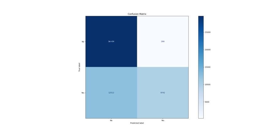
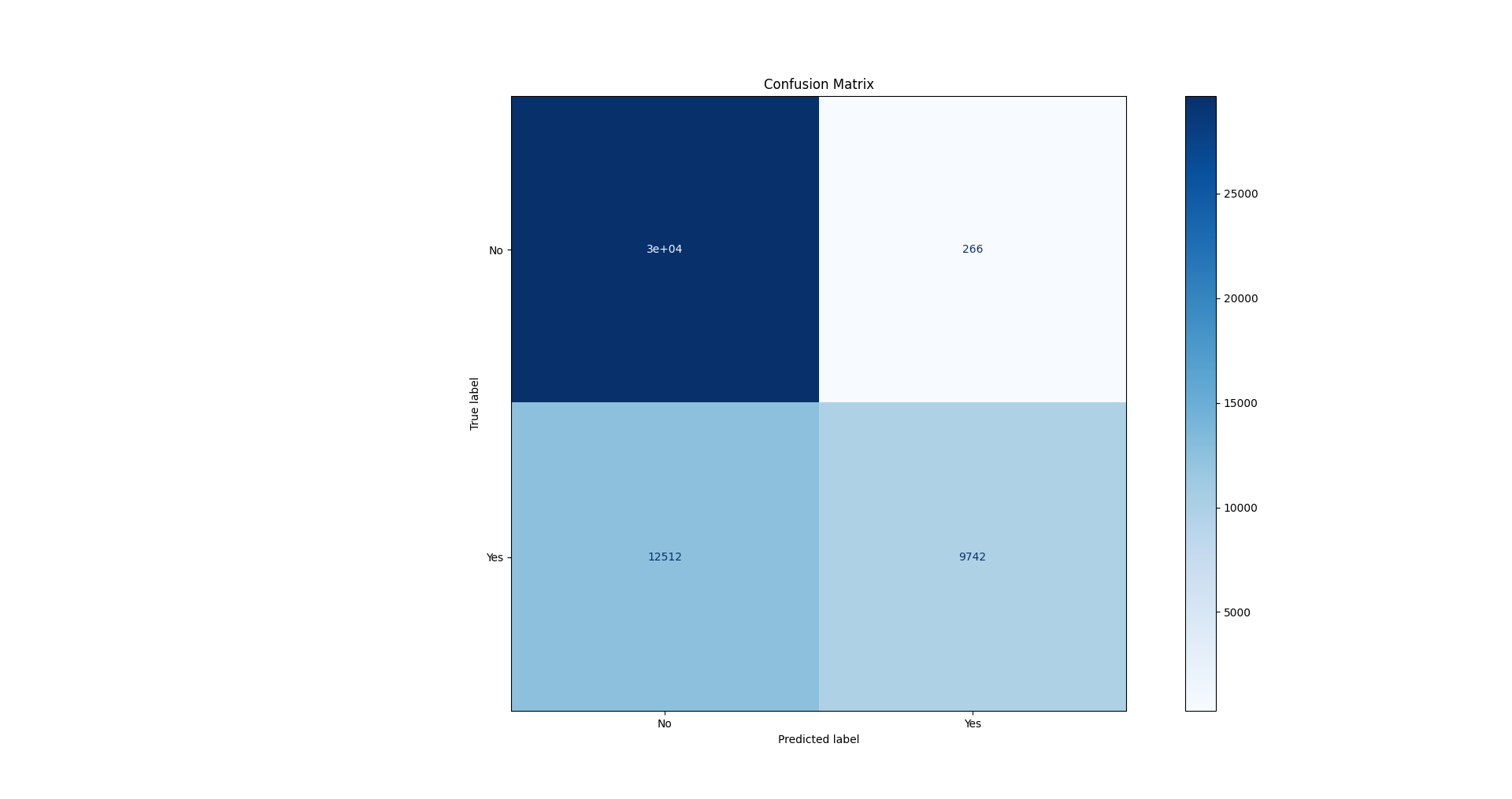
Confusion Matrix
-
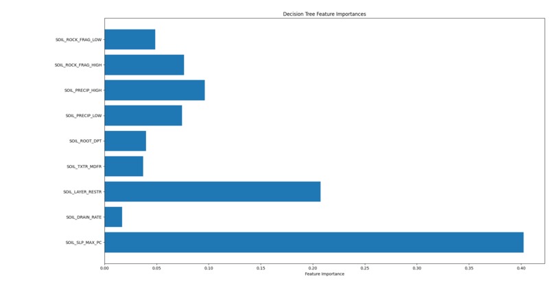
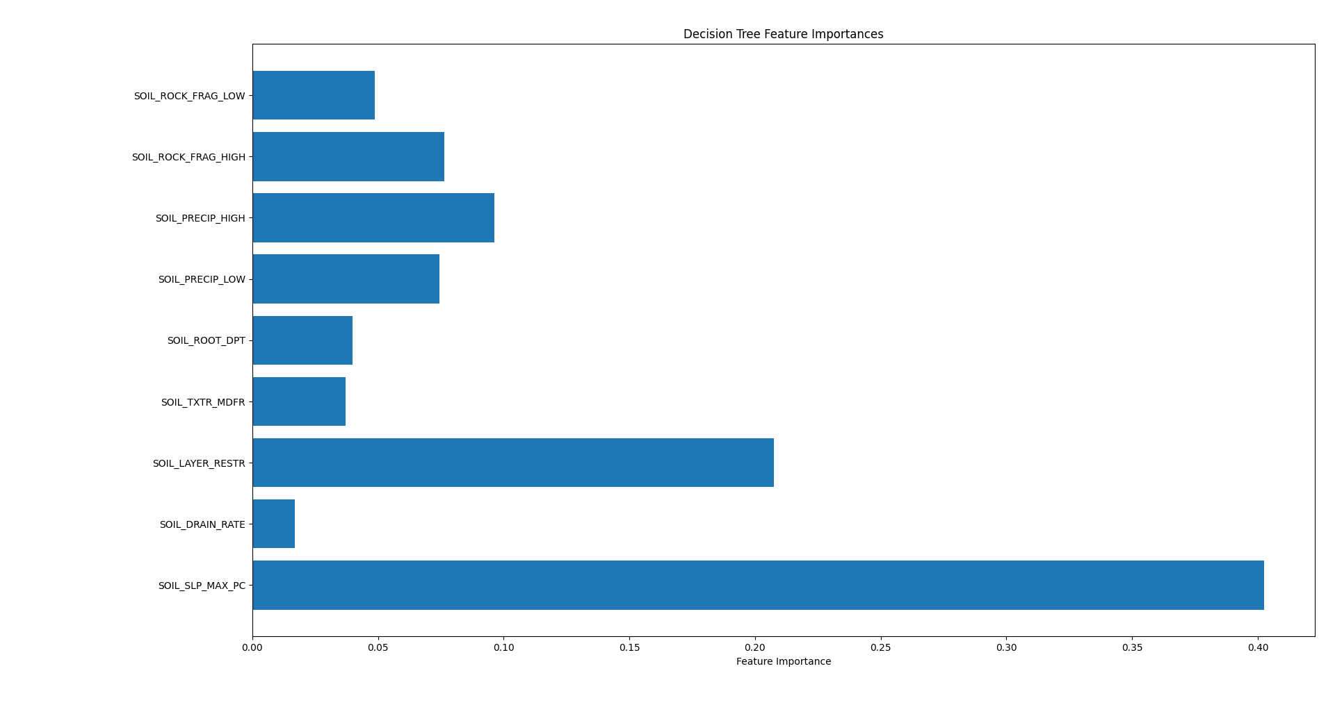
Features Importance Graph
-
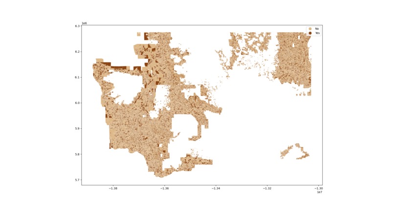
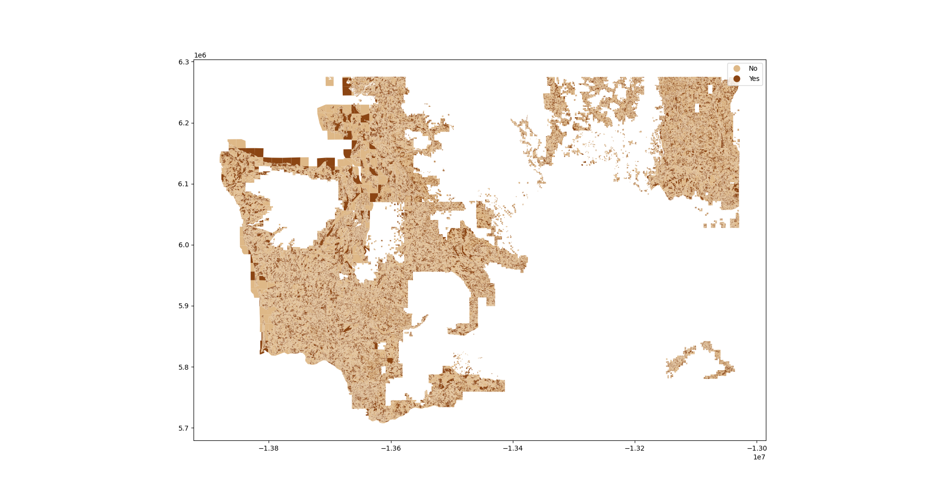
Map of the Data
Inspiration Landslides happen quickly and can cause a lot of damage and even loss of life. We wanted to see if we could use AI to help predict where landslides might happen before they occur. Washington State seemed like a great place to start because it has a lot of landslide data and varied terrain.
What it does Our project uses AI to predict landslide risk based on things like how steep the land is, how much it rains, the type of soil, and how much vegetation there is. It sorts places into low, medium, or high risk. We show the results on a map using Python tools, so people can easily see which areas are most at risk. This can help emergency teams, city planners, or even residents stay safer.
How we built it We collected and cleaned data about the land and environment in Washington. Then we trained a machine learning model with Python libraries like scikit-learn, Pandas, and GeoPandas. After that, we made maps using Matplotlib that color-code the risk level across different areas. We also checked how well our model works with things like a confusion matrix and looked at which features mattered most in making predictions.
Challenges we ran into It was tricky to get all the different data types to line up correctly. Some data was missing or on different scales, so we had to clean and normalize it carefully. Also, validating the model was tough since data isn’t always perfect everywhere.
What we're proud of We built a model that can predict landslide risk pretty accurately. We also made the results easy to understand with clear maps. Plus, the whole system can be adapted to work in other places too, not just Washington. Along the way, we learned a lot about working with complex spatial data.
What we learned We learned how important data cleaning and preparation are for AI projects. We got hands-on experience with geospatial data and visualization tools. We also saw how useful metrics like the confusion matrix and feature importance are to understand what the model is really doing. Most of all, we realized AI can help prevent disasters and save lives.
What’s next We want to add live weather data so predictions can update in real time. Making a web dashboard would let more people access and interact with the maps easily. We also hope to try the model in other landslide-prone areas around the world. Finally, we’d love to work with emergency responders to bring this tool into real use.

Log in or sign up for Devpost to join the conversation.