-
-
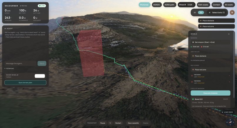
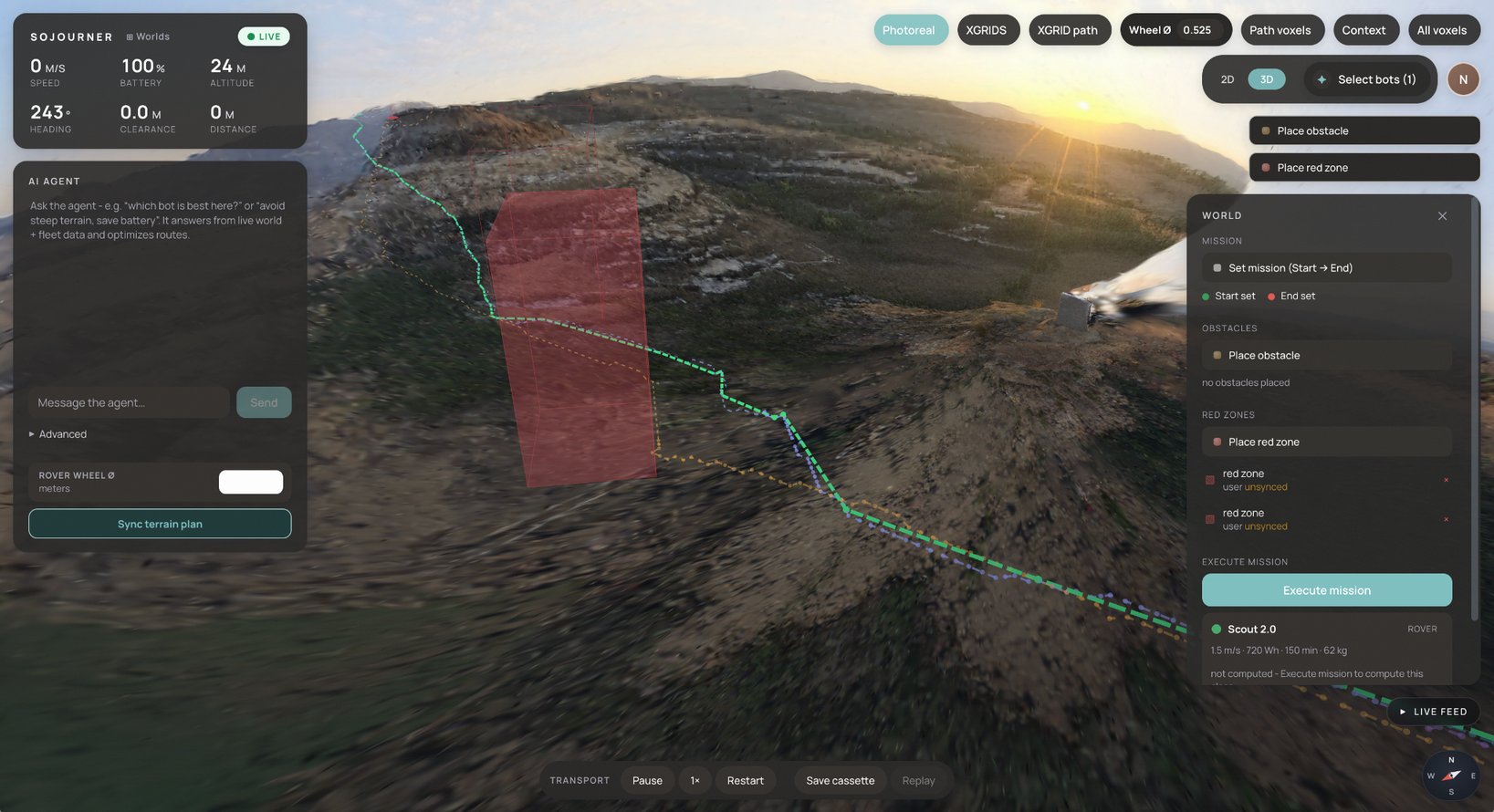
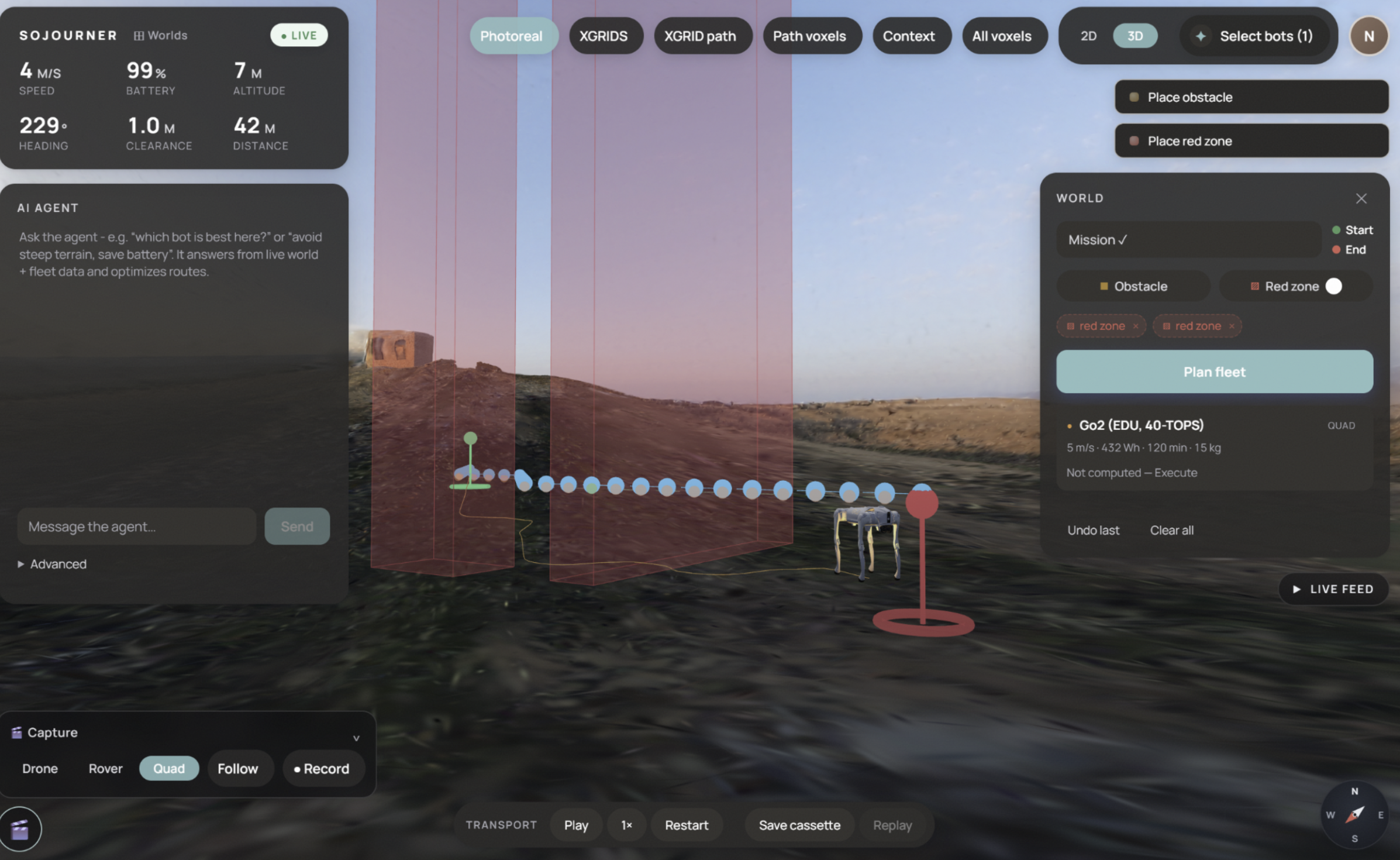
Dashboard view of an autonomous path recomputed based on a obstruction drawn by the user with the interface's simulated obstruction toolkit.
-
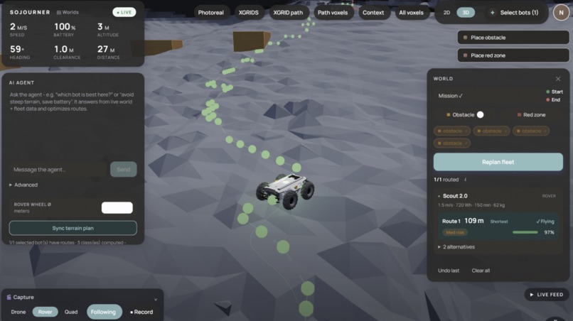
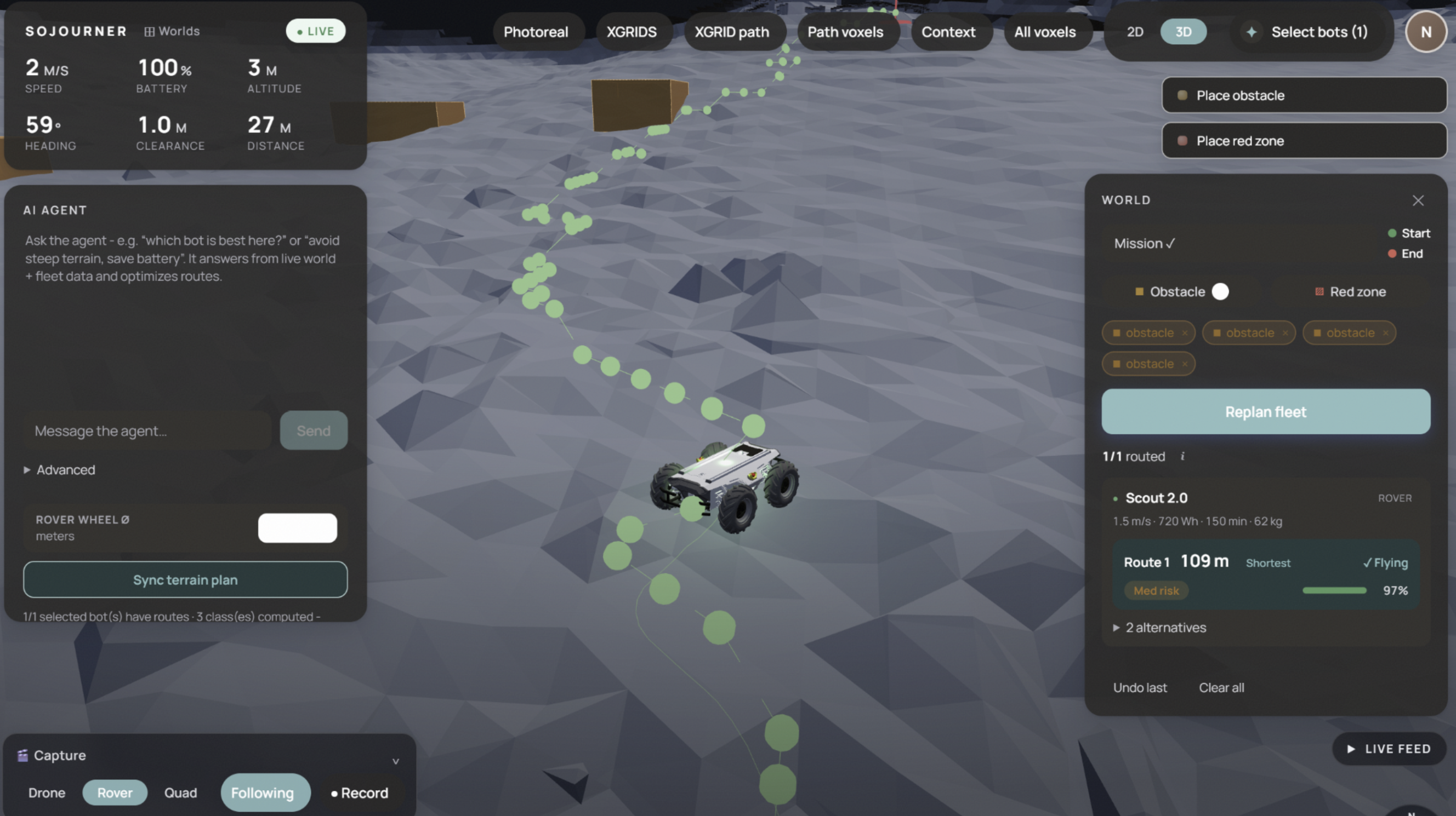
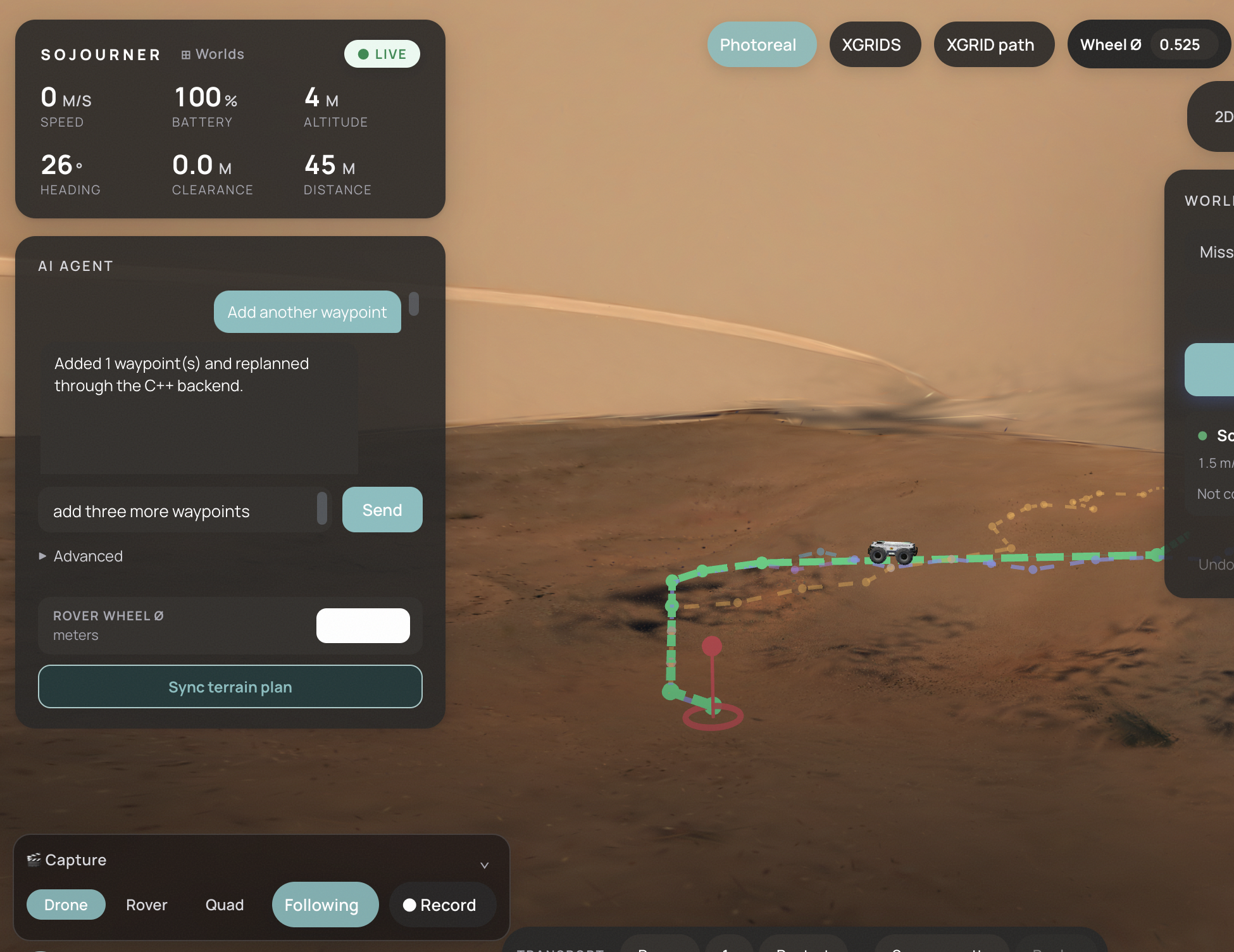
Up-close view of the rover following the simulated path computed from our planning algorithm that considers terrain and wheel size.
-
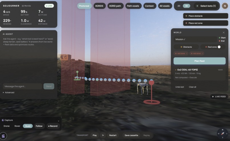
Up-close view of a simulated quad robot following the computed planning path while considering it's hardware parameters.
-
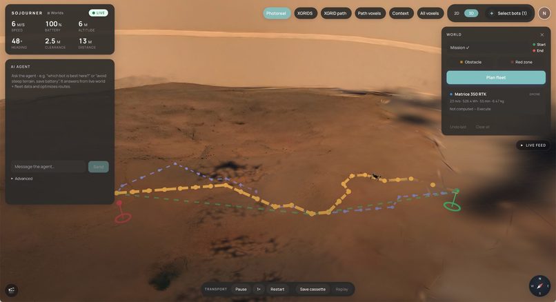
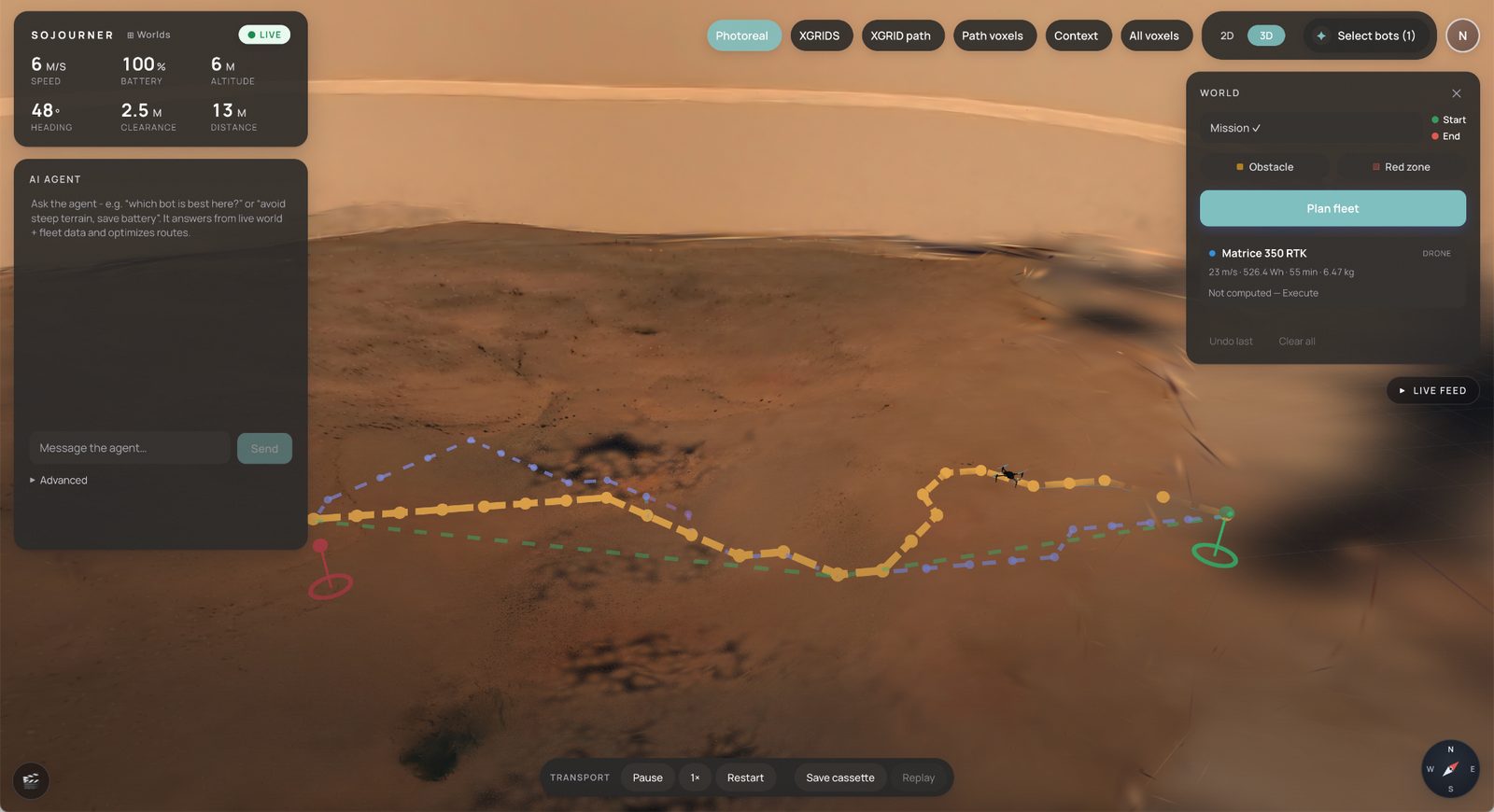
Simulated computed path of quadcopter drone on Mars world generated with the marble api
-
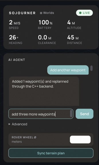
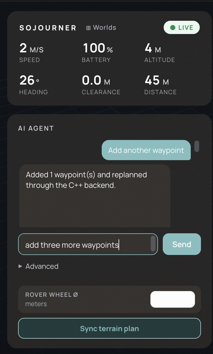
LLM Agent chat to add more waypoints and change the calculated path depending on waypoint -- the LLM has logic to choose waypoints for you.
-
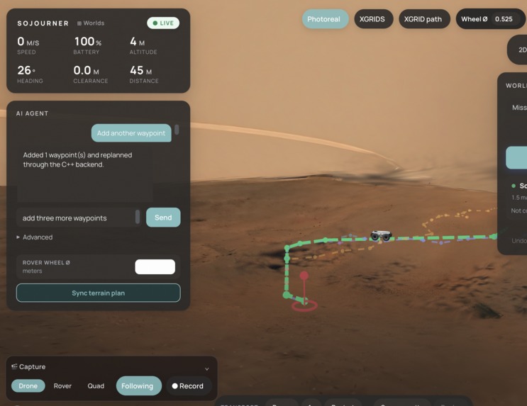
Capture simulated path and send video to colleagues.
Inspiration
Sojourner was inspired by missions in places we can’t fully see: Earth disaster zones, remote infrastructure, Mars rover traverses, and future lunar exploration. We wanted an interactive 3D dashboard where humans can explore a reconstructed world, edit mission risks, and trust that the autonomy stack is planning with real geometry, not just a pretty visualization.
What it does
Sojourner turns sparse imagery into an interactive 3D mission-planning sandbox for drones, quadcopters, rovers, and legged robots. Operators can fly through generated worlds, place obstructions, draw red zones, tune rover wheel size, compare robot options, and watch paths update live using real planners like A*, Dijkstra, Greedy search, and smoothing.
How we built it
We built Sojourner as an interactive 3D autonomy dashboard on top of generated and reconstructed worlds: Marble creates explorable 3D environments from sparse prompts or imagery [1], while XGRIDS/LCC support lets us load splat-based reconstructions through the official Web SDK [2]. Under the hood, we convert world geometry into planner-ready occupancy and terrain data inspired by OctoMap’s probabilistic 3D occupancy mapping approach [3], then run real autonomous planning algorithms in our C++ engine. Our paths are not just drawn curves: A* evaluates routes with the classic cost form (f(n)=g(n)+h(n)), alongside Dijkstra, Greedy search, and smoothing variants for comparing safe, energy-aware drone, quadcopter, and rover missions [4].
Sources [1] World Labs, “Generate a world,” Marble API docs: https://docs.worldlabs.ai/api/reference/worlds/generate [2] XGRIDS, “LCC Web SDK”: https://github.com/xgrids/LCC-Web-SDK [3] Hornung et al., “OctoMap: An Efficient Probabilistic 3D Mapping Framework Based on Octrees”: https://doi.org/10.1007/s10514-012-9321-0 [4] Hart, Nilsson, Raphael, “A Formal Basis for the Heuristic Determination of Minimum Cost Paths”: https://doi.org/10.1109/TSSC.1968.300136
Challenges we ran into
The hardest part was connecting beautiful reconstructed 3D worlds to honest robotics constraints. A splat or mesh can look convincing, but the planner needs voxelized geometry, terrain cost, wheel constraints, red-zone policy, and safe traversability before it can produce trustworthy paths.
Accomplishments that we're proud of
We’re proud that Sojourner is not just a viewer: it is a human-in-the-loop autonomy system. The dashboard supports live 3D interaction, simulated obstructions, multiple robot classes, real path algorithms, and replanning behavior that operators can inspect and edit before deployment.
What we learned
We learned that autonomy demos become much stronger when visualization and planning share the same world model. Geometry, uncertainty, energy, and robot-specific constraints all need to flow into the planner, especially for high-stakes environments like disaster response or planetary exploration.
What's next for LA43 - Sojourner
Next, we want to deepen the XGRIDS/LCC import pipeline, support richer real-world reconstructions, and expand multi-robot coordination. We also want to make Sojourner useful for more mission types: planetary scouting, infrastructure inspection, emergency response, and autonomous exploration in any environment where humans need to plan before they can safely enter.

Log in or sign up for Devpost to join the conversation.